|
Rispondi |
Messaggio 1 di 20 di questo argomento |
|
¿PORQUE DIA Y DIAMETRO TIENEN ORIGEN EN LA DIOSA DIANA?
¿Pero la luna en el marco a RAQUEL NO SIMBOLIZA AL HIJO DE RAQUEL? Sabemos que en el sistema solar LA TIERRA ES LA QUE GIRA ALREDEDOR DEL SOL Y LA LUNA GIRA ALREDEDOR DE LA TIERRA.
TODO EL PATRON PIRAMIDAL DISEÑADO EN FUNCION AL DIAMETRO DE LA TIERRA Y DE LA LUNA, E INCLUSO EN EL CONTEXTO A LA SEMANA DE 7 DIAS, QUE SI MULTIPLICAMOS 7*1440=10080, OSEA EL DIAMETRO DEL CIRCULO, CUYO RADIO ES LA SUMA DEL RADIO DE LA LUNA Y EL RADIO DE LA TIERRA. OSEA QUE SI EN 1 DIA =24 HORAS=1440 MINUTOS. SI CONSIDERAMOS LA LONGITUD DEL CIRCULO MAYOR MULTIPLICAMOS 10080*PI=31680, OSEA UNA REFERENCIA A LA GEMETRIA EN EL GRIEGO DE LA EXPRESION "NUESTRO SEÑOR JESUCRISTO". AHORA SI DIVIDIMOS 31680/1440=22 DIAS. OSEA UNA REFERENCIA A LOS 22 DIAS DE LA FESTIVIDAD DEL OCTAVO DIA DE LA FIESTA DE LAS CABAÑAS. ESTE ES EL SECRETO DE LA RELACION 22/7 CON REFERENCIA A MARIA MAGDALENA. TODO EL PATRON DEL DIA, DIAMETRO, J-ANU-KAH (D-IANA), J-ANUARY, ANU-BY, ANUNAKI, ETC ES UNA REFERENCIA A JANUKAH EN EL CONTEXTO A LA INDEPENDENCIA DE LOS ESTADOS UNIDOS E INCLUSO EL AÑO NUEVO GREGORIANO. ¿LA CLAVE DE LA LETRA DE DIANA, QUE DERIVA DE DINA, OSEA LA UNICA HIJA DE JACOB, CUYO NOMBRE ERA DINA, TIENE MARCO CON LA LUNA CUARTO MENGUANTE CON REFERENCIA A LA CLAVE D-AV-ID / LL-AV-E / CL-AV-E /D-AV-INCI? RECORDEMOS QUE LA LUNA CUARTO MENGUANTE TIENE LA MISMA FORMA DE LA LETRA D. ¿CUAL ES EL SECRETO DEL AÑO NUEVO, INSISTO, EN EL CONTEXTO A LA INDEPENDENCIA DE ESTADOS UNIDOS E INCLUSO EL AÑO NUEVO, QUE ESTA A LOS 180 DIAS DE DICHA INDEPENDENCIA?
|
|
|
|
Rispondi |
Messaggio 6 di 20 di questo argomento |
|
Quote:
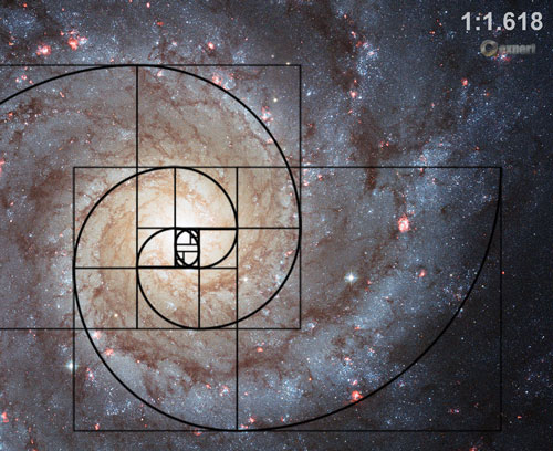
Originally Posted by fr0sty   Did you know the great pyramid is perfect, but they say the top of the pyramid is not in the middle of the square base and has an error of a quarter of a inch lol . but that is because the modern scientists has calculate wrong the Pi number. Pi or π is a mathematical constant whose value is the ratio of any circle's circumference to its diameter in Euclidean space; this is the same value as the ratio of a circle's area to the square of its radius. It is approximately equal to 3.14159 in the usual decimal notation (see the table for its representation in some other bases). π is one of the most important mathematical and physical constants: many formulae from mathematics, science, and engineering involve π.  Circumference = π × diameter  Area of the circle = π × area of the shaded square Calculating Pi number π can be empirically estimated by drawing a large circle, then measuring its diameter and circumference and dividing the circumference by the diameter. Another geometry-based approach, due to Archimedes,[19] is to calculate the perimeter, P n , of a regular polygon with n sides circumscribed around a circle with diameter d. Then 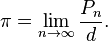 That is, the more sides the polygon has, the closer the approximation approaches π. Archimedes determined the accuracy of this approach by comparing the perimeter of the circumscribed polygon with the perimeter of a regular polygon with the same number of sides inscribed inside the circle. Using a polygon with 96 sides, he computed the fractional range:  I will say only that his ARCHIMEDES axiom (287-212 BC) resulting from the conclusion that seems logical in our OLD thinking and reference, namely that a circle can be compared and even overlapped with circumscribed polygon with infinite number of sides is not accurate! The modern scientist will say to you if you give them the TRUE PI NUMBER "Archimedes established margin that included PI: between 3.1408 (223/71) and 3.1428 (22 / 7), so the your result are not included in this interval, so that is false!" For the moment all the guys out there uses PI=3.1415(....) but the true Pi number is 3,1446(...) go and measure on terrain!!! practical !!! PI=4/radical(PHI, the golden ratio = 1.61803399(...)) = 3.14460550981492(...) !!!  The Golden Ratio!!! 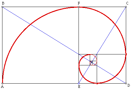 Facts: According to the true pi number the diameter of the Large Hadron Collider is smaller with 8.13 meters! According to the true pi number the GREAT PYRAMID IS P.E.R.F.E.C.T.!!!!!!! According to the true pi number N.A.S.A. is using the true PI number. lol According to the true pi number the humans will be able to build more perfect buildings (and durable ffs!!!) ACCORDING TO THE TRUE PI NUMBER THE MARKO RODIN SINGLE TORUS COIL WILL BE UPGRADED AND MORE EFFICIENT!!! and a little bigger in diameter  ) |
Correction: PI=4/sqrt(PHI)=3.144605511029693144(...)...without doubt...MEASURED!...But, pay attention, please, about the"PARADOX OF THE SMALL ANGLES"up to sqrt[sqrt(89)]=3.071478656(...) sexag.deg. I'll explain you, later! See you, please: http://quadrature.ro V L A H S T A R Mircea-Mugurel Serban
Last edited by vlahstar; 18-06-2009 at 09:21 AM. Reason: Completion!
|
|
|
|
Rispondi |
Messaggio 7 di 20 di questo argomento |
|
Quote:
Originally Posted by fr0sty Did you know the great pyramid is perfect, but they say the top of the pyramid is not in the middle of the square base and has an error of a quarter of a inch lol . but that is because the modern scientists has calculate wrong the Pi number. Pi or π is a mathematical constant whose value is the ratio of any circle's circumference to its diameter in Euclidean space; this is the same value as the ratio of a circle's area to the square of its radius. It is approximately equal to 3.14159 in the usual decimal notation (see the table for its representation in some other bases). π is one of the most important mathematical and physical constants: many formulae from mathematics, science, and engineering involve π. Circumference = π × diameter Area of the circle = π × area of the shaded square Calculating Pi number π can be empirically estimated by drawing a large circle, then measuring its diameter and circumference and dividing the circumference by the diameter. Another geometry-based approach, due to Archimedes,[19] is to calculate the perimeter, P n , of a regular polygon with n sides circumscribed around a circle with diameter d. Then That is, the more sides the polygon has, the closer the approximation approaches π. Archimedes determined the accuracy of this approach by comparing the perimeter of the circumscribed polygon with the perimeter of a regular polygon with the same number of sides inscribed inside the circle. Using a polygon with 96 sides, he computed the fractional range: I will say only that his ARCHIMEDES axiom (287-212 BC) resulting from the conclusion that seems logical in our OLD thinking and reference, namely that a circle can be compared and even overlapped with circumscribed polygon with infinite number of sides is not accurate! The modern scientist will say to you if you give them the TRUE PI NUMBER "Archimedes established margin that included PI: between 3.1408 (223/71) and 3.1428 (22 / 7), so the your result are not included in this interval, so that is false!" For the moment all the guys out there uses PI=3.1415(....) but the true Pi number is 3,1446(...) go and measure on terrain!!! practical !!! PI=4/radical(PHI, the golden ratio = 1.61803399(...)) = 3.14460550981492(...) !!! The Golden Ratio!!! Facts: According to the true pi number the diameter of the Large Hadron Collider is smaller with 8.13 meters! According to the true pi number the GREAT PYRAMID IS P.E.R.F.E.C.T.!!!!!!! According to the true pi number N.A.S.A. is using the true PI number. lol According to the true pi number the humans will be able to build more perfect buildings (and durable ffs!!!) ACCORDING TO THE TRUE PI NUMBER THE MARKO RODIN SINGLE TORUS COIL WILL BE UPGRADED AND MORE EFFICIENT!!! and a little bigger in diameter ) |
Correction: PI=4/sqrt(PHI)=3.144605511029693144(...)...without doubt...MEASURED!...But, pay attention, please, about the"PARADOX OF THE SMALL ANGLES"up to sqrt[sqrt(89)]=3.071478656(...) sexag.deg. I'll explain you, later! See you, please: http://quadrature.ro V L A H S T A R Mircea-Mugurel Serban
Last edited by vlahstar; 18-06-2009 at 09:21 AM. Reason: Completion!
|
|
|
|
Rispondi |
Messaggio 8 di 20 di questo argomento |
|
|
|
|
Rispondi |
Messaggio 9 di 20 di questo argomento |
|
|
|
|
Rispondi |
Messaggio 10 di 20 di questo argomento |
|
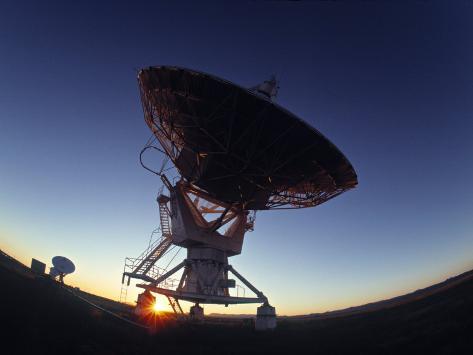
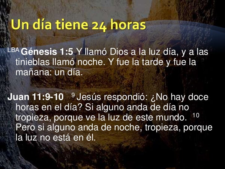
2. Daniel 2:27 Daniel respondió delante del rey, diciendo: El MISTERIO que el rey demanda, ni sabios, ni astrólogos, ni magos ni adivinos lo pueden revelar al rey.
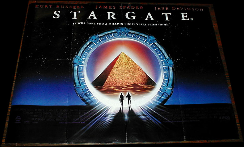
22/7=3.14= PI-RAMIDE
| Reply |
Message 106 of 106 on the subject |
|
|
MONTE HERMON (TRIBU DE DAN)
DAN-IEL / PARALELO 33
MON / MOON / LUNA / TRANSFIGURACION
LINAJE DE A-DAN
58. Génesis 49:16 DAN juzgará a su pueblo, Como una de las tribus de Israel.
Será DAN
serpiente junto al camino, Víbora junto a la senda, Que muerde los talones del caballo, Y hace caer hacia atrás al jinete
.
|
|
|
|
|
|
|
Rispondi |
Messaggio 11 di 20 di questo argomento |
|
|
|
|
Rispondi |
Messaggio 12 di 20 di questo argomento |
|
En este caso no es la jarra de Acuario , este cuadro refiere a los misterios de Eleusis, Cornu-copia, Cornu Latin cuerno, recordemos maiz en Ingles corn, relacionado con la fertilidad. Según el retórico ateniense Isócrates, los mayores dones que Deméter daba a los atenienses eran el grano, que hacía al hombre diferente de los animales salvajes, y los misterios eleusinos, que le daban mayores esperanzas en esta vida y en la otra.4
 |
Click para ampliar |
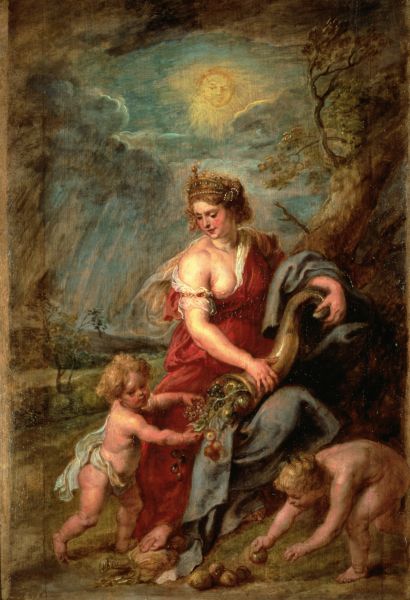 Demeter - Wikipedia, the free encyclopedia Demeter - Wikipedia, the free encyclopediaDeméter como madre de maíz De acuerdo con el ateniense orador Isócrates , los mayores dones de Deméter a la humanidad fueron la agricultura, en particular de los cereales, y los misterios que dan la esperanza de iniciar más en esta vida y el más allá. [ 12 ] Estos dos regalos fueron conectados íntimamente en los mitos de Deméter y cultos mistéricos . En Homero, la Odisea es la diosa de pelo rubio que se separa la paja del grano. [ 13 ] En Hesíodo, las oraciones a Zeus -Ctonio ( ctónica Zeus) y Deméter ayudar a crecer los cultivos lleno y fuerte. [ 14 ] Deméter emblema es el amapola, una flor de color rojo brillante que crece entre la cebada. [ 15 ] En Hesíodo 's Teogonía , Deméter es la hija de Cronos y Rea . En las bodas de Cadmo y Harmonía , Deméter atraídos Iasion lejos de los juerguistas otros. Tenían relaciones sexuales en un surco de arado en Creta , y ella dio a luz a un hijo, Pluto . [ 16 ] Su hija de Zeus era Perséfone , reina del mundo subterráneo. [ 17 ] [ editar ] Fiestas y cultos Artículo principal: Misterios de Eleusis y las Tesmoforias Dos grandes festivales de Deméter eran sagrados misterios . Su Tesmoforias del festival (11 de octubre - 13) fue sólo para mujeres. [ 18 ] Sus misterios de Eleusis estaban abiertas a los iniciados de cualquier género o clase social. En el corazón de ambos festivales son los mitos relativos a Deméter como Madre y Perséfone como su hija. [ editar ] Mitos 11 Octubre - codigo 11 - 8 8 el hipercubo - 11 las coordenadas de la simetria - El -even en los cuernos del Toro. Los cuernos son la figura clave en el Zodiaco de alli que los cuernos sean sinonimo del Diablo, seguna la mitologia Griega se ascocia la Cornucopia y su fertilidad mas a los cuernos de la cabra hoy fiel representante de Satan, en otros tiempos tambien asociado al Toro - Baal, Bel, Bull. El es el Dios sol Los pajaros son las aguilas bicefalas que se encuentran en el oraculo de Delphi a la hora indicada para dejar el huevo cosmico. El perro Anubis Cornucopia - Wikipedia, la enciclopedia libreLa cornucopia (del latín cornu, ‘cuerno’ y copĭa, ‘abundancia’), en español conocida también como cuerno de la abundancia (en latín cornu copĭae), es un símbolo de prosperidad y afluencia que data del siglo V a. C. En la mitología griega, la cabra Amaltea crio a Zeus con su leche. De niño, mientras jugaba con uno de sus rayos, Zeus rompió -sin querer- uno de los cuernos de la cabra. Para compensar a Amaltea, al cuerno roto le confirió poder para que, a quien lo poseyera, se le concediese todo lo que deseara. De ahí surgió la leyenda de la cornucopia. Las representaciones originales eran del cuerno de la cabra lleno de frutas y flores. A varias deidades, especialmente a Fortuna, se les representaba con el cuerno de la abundancia. Imágenes más modernas, como las usadas en los murales del Día de Acción de Gracias, muestran una cesta de mimbre con forma de cuerno llena de frutas y verduras. En otras representaciones modernas, la cornucopia es básicamente un cono curvo, hueco y sin fondo, típicamente relleno con diversos tipos de frutas. Se usa en el escudo de Colombia, donde aparecen dos cornucopias, una atiborrada de frutos y flores exóticas del país y otra llena de monedas de oro. En la parte superior del escudo de Venezuela se encuentran dos cornucopias cruzadas, así como en el escudo de Panamá y en el de Perú, donde aparece una cornucopia dorada que derrama monedas de oro. El cuerno de la abundancia también aparece en el escudo de la Provincia de Mendoza, ubicada en la República Argentina. Al menos durante varios decenios, en México se enseñaba y con colorida representación en mapas -dada su notoria inclinación de noroeste a sureste- se reiteraba que la forma del país es semejante a un cuerno de la abundancia, rebosante de frutas.
|
Click para ampliar |
 En la mitología finlandesa , el Sampo o Sammas era un artefacto mágico de tipo indeterminado construido por Ilmarinen que trajo buena suerte a su titular. Cuando el Sampo había sido robado, se dice que la patria de Ilmarinen cayó en tiempos duros y envió una expedición para recuperarlo, pero en la batalla que se estrelló y perdió en el mar. El Sampo ha sido interpretado de muchas maneras: un pilar del mundo o el árbol del mundo , una brújula o el astrolabio , un cofre que contiene un tesoro, una bizantina dado monedas , un decorado Vendel período de escudo, un cristiano reliquia , etc En el Kalevala , recopilador Lönnrot interpretado como un molinillo de mano o de molino de algún tipo que hace la harina , la sal y el oro de la nada. La hipótesis de los pilares del mundo, desarrollado originalmente por el historiador de las religiones Upo Harva y el lingüista Eemil Néstor Setälä en el siglo 20, es el más ampliamente aceptado. [ 1 ] De acuerdo a Giorgio de Santillana , profesor de la historia de la ciencia en el MIT , y el estudiante de la mitología, el Sampo y el pilar del mundo se refieren a la precesión de los equinoccios . En Molino de Hamlet , en coautoría con el Hertha von Deschend , los autores encuentran que el proceso de Sampo o precesión se creía que moler a cabo las diferentes edades del mundo, de edad de las tinieblas a la edad de oro y de nuevo en el largo ciclo de precesión.
|
Click para ampliar |
 Maná (hebreo:מן), según el libro del Éxodo, era el alimento enviado por Dios todos los días durante la estadía del pueblo de Israel en el desierto. Todos los días menos el sábado, por lo cual debían recolectar doble ración el viernes. También se encuentran referencias en midrashes judíos que el maná tenían el sabor y la apariencia de aquello que uno más deseaba. En el arca de la alianza se conservaba una muestra suya. El maná también se menciona brevemente en el Corán, en las azoras al-Baqara,1 al-Araf,2 y Ta ha,3 mencionando la fuente divina del maná como uno de los milagros con los cuales Dios favoreció a los israelitas. En el libro del Éxodo se le describe apareciendo cada mañana después de que el rocío hubiera desaparecido,4 y debía ser recogido antes de que el calor del sol lo derritiera. Según Números llegaba con el rocío, por la noche.5 Según la descripción bíblica, el maná se parecía a las semillas de coriandro, era de color blanco, y tras molerlo y hornearlo se parecía a las obleas con miel6 aunque en Números se describe del mismo color que la mirra india, y añade que algunas de las tortas sabían a tortas aceitadas.7 Los exégetas creen que estas diferencias se deben que el Éxodo es un texto yavista mientras el de Números es de fuente sacerdotal.8 El Talmud babilónico explica que las diferencias en la descripción se debían a que su gusto variaba según quien lo tomaba, miel para los niños, aceitunas para los jóvenes, pan para los mayores;9 la literatura rabínica clásica soluciona la cuestión de si el maná caía antes o después del rocío, explicando que lo hacía entre dos capas de humedad.10
Última edición por IndigoMerovingio; 20-may-2012 a las 02:18
|
|
|
|
Rispondi |
Messaggio 13 di 20 di questo argomento |
|
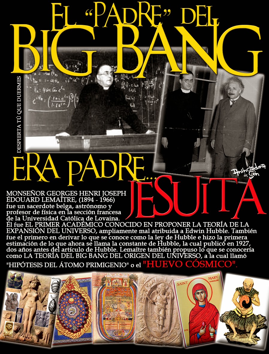
ISLA SAN GIORGIO (VENECIA)=GEORGE LEMAITRE
GEMATRIA EN INGLES DE SEED=33
GEMATRIA EN INGLES DE GATE=33
SARA (CE-SAREA DE FILIPO)=PARALELO 33
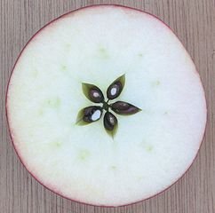 the Apple
| milky way in Simple Gematria Equals: 119 |
( |
m 13 |
i9 |
l 12 |
k 11 |
y 25 |
0 |
w 23 |
a1 |
y 25 |
) |
| queen mary in Simple Gematria Equals: 119 |
( |
q 17 |
u 21 |
e5 |
e5 |
n 14 |
0 |
m 13 |
a1 |
r 18 |
y 25 |
|
| hebrew calendar in Simple Gematria Equals: 119 |
( |
h8 |
e5 |
b2 |
r 18 |
e5 |
w 23 |
0 |
c3 |
a1 |
l 12 |
e5 |
n 14 |
d4 |
a1 |
r 18 |
| mary magdalene in Simple Gematria Equals: 119 |
( |
m 13 |
a1 |
r 18 |
y 25 |
0 |
m 13 |
a1 |
g7 |
d4 |
a1 |
l 12 |
e5 |
n 14 |
e5 |
|
|
|
|
|
Rispondi |
Messaggio 14 di 20 di questo argomento |
|
|
|
|
Rispondi |
Messaggio 15 di 20 di questo argomento |
|
|
|
|
Rispondi |
Messaggio 16 di 20 di questo argomento |
|

Jordan River (Utah)
From Wikipedia, the free encyclopedia
The Jordan River, in the state of Utah, United States, is a river about 51 miles (82 km) long. Regulated by pumps at its headwaters at Utah Lake, it flows northward through the Salt Lake Valley and empties into the Great Salt Lake. Four of Utah's six largest cities border the river: Salt Lake City, West Valley City, West Jordan, and Sandy. More than a million people live in the Jordan Subbasin, part of the Jordan River watershed that lies within Salt Lake and Utah counties. During the Pleistocene, the area was part of Lake Bonneville.
Members of the Desert Archaic Culture were the earliest known inhabitants of the region; an archaeological site found along the river dates back 3,000 years. Mormon pioneers led by Brigham Young were the first European American settlers, arriving in July 1847 and establishing farms and settlements along the river and its tributaries. The growing population, needing water for drinking, irrigation, and industrial use in an arid climate, dug ditches and canals, built dams, and installed pumps to create a highly regulated river.
Although the Jordan was originally a cold-water fishery with 13 native species, including Bonneville cutthroat trout, it has become a warm-water fishery where the common carp is most abundant. It was heavily polluted for many years by raw sewage, agricultural runoff, and mining wastes. In the 1960s, sewage treatment removed many pollutants. In the 21st century, pollution is further limited by the Clean Water Act, and, in some cases, the Superfund program. Once the home of bighorn sheep and beaver, the contemporary river is frequented by raccoons, red foxes, and domestic pets. It is an important avian resource, as are the Great Salt Lake and Utah Lake, visited by more than 200 bird species.
Big Cottonwood, Little Cottonwood, Red Butte, Mill, Parley's, and City creeks, as well as smaller streams like Willow Creek at Draper, Utah, flow through the sub-basin. The Jordan River Parkway along the river includes natural areas, botanical gardens, golf courses, and a 40-mile (64 km) bicycle and pedestrian trail, completed in 2017.[6]
The Jordan River is Utah Lake's only outflow. It originates at the northern end of the lake between the cities of Lehi and Saratoga Springs. It then meanders north through the north end of Utah Valley for approximately 8 miles (13 km) until it passes through a gorge in the Traverse Mountains, known as the Jordan Narrows. The Utah National Guard base at Camp Williams lies on the western side of the river through much of the Jordan Narrows.[7][8] The Turner Dam, located 41.8 miles (67.3 km) from the river's mouth (or at river mile 41.8) and within the boundaries of the Jordan Narrows, is the first of two dams of the Jordan River. Turner Dam diverts the water to the right or easterly into the East Jordan Canal and to the left or westerly toward the Utah and Salt Lake Canal. Two pumping stations situated next to Turner Dam divert water to the west into the Provo Reservoir Canal, Utah Lake Distribution Canal, and Jacob-Welby Canal. The Provo Reservoir Canal runs north through Salt Lake County, Jacob-Welby runs south through Utah County. The Utah Lake Distribution Canal runs both north and south, eventually leading back into Utah Lake.[9] Outside the narrows, the river reaches the second dam, known as Joint Dam, which is 39.9 miles (64.2 km) from the river's mouth. Joint Dam diverts water to the east for the Jordan and Salt Lake City Canal and to the west for the South Jordan Canal.[10][11][12]

Map of the Salt Lake Valley
The river then flows through the middle of the Salt Lake Valley, initially moving through the city of Bluffdale and then forming the border between the cities of Riverton and Draper.[7] The river then enters the city of South Jordan where it merges with Midas Creek from the west. Upon leaving South Jordan, the river forms the border between the cities of West Jordan on the west and Sandy and Midvale on the east. From the west, Bingham Creek enters West Jordan. Dry Creek, an eastern tributary, combines with the main river in Sandy. The river then forms the border between the cities of Taylorsville and West Valley City on the west and Murray and South Salt Lake on the east. The river flows underneath Interstate 215 in Murray. Little and Big Cottonwood Creeks enter from the east in Murray, 21.7 miles (34.9 km) and 20.6 miles (33.2 km) from the mouth respectively. Mill Creek enters on the east in South Salt Lake, 17.3 miles (27.8 km) from the mouth. The river runs through the middle of Salt Lake City, where the river travels underneath Interstate 80 a mile west of downtown Salt Lake City and again underneath Interstate 215 in the northern portion of Salt Lake City. Interstate 15 parallels the river's eastern flank throughout Salt Lake County. At 16 miles (26 km) from the mouth, the river enters the Surplus Canal channel. The Jordan River physically diverts from the Surplus Canal through four gates and heads north with the Surplus Canal heading northwest. Parley's, Emigration, and Red Butte Creeks converge from the east through an underground pipe, 14.2 miles (22.9 km) from the mouth.[7] City Creek also enters via an underground pipe, 11.5 miles (18.5 km) from the river's mouth. The length of the river and the elevation of its mouth varies year to year depending on the fluctuations of the Great Salt Lake caused by weather conditions. The lake has an average elevation of 4,200 feet (1,300 m) which can deviate by 10 feet (3.0 m).[3] The Jordan River then continues for 9 to 12 miles (14 to 19 km) with Salt Lake County on the west and North Salt Lake and Davis County on the east until it empties into the Great Salt Lake.[7][8][11]
Discharge[edit]
The United States Geological Survey maintains a stream gauge in Salt Lake City that shows annual runoff from the period 1980–2003 is just over 150,000 acre-feet (190,000,000 m3) per year or 100 percent of the total 800,000 acre-feet (990,000,000 m3) of water entering the Jordan River from all sources. The Surplus Canal carries almost 60 percent of the water into the Great Salt Lake, with various irrigation canals responsible for the rest. The amount of water entering the Jordan River from Utah Lake is just over 400,000 acre-feet (490,000,000 m3) per year. Inflow from the 11 largest streams feeding the Jordan River, sewage treatment plants, and groundwater each account for approximately 15 percent of water entering the river.[13]
Watershed[edit]

Map of the entire Jordan River Basin
|
|
|
|
Rispondi |
Messaggio 17 di 20 di questo argomento |
|
Jordan River (Utah)
From Wikipedia, the free encyclopedia
The Jordan River, in the state of Utah, United States, is a river about 51 miles (82 km) long. Regulated by pumps at its headwaters at Utah Lake, it flows northward through the Salt Lake Valley and empties into the Great Salt Lake. Four of Utah's six largest cities border the river: Salt Lake City, West Valley City, West Jordan, and Sandy. More than a million people live in the Jordan Subbasin, part of the Jordan River watershed that lies within Salt Lake and Utah counties. During the Pleistocene, the area was part of Lake Bonneville.
Members of the Desert Archaic Culture were the earliest known inhabitants of the region; an archaeological site found along the river dates back 3,000 years. Mormon pioneers led by Brigham Young were the first European American settlers, arriving in July 1847 and establishing farms and settlements along the river and its tributaries. The growing population, needing water for drinking, irrigation, and industrial use in an arid climate, dug ditches and canals, built dams, and installed pumps to create a highly regulated river.
Although the Jordan was originally a cold-water fishery with 13 native species, including Bonneville cutthroat trout, it has become a warm-water fishery where the common carp is most abundant. It was heavily polluted for many years by raw sewage, agricultural runoff, and mining wastes. In the 1960s, sewage treatment removed many pollutants. In the 21st century, pollution is further limited by the Clean Water Act, and, in some cases, the Superfund program. Once the home of bighorn sheep and beaver, the contemporary river is frequented by raccoons, red foxes, and domestic pets. It is an important avian resource, as are the Great Salt Lake and Utah Lake, visited by more than 200 bird species.
Big Cottonwood, Little Cottonwood, Red Butte, Mill, Parley's, and City creeks, as well as smaller streams like Willow Creek at Draper, Utah, flow through the sub-basin. The Jordan River Parkway along the river includes natural areas, botanical gardens, golf courses, and a 40-mile (64 km) bicycle and pedestrian trail, completed in 2017.[6]
The Jordan River is Utah Lake's only outflow. It originates at the northern end of the lake between the cities of Lehi and Saratoga Springs. It then meanders north through the north end of Utah Valley for approximately 8 miles (13 km) until it passes through a gorge in the Traverse Mountains, known as the Jordan Narrows. The Utah National Guard base at Camp Williams lies on the western side of the river through much of the Jordan Narrows.[7][8] The Turner Dam, located 41.8 miles (67.3 km) from the river's mouth (or at river mile 41.8) and within the boundaries of the Jordan Narrows, is the first of two dams of the Jordan River. Turner Dam diverts the water to the right or easterly into the East Jordan Canal and to the left or westerly toward the Utah and Salt Lake Canal. Two pumping stations situated next to Turner Dam divert water to the west into the Provo Reservoir Canal, Utah Lake Distribution Canal, and Jacob-Welby Canal. The Provo Reservoir Canal runs north through Salt Lake County, Jacob-Welby runs south through Utah County. The Utah Lake Distribution Canal runs both north and south, eventually leading back into Utah Lake.[9] Outside the narrows, the river reaches the second dam, known as Joint Dam, which is 39.9 miles (64.2 km) from the river's mouth. Joint Dam diverts water to the east for the Jordan and Salt Lake City Canal and to the west for the South Jordan Canal.[10][11][12]
Map of the Salt Lake Valley
The river then flows through the middle of the Salt Lake Valley, initially moving through the city of Bluffdale and then forming the border between the cities of Riverton and Draper.[7] The river then enters the city of South Jordan where it merges with Midas Creek from the west. Upon leaving South Jordan, the river forms the border between the cities of West Jordan on the west and Sandy and Midvale on the east. From the west, Bingham Creek enters West Jordan. Dry Creek, an eastern tributary, combines with the main river in Sandy. The river then forms the border between the cities of Taylorsville and West Valley City on the west and Murray and South Salt Lake on the east. The river flows underneath Interstate 215 in Murray. Little and Big Cottonwood Creeks enter from the east in Murray, 21.7 miles (34.9 km) and 20.6 miles (33.2 km) from the mouth respectively. Mill Creek enters on the east in South Salt Lake, 17.3 miles (27.8 km) from the mouth. The river runs through the middle of Salt Lake City, where the river travels underneath Interstate 80 a mile west of downtown Salt Lake City and again underneath Interstate 215 in the northern portion of Salt Lake City. Interstate 15 parallels the river's eastern flank throughout Salt Lake County. At 16 miles (26 km) from the mouth, the river enters the Surplus Canal channel. The Jordan River physically diverts from the Surplus Canal through four gates and heads north with the Surplus Canal heading northwest. Parley's, Emigration, and Red Butte Creeks converge from the east through an underground pipe, 14.2 miles (22.9 km) from the mouth.[7] City Creek also enters via an underground pipe, 11.5 miles (18.5 km) from the river's mouth. The length of the river and the elevation of its mouth varies year to year depending on the fluctuations of the Great Salt Lake caused by weather conditions. The lake has an average elevation of 4,200 feet (1,300 m) which can deviate by 10 feet (3.0 m).[3] The Jordan River then continues for 9 to 12 miles (14 to 19 km) with Salt Lake County on the west and North Salt Lake and Davis County on the east until it empties into the Great Salt Lake.[7][8][11]
Discharge[edit]
The United States Geological Survey maintains a stream gauge in Salt Lake City that shows annual runoff from the period 1980–2003 is just over 150,000 acre-feet (190,000,000 m3) per year or 100 percent of the total 800,000 acre-feet (990,000,000 m3) of water entering the Jordan River from all sources. The Surplus Canal carries almost 60 percent of the water into the Great Salt Lake, with various irrigation canals responsible for the rest. The amount of water entering the Jordan River from Utah Lake is just over 400,000 acre-feet (490,000,000 m3) per year. Inflow from the 11 largest streams feeding the Jordan River, sewage treatment plants, and groundwater each account for approximately 15 percent of water entering the river.[13]
Watershed[edit]
Map of the entire Jordan River Basin
|
|
|
|
Rispondi |
Messaggio 18 di 20 di questo argomento |
|
|
|
|
Different cyclotron size: a) Lawrence ́s first one, b) Venezuela First one (courtesy of Dorly Coehlo), c) Fermi National Laboratory at CERN. And size matters, and Cyclotrons win as best hospital candidates due to Reactors are bigger, harder and difficult to be set in a hospital installation. Can you imagine a nuclear reactor inside a health installation? Radiation Protection Program will consume all the budget available. Size, controlled reactions, electrical control, made cyclotrons easy to install, and baby cyclotrons come selfshielded so hospital don ́t need to spend money in a extremely large bunker. Now on, we are going to talk about our first experience with the set up of a baby cyclotron for medical uses inside the first PET installation in Latin America. “Baby” means its acceleration “D” diameters are suitable to be set inside a standard hospital room dimensions, with all its needs to be safetly shielded for production transmision and synthetized for human uses for imaging in Nuclear Medicine PET routine. When we ask why Cyclotrons are better than reactors for radioisotopes production to be used in Medicine, we also have to have in mind that they has: 1. Less radioactive waste 2. Less harmful debris
https://www.researchgate.net/figure/Different-cyclotron-size-a-Lawrence-s-first-one-b-Venezuela-First-one-courtesy-of_fig3_221906035 |
|
|
|
|
|
|
Rispondi |
Messaggio 19 di 20 di questo argomento |
|
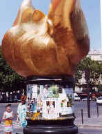
Llama de la Libertad (París)
 La Llama de la Libertad, ofrecida al pueblo francés por donantes de todo el mundo como símbolo de la amistad franco-americana, en la plaza Diana (París).
La Llama de la Libertad (en francés, Flamme de la Liberté) de París es una réplica del mismo tamaño de la nueva llama situada en el extremo de la antorcha que lleva en la mano la Estatua de la Libertad de Nueva York desde 1986.1 El monumento, que tiene aproximadamente 3,5 metros de longitud, es una escultura de una llama de cobre dorado, apoyada en un pedestal de mármol gris y negro. Está situado cerca del extremo norte del puente del Alma, en la plaza Diana, en el distrito 8 de París, Francia.2
Fue ofrecida a la ciudad de París en 1989 por el International Herald Tribune en nombre de los donantes, que habían contribuido aproximadamente 400 000 dólares para su realización. Representaba la culminación de las celebraciones de 1987 del periódico por su cien aniversario de la publicación de un periódico en inglés en París. Más importante, la Llama era una muestra de agradecimiento por la restauración de la Estatua de la Libertad realizada tres años antes por dos empresas francesas que hicieron el trabajo artesanal del proyecto: Métalliers Champenois, que hizo el trabajo del bronce, y Gohard Studios, que aplicó el pan de oro. Aunque el regalo a Francia fue motivado por el centenario del periódico, la Llama de la Libertad es un símbolo más general de la amistad que une los dos países, igual que la Estatua de la Libertad cuando fue regalada a los Estados Unidos por Francia.
Este proyecto fue supervisado por el director de la unión de artesanos franceses en aquel momento, Jacques Graindorge. Propuso la instalación de la Llama de la Libertad en una plaza pública llamada Place des États-Unis en el distrito 16, pero el alcalde de París, Jacques Chirac, se opuso a esto. Tras un prolongado período de negociaciones, se decidió que la alama se situaría en una zona abierta cerca de la intersección de la Avenue de New-York y la Place de l'Alma. El monumento fue inaugurado el 10 de mayo de 1989 por Chirac.
En la base del monumento hay una placa conmemorativa que relata la siguiente historia:
"La Llama de la Libertad. Una réplica exacta de la llama de la Estatua de la Libertad ofrecida al pueblo de Francia por donantes de todo el mundo como símbolo de la amistad franco-americana. Con ocasión del centenario del International Herald Tribune, París 1887-1987."
La llama se convirtió en un monumento no oficial de Diana de Gales después de su muerte en 1997 en el túnel bajo el Pont de l'Alma.3 La llama es una atracción para turistas y seguidores de Diana, quiens pegan pósteres y folletos con material conmemorativo en la base. El antropólogo Guy Lesoeurs dijo que "la mayoría de las personas que vienen aquí piensan que se construyó para ella."2 La plaza del monumento se llama desde entonces Plaza Diana (París).
El monumento está cerca de la estación del Metro de París llamada Alma-Marceau en la línea 9 y de la estación Pont de l’Alma Línea 'C' del RER, así como por los buses número 42, 63, 72, 80, 92, y los autobuses turísticos Balabus.
El 14 de junio de 2008 se inauguró una nueva Llama de la Libertad, una escultura de Jean Cardot, que también simboliza las relaciones cálidas y respetuosas entre Francia y los Estados Unidos. Fue instalada en los jardines de la Embajada de los Estados Unidos en Francia en la Place de la Concorde, y se inauguró en presencia del Presidente de la República Francesa, Nicolas Sarkozy, y el Presidente de los Estados Unidos, George W. Bush. Esta nueva llama es la realización de un impulso compartido por el empresario francés Marc Ladreit de Lacharrière, y el embajador estadounidense Craig Roberts Stapleton, y tiene dos inscripciones, una del francés Marqués de La Fayette y otra del estadista americano Benjamin Franklin.
|
|
|
|
Rispondi |
Messaggio 20 di 20 di questo argomento |
|
Michael Jackson's untimely death was the tsunami wave hitting land. And he had a message to deliver...

He was 'Bigfoot'...

[Bigfoot = super theme of 2009]
...born in Gary, Indiana
|
Indiana => 'In-Diana' => 'In Moon' (Diana = moon goddess)
|

['Dirty Diana' - video]
...launched to Moon at Apollo

 
...carrying a torch

[Indiana state flag]

...of Diana
AKA Flame of Liberty
...burning bright in Paris
where she was killed on August 31, 1997

[Diana car accident site in Paris]
...precisely 10 years after 'Bad'
containing hit song 'Dirty Diana'

[Release August 31, 1987]
It was...
'Moon Impact'


* * *
'For now doth Cain with fork of thorns confine
On either hemisphere, touching the wave
Beneath the towers of Seville. Yesternight
The moon was round.'
- Dante, Inferno
Why Diana?
'Follow the rabbit', whispered the Man in the Mirror...


 'King of Pop' 'King of Pop'- Christmas - birth of 'King of the Jews'
- Death of Eartha Kitt famous for singing 'Santa Baby'
Reflected in the mirror was a messianic baby... a prince.
Michael Jackson had two boys named 'Prince Michael' and a daughter 'Paris Michael (Katherine)' whom, according to his will, he wanted in the hands of Diana (Ross) if his mother was unavailable, as widely reported on Princess Diana's birthday (July 1).

The close, lifelong ties between Michael Jackson's and his friend Diana Ross are made dramatically clear in his 2002 will - he chose her to raise his three children if his mother is unable to do so. [...]
Note also:
- Princess Diana died in Paris
- Diana's 'baby' Prince William had his birthday (June 21) marked by literal Moon Impact (TV movie) 4 days before MJ's death
- A member of the British Royal Family named Prince Michael (of Kent)
-- June 21, 2009 --
 
['Impact' preview video]
Prince William
He was 'in-Diana'...

He came out of Diana's womb...

He became Prince Charles' 'angel'...
  
...as in Charlie's Angels


Jun 25 Farrah Fawcett succumbs to cancer at 62
Farrah Fawcett:
- One of 'Charlie's Angels'
- Born in Corpus Christi or 'Body of Christ'
- Death hours before Michael Jackson's
Closely preceded by Neda...
Neda:
- Killed on June 20, day before Prince William's BD
- 'Neda' means 'divine message' ('angel' means 'messenger')
Following her heart-breaking death captured on video, Neda became the face of the protests raging at the time in Iran following the June 12 presidential election (starting on June 13).
June 12-13...
|
 |
| June 11 - Kaguya Moon Impact |
June 12 - Film 'Moon' release |
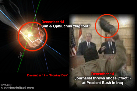
...Moon/Diana and Bigfoot/St. Anthony
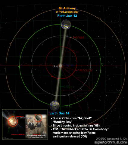
Dec 14 Shoes thrown at Bush on Iraq trip
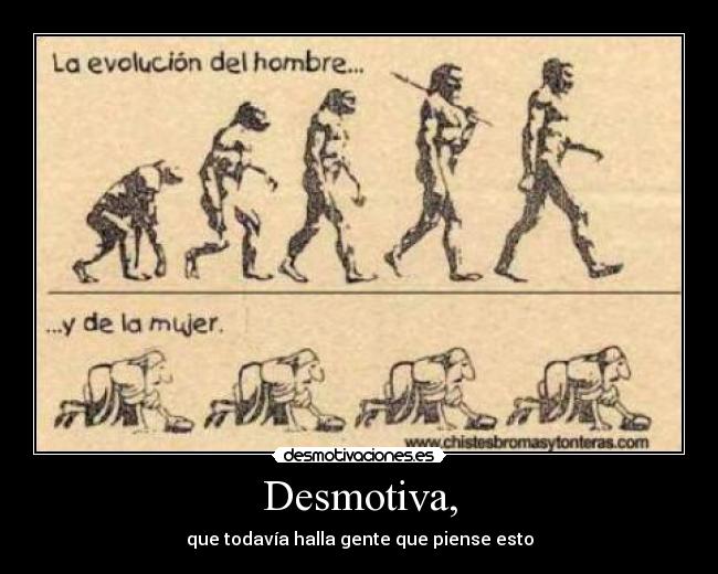
'Bigfoot' = evolution/missing link
Michael Jackson = one-man 'evolution'

[MJ's ever-changing face]

 Werewolf = man-beast = Bigfoot Werewolf = man-beast = Bigfoot
Etymology: The first part, wer, translates as "man"... The second half, wulf, is the ancestor of modern English "wolf"; in some cases it also had the general meaning "beast."
His was an unnatural evolution (plastic surgeries, etc.). What about ours? Is human evolution natural? If not, has the Moon had a hand in it?
We can almost hear the whisper: 'Human evolution is a hoax':
August 15, 2008
St. Anthony of Padua birthday
Bigfoot hoax...
https://www.goroadachi.com/etemenanki/moonwalker.htm |
|
|
 Primo
Precedente
6 a 20 de 20
Successivo Primo
Precedente
6 a 20 de 20
Successivo
 Ultimo
|