|
|
This term “Pixel” which happens to be like the smoking gun in proving the artificial Matrix, is why we have “Pi” & “Phi” and “Patmos Island” as codes:
PIXEL ~~~ the number PI (3.14…)
PIXEL ~~~ the number “PHI“
PIXEL ~~~ Patmos Island
http://en.wikipedia.org/wiki/Pi
http://en.wikipedia.org/wiki/Phi
ANY SIMIL BETWEEN THE GREEK LETTER FOR No. “PI” AND THE HEBREW LETTER “H” IN THE TETRAGRAMMATON IS SHEER COINCIDENCE…?

Tetragrammaton (reads from right to left as YHVH in hebrew)

Number “PI” in the Matrix

Number “PI” as to number “PHI”
|
|
|
|
|

Foto: INAH
24 de julio 2021
Pirámides circulares que puedes visitar en la CDMX
Nada de ovnis, chilangos, estas pirámides circulares cerca de CDMX esconden un simbolismo que remite a antiquísimos mitos prehispánicos.
Seguramente has escuchado extrañas teorías acerca de estas construcciones cuya forma no fue la prototípica en Mesoamérica, pero no es para menos, ya que somos el único país con este tipo de basamentos. Aún así, la explicación a esas peculiares formas no son de otro mundo, sino que tienen fundamento en la cosmovisión de los diferentes asentamientos que las poblaron. Te decimos dónde encontrar pirámides circulares cerca de CDMX.
Mira esto: Dioses, conejos y… ¿pulque? Leyendas mexicas de la luna
Por un lado, varias de estas pirámides circulares tienen que ver con Ehécatl, dios del viento. Por el otro, estudiosos han planteado que los templos con esta forma se construían intentando simular la forma de los astros, los cuales estaban íntimamente ligados con las divinidades.
1Pirámide de Cuicuilco A
 Foto: Inah
La pirámide circular más conocida en la Ciudad de México es la de Cuicuilco, aunque según el INAH es incorrecto considerarla como pirámide, sino que es un basamento. La zona arqueológica de Cuicuilco se encuentra en el sur de la ciudad y fue un asentamiento de una cultura del preclásico —800 a.C.—, o sea mucho antes de las grandes civilizaciones del Valle de México.
Lamentablemente el basamento de circular de Cuicuilco se encuentra muy deteriorado, no sólo por el paso del tiempo, también debido a la erupción del volcán Xitle, la cual se cree puso fin a esta civilización al cubrir todo el terreno del Pedregal con lava.
Dónde: Av. Insurgentes Sur esquina con Periférico Sur
Horario: mié-vie 10-16 h
2Pirámide de Tenantongo
Pocos lo saben, pero la zona arqueológica de Cuicuilco no se limita al enorme y famoso basamento, sino que hay otras formaciones circulares en el área. La primera de ellas es la pirámide de Tenantongo, en el bosque de Tlalpan.
Únicamente es posible ver la parte superior de la pirámide, ya que el resto se encuentra sepultado en roca volcánica de la erupción del Xitle. Sin embargo, arqueólogos del Instituto Nacional de Antropología e Historia, INAH, estiman que tiene 18 metros de altura y un diámetro de 50 a 70 metros.
Te recomendamos: Samuráis, kimonos y otras curiosidades de oriente en CDMX
Al igual que el basamento circular de Cuicuilco, se cree que la pirámide de Tenantongo estaba dedicada al Dios Viejo del Fuego y que era un sitio donde se realizaban danzas y rituales.
Dónde: Adentro del Bosque de Tlalpan. Camino a Santa Teresa s/n, Parques del Pedregal. Por la entrada principal hay que caminar aproximadamente 1 km.
Horario: mié-vie 10-16 h
3Pirámide de Cuicuilco B y montículo de Peña Pobre
¡Otra más de Cuicuilco? Pues sí, tal como te platicamos, la civilización de Cuicuilco fue una de las más importantes en el preclásico, por lo que la zona del pedregal esconde un importante pasado prehispánico. El complejo ceremonial del Dios Viejo del Fuego contaba con varias pirámides, siendo la de Cuicuilco A la más importante, pero existen otros dos basamentos y montículos circulares en la Unidad Habitacional Villa Olímpica y dentro del Parque Ecológico Loreto y Peña Pobre respectivamente.
Dónde: Adentro del Parque Ecológico Loreto y Peña Pobre. Avenida San Fernando #765, Peña Pobre.
Horario: lun-dom 8-18 h
4Pirámide de Ehécatl
 Foto: Wikimedia Commons
La pirámide circular más visitada de la ciudad es la que se encuentra en el metro Pino Suárez, no hay duda alguna. Esta pirámide es la única que se encuentra bajo el resguardo del Sistema Colectivo Metro, esto es porque se descubrió en 1968 durante los trabajos de construcción de la Línea 2. A diferencia de la zona arqueológica de Cuicuilco que perteneció a una civilización del preclásico, la pirámide de Ehécatl fue construida por los mexicas.
¿Pero quién fue Ehécatl? Ah, pues el dios del viento de los mexicas, a quien se le construían adoratorios y templos circulares. Se cree que esta pirámide formó parte de un antiguo centro ceremonial que abarcó todo Izazaga y que se conectaba con el Templo Mayor.
Dónde: Adentro de la estación de Metro Pino Suárez, de la línea 2.
Horario: lun-dom 6-12 h
5Calixtlahuaca
Ahora nos vamos al Estado de México, muy cerca del valle de Toluca, aquí se encuentra una zona arqueológica llamada Calixtlahuaca, que significa “lugar de casas en la llanura”. Los vestigios más antiguos de aquí datan del año 1,500 a.C. y se cree que distintos grupos habitaron la zona, entre ellos los matlazincas. También existen los rumores de que los ovnis también pasaron por aquí debido a una pirámide circular.
También lee: Momias, tumbas prehispánicas y otros vestigios en CDMX
Se cree que esta pirámide circular está dedicado a Quetzalcóatl o a Ehécatl, aunque los arqueólogos no lo tienen muy claro por el estado deteriorado en el que se encuentra. En la parte superior de este templo se puede ver un adoratorio con dos caras labradas en piedra.
Dónde: Calle Hidalgo s/n, pueblo de Calixtlahuaca, Toluca de Lerdo
Horario: mar-dom 10-17 h
6Huexotla
 Foto: Wikimedia Commons
A las afueras de San Luis Huexotla, muy cerca de la Universidad Autónoma de Chapingo, se encuentran una serie de templos chichimecas que datan del 1200-1521 d.C. Una de estas construcciones es un templo circular dedicado a Ehécatl, el cual fue construido sobre una base redonda de más de 19 metros de diámetro. Quizás no es una pirámide, ya que su altura no permite catalogarla así, pero la impresionante construcción circular no deja de sorprender.
Hace algunos años surgieron rumores de unos túneles secretos debajo de la pirámide circular, sin embargo, arqueólogos del INAH lo desmintieron. Quizás sólo es la curiosidad que causa la peculiar forma de estas pirámides, lo que sí podemos asegurar es que son el producto de las grandes civilizaciones prehispánicas.
Dónde: Calle San Francisco s/n, pueblo San Luis Huexotla
Horario: lun-dom 8-15 h y 16-17 h
Para seguir explorando el pasado prehispánico de nuestra ciudad, te recomendamos echarle un ojo a este recuento de zonas arqueológicas ocultas, a la historia de los monolitos de la CDMX y a estos secretos del Museo de Antropología.
https://www.chilango.com/cultura/piramides-circulares-cerca-cdmx/ |
|
|
|
|
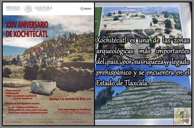
XXIV ANIVERSARIO DE XOCHITÉCATL.
A finales del mes de noviembre y principios de diciembre, se cumple el XXIV aniversario del Descubrimiento del Centro Ceremonial Xochitécatl, en la zona arqueológica de Cacaxtla, por lo cual, este 2 de diciembre del 2018, se tienen preparados una serie de actividades donde se busca dar a conocer los últimos hallazgos de este sitio, por investigadores y arqueólogos del Instituto Nacional de antropología e Historia (INAH).
 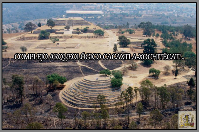 La investigación en el sitio se remonta a los años 40 del siglo pasado, cuando el arqueólogo Pedro Armillas realizó el registro del yacimiento Cacaxtla y Xochitécatl; posteriormente, en los años 60, la Fundación Alemana para la Investigación Científica hizo un proyecto de antropología, arqueología y lingüística, y llevó a cabo un recorrido de superficie, con el que se le dio la fecha de ocupación, ubicándolo en el Formativo Temprano (1000 a.C.). Ese dato se mantuvo hasta los años 90, cuando la doctora Mari Carmen Serra Puche efectuó una excavación extensiva y proporcionó nuevas fechas de ocupación del sitio, cuya construcción inició en 700 a.C. La investigación en el sitio se remonta a los años 40 del siglo pasado, cuando el arqueólogo Pedro Armillas realizó el registro del yacimiento Cacaxtla y Xochitécatl; posteriormente, en los años 60, la Fundación Alemana para la Investigación Científica hizo un proyecto de antropología, arqueología y lingüística, y llevó a cabo un recorrido de superficie, con el que se le dio la fecha de ocupación, ubicándolo en el Formativo Temprano (1000 a.C.). Ese dato se mantuvo hasta los años 90, cuando la doctora Mari Carmen Serra Puche efectuó una excavación extensiva y proporcionó nuevas fechas de ocupación del sitio, cuya construcción inició en 700 a.C.
CACAXTLA.
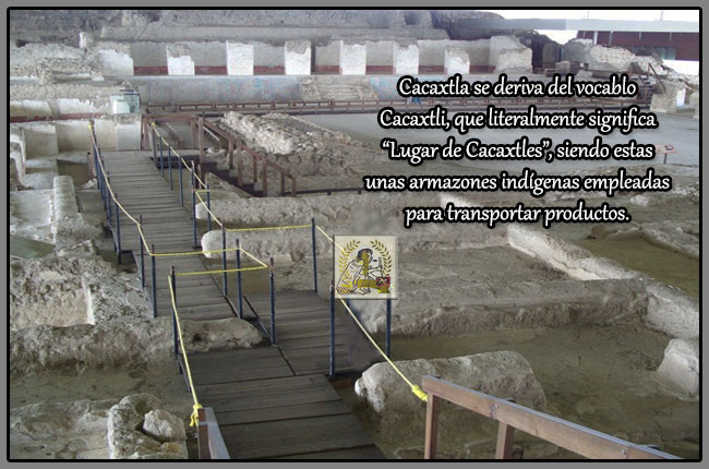 Las investigaciones arqueológicas realizadas en la sección oriente del sitio a partir de su descubrimiento en la década de 1970 en el área conocida como Cacaxtla, develan una de las sociedades más importantes que se desarrollaron en el periodo Epiclásico (650-900 d.C.) de Mesoamérica. Su poderío logró la hegemonía política, militar y económica en gran parte del valle poblano-tlaxcalteca después de la caída de Teotihuacán y Cholula, consiguiendo entablar relaciones comerciales a larga distancia con regiones distantes como la Costa del Golfo y la Cuenca de México. Las investigaciones arqueológicas realizadas en la sección oriente del sitio a partir de su descubrimiento en la década de 1970 en el área conocida como Cacaxtla, develan una de las sociedades más importantes que se desarrollaron en el periodo Epiclásico (650-900 d.C.) de Mesoamérica. Su poderío logró la hegemonía política, militar y económica en gran parte del valle poblano-tlaxcalteca después de la caída de Teotihuacán y Cholula, consiguiendo entablar relaciones comerciales a larga distancia con regiones distantes como la Costa del Golfo y la Cuenca de México.
XOCHITÉCATL.
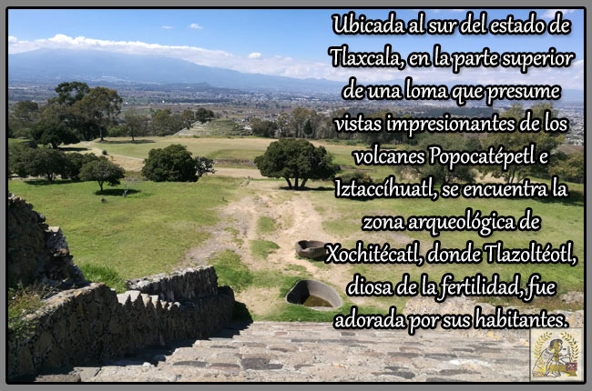 El nombre de Xochitécatl significa en lengua náhuatl “Lugar del linaje de las flores”. La referencia más antigua que se tiene de este lugar se halla representada en el llamado “mapa número dos de Cuauhtinchan”. Documento donde el glifo toponímico de Xochitécatl representado por la imagen de un cerro coronado de flores. El nombre de Xochitécatl significa en lengua náhuatl “Lugar del linaje de las flores”. La referencia más antigua que se tiene de este lugar se halla representada en el llamado “mapa número dos de Cuauhtinchan”. Documento donde el glifo toponímico de Xochitécatl representado por la imagen de un cerro coronado de flores.
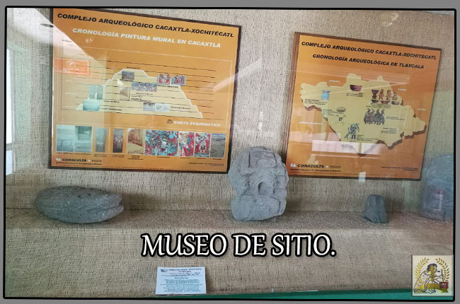
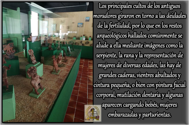
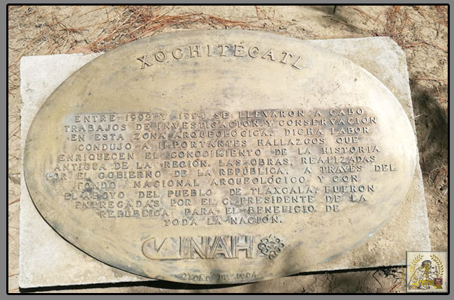 Una de sus principales características fue distinguirse como un centro de labores diversas, a causa de los talleres de navajas identificados y de las tinas, que demostraban un avanzado conocimiento en los procesos de producción. Ahí se realizaban ritos de fertilidad, como lo demuestran los entierros de mujeres e infantes encontrados en la pirámide de las flores, así como la gran cantidad de figurillas femeninas; muchas de ellas se exhiben actualmente en el museo de sitio. Una de sus principales características fue distinguirse como un centro de labores diversas, a causa de los talleres de navajas identificados y de las tinas, que demostraban un avanzado conocimiento en los procesos de producción. Ahí se realizaban ritos de fertilidad, como lo demuestran los entierros de mujeres e infantes encontrados en la pirámide de las flores, así como la gran cantidad de figurillas femeninas; muchas de ellas se exhiben actualmente en el museo de sitio.
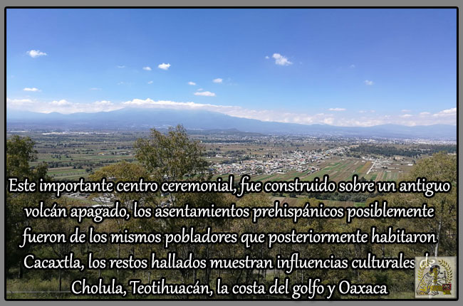 La población que le habitó dedicaba la mayor parte de su tiempo a la agricultura sobre extensas y fértiles planicies que le rodean, y a través de importantes intercambios comerciales obtuvo elementos de lujo para fines ceremoniales, provenientes de varias regiones de Mesoamérica. La población que le habitó dedicaba la mayor parte de su tiempo a la agricultura sobre extensas y fértiles planicies que le rodean, y a través de importantes intercambios comerciales obtuvo elementos de lujo para fines ceremoniales, provenientes de varias regiones de Mesoamérica.
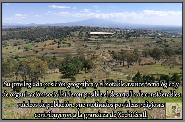
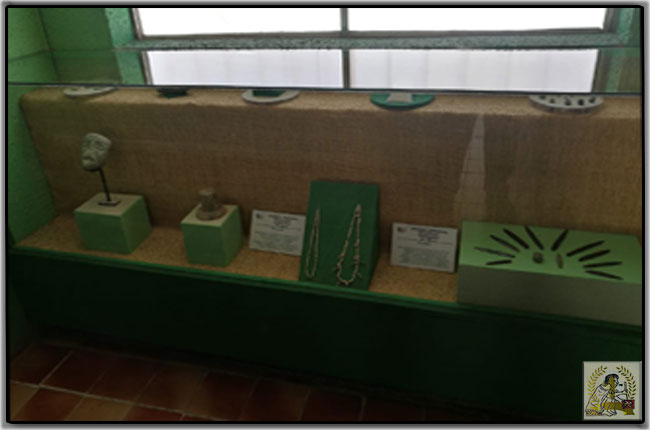
  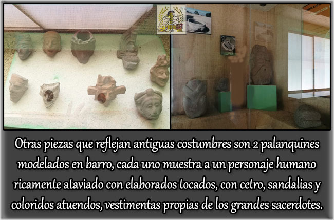 Los entierros son en su mayoría de niños que muestran deformación craneana, cada uno es acompañado de ricas ofrendas mortuorias consistentes en conchas y caracoles marinos, navajillas de obsidiana, cuentas de piedra verde o cuchillos de color gris, anillos y sahumadores. Los entierros son en su mayoría de niños que muestran deformación craneana, cada uno es acompañado de ricas ofrendas mortuorias consistentes en conchas y caracoles marinos, navajillas de obsidiana, cuentas de piedra verde o cuchillos de color gris, anillos y sahumadores.
 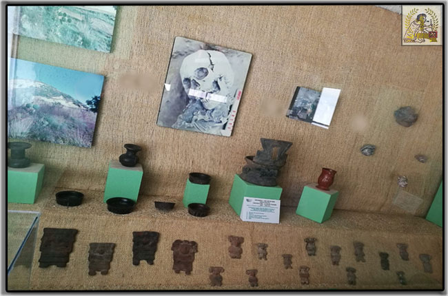 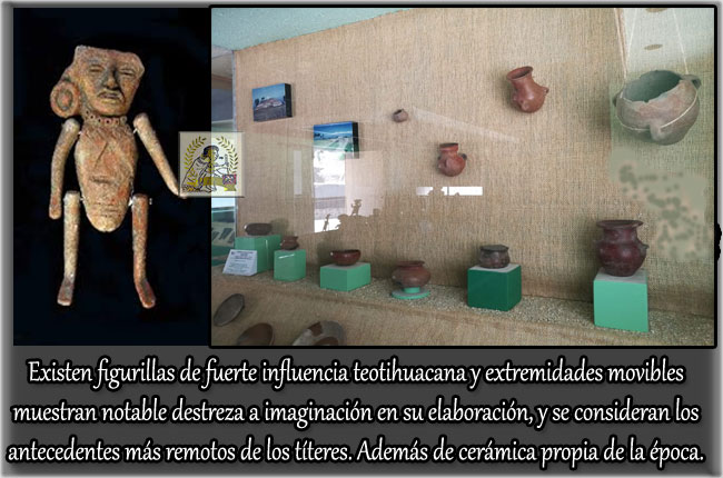
LA GRAN PLAZA Y SUS EDIFICIOS.
Al igual que la gran mayoría de las ciudades prehispánicas, es notoria la presencia de basamentos sobre los cuales se asentaba la morada para los altos sacerdotes y signatarios; así como grandes edificaciones realizadas en forma piramidal en cuya cima se ubican los principales templos o recintos ceremoniales.
LA PIRÁMIDE DE LA ESPIRAL.
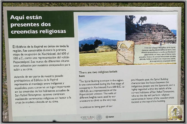 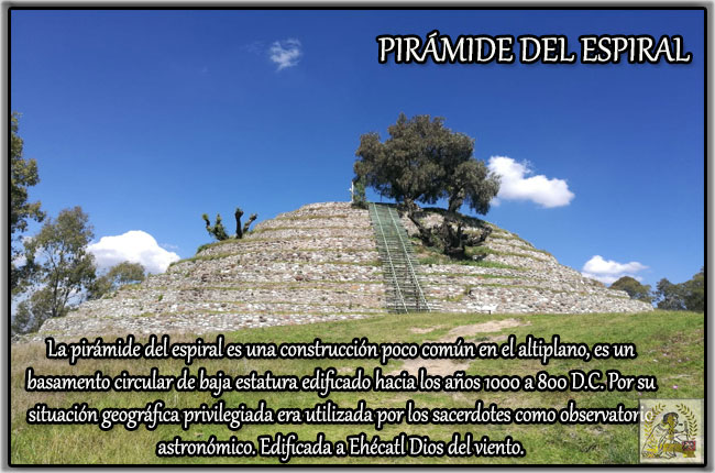 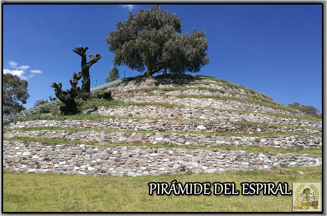 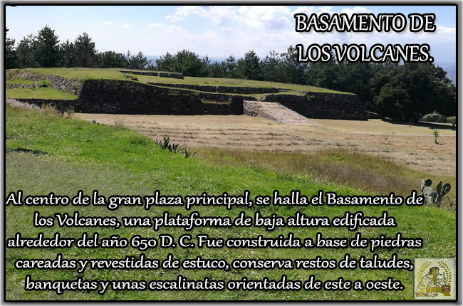 En su parte central y en el interior, se observa una sub-estructura construida en el periodo formativo. En etapas posteriores, aquí mismo fueron depositados varios entierros humanos, uno de ellos relacionados con la clase privilegiada por lo que aparece con ofrendas de placas de piedra verde, figurillas y anillos. En su parte central y en el interior, se observa una sub-estructura construida en el periodo formativo. En etapas posteriores, aquí mismo fueron depositados varios entierros humanos, uno de ellos relacionados con la clase privilegiada por lo que aparece con ofrendas de placas de piedra verde, figurillas y anillos.
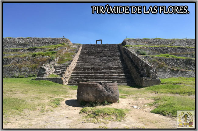 Es la de mayores dimensiones en la zona y a nivel prehispánico es la cuarta más grande de las construcciones mesoamericanas. Es considerada la de mayor importancia en Xochitécatl ya que es la edificación que presenta una secuencia completa de construcción, que va desde el horizonte preclásico o formativo hasta la época colonial. Es la de mayores dimensiones en la zona y a nivel prehispánico es la cuarta más grande de las construcciones mesoamericanas. Es considerada la de mayor importancia en Xochitécatl ya que es la edificación que presenta una secuencia completa de construcción, que va desde el horizonte preclásico o formativo hasta la época colonial.
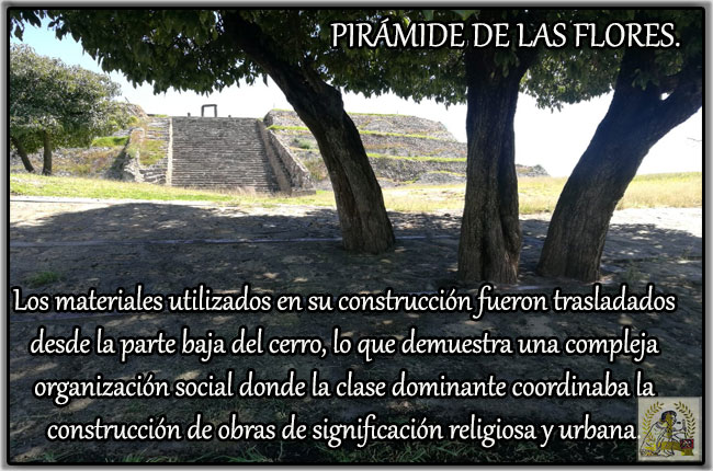 Construida en base a cuerpos rectangulares, su estructura contiene dos terrazas escalonadas y es la que ha aportado la mayor parte de las piezas y elementos arqueológicos, entre los que destacan 30 entierros infantiles y uno de adulto. Construida en base a cuerpos rectangulares, su estructura contiene dos terrazas escalonadas y es la que ha aportado la mayor parte de las piezas y elementos arqueológicos, entre los que destacan 30 entierros infantiles y uno de adulto.
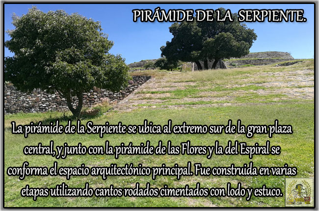 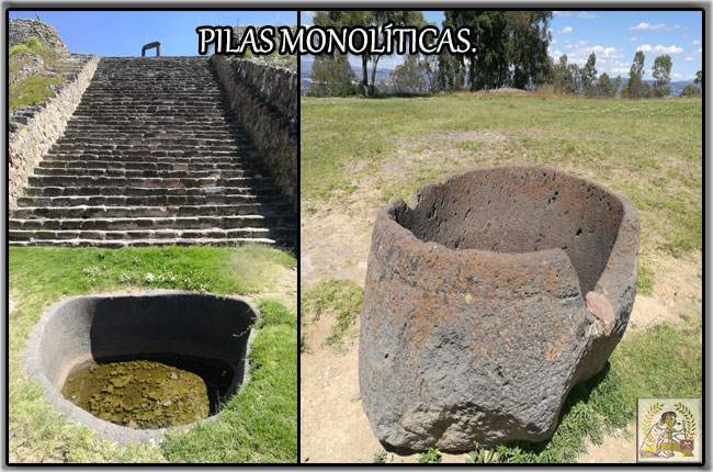 En la parte central de la Pirámide de la Serpiente, se halló una de las tres pilas monolíticas existentes en la zona y cuyo interior conserva una estela mutilada en forma de cabeza de serpiente. Junto a esta se rescató un jaguar y un personaje humano de pie, ojos redondos y boca prominente, que porta una especie de bastón. En la parte central de la Pirámide de la Serpiente, se halló una de las tres pilas monolíticas existentes en la zona y cuyo interior conserva una estela mutilada en forma de cabeza de serpiente. Junto a esta se rescató un jaguar y un personaje humano de pie, ojos redondos y boca prominente, que porta una especie de bastón.
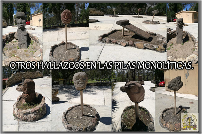 En la terraza superior y frente a las escaleras fueron halladas dos pilas monolíticas cuyo uso fue tal vez astronómico y ritual. Dentro de la pila que se halla por sobre el nivel del piso fueron halladas cuatro esculturas, dos de ellas antropomorfas una zoomorfa y ora mitológica. En la terraza superior y frente a las escaleras fueron halladas dos pilas monolíticas cuyo uso fue tal vez astronómico y ritual. Dentro de la pila que se halla por sobre el nivel del piso fueron halladas cuatro esculturas, dos de ellas antropomorfas una zoomorfa y ora mitológica.
 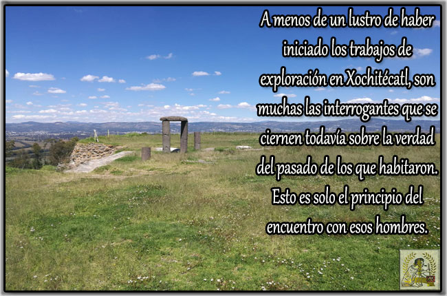 ANDADOR PARA UNIR LOS DOS SITIOS ARQUEOLÓGICOS. ANDADOR PARA UNIR LOS DOS SITIOS ARQUEOLÓGICOS.
En el año 2015, como parte de las actividades realizadas por su XXI aniversario de Xochitécatl, el Gobierno del Estado mandó a construir un andador, con el cual se posibilitaría a los visitantes recorrer los dos espacios en aproximadamente dos horas. El acceso puede ser por cualquiera de los dos sitios y con el pago de un solo boleto. Con este paso peatonal se busca que las comunidades de los alrededores se acerquen más a la zona arqueológica para conocerla y cuidarla, porque es parte de su pasado.
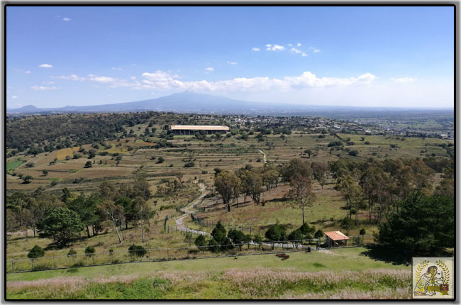 ACCESO. ACCESO.
La zona Arqueológica de Cacaxtla-Xochitécatl se localiza en la población de San Miguel del Milagro, a unos 19 km al suroeste de la capital, en el municipio de Nativitas. Para acceder a las zonas desde el Distrito Federal, se recorre la Autopista No. 150 hasta la caseta de San Martín Texmelucan, Puebla. Unos pocos kilómetros después, se toma la salida del libramiento en Xalmimilulco con dirección al poblado de San Miguel Xochitecatitla, donde se puede seguir las indicaciones para llegar al camino asfaltado (1.9 km.) que sube por la ladera hacia Xochitécatl.
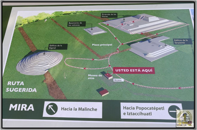 Para visitar Cacaxtla, se debe pasar San Miguel Xochitecatitla continuando en dirección a Nativitas hasta topar con el entronque de San Miguel del Milagro y Cacaxtla. Para visitar Cacaxtla, se debe pasar San Miguel Xochitecatitla continuando en dirección a Nativitas hasta topar con el entronque de San Miguel del Milagro y Cacaxtla.
Los horarios para visitar este complejo arqueológico es: Lunes a Domingo de 09:00 a 17:30 horas. Mayor información en Centro INAH Tlaxcala. tlaxcala.ci@inah.gob.mx
*Revista Cacaxtla, abril, mayo y junio de 1997, número 14, año 1.
*Boletines del INAH.
*Archivo personal Tlaxcala Cultural.
https://tlaxcalacultural.com/2018/11/16/xxiv-aniversario-de-xochitecatl/ |
|
|
|
|
LAST UPDATED: 27 NOVEMBER 2024
You may know Paris for its cathedral Notre-Dame, the Eiffel Tower, its café culture and its amazing museums and art galleries. The French capital is also famous for its fantastic perspective that runs from the Louvre to La Défense. This is the ‘Voie Triomphale’, aka the Historical Axis of Paris.
This line is one of the most prestigious perspectives in the world. In fact, its design has inspired cities such as Buenos Aires, Washington DC, New Delhi and Canberra. In this article, we’ll learn more about the Historical Axis of Paris. We’ll discover the stunning monuments and I reveal to you some stunning facts.
What is the Historical Axis of Paris?
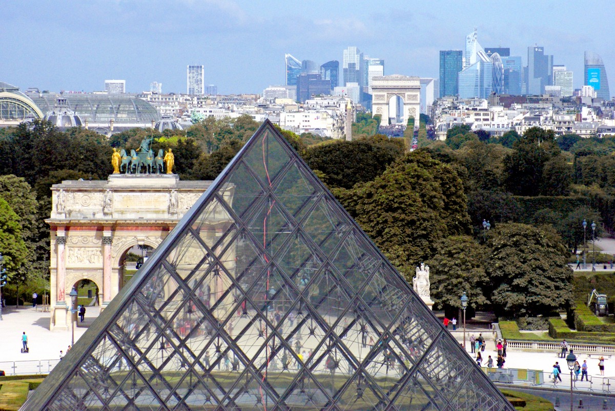 The glass pyramid and the historical axis of Paris © French Moments The glass pyramid and the historical axis of Paris © French Moments
The Historical Axis, also known in French as “Axe Historique”, “Voie Triomphale” or “Voie Royale” is orientated on a 26° angle.
It follows the course of the Sun from its rising in the East to its setting in the West.
Oddly, this angle of orientation is the same as that of Paris’ Notre-Dame Cathedral, some 1,000 metres away from the Louvre Palace.
More than just a series of monuments placed along the axis, it seems that a complex symbolism was at work in the mind of the successive urban planners.
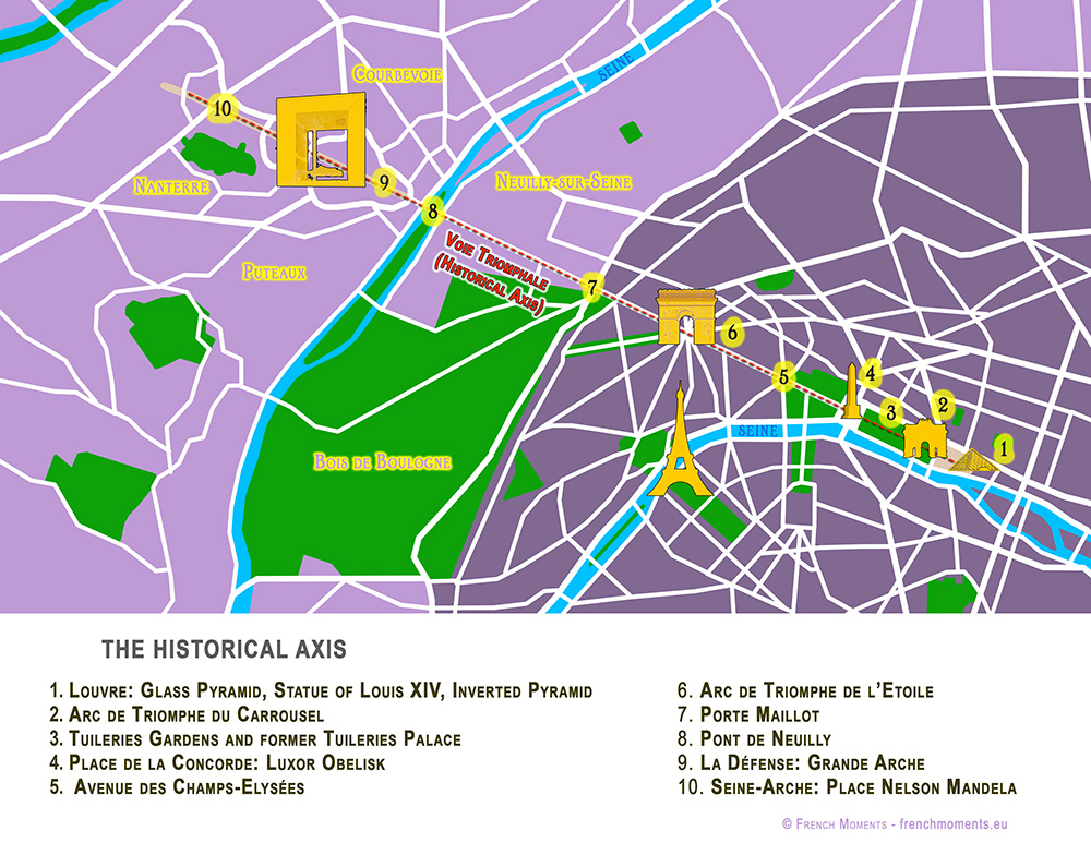
The Historical Axis runs through some of Paris’ most celebrated monuments and squares:
Let’s move along the Historical Axis of Paris, from East to West, starting from the Louvre.
The Palace of the Louvre
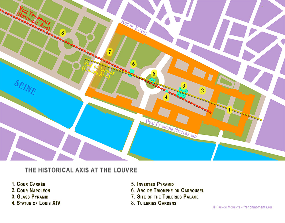
Today the great perspective starts at the Louvre, immediately beyond the Church of St Germain l’Auxerrois.
The crab-shaped Palace was the main residence of the kings of France until 1682, when Louis XIV, the ‘Sun King’, moved his court to Versailles. It currently houses one of the world’s most wonderful museums in a complex that is known as the “Grand Louvre”.
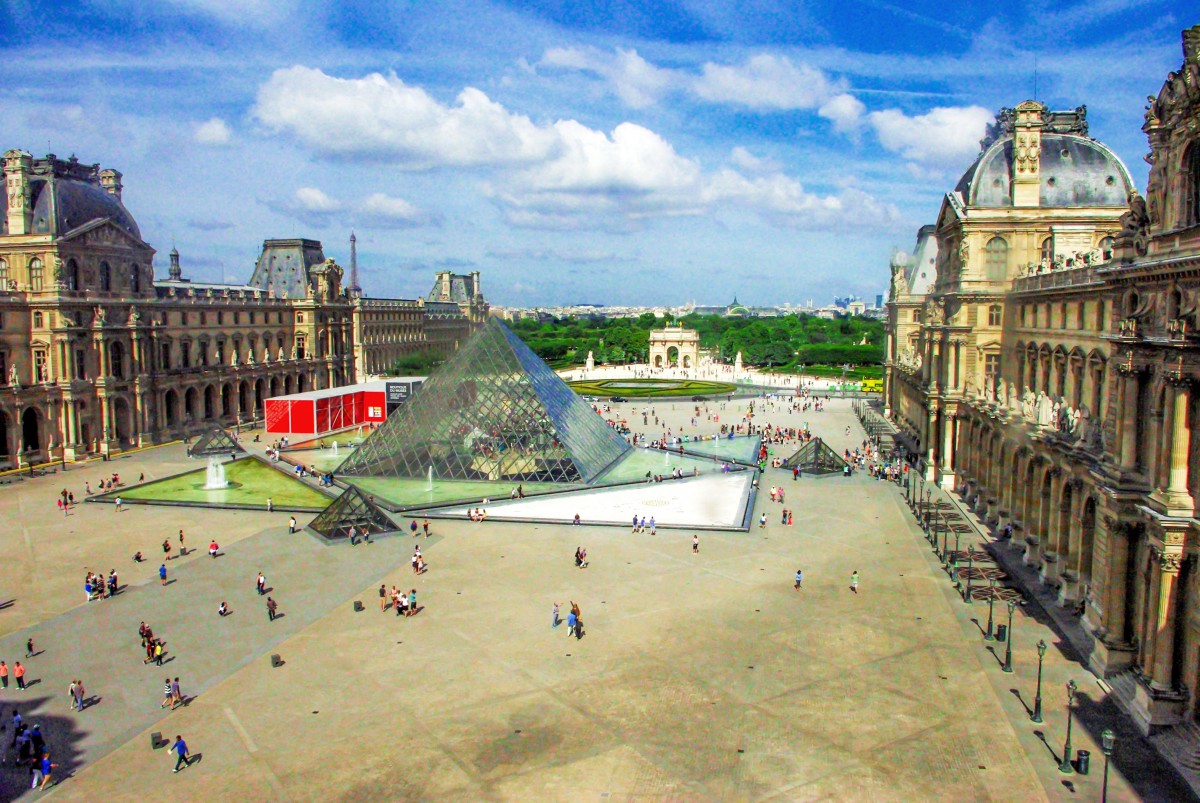 The Louvre today © French Moments The Louvre today © French Moments
The controversial glass pyramid of the Louvre
President François Mitterrand left his mark with his pharaonic project of “Le Grand Louvre”. He wished to complete it for the bicentennial celebration of the French Revolution in 1989. The titanic project comprised of major renovation works and the construction of a new landmark along the Historical Axis: the celebrated (and controversial) Glass Pyramid.
But if you look closer, you’ll notice that the glass pyramid is not aligned with the other monuments on the Historical Axis.
That’s why something had to be added in this vast courtyard of the Louvre…
https://frenchmoments.eu/historical-axis-of-paris-la-voie-triomphale/ |
|
|
|
|
That's right: Sirius rises at 26 degrees south of east, or bearing 116 degrees, from the latitude of Paris, and this is the direction in which the Champs Elysées is aligned.
|
|
|
|
|
Dimensions of the Cheops-pyramid (Khufu's pyramid)
Numbers and figures of the Cheops (Khufu) pyramid:
The pyramid of Khufu - Output / performance - Building material - Dimensions of the pyramid - Dimensions in Royal Cubits - Sources
 Cheops-pyramid (pyramid of Khufu) Cheops-pyramid (pyramid of Khufu)
Of the the famous Seven Wonders of the Ancient World the Great Pyramid of Khufu (Cheops) at Giza is the only one still standing. Even for modern men it is amazing how this man-made structure lasted so long.
The Giza pyramids must have made an incredible visual impact - at the edge of the desert three abstract geometrical symbols were rising, huge luminous white triangles reflecting the blinding light of the sun!
The pyramids on the Giza plateau are with 146.59m (Khufu / Cheops) and 143.87m (Khafre / Chefren) respectively the largest, however there are over 30 major pyramids and a myriad of smaller pyramids in Egypt.
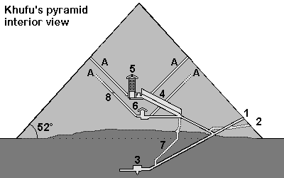
Cheops-Pyramid
1. Entrance 2. Entrance cut by grave robbers 3. Subterranean chamber 4. Grand Gallery 5. King's chamber, relieving chambers, granite portcullis slabs 6. Queen's chamber 7. Shaft 8. Limestone plugging the air shaft A= "Air shafts"
 Output / performance Output / performance
 Detailed calculations how many workers were necessary to build the pyramid Detailed calculations how many workers were necessary to build the pyramid
 Overview pyramid building Overview pyramid building
Builder
------------------- |
|
Khufu (Chuefui-Chnum or Khnum-Khuf, Cheops in Greek) during the 4th dynasty of the old kingdom |
| Time to build |
|
Probably max. 23 years (Khufu reigned from 2551 to 2528 before Christ *). Herodotus writes about 10 years of preparation and 20 years of building (details of the text) |
| Per day |
|
With 2'500'000 stones 342 stones have to be moved daily (working during 365 days a year) or 431 stones daily (working during 290 days a year). |
|
Per minute
|
|
10-hour day: every 2 minutes a stone (34 to 43 per hour)
8-hour day: nearly a stone every minute (42 to 53 stones per hour)
|
| Rule of thumb |
|
| While construction the pyramid the rate of delivery was 1 stone weighting 2.5 tons every minute. |
For our calculations we assume 500 stones a day. This is a rough estimate, assuming a 8-hour day, during 290 days a year, with 20 years to build the pyramid. Also assuming, that more time had to be used for the huge granite blocks for the King's chamber and for the more difficult upper part of the pyramid, where work went slower than in the lower parts. There probably were also other factors delaying the building of the pyramid such as the weather or a temporary shortage of certain building materials.
|
 Building materials for the Cheops-pyramid Building materials for the Cheops-pyramid
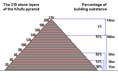
The Khufu-pyramid (Cheops) probably originally had 210 stone layers. At 50m height already 82% of the entire pyramid was built [3].
 Quarrying stones for the pyramid Quarrying stones for the pyramid
 Shipping the stone blocks down the Nile to Giza Shipping the stone blocks down the Nile to Giza
 Transporting the stone blocks using a sledge on tracks Transporting the stone blocks using a sledge on tracks
 Löhner's rope roll Löhner's rope roll
Stone blocks
------------------- |
|
2'300'000 stones |
| Casing blocks |
|
115'000 to 200'000 stones or 67'390m³ [1] |
| Total blocks |
|
2'500'000 stones |
| Stone layers |
|
Originally probably 210 stone layers, now only 201 layers [2] |
| Stone size |
|
The stone blocks usually are larger in the lower layers (1.5m = 3 cubit) and smaller in the upper layers. Most are between 1.5 and 2 cubit large (average of 127 x 127 x 71cm). 1 cubit = 0.524m - Details |
| Weight of the stone blocks |
|
With an average density of 2,6 - 2,9 t/m³ the large limestone blocks weighted 6.5 - 10 tons and the smaller ones about 1.3 tons. For all calculations on this website an average weight of 2.5 tons was used. |
| Special blocks |
|
For the King's chamber granite blocks weighting 40 to 50 tons were used |
| Total weight |
|
6'500'000 tons (average weight of a block was about 2.5 tons) |
| Pyramidion |
|
The final stone on the top was a large block in the shape of a pyramid. It was perhaps around 1.5m by 1.5m wide and 1.3m high (about 3 cubits). It was made from white Tura limestone (Turah), granite or perhaps diorite and perhaps gold plated. More information |
| Building materials |
|
Pyramid: Nummulite limestone from quarries about 200-400m south of the pyramid were used for the core stones.
Casing: light white limestone, so called Tura-limestone from quarries from the eastern shores of the Nile
King's chamber: Rose granite from Aswan 900km away
Further materials: Graywacke from the Wadi Hammamat (Eastern desert), basalt from the northern Faiyum
 Map of quarries in Egypt Map of quarries in Egypt
|
 Dimensions of the pyramid of Khufu Dimensions of the pyramid of Khufu
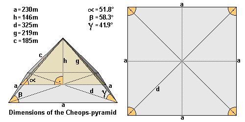
Length (a)
------------------- |
|
The average length of the edge is ~ 230.360m (230,12m = 440 cubits). Northern edge 230.328m - eastern edge 230.369m - southern edge 230.372m - western edge 230.372m. Largest difference is only 4.4cm. [3] |
| Height (h) |
|
Originally 146.59m high (= 280 cubits), the pyramid is now only 138.75m high [7] |
| Diagonal (d) |
|
325.77m |
| Ridge (g) |
|
219m |
| Height of the lateral surface |
|
186.42m |
| Pyramid angle α |
|
51° 50' 40' = inclination of the lateral surface (= 52° rounded off) [3] which corresponds to a seked of 5½ palms |
| Pyramid angle β |
|
58.3° = the two angles of the triangular lateral surface (62° = angle of the apex or tip of the pyramid) - nearly forming an equilateral triangle! |
| Pyramid angle γ |
|
41.9° = angle of the ridge |
| Corner angle |
|
Right angle base with angles from 89° 59' to 90° |
| Base area |
|
53'065.73m² |
| Superficies surface |
|
85'890.69m² |
| Pyramid volume |
|
2'592'968.43m³ including the rock core. This would be a cube with a length of 137.38m. Probable volume of stones used: 2'583'283m³ [1] or 2'326'501m³ [2]. |
| Alignment |
|
Exactly to the north (deviation only 2' 28') |
| Latitude and longitude |
|
N 29° 58’ 44.3830” latitude and E 31° 07’ 57.0194” longitude [5] |
| Altitude |
|
The base of the pyramid of Khufu lies about 60m above sea level, so the tip of the pyramid used to be on 206m above sea level [6]. |
 Alignment of the pyramids and controlling the shape of the pyramid (north-south alignment etc.) Alignment of the pyramids and controlling the shape of the pyramid (north-south alignment etc.)
 Dimensions of the pyramid of Khufu in Egyptian Royal Cubits Dimensions of the pyramid of Khufu in Egyptian Royal Cubits
 |
Length (a) |
|
440 Royal Cubits |
| Height (h) |
|
280 Royal Cubits |
| Height of the lateral surface (c) |
|
356 Royal Cubits (356.09) |
| Diagonal (d) |
|
622.25 Royal Cubits |
| Ridge (g) |
|
418.56 Royal Cubits |
| Pyramid angle α |
|
51.843° |
| Pyramid angle β |
|
58.3° |
| Pyramid angle γ |
|
41.9° |
| Corner angle |
|
90° |
It is suggested, that the Egyptians used a right angled triangle to determinate the angle of inclination of the pyramid, using the numbers a=11 and b=14 with c=17.8 (or a=22 - b=28 - c= 35.6). This determines a so called seked of 5½ palms.
 Alignment of the pyramids and controlling the shape of the pyramid (seked) Alignment of the pyramids and controlling the shape of the pyramid (seked)
 Sources Sources
[1] M. Lehner The Complete Pyramids of Egypt
[2] G. Goyon Die Cheops-Pyramide
[3] R. Stadelmann Die grossen Pyramiden von Giza
[4] F. Abitz Der Bau der grossen Pyramide mit einem Schrägaufzug
[5] GPS-coordinates of a brass disk on top of the pyramid of Khufu, Giza Plateau Mapping Project (GPMP)
[6] Maps of the Giza Plateau Mapping Project show the altitude as 60m
[7] D. Arnold Building in Egypt
* Dates according to conventional Egyptian chronology are used in this website. These are based on several list of the dynasties of pharaohs, for example the Aegyptiaca of Manetho of Sebennytos.
https://www.cheops-pyramide.ch/khufu-pyramid/khufu-numbers.html |
|
|
|
|
72. The Egyptian Royal Cubit, the Inch, the Metre, and 254
Updated: Apr 16, 2024
A centimetre is 2.54 inches. At Giza, the number 254 is found as a factor which links various linear dimensions. What does it mean to multiply or divide a linear measure by 254? What does it mean to convert inches to metres, or vice versa?
254 is not the only factor that links the key dimensions at Giza, but it is a common theme. The other factors seem to be based in geometry (such as π , √3), and astronomy (such as 223, 235 and 29.53059).
As 29.53059 x 4/3 inches are close to 10 000 / 254 inches, as are 365.242199 / 354.36708 x 100 / 2.61803 inches, they can be used almost interchangeably to interpret the dimensions at Giza.
10000 / 254 = 39.3700787402
29.53059 x 4/3 = 39.37412
365.242199 / 354.36708 x 100 / 2.61803 = 39.368871
The number 254 is linked to both astronomy and geometry. It is linked to pi, to Phi squared, and to the solar and lunar years, as well as being the number of sidereal months in a Metonic period.
When linear dimensions at Giza are multiplied or divided by 254, it's not necessarily that in one place inches were used and in another metres were used. The metre and the inch can both be said to co-exist at Giza, and even if the metre hadn't appeared in the 18th century it would still appear at Giza. But the use of 254 could in fact be a reference to the ratio between the solar and lunar years combined with Phi squared, or to pi divided by the mean number of lunations in a year.
If we think of possible links between the metre, the inch and the Egyptian royal cubit, the number 254 also makes an appearance, since 2.54 cm are an inch. Converting between inches and metres allows us to see ways of thinking about the Egyptian royal cubit, in relation to geometry and astronomy.
The links between these three units, inch, metre and cubit, and to astronomy and geometry, may hint at something of the symbolic and religious significance of the cubit in ancient Egyptian cosmology and astronomy. It could also explain some of the enduring appeal of the metre and the inch.
Another interesting connection to be made to the number 254 is that, as Howard Crowhurst points out in his book Carnac the Alignments, there are 127 kerb stones around the base of Knowth, in Ireland.
127 is a major prime number (...) and as such is a mirror of the fundamental prime number, One. But it is also half of 254 which is the number of lunar orbits in the 19 year Metonic cycle which also counts 235 full moons. The exact relationship between the metre length and the foot is also to be found through this number since 1 inch = 2.54 cm. Also a right angled triangle with a hypotenuse of 254 m and a base of 235 m has a third side measuring 100.0037 x √10 feet. (1)
The presence of the number 127 in Ireland seems to suggest a link to the repeated presence of 254 at Giza. The 127 stones at Knowth also suggest we should take the inch - metre connection seriously when analysing ancient sites.
https://www.mercurialpathways.com/post/72-the-egyptian-royal-cubit |
|
|
|
|

72. The Egyptian Royal Cubit, the Inch, the Metre, and 254
Updated: Apr 16, 2024
A centimetre is 2.54 inches. At Giza, the number 254 is found as a factor which links various linear dimensions. What does it mean to multiply or divide a linear measure by 254? What does it mean to convert inches to metres, or vice versa?
254 is not the only factor that links the key dimensions at Giza, but it is a common theme. The other factors seem to be based in geometry (such as π , √3), and astronomy (such as 223, 235 and 29.53059).
As 29.53059 x 4/3 inches are close to 10 000 / 254 inches, as are 365.242199 / 354.36708 x 100 / 2.61803 inches, they can be used almost interchangeably to interpret the dimensions at Giza.
10000 / 254 = 39.3700787402
29.53059 x 4/3 = 39.37412
365.242199 / 354.36708 x 100 / 2.61803 = 39.368871
The number 254 is linked to both astronomy and geometry. It is linked to pi, to Phi squared, and to the solar and lunar years, as well as being the number of sidereal months in a Metonic period.
When linear dimensions at Giza are multiplied or divided by 254, it's not necessarily that in one place inches were used and in another metres were used. The metre and the inch can both be said to co-exist at Giza, and even if the metre hadn't appeared in the 18th century it would still appear at Giza. But the use of 254 could in fact be a reference to the ratio between the solar and lunar years combined with Phi squared, or to pi divided by the mean number of lunations in a year.
If we think of possible links between the metre, the inch and the Egyptian royal cubit, the number 254 also makes an appearance, since 2.54 cm are an inch. Converting between inches and metres allows us to see ways of thinking about the Egyptian royal cubit, in relation to geometry and astronomy.
The links between these three units, inch, metre and cubit, and to astronomy and geometry, may hint at something of the symbolic and religious significance of the cubit in ancient Egyptian cosmology and astronomy. It could also explain some of the enduring appeal of the metre and the inch.
Another interesting connection to be made to the number 254 is that, as Howard Crowhurst points out in his book Carnac the Alignments, there are 127 kerb stones around the base of Knowth, in Ireland.
127 is a major prime number (...) and as such is a mirror of the fundamental prime number, One. But it is also half of 254 which is the number of lunar orbits in the 19 year Metonic cycle which also counts 235 full moons. The exact relationship between the metre length and the foot is also to be found through this number since 1 inch = 2.54 cm. Also a right angled triangle with a hypotenuse of 254 m and a base of 235 m has a third side measuring 100.0037 x √10 feet. (1)
The presence of the number 127 in Ireland seems to suggest a link to the repeated presence of 254 at Giza. The 127 stones at Knowth also suggest we should take the inch - metre connection seriously when analysing ancient sites.
https://www.mercurialpathways.com/post/72-the-egyptian-royal-cubit
|
|
|
 Primer Primer
 Anterior
564 a 578 de 578
Siguiente Anterior
564 a 578 de 578
Siguiente
 Último

|

 La investigación en el sitio se remonta a los años 40 del siglo pasado, cuando el arqueólogo Pedro Armillas realizó el registro del yacimiento Cacaxtla y Xochitécatl; posteriormente, en los años 60, la Fundación Alemana para la Investigación Científica hizo un proyecto de antropología, arqueología y lingüística, y llevó a cabo un recorrido de superficie, con el que se le dio la fecha de ocupación, ubicándolo en el Formativo Temprano (1000 a.C.). Ese dato se mantuvo hasta los años 90, cuando la doctora Mari Carmen Serra Puche efectuó una excavación extensiva y proporcionó nuevas fechas de ocupación del sitio, cuya construcción inició en 700 a.C.
 Las investigaciones arqueológicas realizadas en la sección oriente del sitio a partir de su descubrimiento en la década de 1970 en el área conocida como Cacaxtla, develan una de las sociedades más importantes que se desarrollaron en el periodo Epiclásico (650-900 d.C.) de Mesoamérica. Su poderío logró la hegemonía política, militar y económica en gran parte del valle poblano-tlaxcalteca después de la caída de Teotihuacán y Cholula, consiguiendo entablar relaciones comerciales a larga distancia con regiones distantes como la Costa del Golfo y la Cuenca de México.
 El nombre de Xochitécatl significa en lengua náhuatl “Lugar del linaje de las flores”. La referencia más antigua que se tiene de este lugar se halla representada en el llamado “mapa número dos de Cuauhtinchan”. Documento donde el glifo toponímico de Xochitécatl representado por la imagen de un cerro coronado de flores.
 Una de sus principales características fue distinguirse como un centro de labores diversas, a causa de los talleres de navajas identificados y de las tinas, que demostraban un avanzado conocimiento en los procesos de producción. Ahí se realizaban ritos de fertilidad, como lo demuestran los entierros de mujeres e infantes encontrados en la pirámide de las flores, así como la gran cantidad de figurillas femeninas; muchas de ellas se exhiben actualmente en el museo de sitio.
 La población que le habitó dedicaba la mayor parte de su tiempo a la agricultura sobre extensas y fértiles planicies que le rodean, y a través de importantes intercambios comerciales obtuvo elementos de lujo para fines ceremoniales, provenientes de varias regiones de Mesoamérica.

 Los entierros son en su mayoría de niños que muestran deformación craneana, cada uno es acompañado de ricas ofrendas mortuorias consistentes en conchas y caracoles marinos, navajillas de obsidiana, cuentas de piedra verde o cuchillos de color gris, anillos y sahumadores.


 En su parte central y en el interior, se observa una sub-estructura construida en el periodo formativo. En etapas posteriores, aquí mismo fueron depositados varios entierros humanos, uno de ellos relacionados con la clase privilegiada por lo que aparece con ofrendas de placas de piedra verde, figurillas y anillos.
 Es la de mayores dimensiones en la zona y a nivel prehispánico es la cuarta más grande de las construcciones mesoamericanas. Es considerada la de mayor importancia en Xochitécatl ya que es la edificación que presenta una secuencia completa de construcción, que va desde el horizonte preclásico o formativo hasta la época colonial.
 Construida en base a cuerpos rectangulares, su estructura contiene dos terrazas escalonadas y es la que ha aportado la mayor parte de las piezas y elementos arqueológicos, entre los que destacan 30 entierros infantiles y uno de adulto.
 En la parte central de la Pirámide de la Serpiente, se halló una de las tres pilas monolíticas existentes en la zona y cuyo interior conserva una estela mutilada en forma de cabeza de serpiente. Junto a esta se rescató un jaguar y un personaje humano de pie, ojos redondos y boca prominente, que porta una especie de bastón.
 En la terraza superior y frente a las escaleras fueron halladas dos pilas monolíticas cuyo uso fue tal vez astronómico y ritual. Dentro de la pila que se halla por sobre el nivel del piso fueron halladas cuatro esculturas, dos de ellas antropomorfas una zoomorfa y ora mitológica.
 ANDADOR PARA UNIR LOS DOS SITIOS ARQUEOLÓGICOS.
 Para visitar Cacaxtla, se debe pasar San Miguel Xochitecatitla continuando en dirección a Nativitas hasta topar con el entronque de San Miguel del Milagro y Cacaxtla.


 Foto: Wikimedia Commons
 Foto: Wikimedia Commons


 Flip
Flip


