|
Rispondi |
Messaggio 1 di 52 di questo argomento |
|
|
|
|
|
Rispondi |
Messaggio 38 di 52 di questo argomento |
|
EN WASHINGTON D.C ESTA CODIFICADA LA INDEPENDENCIA DE ISRAEL EN FUNCION A LA INDEPENDENCIA DE EEUU EL 4 DE JULIO DE 1776-ENTRE EL AÑO 1618 (NUMERO DE ORO) HASTA 1948 TENEMOS 330 AÑOS. ESTE ES EL SECRETO DETRAS DE LA INTERRELACION DE LOS ESTADOS UNIDOS CON EL PARALELO 33 E INCLUSO DE LA INTERRELACION DE WASHINGTON D.C CON LA GRAN PIRAMIDE (FUNCION DE PI=3.14 Y PHI=1.618)-YHWH PREDESTINO EN LA GRAN PIRAMIDE, NEXO ALQUIMICO, LA INDEPENDENCIA DE ISRAEL
Si hacemos las matematicas , en el contexto a que la independencia del estado de Israel fue en el 14 de mayo de 1948, observamos que la misma fue en el año 171 (1947-1776=171) aniversario. El 4 de julio de 1948 fue el 172 aniversario de la Independencia de EEUU. Hay algo que es curioso y que no es casualidad, que el 20 de Junio (Solsticio de Verano) es el dia numero 171 del año y que incluso kavalisticamente 171=37x5. El numero 37 esta interrelacionado con el 1776=48x37. La ESTATUA DE LA LIBERTAD ESTA DISEÑADA EN FUNCION AL 20/21 DE JUNIO EN EL CONTEXTO A LA POSICION DE LA CONSTELACION DE ORION.
Sabemos tambien que desde el 4 de Julio de 1947 (CODIFICADO EN EL MISMO DISEÑO DE WASHINGTON D.C) hasta el 14 de Mayo de 1948 hay exactamente 314 (numero PI=3.14) dias. Es increible, insisto, que en el MISMO WASHINGTON D.C ESTE CODIFICADO.
Incluso considerando como MARZO/PRIMER MES, ABRIL/SEGUNDO MES, MAYO/TERCER MES como era la antigua denominacion tenemos que el 14 de Mayo tambien es 14/3 o 3/14 y volvemos con el numero PI. Desde el 4 de Julio hasta el 31 de diciembre tenemos 180 dias y desde el 1 de enero hasta el 14 de Mayo tenemos 134 dias, lo que sumando ambas cifras nos, insisto, 314 dias que no es casualidad. ESTO EVIDENCIA QUE EN EL MISMO DISEÑO DE WASHINGTON YHWH YA PREDESTINO QUE LOS EEUU IVAN A ESTAR DETRAS DE LA INDEPENDENCIA DE ISRAEL. Lo que es asombroso que en el mismo contexto al RIO NILO, con su curva a 19.5, en el contexto a la SEÑAL DE JONAS, estaba CODIFICADO. El numero 19 tiene fuerte nexo con la serpiente y el 47 con el shabbat.

INSISTO, LA INDEPENDENCIA DE ISRAEL, QUE FUE EL 14/5/1948 ESTA INTERRELACIONADA CON DICHO AÑO EN EL CONTEXTO A QUE LA DIFERENCIA ENTRE 1948-1618=330 AÑOS. ESTO LE DA UN MATIZ CIENTIFICO AL DISEÑO DE WASHINGTON D.C EN FUNCION A LA GRAN PIRAMIDE. ESTA TODO CODIFICADO. YHWH EXISTE Y ES AMOR. TODO LO DEMAS ES MENTIRA.
 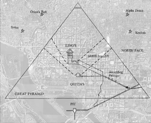
 1947=33x59 ROLLOS DEL "MAR MUERTO"-¿NEXO CON LA
EL 13VO BAKTUN (CALENDARIO MAYA CON REFERENCIA A PERIODO DE 144000 DIAS) COMENZO EN EL AÑO 1618 (NUMERO DE ORO PHI=1.618).
171. Salmos 45:9: Hijas de reyes están entre tus ilustres;
Está la REINA a tu diestra con oro de OPHIR.
|
|
|
|
Rispondi |
Messaggio 39 di 52 di questo argomento |
|
Days of Creation
This report explores the astrological significance of the six days of creation in Genesis 1:2-2.4a. First, some terms need to be defined.
In astrological time, the Age of Gemini began around 6380 BCE. (See Dating Creation) An astrological Great Year takes 25, 920 earth years. An Age, the astrological equivalent to a month takes 25,920/12 or 2160 earth years. A House, the astrological equivalent to a day, takes 2160/12 or 180 earth years.
The definition of a day of creation contains some double meanings. If 180 years was 180 days, it would be half a year, six zodiac houses, or the amount of time when the sun is above the equator. Similarly, in a real day the sun is above the horizon for about half the time. So in biblespeak six days symbolize the six zodiacal houses when the sun is above the equator. On the seventh day when God is said to rest, the sun went below the equator. A creation day cannot be defined scientifically because it is not based on reality.
By definition, the zero hour on the astrological clock begins on the day of the spring equinox when the sun crosses above the equator. So the Age of Gemini began when the sun entered the House of Gemini during the spring equinox. When it was believed that the sun rotated around earth, the sun seemed to spiral around earth at about a 23 degree angle from the equator. In the Figure 1 below, the sun drifts closer to Taurus with each yearly spiral. The two red lines define the path of the sun at the beginning and end of the Age of Gemini.
In very ancient times, the astrological element air was assigned to Gemini. As explained in Elements of Creation, God's Spirit is biblespeak for air. In Figure 1, below Gemini, the constellation Orion is also synonymous with Spirit. In Jesus' Ghost, Jesus calls his Spirit the Son of Man. This stems from the ancient belief that breathing bodies are brought to life by spirits.
So when Genesis 1:2 says the Spirit of God was moving over the face of the waters, it speaks of a time before the sun entered the Age of Gemini when there was nothing but a formless mass of water and a sea monster called Deep. Note: God's Spirit is said to have existed before God.
1In the beginning God created the heavens and the earth.
2The earth was without form and void, and darkness was upon the face of the deep; and the Spirit of God was moving over the face of the waters. (Gen 1:1-2)
In the Age of Aries, the spring equinox occurs in Aries and the summer solstice occurs in Gemini. When Jesus talks about the Son of Man sitting on his glorious throne, he is pointing to Orion when the sun is in Gemini. Gemini looks something like a crown, Orion is a man, and below Orion is Lepus which looks somewhat like a throne.
28"Truly, I say to you, in the new world, when the Son of man shall sit on his glorious throne, you who have followed me will also sit on twelve thrones, judging the twelve tribes of Israel. (Matt. 19:28)

Figure 1. The sun was in the Age of Gemini approximately from 6380 BCE to 4220 BCE.

Figure 2. In the Age of Gemini, the spring equinox begins when the sun enters Gemini.
The pie chart above gives us a visual picture of how the six days of creation correspond to six houses of the zodiac between the two equinoxes.
First day-Gemini
On the first day when the sun rises above the equinox, He created light and separated it from darkness. And he saw that the light was good.
3And God said, Let there be light; and there was light.
4And God saw that the light was good; and God separated the light from the darkness.
5God called the light Day, and the darkness he called Night. And there was evening and there was morning, one day. (Gen.1:3-5)
God's Spirit does the creating. The light symbolizes his self created body and darkness was equated with evil. The analogy comes from the observation that a breathing body creates its own heat. The wind was believed to come from good or evil spirits, depending on how much light there was. Similarly, a person's breath was believed to be his spirit.
Second Day-Cancer
On the second day He created a firmament (metal shell) to separate the lower waters from the upper waters.
6And God said, Let there be a firmament in the midst of the waters, and let it separate the waters from the waters.
7And God made the firmament and separated the waters which were under the firmament from the waters which were above the firmament. And it was so.
8And God called the firmament Heaven. And there was evening and there was morning, a second day. (Gen.1:6-8)
To ancient minds earth looked like it was floating on water. The blue sky looks like water too. To account for the air space, they invented the idea of a metal shell.
Third Day-Leo
On the third day dry land appeared from the lower waters.
9And God said, Let the waters under the heavens be gathered together into one place, and let the dry land appear. And it was so.
10God called the dry land Earth, and the waters that were gathered together he called Seas. And God saw that it was good. (Gen. 1:9-10)
Throughout the Bible, water symbolized birth and renewal. They imagined earth floating on water.
Earth gave forth vegetation, plants yielding seed and fruit trees bearing fruit, each according to its kind.
11And God said, Let the earth put forth vegetation, plants yielding seed, and fruit trees bearing fruit in which is their seed, each according to its kind, upon the earth. And it was so.
12The earth brought forth vegetation, plants yielding seed according to their own kinds, and trees bearing fruit in which is their seed, each according to its kind. And God saw that it was good.
13And there was evening and there was morning, a third day. (Gen. 1:11-13)
There is a faint trace from Mesopotamian religions that believed earth was the mother companion to the sun god. God claims that plants and trees came before their respective seeds and fruit.
Forth Day-Virgo
On the fourth day, He put the stars and planets in the sky to give us the signs and seasons for the days and years. The sun would rule the day and the moon would rule the night.
14And God said, Let there be lights in the firmament of the heavens to separate the day from the night; and let them be for signs and for seasons and for days and years,
15and let them be lights in the firmament of the heavens to give light upon the earth. And it was so.
16And God made the two great lights, the greater light to rule the day, and the lesser light to rule the night; he made the stars also.
17And God set them in the firmament of the heavens to give light upon the earth,
18to rule over the day and over the night, and to separate the light from the darkness. And God saw that it was good.
19And there was evening and there was morning, a fourth day. (Gen.1:14-19)
Terms like "signs" and "rule" come from an astrologer's lexicon when it was believed that heavenly bodies either ruled or gave signs to what the gods were thinking.
Fifth Day-Libra
On the fifth day, the waters brought forth swarms of living creatures. -Again, water was seen as a source of birth.
20And God said, Let the waters bring forth swarms of living creatures, and let birds fly above the earth across the firmament of the heavens.
21So God created the great sea monsters and every living creature that moves, with which the waters swarm, according to their kinds, and every winged bird according to its kind. And God saw that it was good. (Gen.1:20-21)
22And God blessed them, saying, Be fruitful and multiply and fill the waters in the seas, and let birds multiply on the earth.
23And there was evening and there was morning, a fifth day. (Gen.1:22-23)
Sixth Day-Scorpio
On the sixth day, earth gave birth to living creatures according to their kind like a mother gives birth to her children.
24And God said, Let the earth bring forth living creatures according to their kinds: cattle and creeping things and beasts of the earth according to their kinds. And it was so.
25And God made the beasts of the earth according to their kinds and the cattle according to their kinds, and everything that creeps upon the ground according to its kind. And God saw that it was good. (Gen.1:24-25)
Just as children bear resemblance to their parents, God created man in our image.
26Then God said, Let us make man in our image, after our likeness; and let them have dominion over the fish of the sea, and over the birds of the air, and over the cattle, and over all the earth, and over every creeping thing that creeps upon the earth.
27So God created man in his own image, in the image of God he created him; male and female he created them. (Gen.1:26-27)
28And God blessed them, and God said to them, Be fruitful and multiply, and fill the earth and subdue it; and have dominion over the fish of the sea and over the birds of the air and over every living thing that moves upon the earth. (Gen.1:28)
29And God said, Behold, I have given you every plant yielding seed which is upon the face of all the earth, and every tree with seed in its fruit; you shall have them for food.
30And to every beast of the earth, and to every bird of the air, and to everything that creeps on the earth, everything that has the breath of life, I have given every green plant for food. And it was so.
31And God saw everything that he had made, and behold, it was very good. And there was evening and there was morning, a sixth day. (Gen.1:29-31)
Seventh Day
When God rested, the sun disappeared below the horizon.
1Thus the heavens and the earth were finished, and all the host of them.
2And on the seventh day God finished his work which he had done, and he rested on the seventh day from all his work which he had done.
3So God blessed the seventh day and hallowed it, because on it God rested from all his work which he had done in creation.
4These are the generations of the heavens and the earth when they were created. (Gen.2:1-4a)
End
Related articles
Seven Days of Creation for a detailed examination of other points.
Creation Myths
|
|
|
|
Rispondi |
Messaggio 40 di 52 di questo argomento |
|
FUERTE INTERRELACION DE LA CONSTELACION DE VIRGO CON LA FIESTA HEBREA DE PENTECOSTES (COSECHA DEL TRIGO)-FIESTA DE ISTAR
La Espiga de Trigo
 La constelación zodiacal de Virgo es una de las figuras formada por estrellas más grande del cielo. Desde el hemisferio sur la vemos al anochecer finalizando el Otoño y a comienzos del Invierno. Está ubicada entre los signos zodiacales de Leo y Libra y representó para los griegos a Astrea, divinidad relacionada con la justicia, aunque a veces se le asocia con Deméter, la diosa de las cosechas. Ese es el motivo del porqué su estrella principal se llame Spica, nombre latino que significa : "La Espiga de Trigo", ya que, Virgo aparece en el cielo sosteniendo un puñado de espigas de trigo entre sus manos. Para el astrónomo contemporáneo, Spica es una estrella azul de tipo espectral B1 que tiene una temperatura superficial de 22400 K. Se sitúa a 263 años luz de nosotros, su magnitud absoluta es de -2,43 y su brillo aparente es de +0,98. En tamaño es unas 8 veces más grande que el Sol, su masa unas 11 veces la de nuestra estrella y su brillo intrínseco es equivalente al emitido por 2100 estrellas idénticas al Sol. Hoy se conjetura que Spica podría ser un sistema triple de estrellas y no doble. La más conocida de las estrellas de Virgo, se aleja de nosotros a una velocidad de 1 kilómetro por segundo, y su densidad podría ser 1000 veces la del acero. mundoslejanos@gmail.com
Éxodo 34:22: También celebrarás la fiesta de las semanas, la de las primicias de la siega del TRIGO, y la fiesta de la cosecha a la salida del año.
19. Jueces 15:1: Aconteció después de algún tiempo, que en los días de la siega del TRIGO Sansón visitó a su mujer con un cabrito, diciendo: Entraré a mi mujer en el aposento. Mas el padre de ella no lo dejó entrar.
20. Rut 2:23: Estuvo, pues, junto con las criadas de Booz espigando, hasta que se acabó la siega de la cebada y la del TRIGO; y vivía con su suegra.
40. Cantares 7:2: Tu ombligo como una taza redonda Que no le falta bebida. Tu vientre como montón de TRIGO Cercado de lirios.
MARCOS 2
2:23 Aconteció que al pasar él por los sembrados un día de reposo, sus discípulos, andando, comenzaron a arrancar espigas.
2:24 Entonces los fariseos le dijeron: Mira, ¿por qué hacen en el día de reposo lo que no es lícito?
2:25 Pero él les dijo: ¿Nunca leísteis lo que hizo David cuando tuvo necesidad, y sintió hambre, él y los que con él estaban;
2:26 cómo entró en la casa de Dios, siendo Abiatar sumo sacerdote, y comió los panes de la proposición, de los cuales no es lícito comer sino a los sacerdotes, y aun dio a los que con él estaban?
2:27 También les dijo: El día de reposo fue hecho por causa del hombre, y no el hombre por causa del día de reposo.
2:28 Por tanto, el Hijo del Hombre es Señor aun del día de reposo.
Mateo12:1 En aquel tiempo iba Jesús por los sembrados en un día de reposo; y sus discípulos tuvieron hambre, y comenzaron a arrancar espigas y a comer. 12:2 Viéndolo los fariseos, le dijeron: He aquí tus discípulos hacen lo que no es lícito hacer en el día de reposo. 12:3 Pero él les dijo: ¿No habéis leído lo que hizo David, cuando él y los que con él estaban tuvieron hambre; 12:4 cómo entró en la casa de Dios, y comió los panes de la proposición, que no les era lícito comer ni a él ni a los que con él estaban, sino solamente a los sacerdotes? 12:5 ¿O no habéis leído en la ley, cómo en el día de reposo los sacerdotes en el templo profanan el día de reposo, y son sin culpa? 12:6 Pues os digo que uno mayor que el templo está aquí. 12:7 Y si supieseis qué significa: Misericordia quiero, y no sacrificio, no condenaríais a los inocentes; 12:8 porque el Hijo del Hombre es Señor del día de reposo.

Al inicio de la ERA CRISTIANA SPICA/ESPIGA estaba justo en el ECUADOR.
¿PORQUE SPICA estaba exactamente en el ECUADOR?
VIRGO (CASA DE PAN) Y SU RELACION CON RAQUEL, LA ESPOSA AMADA DE JACOB/ISRAEL
32. Génesis 30:6: Dijo entonces Raquel: Me juzgó Dios, y también oyó mi voz, y me dio un hijo. Por tanto llamó su nombre DAN.
1. Génesis 35:19: Así murió Raquel, y fue sepultada en el camino de Efrata, la cual es Belén.
2. Génesis 48:7: Porque cuando yo venía de Padan-aram, se me murió Raquel en la tierra de Canaán, en el camino, como media legua de tierra viniendo a Efrata; y la sepulté allí en el camino de Efrata, que es Belén.
- La Virgen María es la constelación de Virgo. América está en Virgo. El antiguo símbolo de Virgo es una "m" cambió. Esto explica por qué el nombre de María como otras madres vírgenes, como la madre de Adonis, Mirra, o el de la madre de Buda, Maya, comienza con una M. Virgo (constelación de Virgo) también se conoce como la "Casa del pan", y la representación de Virgo es una Virgen que sostiene una gavilla de trigo. Esta "casa del pan" y su símbolo de trigo representa agosto y septiembre, cuando la cosecha. A su vez, Belén (Belén), es la traducción literal de "La Casa del Pan". Belén es también la referencia a la constelación de Virgo, un lugar en el cielo, no en la Tierra.
BETHLEHEM (CASA DE PAN), esta relacionado con el NACIMIENTO DE BENJAMIN/LOBO/PERRO/CAN MAYOR/SIRIO segun GENESIS 35. Cuando el mismo nace, muere RAQUEL y es enterrada en BETHLEHEM.(GENESIS 35). Concretamente la ESPIGA/SPICA es el mismo BENJAMIN. Esto explica del porque WASHINGTON D.C ESTA DISEÑADO EN FUNCION A SIRIO E INCLUSO LA MISMA INDEPENDENCIA DE EEUU. Vemos que astronomicamente SPICA estuvo en el ECUADOR aproximadamente en el 30 despues de Cristo. ¿QUIEN ES EL NUEVO BENJAMIN?

GENESIS 35
35:14 Y Jacob erigió una señal en el lugar donde había hablado con él, una señal de piedra, y derramó sobre ella libación, y echó sobre ella aceite.
35:15 Y llamó Jacob el nombre de aquel lugar donde Dios había hablado con él, Bet-el.
35:16 Después partieron de Bet-el; y había aún como media legua de tierra para llegar a Efrata, cuando dio a luz Raquel, y hubo trabajo en su parto.
35:17 Y aconteció, como había trabajo en su parto, que le dijo la partera: No temas, que también tendrás este hijo.
35:18 Y aconteció que al salírsele el alma (pues murió), llamó su nombre Benoni; mas su padre lo llamó Benjamín.
35:19 Así murió Raquel, y fue sepultada en el camino de Efrata, la cual es Belén.
35:20 Y levantó Jacob un pilar sobre su sepultura; esta es la señal de la sepultura de Raquel hasta hoy.
35:21 Y salió Israel, y plantó su tienda más allá de Migdal-edar.

http://asteromia.net/peliculas/pelibarridoorion.html

Comparando la estatua de la la libertad o Columbia que tiene una LUZ EN LA MANO, en un contexto a que VIRGO tiene una espiga, es obvio que EL MENSAJE ES QUE LA ESPIGA ES LA LUZ MISMA, OSEA EL GRIAL. LA MUJER DA A LUZ UN HIJO. SPICA ES EL GRIAL MISMO. COLUMBIA/ISHTAR/STAR/ESTHER en la tora era de BENJAMIN. SEGUN JUECES 15:37 se la relaciona con MIGDAL-GAD (TORRE DE GAD) que tiene segun la kavala fuerte relacion con VIRGO. GOD/DOG/GAD es sinonimo, insisto, de BENJAMIN.
29. Deuteronomio 33:12: A Benjamín dijo: El amado de Jehová habitará confiado cerca de él; Lo cubrirá siempre, Y entre sus hombros morará.
2. 2 Samuel 12:24: Y consoló David a Betsabé su mujer, y llegándose a ella durmió con ella; y ella le dio a luz un hijo, y llamó su nombre Salomón, al cual amó Jehová,
Noten que SAL-O-MON es AMADO DE JEHOVA AL IGUAL QUE BENJAMIN. SAL-O-MON (SOL Y LUNA) es una referencia al SUEÑO DE JOSE de GENESIS 37, en el contexto al SOL/JACOB Y RAJEL/LUNA. En el contexto a SAL-O-MON (NUEVO BENJAMIN ESPIRITUAL) EL SOL ES DAVID Y LA LUNA BETZABE. Por eso la tora dice que JEHOVA AMO A SALOMON AL IGUAL QUE BENJAMIN. Cuando CRISTO en MATEO 12 afirma que tambien el ES SALOMON, confirma esotericamente que el TAMBIEN TIENE UNA LUNA/MARIA MAGDALENA y un BENJAMIN/PERRO/LOBO/JUAN MARCOS. EL secreto de la DUALIDAD DE CRISTO DE SER DAVID Y SALOMON tiene este mensaje esoterico. ESTE TAMBIEN ES EL SECRETO DE LA DUALIDAD OSIRIS/HORUS y ORION/SIRIO que son dos caras de la misma moneda. IRIS, insisto es una referencia al PACTO DE NOE de GENESIS 9:11 (ARCO IRIS) Y OR-ION esta relacionado con la SEÑAL DE JONAS.
LA CLAVE ORION/SIRIO/OS-IRIS/HORUS E INCLUSO ARKTURO/ARCA DE TAURO tienen la misma clave en el contexto a COLUMBIA/ARCA DE NOE.
CRISTO ES ARTURO/ BOOTES, MARIA MAGDALENA/VIRGO Y SPICA (ESPIGA DE TRIGO INTERRELACIONADA CON PENTECOSTES QUE ES LA FIESTA DE LA COSECHA DE TRIGO) ES EL GRIAL (JUAN MARCOS).
|
|
|
|
Rispondi |
Messaggio 41 di 52 di questo argomento |
|
CALENDARIO COPTO (AÑO NUEVO=11 DE SEPTIEMBRE-PATRONES DE LA IGLESIA COPTA SON MARIA Y JUAN MARCOS=SEÑAL DE JONAS)-29 DE ABRIL=DIA 231=7X33-RELACION CON LA CONSTELACION DE PHOENIX-6 DE AGOSTO ES EL DIA NUMERO 330 DEL CALENDARIO COPTO
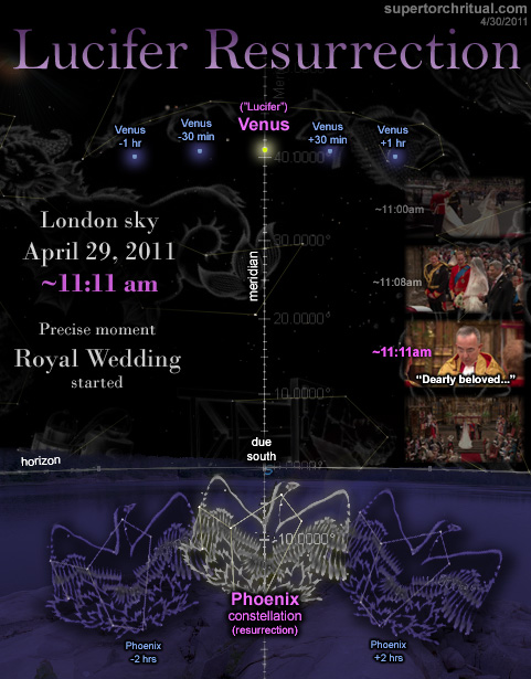
Efectivamente el dia NUMERO 227 (DIA DE SAN MARCOS=25/4) del CALENDARIO COPTO esta en la SEM-ANA/SEMEN/SEM/SEMITA/SEMILLA /TECER DIA DE LA CREACION/MARTES/PLANETA ROJO/SANGRE/LINAJE NUMERO 33 DEL CALENDARIO COPTO. EFECTIVAMENTE 231=7X33. En este contexto la SEMANA 33 comienza en el dia numero 225 (CICLO SIDEREO DE VENUS=ESTRELLA DE 5 PUNTAS=ALQUIMIA), OSEA EL 23 DE ABRIL. EL 25 DE ABRIL ES EL TERCER DIA (MARTES/SANGRE) DE LA SEMANA 33 QUE CONCLUYE, INSISTO EL 29 DE ABRIL. SE REPITE EL PATRON GREGORIANO 13 DE AGOSTO=DIA NUMERO 225 Y 15 DE AGOSTO=227=22/7 (ASUNCION DE LA VIRGEN QUE ES MARIA LA MAGDALENA) QUE TAMBIEN ESTA EN LA SEMANA 33 PERO DEL CALENDARIO GREGORIANO. LA RELACION CON MARTE ESTE EN EL CONTEXTO A LA DISTANCIA DEL SOL AL PLANETA ROJO QUE ES DE APROXIMADAMENTE 227000000 KM. ESTE ES EL SECRETO DE ROSE LINE. LUCIFER/LUCERO/APOCALIPSIS 22:16 (22:(1+6)-22:7) ES EL MISMO CRISTO, OSEA UNA REFERENCIA AL SEXTO DIA DE LA CREACION EN QUE FUERON CREADOS EL HOMBRE Y LA MUJER. 22:16 ES UNA REFERENCIA A 22 CICLOS LUNARES Y 16 DIAS (666 DIAS=TALENTOS DE ORO DEL REY SALOMON=PIRAMIDE DE LOUVRE=1 DE REYES 10:14). CONCRETAMENTE EL CALENDARIO COPTO AL TENER EL MISMO PATRON GREGORIANO EN EL CONTEXTO A LA ASUNCION DE LA VIRGEN, INSISTO, ES UNA REFERENCIA AL SANTO GRIAL.
SANTO GRIAL (SAN JUAN MARCOS 25/4)=ASUNCION DE LA VIRGEN (15/8=MARIA MAGDALENA)
NUMERO 33 (MONSTRUOSO CODIGO ALQUIMICO)
|
|
|
|
Rispondi |
Messaggio 42 di 52 di questo argomento |
|
THE WHITE RABBIT= 1060 = THE ONE IS HERE,I HAVE OPENED THE GATE, THE ALPHABETICAL CODE.[The White Rabbit = 1329 (1060 + 269/GEMATRIA)].1329 : THE WISDOM OF S'LBA,OPENED THE GATE OF ONYX, OPEN DAATH(474), THE STARGATE, THE TRIPLE STONE
PERFECTION438 = אבנ שלימה (The 'Whole' or 'Perfect' Stone - or Ion)[PERFECT = 716 ~ ION = 716]ICOSAHEDRON°[20 faces]1128 = [1~47] THE EGG OF LAM [Ηαρποκρατης (Harpocrates) = 888],THE GLOBED PRIEST [=888],ICOSAHEDRON, THE NINE NUMBERS [HEG= 888A MESSAGE FROM GOD [Simple: 888]Η Μαγια Ημερολογιακο Ημερομηνια Ληξης (The Mayan Calendar End Date)12 Points (13th Inside)BEE = 121 + 2 + 3 + 4 + 5 + 6 + 7 + 8 + 9 10 + 11 + 12 = 78'Melissa' (Greek for Bee) = 78Μελιςςα = 486 =H.E.G.: PATH, GATEWAYS, WORMOLES,FOUR ELEMENTS, THE ANKH, ALIEN PORTAL,THE VATS, TARTARUS,THE BAVARIAN ILLUMINATI,Malkuth (496) - 10
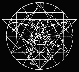
The Freemasonic symbology of the architecture in Washington, D.C. is replete with occult concepts and references.
The Square and Compass is aligned horizontally to revere the direction in which the Sun as well as the 'Sun behind the Sun' - the Star of Set, or Sirius which is also included in the layout as the White House is not only at the left side of the Compass, but it is at the bottom of the averse pentagram aligned with the North.
The Star Sirius is a binary star, and the lesser star - Sirius B - is depicted as the smaller star to the bottom left; 'The Pentagon'. Even the hieroglyph of Sirius contains the predominant elements of the architecture;
 the Obelisk (Washington Monument), the 5 pointed star, and the Dome (The Capital Building). the Obelisk (Washington Monument), the 5 pointed star, and the Dome (The Capital Building).
What's more is not only is the White House 13 blocks south the Masonic Temple, an inverted cross is formed by the lower line of the pentagram which is also 13 blocks.
(5 x 5 = 25)
so that he maketh fire come down from heaven on the earth in the sight of men.]
The Capital Building, other than being surrounded by an OWL (symbolic of Knowledge),
is reminiscent of The Bee Hive as well where Rule and Justice are meant to be centered.
The Bee is not only a symbol of Immortality and Resurrection, but Sacred Knowledge.
 The Owl is typified by Moloch, the 'Janus Face' of Thaumiel whose counterpart is Satan in the qliphoth. Thaumiel means 'The Twins of God', the qlipha of Kether. It should then be noted that most of these particular symbols represents not only Qabalistic concepts, but also Qliphothic concepts. THE TREE OF LIFE+THE TREE OF DEATH = 1871 = THE SQUARE AND COMPASS, THE FIRST VERSE OF GENESIS, THE MAGICK CODE OF MANIFESTATION, and the year the Freemasonic textbook Morals and Dogma was published by Albert Pike. Reversed, 1871 is 1781, enumerates the phrases; THE MARRIAGE OF OPPOSITES, THE DOUBLE WAND OF POWER+THE TREE OF LIFE, THE NUMBER OF THE UNIVERSE, THE IMPLICATION, and The year Uranus was discovered. (Uranus is attributed to Daath). The Owl is typified by Moloch, the 'Janus Face' of Thaumiel whose counterpart is Satan in the qliphoth. Thaumiel means 'The Twins of God', the qlipha of Kether. It should then be noted that most of these particular symbols represents not only Qabalistic concepts, but also Qliphothic concepts. THE TREE OF LIFE+THE TREE OF DEATH = 1871 = THE SQUARE AND COMPASS, THE FIRST VERSE OF GENESIS, THE MAGICK CODE OF MANIFESTATION, and the year the Freemasonic textbook Morals and Dogma was published by Albert Pike. Reversed, 1871 is 1781, enumerates the phrases; THE MARRIAGE OF OPPOSITES, THE DOUBLE WAND OF POWER+THE TREE OF LIFE, THE NUMBER OF THE UNIVERSE, THE IMPLICATION, and The year Uranus was discovered. (Uranus is attributed to Daath).In H.E.G., 847 also =THE MANIFESTATION OF THE SECRET-ION,THE STAR TETRAHEDRON, &SEVEN STARS (Ursa Major, the 'Great Bear'/Typhon, the mother of Set/Sirius who is the eighth - or the height/Daath.)[Counting up from Malkuth, Daath is the eighth 8 = ∞ ,the infinity. The Dual One (11), which when counted from Kether is the 4th down. 11 x 4 = 44; the years between The Aeon of Horus and the Ma-Ion in 1948 / and 44 years between then and 1992 (8-21) when the culmination of Ma-Ion was I born - a total of 11 x 8 years.]Grant notes that 88 is the number of KHABS, meaning 'The Star' - (mentioned in AL.I.8), which is composed of DLI (44) (Water/Aquarius) and LHT (44) (Fire/Leo).Thus 88 years after 1904 The Dual Star was bornMA C R AN A LA B E LS13 letters totaling 1331 - the number of HECATE'S FOUNTAIN which also appeared in 1992.13 x 102 / 1~51 = 1326 = THE ILLUSION [FIRE = 221 x 6 (Tiphareth)] + 666 = 1992.
|
|
|
|
Rispondi |
Messaggio 43 di 52 di questo argomento |
|
The Dual Star is the Magus of the Tarot - the Maker of Illusions -mentioned in The Cry of the 3rd Aethyr by Crowley in 1909. The locus of Daath - the top point of the hexagon of Ruach (the Spirit/Intellect) is reflected in itself and creates a twisting reversal which reflects the light inward - thus the hollow Air of 0-The Fool condenses as the Sword of Light travels down the paths meeting the Water in the middle at Mem, then the Fire of Shin, and finally the MANIFESTATION of Tau/496 [1~31] and reflects into the Spirit when the 0+1~21 (231) is also traversed in The Crossing of The Abyss and becomes the ∞ of The Magician.

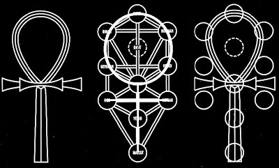 
When put upright, this arrangement is exactly what would result if an inverted Tree of Life were to be placed over a regular Tree of life - pivoted around Tiphareth - and could even be multiplied and extended in six different directions around the central focus.In this way, the ANKH/Venus Symbol of the Tree of Life is restored to its Eternal/Immortal State of Perfection and The Tree of Life blooms into the 19 sphered Flower of Life surrounded by the 20th Circle.
Pink is the color of Daath because as the 8th/height of the Six primary/secondary colors of the Ruach it is the 'Purple beyond purple' (AL.II.51) as the reflection of Yesod and 'Light higher than eyesight.') TMAAT, the counterpart to Horus = 51 and doubled (II) = 102; LAMAL - 13+13 x 31 = 806 = BABALONTHE COLOR PINK = 943 = PURPLE BEYOND PURPLE= THIRTEEN, THE ATOMIC AGE, O.T.C.O.T
806 + 608 = 1414 = HORUS+LAM+MAAT, The Way, Gateway,The Sword and The Egg,

ציון (Zion/Zain) [718+88],THE MAYAN CALENDAR, MAYAN CALENDAR DATE, THE ALIENSThe Seven Fold Light of the Ruach + the 6 Refelctions is thus the Manifestation (13) of the Secret-Ion.SECRETION = 1319 ='ONE MAY HAVE MISSED IT WITH HIS MA' (OKBISh 564 - 16.) a verse that refers to Frater Achad having took the Key of the Rituals (AL.I.20) to be MAnifestatION, and in The Ninth Arch Kenneth Grant refers to the Secret Word (of AL.I.20) to be Secret-Ion.It is in fact BOTH, for the MANIFESTATION is the Secretion of the SECRET-ION.Together they are The One's (The Magician)Double Wand of Power; The Wand of the Force of Coph NIA -Qoph - 100 - The Moon/Back of the Head/Illusory World / Kaph - the Wheel/11[120]NIA - the reverse or inversion of AIN (Nothing) [ + 1= 121 (11 x 11) - SATAN.]- the dual polarites of The One/Horus (12 - the BEE) in the middle wherin resides the Hidden One (The O {1O2}), the 13 (Achad, One) corresponding to Set [soot (black)/set (standing stone)].[121 - 13 = 108]
The fact that the Phallus central to the Square and Compass of Washington, D.C. is 555 feet tall, and 111 feet deep shows the full enumeration of the 6 points ignited the the Fire (6) (6x6 = 36, whose Mystic Number is 666). (111 x 6 = 666)This inturn implies the cube of Ruach becomes fractalized by the duality of Daath (Knowledge) and thus 6 x 7 = 42, the '42-fold Table of Wickedness', also mentioned the The Cry of the 3rd Aethyr;
[156 + 42 = 198]This is the Book of of the Seven Seals and the 42 Assessors of Maat (Truth and Justice).The 6 (Tiphareth/Soul) is to multiply and divide its self by all 7 chakras/wheels/seals purify itself.This may be happening macrocosmically in our Solar System as we align with Daath/The Galactic Center because the end of the Mayan (Illusion) Calendar is in 2012, the year of THE MANIFESTATION of the SECRET-ION 42 x 42 = 1764 =Κωνος Πενκου (Pine Cone) + TWO THOUSAND+TWELVE.[1764 in Jewish Gematria = Fresh Fever From the Sky]
The Table is composed of The Nine Numbers arranged in a way that yields Seven Ascending/Descending numbers which are reflected and divided.6 x 7 x 9 = 378 = [1~27],AIWASS, SECRET NAME, CHOSEN ONES, IT IS WRITTEN, CONDUIT CLOSING,ARMAGEDDON(There are really 27 Hebrew Letters including the Final Letters. 3 x 3 x 3)I have found that 2012 is 66 years after The Babalon Working in 1946,as 2011, the year of my receiving of the Egg of Lam/Mu [Mu is the reverse of OM.]corresponds to 1945 when Kenneth Grant received The Portrait of LAM from Aleister Crowley which was also 66 years apart.1947, the year when BABALON (=156=ALIENS) is said to have manifested corresponds to 2013;and the triple connection of these dual synchronicities are verified by the fact that 66 = 1 ~ 11, 33 + 33,Ηωρυς+Σετ = 2013,THE MANIFESTATION (2012) + 1,66 x 3 = 1981904 (The Aeon of Horus) + 198 = 2,102 the reverse of 2012 (108th year of The Aeon of Horus)
2000 ELEVEN(715)+THIRTY-THREE(1249), THE SECRET OF THE UNIVERSE, HE COMETH ON A GREAT WIND
+ 12 (BEE) = 2012 (THE MANIFESTATION) / + 102 = 2102 = (Ματριχ (Matrix)/THE FRACTAL (1051) + Θηε Αρχηονς (The Archons) (1051)
What will manifest in 2013, only Time [Χρονος (1090]) will tell. It will likely have to do with the 66 year previous date (1947). (1090=THE CENTER, TIMELESS, THE ARRIVAL OF ALIENS, The Day LAM Descends From Daath.)
 Mars Attacks, 1996
 Independence Day, 1996
Another correspondence in the 66 years between 1945 and 2011 is that 1945 was the year the first Atomic Bomb was detonated, and 2011 was the year of the disaster at Fukushima - two of the most significant Nuclear/Atomic events in the history of mankind.
Another 'Tangential Tantrum', in these 6 dates is the fact that; 1945 1946 1947 2011 2012+201311,874which when divided by 6 = 1979 HECATE'S FOUNTAIN, Kenneth Grant's 6th Typhonian Trilogy which is all about the tangential tantrums surrounding the events of the Nu-Isis Lodge.1979 was 13 years prior to 1992, the year the book was released along with 13x102+5.
The mention of the BEE is relevant since it's number is 12, and is a glyph of Maat whose Letter is Lamed (Adjustment), the 12th letter.The dayside zootype of Maat is the Bee, while the nightside zootype is the Spider, whose number is 13, and WEB = 13.Together they symbolize the Sun and the Moon, which when conjoined (12x13) = 156/BABALON (12 + 13 = 25, reduces to 7, the number of B.A.B.A.L.O.N.[806/608 reduces to 14 (7x2) or 28 (1~7) /// 14 reduces to 5, and two of them multiply to equal 12+13]Therefore, THE BEE HIVE is really the SUPREME MATHEMATICS of the G-SEVEN... which in turn shows THE EFFECTS OF DECIPHERING GEMATRIA...A spider web (The Invisible House) is 'unearthed', hence the Bee as a symbol of the link to the Underworld unlocking the Logos and fully engendering CHRIST CONSCIOUSNES (=794 = Εςτε Θεος (Ye are Gods)The Hexagon is the 6 sided shape implying the PERFECTION of LIGHT forTHE BEEHIVE also equals 448 = LIGHT.[Incidentally, I was born at 4:48 AM.]
MORPHEUS =706 = MASTER, GNOSTICISM,THE NIGHTSIDE OF EDEN, EAST,THE ANCIENT OF DAYS,In Greek Mythology, Μορφευς is the 'shaper of dreams.'Μορφευς = 1315=THE GREAT WORK,THE HEXAGRAM,THE PYRAMID ACTIVATION, THE CODE OF THE COSMOS,Φαζυζυ (Pazuzu) (PAZUZU = 107 (The Greys/ALIEN EGG)TRINITY = 689 =THE ROSWELL CRASH,ETERNITY,HYPSERSPACE,LAM'S LEGIONS
THE TRINITY TEST= 1813 =THE ATOM BOMB,ISIS+OSIRIS+HORUS+MAAT,THE SEPHER YETZIRAH
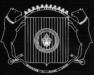
 THE MEROVINGIAN BEE = 1342=THE GREAT DATABASE,THE SEVEN SEALS,THE ARK OF THE COVENANT,Σωματα (Body) [The Seven Seals are the 7 Chakras/7 Colors of Ruach]
[1414 - 1342 = 72;AL.II.72: I am the Lord of the Double Wand of Power; the wand of the Force of Coph Nia— but my left hand is empty, for I have crushed an Universe; & nought remains. (1414 = The Invisible House x 7)] |
|
|
|
Rispondi |
Messaggio 44 di 52 di questo argomento |
|
THE MEROVINGIAN =
855
=
HE IS THE ONE,
OPEN,
THE CIRCLES OF TIME
855 is ONE more than 854 =
THE CONSRUCT,
THE FLOWER OF LIFE
The Bee gives the Flower Life with its ONE/HAD/HE/★. The BEE (12) + 1 = 13, the Flower/Fleur de Lys that blooms into the Cube of Metatron.NECTAR = 676 (26(GOD) x 26(IHVH)The NECTAR (659) is the source of the THE ATOMIC CODE(659) which One may UNLOCK(659) viathe formula of THE MANIFESTATION OF NU-ISIS/THE EGG OF MA-ION (1318) ...WHEN WE REACH THE GALACTIC PLANE (1318).METATRON384 = AQUARIUS, CHAOS, OPPOSITE, IXAXAAR, Ο Μαγος (The Magician)984 = מטטרון (Metatron), EGYPTIAN PYRAMIDS, The Manifestation of Lucifer[Light]1034 = CONSTANT, TIME LOOP, EXTRATERRESTRIAL, Word, The Law, Levitation1166 = SERPENTARIUS, THE GREAT GRIMOIRE, CEASELESS BECOMING
1425 = THE BOOK OF REVELATION, THE SECRET OF PINK, TIME LOOP, Οφεων (Serpent/Ouroboros), Holographic Universe
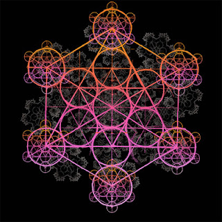
METATRON'S CUBE396 = IPSISSIMUS, SUPREME, MAYAN CALENDAR, Galactic Alignment, The Secret, Horoscope460 = Γεματρια (Gematria), המאיה לוח שנה (Mayan Calendar), Ανατολη (Anatole, East)767 = מטטרון של קוביה (Metatron's Cube), THE ANTICHRIST, THE APOCALYPSE, THE MAGUS OF MAION, את הידע האסורה (The Forbidden Knowledge)851 = THE WORK OF AGES, TALISMAN, MARTYR
1417 = THE BOOK OF THE SPIDER, MAIDEN-MOTHER-CRONE
1758 : Μετατρονς Κυβος (Metatron's Cube), CRACK THE FRACTAL
THE CONSTRUCT = 820+ The 1821 = MA-ION,THE COMING OF LAM'S EGG
All of this is still being refined, but so far I am sure it has much to do with the code in AL.II.76.76 x II = 836 (418+418) = THE PROOF, UNION,Computer Program, The Decrypted Code.
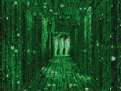 THE ARCHITECT=1046 =MATTER,THE GEMATRIA DICTIONARY, GEMATRIA REVELATION, KETHER+DAATH, HORUS+SET, THUNDEROUS, PATERNALISM, THE BEE-HIVE OF HUMANITY, WORM HOLES, THE PIT OF HELL, THE COLOR RING, MAYAN CALENDAR,A MAN NAMED BLACK WILL OPEN THE GATE76 x 10 = 760 =(Kether + Chokmah + Binah), THE MATRIX,ARCHONIC COMPUTER, Αραχνη (Arachne, the weaver of the WEB),THE NINTH ARCH, Νυιτ (Nuit)
THE MATRIX + The 1 = 761 = מארק אלאנ להבאש°,CONSPIRACY,THE GEMATRIA CODE
760+761 = 1521=EXPECT HIM NOT FROM THE EAST NOR THE WEST, THE TWENTY-TWO PATHS, THE POWER OF THE PINEAL GLAND, THE INVISIBLE LIGHT, GO TOWARDS THE LIGHT, LAM IS OKBI SPIDER WRITING (OKBISh-5.),WHAT MEANETH THIS O PROPHET?
OKBI = 102+ 1521 =1623=THE CHOSEN ONE,I AM THE ANTICHRIST.(The Antichrist is merely the Scorpionic aspect of the Death (13) card.)"The 17th page of the original manuscript of Liber AL indicates, in cipher, the identity of the 'child' in question. - pg. 528 of The Ninth Arch.

Counting the Title Page of Liber AL as '1', the 'child' who is come from 'no expected house' is found, as Grant says, "in cipher" in the underlined word HE towards the bottom of the 16th page, which is actually the 17th page.'HE' is also mentioned on the page numbered 17 towards the bottom as well.HE is HAD.HE = 10 / HAD = 10.HE IS HAD = 330 = HRUMACHIS, 'Horus of the Star'.HE is also the letter He, attributed to none other than The Star; the 17th Atu.
THE MANIFESTATION of the Child 88 years into The Aeon of Horus signifies the Child (Horus/M.A.L.) will be contrasted by the SECRET-ION (Set/LAM) who manifested 66 years after 1945 when LAM was received by Grant. (Egg of LAM = 66).66 is 22 (letters of Manifestation+Secret-ion) less than 88. Note also that the word Manifestation appears in the 1st and 66th verses of Chapter one of Liber AL.And counting the 0 (Egg) 1945 was 0~21 (22) years after Grant was first born.2012 being the year of THE MANIFESTATION of the SECRET-ION (MA-ION) is then justified in that 107 is number of Ma-Ion, BITzH (An Egg), OVAL, THE MAGICK EGG, ALIEN EGG, Aquarius, An Obsidian Egg+ 1= 108:Geometry,The Spiral,Fifty Five (1~10) [DNA = 55]......All having to do with the sacred geometry of manifestation the akashic field/The Matrix of its secretion.
The ties between THE MANIFESTATION (2012)and the SECRET-ION (2013) further connect by the fact that the ICOSAHEDRON (the PERFECTION)has 20 sides and 13 points (counting the center point).20 x 13 = 260, the number of BARATCHIAL, the Tunnel of Beth/The Magician, as well as LUCIFER - the Light mentioned earlier.260 is alo the number of 'Fresh Fever From the Skies', and 'The Thirteenth Tarot Card'.
 Any point on either the downward or upward triangles within a sphere are at 19.47°.This formula is tied in with the Merkabah and the Icosahedron and holds the keys to the Outer Gateways mentioned in the books of Kenneth Grant and these 20 pages of this grimoire It's All in the Egg thus far.Merkabah + L/Lamed/Adjustment/12 = MerkLabah; a version of my First and Last name that equals 444 (The Key/Gematria/DMT[The Spirit Molecule]/The Akasha/Tarot/Occult).The Egg of MU is The Egg of Daath since MU is the reversal of the OM - the word of manifestation, and is therefore The SecretIon.0 = 2
1945 + 2 = 1947; The Twenty Third Card,The Divine Operating System,התקשרויותייך : connection; alliance; communicationTHE ALIEN HARVESTERS, THE SECRET HAS BEEN REVEALED, IT IS ALREADY TOO LATE, KILLING THE ANTICHRIST, THE YEAR OF THE END OF THE WORLD, INFINITE SPACE AND THE INFINITE STARS THEREOF, THE ASCENSION OF MALKUTH
2011 + 2 = 2013 =Ηωρυς+Σετ (Horus+Set),61 (אין, Heaven) x 33 (ΑΙΔΗΙ, Hell), SYNCHROTRON,FROM NO EXPECTED HOUSE COMETH THAT CHILD,התרחשתן : to happen, occur,השתבשותם : going wrong; erring; confusion; upset,
השתברותן : breaking; refraction (optics).
|
|
|
|
Rispondi |
Messaggio 45 di 52 di questo argomento |
|
¿PORQUE LA INDEPENDENCIA EN FILADELFIA EN LOS EEUU? NEXO CON WASHINGTON D.C / COLUMBIA / MARYLAND / VIRGINIA / CIUDAD DE 7 COLINAS
- Is Washington DC the City of 7 Hills, the Endtimes Babylon City?
- Revelation 17 (New King James Version)
9 “Here is the mind which has wisdom: The seven heads are seven mountains on which the woman sits. ….
15 Then he said to me, “The waters which you saw, where the harlot sits, are peoples, multitudes, nations, and tongues. …
18 And the woman whom you saw is that great city which reigns over the kings of the earth.”
-
- Could Washington DC be the endtimes Mystery Babylon city? It is possible. Some Christians are pretty dogmatic that it must be Rome (the city of 7 hills). I am not. Don’t get me wrong, it could be Rome. I just don’t think that it must 100% be so! I actually do not think this issue is very important. It will be a city much like Rome in Apostle John’s time that ruled over the entire world.
-
- There are some evidence that Washington DC is build on 7 hills.
-
There is another “city of seven hills”, it’s called Washington D.C!
by heavensclimb.blogspot.com
There is another “city of seven hills”, it’s called Washington D.C. Here is a brief excerpt from an article on it:
-
“Washington D.C.’s original name was Rome, Maryland, and a branch of the Potomac River was called Tiber Creek, which was named after the Tiber river in Rome. Like Rome, Washington D.C. has 7 hills, whose names are: 1. Capitol Hill, 2. Meridian Hill, 3. Floral Hills,4. Forest Hills, 5. Hillbrook, 6. Hillcrest, and 7. Knox Hill.”
-
Washington DC – Is this the city of seven hills that will be destroyed?
by http://gnosticwarrior.com/
It is well known that the city of Rome was built on seven hills or mountains, but did you know that Washington DC was also has seven hills? Yes, Washington D.C. really does have seven hills:
-
1. Capitol Hill
2. Meridian Hill
3. Floral Hills
4. Forest Hills
5. Hillbrook
6. Hillcrest
7. Knox Hill
-
In biblical prophecy, at the end of which the city of seven hills will be destroyed. Will this city be Rome or Washington?
-
- It is pretty much a historical fact that Washington DC is a twin city of the Vatican city and built/designed largely by Freemasons. It is not a Christian city but built according to occult, Greek and Egyptian designs. Historically, it was also known as Rome.
-
Francis Pope, Original Landowner of Washington, DC aka Rome!
by Barbara Price, http://genforum.genealogy.com/
I have done extensive research on the beginnings of Washington, DC as my Burnes family owned much of the old downtown are of present-day Washington, DC. While conducting this research, I came across Francis Pope, one of the original owners of the land that became Washington, DC. Not only are we connected in that way, but Francis’s wife, Margaret Porter, is probably the sister of another ancestor, Johanna Porter, the second wife of John Neville, who came to America on The Ark and The Dove. Below is from, “Original Patentees of Land at Washington,” by Bessie Wilmarth Gahn:
-
“No. 7. Francis Pope, owner of “Rome” on the Tyber, June 5, 1663.
….
… actually are convinced that Pope’s “Rome” was on the site where our Nation’s Capital Building now stands. …. we understand why the name “Rome” faded away from the area of the National Capital in so complete a manner …
-
The Catholic Encyclopedia: Daniel Carroll
.. Daniel Carroll was named with Thomas Johnson and David Stuart as his associates. The choice of the present site of Washington was advocated by Carroll … The capitol was built on the land transferred to the Government by Carroll. And there is additional interest to Catholics in the fact that, in 1663, this whole section of country belonged to a man named Pope, who called it Rome.
….
The Jesuit Bishop John Carroll was probably the richest man in America in the late 1700’s. Carroll allowed funding to construct D.C. (which is nicknamed “Rome on the Potomac”). The owner of the land used to be Francis Pope and his priest was Jesuit Andrew White (White House).
….
Washington D.C.’s original name was Rome, Maryland, and a branch of the Potomac River was called Tiber Creek, which was named after the Tiber river in Rome. Like Rome, Washington D.C. has 7 hills, whose names are: Capitol Hill, Meridian Hill, Floral Hills, Forest Hills, Hillbrook, Hillcrest, and Knox Hill.

Freemason, occult symbols in the design of Washington DC!

What is an Egyptian obelisk doing in DC?
|
|
|
|
Rispondi |
Messaggio 46 di 52 di questo argomento |
|
|
Resumido… del Seminario de Magos y Magas de la Tierra, Picarquin, Chile ( 1999)
(…)
La ciencia comprehensiva unifica lo que nosotros usualmente pensamos que es ciencia. Debemos recordar que la ciencia, realmente, es un intento de descubrir la verdad. Los alimentos genéticamente modificados son una aberración de la verdadera ciencia, y, tiene algo que ver con la necesidad que se tiene de profecía. Decimos que la profecía es ley natural, y tiene que ver con la corrección del orden genético en el tiempo.
Usualmente, cuando pensamos en la profecía, creemos que alguien está dando una visión que ocurrirá en el futuro. Por esto, la profecía ha de tener algo que ver con un conocimiento del tiempo, con lo que llamamos pre-visión, o pre-ver. Pero parece ser algo más profundo que la mera pre-visión. Si sabemos que la profecía tiene que ver con la corrección del orden genético, entonces, por lo tanto, debe de haber algo erróneo con el orden genético. Como podréis recordar, en la última meditación sobre el tiempo, la última semana, hablamos acerca de la deformación genética de la frecuencia de tiempo 12:60. Si no hubiera una deformación genética, no necesitaríamos profecías. Es a causa de que hemos entrado en este mundo de Velatropa 24.3, en el que tenemos todos los exagerados errores del universo, encarnados aquí y ahora, que empezamos a prestar atención a la profecía.

La profecía confirma la existencia del tiempo natural. Si examinamos las diferentes profecías, todas ellas parecen tener temas similares: Hay un tiempo original, hay un tiempo de corrupción, hay un tiempo de profecías para acabar con la corrupción; luego hay un retorno al tiempo original, o al tiempo natural, o a la Edad de Oro. Vemos que a menudo hay un tema sobre las Cuatros Eras, y el momento final es la entrada a la Quinta Era. Este es el tema general de la profecía. El tema general de la profecía también confirma el que debe de haber algún error genético. Vemos pues que en todas las grandes tradiciones proféticas hay también, obviamente, una cualidad moral, porque el fallo genético produce crecientes niveles de fracaso moral. Este incremento del fracaso moral crea una situación a la que, normalmente, nos referimos como el Día del Juicio. Este Día del Juicio es el tiempo en el que vamos a despertar y recordar. Todos los verdaderos maestros hablan de recordar. Lo que re-cordamos, es el tiempo original y el retorno del tiempo original.
(…)
Las tradiciones del Chilam Balam fueron desarrolladas en Yucatán y Chiapas, y con los siglos, los Mayas Quiché fueron separados de esas tradiciones. Algunos Mayas Quiché no entienden este punto. Afortunadamente, hay otros que sí. Los Adivinos de Años tienen que ver con la custodia de las fechas relacionadas con lo que ahora llamamos, la fecha de sincronización del 26 de Julio. Las tradiciones del Chilam Balam incluyen textos y tradiciones muy diferentes. Las más famosas y extensas de estas tradiciones, es la llamada tradición del Chumayel. Hay otras, como la tradición de los Libros de Mani. Estas tradiciones decayeron hacia la mitad del siglo XIX.
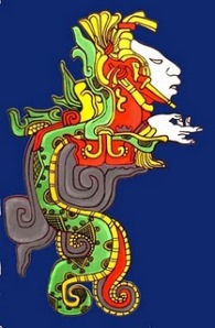
Todas ellas tienen una cosa en común: la fecha de sincronización del 26 de Julio, que está sincronizada por lo que llamamos Familia Terrestre Portal. Esta fecha, antes del Calendario Gregoriano, en el Calendario Juliano, era el 16 de Julio. Como la sincronización del Tzolkin y de los Calendarios Solares esta fecha del 16 de Julio nos lleva al año cristiano 692, que en el Baktún de la cuenta larga, era 9.13.0.0.0 . Por supuesto, ésta es la fecha de la dedicación de la tumba de Pacal Votan. Esta fecha de sincronización era conmemorada, en el sitio llamado Edzna, que está en los 19.5° Norte, y tiene que ver con la elevación de Sirio. Esta era también la fecha de inicio del Calendario de Thoth en Egipto. También, años antes de la dedicación de la Tumba de Pacal Votan, la misma fecha en el Calendario Cristiano, 16 de Julio, era la fecha de la Hejira de Mahoma, y marca el comienzo del Calendario Lunar Islámico. Así pues, tenemos muy interesantes conjunciones y correspondencias: es la función de los Adivinos de Años, señalar esto. Cuando, empecé a seguir el Calendario en 1974, yo también empecé a seguir tradición la del Chilam Balam. Desde ese momento seguí las fechas de la Familia Portal y del 26 de Julio: ésta es la base de la Nueva Dispensación del Tiempo, que viene de la tradición del Chilam Balam.
(…)
La quinta categoría de las profecías del Chilam Balam, se refiere a las Profecías Especiales de Antonio Martínez. A Antonio Martínez se le describe como un ser de carácter totalmente desconocido, y nadie sabe quién era, de dónde vino, ni cómo llegó a estar en las Profecías del Chilam Balam. Desde la época en que yo empecé a estudiar el Chilam Balam me sentí inmediatamente atraído por las Profecías de Antonio Martínez. Leí las Profecías de Antonio Martínez muchas veces, y creo que la Profecía de Antonio Martínez es uno de los dos sitios que contienen una referencia al Libro de las Siete Generaciones. Supe que este libro era la clave para las Profecías de Pacal Votan. Entendí que las Siete Generaciones se referían a los siete ciclos Katun, entre 9.13.0.0.0 y el principio del siguiente ciclo Baktun, 10.0.0.0.0. Sabía además por esta causa, que estaba estrechamente conectada con la tumba de Pacal Votan y también con la fecha de sincronización del Calendario Juliano, el 16 de Julio – 26 de Julio, del Gregoriano.
Otro punto interesante hace referencia a la ciudad de Chichén Itzá: La llamada Vieja Chichén Itzá fue fundada muy al principio del ciclo Baktun, 9.0.0.0.0 y fue abandonada precisamente en el 9.13.0.0.0. Lo que llamamos la Nueva Chichén Itzá, empezó en el año 987. La Nueva Chichén Itzá fue iniciada por Quetzalcoalt. Este fue el milenio de Quetzalcoalt, que iba desde la fundación del Nuevo Chichén Itzá ( 987 ) a la Convergencia Armónica (1987). El ciclo de los 13 Cielos y los 9 Infiernos empezó en el año 843, y los 13 Cielos llegaron a su conclusión 576 años más tarde, en 1519, cuanto Cortés desembarcó en México. Por supuesto era un Viernes Santo cuando Cortés toca tierra en México, lo que ocurrió el día 1 Caña, que es lo mismo que Caminante del Cielo Magnético, la firma galáctica de Quetzalcoalt. Como una nota de pie de página: cuando El Factor Maya fue publicado llegó a nuestra casa el Viernes Santo de 1987 – así empezamos a darle la vuelta al karma.
(…)
Es muy interesante dónde esta Profecía aparece en el texto completo del Chilam Balam. La profecía anterior es la Profecía de la Verdadera Religión del Hunab Ku. Es muy claro, leyendo esto, que la religión del Hunab Ku es la que vendrá después del tiempo de la conquista. No es la religión cristiana, sino la religión que vendrá después de la religión cristiana. Esta es por otro lado una de las pocas y raras referencias que encontraran sobre Hunab Ku.

En la sección después de la Profecía de Antonio Martínez están las expresiones de las declaraciones de los Ah Bobat. “Ah Bobat” el nombre Maya para los profetas. Los Ah Bobat es el linaje de los profetas que surgieron al final de los Mayas Galácticos o la civilización Maya Clásica. Este linaje de profetas era para mantener la transmisión de la enseñanza espiritual que por otro lado había desaparecido con el final de la Cuenta Larga, en el 10.0.0.0.0. El más famoso de ellos fue efectivamente un profeta llamado Chilam Balam, que vivió precisamente antes de la conquista española, y tenía mucho que decir sobre ella. En las expresiones de los Ah Bobat hay una frase que se repite una y otra vez:
¿Quién será el profeta, el Ah Bobat? ¿Quién será el vidente solar, el Ah Kin que explique correctamente las palabras de estos signos jeroglíficos?
(…)
También supe por otras investigaciones que 5 años después de la Profecía de Antonio Martínez, en el 1697 – esto fue el año, incidentalmente, el año de la conquista final de los mayas como nación o pueblo político soberano en este tiempo – en la ciudad de San Cristóbal de las Casas en Chiapas, había habido una correspondencia entre dos monjes cristianos. En dicha correspondencia se referían a cierto texto del que ellos habían oído. Este texto es llamado “La Probanza de Votan,” o “los Ensayos, o la Prueba de Votan”. Hablan sobre un personaje mítico llamado Votan, que había sido rey gobernante o un hombre sabio que vivió en una ciudad muy especial en la selva. Este Votan había sido una persona supra-normal. Parecía ser descendiente de Noé; fue testigo de la construcción de la Torre de Babel; y finalmente, hizo su camino hacia el Nuevo Mundo, donde fundó su ciudad, que fue conocida como Nah Chan, La Casa de la Serpiente – que conocemos hoy, como Palenque.
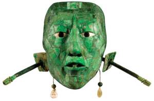
Antes de venir a Nah Chan él se encarnó, o emanó, o vino de la tierra. Salió de la tierra en un lugar cerca de Nah Chan, llamado Valum Votan. Este fue un sitio de entrada y salida de Pacal Votan. Este Pacal Votan o el Gran Votan, como fue conocido, construyó una torre, que conocemos como la Torre de Bolon IK, o la Torre de los Vientos. Debajo de esta Torre había una roca y 4 veces fue allí el Gran Votan, por medio de esta roca, por una escalera hecha de 13 serpientes. Fue y visitó el interior de la Tierra, y luego fue al Cielo. Estas fueron algunas de las cosas que anotaron estos monjes cristianos, supuestamente escritas en el texto llamado La Probanza de Votan. Como dije, esto fue en 1697. Tomaremos nota de que 1692 era 300 años antes del año 1992-1993. El año 1992, al que llamé el Comienzo del Cambio del Tiempo, ocurrió exactamente 1300 años después de la dedicación de la Tumba. 1697: 300 años mas tarde era 1997 – fue en ese tiempo que a lo que llamo el perfume de Valum Votan, llenó todo mi ser.
De este modo, el misterio llega hasta al gran Pacal, y a quien era él. Hay alguna controversia acerca de qué edad tenía o cuánto vivió. El arqueólogo, Alberto Ruz estaba seguro de que Pacal Votan fue alguien que probablemente murió próximo a sus 50 años de edad, pero parece también que eso es muy controversial. Otros dicen: “No, esta fue una persona más vieja”. Ahora, después de posteriores descodificaciones de los jeroglíficos, parece que Pacal Votan nació en el año 603, y que murió 80 años más tarde en el 683. Es muy interesante que su vida se divida en dos ciclos. El primer ciclo es un ciclo de 28 años, y el segundo ciclo, es un ciclo de 52 años. La mayoría de las tradiciones del Buda, dicen que Buda vivió 80 años, y cuando tenía 28 años dejó su vida en el palacio, o sea, esto nos deja 52 años – justo como Pacal Votan.
(…)
Es interesante, como saben, que la tumba se abrió en 1952 – lo que por supuesto fue 1260 años más tarde de su dedicación. 40 años más pasaron antes del año del Cambio del Tiempo, que fue entre el 26 de Julio del 1992 y el 93. 40 años más tarde de la apertura de la Tumba, estando en el desierto. Desde el tiempo, en que tuve por primera vez una revelación de mi misión (lo que ocurrió yo sospecho algún tiempo muy cercano al 26 de Julio de 1953, cuando yo tenía 14 años), mis 40 años fueron de 1953 a 1993, y fue precisamente en ese momento, cuando yo estaba empezando a decodificar el significado de la Tumba de Pacal Votan. Cuando empecé esta meditación con ustedes hoy, estuve hablando acerca de Terma y Tertón y hay una afirmación de Padmasambhava. Él dice: “Yo, el Gurú Padmasambhava, hice la aspiración. Que estas enseñanzas encuentren a la persona afortunada, quienquiera que sea en el futuro. Debido a esta aspiración las enseñanzas encontrarán a la persona afortunada”. Esta clases de enseñanzas son muy precisas en el tiempo, pero por otro lado eso no es ningún problema, porque si ustedes son como yo – es decir viven haciendo caso a las señales- siempre estarán dispuestos en el momento correcto; pero eso es un comportamiento muy profundo.
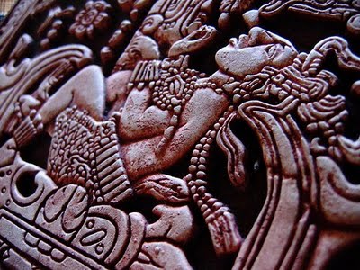
detalle del relieve sarcófago de Pacal Votan
Muchas veces ignoramos las señales, pero vivimos puramente por las señales, y a causa de esto, he sido una persona verdaderamente afortunada de poder estar en el lugar correcto y en el tiempo correcto y que se me revelaran las enseñanzas a mí. Está muy claro que lo que llamamos Terma de la Tumba de Pacal Votan es una Terma de la Tierra muy, muy poderosa. Me tomó 40 años para que esta Terma estuviera totalmente lista. Me tomó 40 años estar completamente listo para la Terma. Pero en el preciso momento, la Terma empezó a revelárseme.
Desde entonces he comprendido que no tengo una personalidad real. Que realmente estoy viviendo una función de ciertas emanaciones de la mente que usan mi alegre cuerpo de Mono para realizar lo que ha de realizarse. La Tumba de Pacal Votan, de algún modo, es la más grande de todas las Termas, porque es la Terma para cerrar el ciclo. Es la Terma que define el Día del Juicio. Es la Terma que define el Tiempo de la Profecía. Es la Terma que define la Segunda Creación. Es la Terma que define la llegada del Cielo a la Tierra. Es una Terma, muy, muy poderosa. Es por lo que ahora sabemos que somos todos un Mundo, que somos todos una Tierra y que tiene que existir una Profecía, y una enseñanza que sea para toda la Tierra, que unifique todas las religiones, todas las tradiciones espirituales, todas las visiones de todos los mártires.
Cuando por primera vez empecé a decodificar el Telektonon supe que había un Telektonon muy , muy grande, que el Telektonon original es tan vasto como el sistema solar y se extiende a la Galaxia; y que el Telektonon que yo estaba decodificando era justamente una pequeña parte de este Telektonon. Este gran Telektonon lo podemos describir como la visión redentora del orden estelar de Kinich Ahau. Es a causa de Kinich Ahau por lo que el Telektonon es revelado.
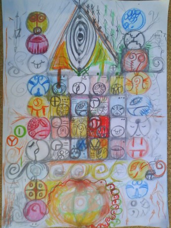
Como hemos dicho, somos parte de esta estrella, la estrella que está evolucionando. Toda estrella al final llega ha ser una supernova. ¿Cómo lo vamos a hacer?. ¿Cómo evolucionaremos hacia eso?. ¿Qué significa eso?. Es de un gran significado que a causa de la captura del falso tiempo que el planeta, cuando llegó a conocerse a sí mismo como planeta, estaba unificado bajo un falso Calendario Solar. Por eso, no podíamos elevarnos a la Conciencia Solar. Eso nos lleva de vuelta, también al punto de la Profecía del Telektonon. Cristo tenía que expulsar a los prestamistas de dinero del Templo. Este es el Templo de la Tierra; ¿Quién me ayudará a expulsar a los prestamistas de dinero?.
****
Telektonon
Cuando miramos en la sección del texto del libro de instrucción del Telektonon, encontramos una sección que dice que “la Ley de Bode confirma al Telektonon”. Bode, como quizás alguno de ustedes han encontrado, era un astrónomo alemán que vivió al final del siglo XVIII y principios del siglo XIX. A través de sus estudios, que estaban basados en los estudios de Copérnico y Kepler, el determinó que a las órbitas planetarias se les podría asignar un juego total de números, que definían los radios orbitales de los planetas con cada uno en relación a su distancia al sol. Así es muy interesante que el primer planeta, Mercurio, es 4, y Venus el segundo es 7. Esta es la base: el 4 es a 7 como 7 es a la proporción del 13. Entonces la tierra es 10, que actualmente es el poder de las 10 órbitas en la tierra pero es solo una mitad del 20. Por ejemplo Saturno, que es 100, es 10 veces mas que la Tierra. El 100 de Saturno es la base del sistema monetario, que es el concepto del “tiempo es dinero” así tenemos $100 o $100.000.000 . Todos los valores monetarios están basados en el 10. Marte es 16 y corresponde al Cubo de la Ley.
VER : Tablero del telektonon

Fue a través de este sistema de números totales que definen estas proporciones que Bode determinó que había algo entre Marte y Júpiter, lo que fue descubierto como el Cinturón de Asteroides, el planeta perdido de Maldek. Suficientemente interesante, su numero es 28. Así que cuando hablamos sobre el circuito de 28 días y el porque nosotros tenemos que regresar a este, es porque ahí vamos a tener el retorno de la memoria de Maldek hacia nosotros también.
Algo muy interesante además, el número Bode de Júpiter es el 52. Fue el 52 de Júpiter que se convirtió en las 52 semanas del sistema Babilónico de 7 días a la semana. Pero ellos solo usaron esto meramente como un circuito tridimensional, para que el Saturno 100, pudiera usar esto como la estructura de “tiempo es dinero”. Cuando ustedes llegan a Urano, tienen el numero de Bode 196. Ahí nosotros tenemos los números 28 y 7 otra vez- porque el 196 es 28 x 7. Esta es la conexión hacia la Tierra que debe realizarse, que hizo cortocircuito por el Saturno 100 y el Júpiter 52, quien destruyo el Maldek 28 y que hizo extinguir la civilización de Marte 16. Así que llegamos a Neptuno 300, que es lo mismo que sumar, 1 + 2 + 3 +…. hasta 24, y, esto es Kinich Ahau, Velatropa 24. La memoria del poder acumulativo del 24 es guardada en Neptuno. El planeta final, Plutón, es 388 – que es 4 x 97 , ( 96 + 1). 96 es 24 x 4 de nuevo.
Así que cuando vemos esto en los dos flujos del tablero del Telektonon, tenemos Plutón, después Neptuno, aquí abajo esta Mercurio, después Venus. Aquí esta el circuito de la Tierra. Nosotros vemos que está conectado al circuito de Urano. Esta forma que esta aquí {Señalando la sección del día 7-22} es el diapasón. Si ustedes pueden tocar este diapasón, van a oír el quinto acorde. Aquí tenemos Marte y Maldek, y aquí tenemos Júpiter y Saturno. Van a ver que en esta definición, están los dos planetas perdidos, (Marte y Maldek ) y aquí están los planetas dominante (Júpiter y Saturno) el sol Kinich Ahau esta aquí {señalando a la parte de abajo del tablero}.
VER : Tablero del telektonon
Originalmente había un sistema de tubos de flujo que conectaban el Sol con los planetas. Cuando Maldek fue destruido, el sistema de tubos de flujo fue dañado gravemente. Cuando la civilización en Marte fue destruida, ese sistema de tubos de flujo fue totalmente quebrado. Por eso es que esta es
Velatropa 24.3, la tercera órbita desde el Sol, por esto la energía fue puesta dentro de este planeta. Todos los efectos kármicos que ocurrieron ( en los planetas perdidos ) fueron arrojados dentro del planeta Tierra como si fuera un cesto de basura. Pero lo hicieron con un motivo: ver si todo esto podría ser redimido. Por esta razón la Tierra ha tenido sus guardianes. Este es el significado de Arcturus, la estrella Pastora, o Estrella Guardiana.
Todo esto había sido cuidadosamente observado y, en alguna manera, muy cuidadosamente preparado. Cuando hablamos acerca del sistema de conciencia, ¿donde esta la conciencia? Tenemos que pensar, ¿qué es lo que nos da vida como un ser biológico? El Sol el sol nos da vida. Todo en el Sistema solar evoluciona alrededor y depende del sol. Las diferentes órbitas planetarias son como olas armónicas. La música de las esferas es también la música de conciencia y las diferentes órbitas entonces sostienen diferentes niveles o puntos de conciencia.
También, cuando miramos en este mapa { El tablero del Telektonón } tenemos de nuevo las tortugas. Las tortugas muestran la sincronización del 13:20 con el 13:28 que es el ciclo de las 13 lunas. El 13:20 es dividido en 4 partes, que corresponden a los 4 clanes : el clan del fuego, el clan de la sangre, el clan de la verdad, el clan del cielo. De nuevo una mitad de eso lo pueden encontrar como el Flujo Galáctico-Kármico. La otra mitad la pueden encontrar aquí como el Flujo Solar- Profético. Luego la misma proporción de 13 y 4 define a la tortuga de abajo. Están las dos primeras semanas de siete días, que a nivel fractal se refieren al Flujo Galáctico-Kármico; y las tercera y cuarta semana se refieren al Flujo Solar-Profético. La proporción 4 : 7 nos lleva a 4 veces 7 , que es 28, y el 28 veces 7 nos da 196, que es el numero de Bode para la órbita de Urano. Así este circuito de 28 días tiene dos funciones interplanetarias: una de ellas es re-establecer el número de órbita de Maldek que fue destruido; el otro es establecer el túnel del tiempo conectando la Tierra con Urano, que es una función de este lado de aquí del diapasón {señalando a la parte derecha del tablero}.
VER : Tablero del telektonon
Todo acerca de este mapa es una muy precisa descripción del orden matemático de la cuarta dimensión. Nuevamente, aquí tenemos los dos flujos: el Flujo Gálactico-Kármico y el Flujo Solar-Profético, que ustedes pueden ver tomando la penta binaria { mostrando el Tablero de Viaje del Encantamiento del Sueño }: el flujo exterior es el Flujo Galáctico – Kármico en el (Tablero del Telektonon ), y el flujo interior que va en dirección opuesta, es el Flujo Solar – Profético. Pueden ver que cada uno de los planeta tiene dos diferentes funciones. Plutón, que representa el sol, es el poder de iluminación y de autogeneración. Este es el orden galáctico, { más allá de Plutón }. Cuando tu sales del sistema estelar entonces estas en el orden galáctico. Se dice que la iluminación es intrínseca a nuestro ser. El orden galáctico es iluminante, por esto es que el empieza con eso (con el poder). Así cuando el flujo Solar Profético va en esta dirección contraria, se dice que el poder de autogeneración es también intrínseco. Cuando estamos iluminados entendemos esto, y cuando somos verdaderamente capaces de autogenerar nosotros somos iluminados.
Neptuno se refiere al poder del nacimiento, que en el Telektonon es el poder de la memoria. Esto es muy interesante para reflexionar, en ello. Cuando nacemos, tenemos toda nuestra memoria cósmica en nosotros. Así tenemos funciones de conciencia: iluminación, autogeneración, memoria, meditación. Meditación es la función de conciencia por la cual somos capaces de ver claramente y mantenernos a nosotros mismos. Luego Urano sostiene el poder consciente de Espíritu y de navegación. Navegación es el poder intrínseco de conocer a donde vamos, y como llegar ahí.
Saturno es el poder consciente de abundancia y de inteligencia. Ellos están muy relacionados. Cuando pensamos en abundancia, es un poder de conciencia mas que de acumulación de cosas materiales. Así en otras palabras, la abundancia de conciencia es la capacidad para establecer cualquier numero de diferentes niveles de orientaciones intuitivas. La inteligencia también esta relacionada a esto, porque la inteligencia es el poder de discriminar cualquier cantidad de niveles diferentes. Por esto es que la inteligencia cuestiona, para discriminar dentro de diferentes niveles de orden. Júpiter es el florecimiento y la visión. El florecimiento es una función de conciencia. La flor es conciencia solar, se abre al sol – esa es una clave muy fuerte. La visión es una función del mismo poder solar – Sin luz tu no puedes ver.
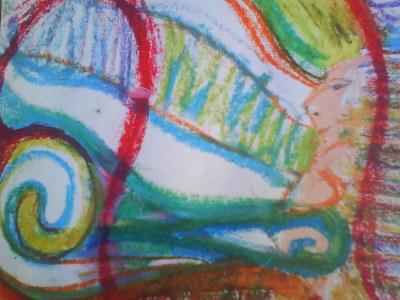
Pacal Votan y los Siete Sellos de la Profecia
Estos son los planetas exteriores y las funciones exteriores de conciencia. Vamos a los planetas interiores y llegamos a los niveles mas biológicos e instintivos. Maldek es función de la fuerza de vida. Aquí es donde el patrón del Adán original fue plasmado en el sistema solar. La función solar de eso es Atemporalidad. La fuerza vital esta siempre fluyendo, y el poder del Mago es estar en el medio del flujo y permanecer en la Atemporalidad. Con los Marcianos tenemos el poder de la muerte, pues donde hay fuerza de vida también hay muerte, la muerte es nada mas un portal, o una puerta. Conocemos que en la tierra, todo en la biosfera es una circulación continua, que es llamada la migración biogénica de átomos. Así los mismos átomos que están en el pasto, o en el alimento que comemos llegan a ser las células de nuestro cuerpo. Ellas han tenido incontables formas anteriores de vida. El Budismo habla mucho acerca de esto.
La contraparte a la muerte es profecía. Profecía es ley natural que corrige el desviado entendimiento de la muerte, su propósito es traernos continuamente a nuevos niveles de orden que corrigen los defectos que se han sucedido. Los polos de conciencia que la tierra sostiene, el poder de libre voluntad y el poder de realización, están muy relacionados al poder de memoria al nacer. Todos tenemos intrínseco en nuestro ser el poder de realización: eso significa realizando, completando el orden del universo. Esto lo hacemos a través del correcto uso de la libre voluntad que es alinearnos a nosotros mismos con el plan divino. Luego el poder de Venus que es el poder del arte y el poder de la magia. El arte es la función natural del poder de la realización. La magia viene del correcto alineamiento de nuestra voluntad con el plan divino, porque el plan divino consiste de todas las leyes de la naturaleza. Las leyes de la naturaleza no son siempre lo que dice de ellas la ciencia moderna. Ellas tienen mucho mas que ver con poner la mente en el lugar correcto. Cuando llegamos a Mercurio, llegamos al punto mas cercano a Kinich Ahau, la estrella; Mercurio sostiene las funciones de purificación y amor : purificación es una función natural.
Fuente :
Tercera Respiración, Hoja del Misterio, Semana Tres
Meditación 9-12: Telektonon, Tiempo y Profecía, Terma y Terton
Currículum Central: Ciencia Comprensiva
tercerasemana.doc
Seminario de Magos y Magas de la Tierra, Picarquin, Chile ( 1999)
Pagina sobre :
PACAL VOTAN – EL JUEGO DE LA PROFECÍA – TELEKTONON
Todo los hilos:
http://es.wordpress.com/tag/telektonon/
RELACION SIRIO CON EL ANGULO 19.47 |
|
|
|
Rispondi |
Messaggio 47 di 52 di questo argomento |
|
|
|
|
Rispondi |
Messaggio 48 di 52 di questo argomento |
|
eluniversohoy.net
el domo del Capitolio en
448 × 536 - 33k - jpg |

es.123rf.com
Capitol Dome Congreso Libertad
297 × 450 - 91k - jpg |

es.123rf.com
Unidos en Washington DC
305 × 450 - 60k - jpg |

es.azimage.com
Capitolio de Washington DC,
129 × 108 - 4k - jpg |

es.azimage.com
Capitolio de Washington DC
96 × 150 - 4k - jpg |

es.azimage.com
Capitolio de Washington DC,
150 × 98 - 4k - jpg |

es.azimage.com
Capitolio de Washington DC
139 × 107 - 4k - jpg |

es.123rf.com
Capitolio en Washington DC
1300 × 1028 - 141k - jpg |

sp.depositphotos.com
Capitolio en washington dc
1023 × 1002 - 252k - jpg |

noticiasseleccionvalde...
Capitolio en Washington DC
450 × 575 - 62k - jpg |

es.123rf.com
Capitolio, Washington DC, EE.
450 × 300 - 48k - jpg |

es.123rf.com
Washington DC Capitol paisaje,
1300 × 924 - 185k - jpg |

noticel.com
Vista del domo del Capitolio
500 × 250 - 20k - jpg |

es.hdstockphoto.com
Capitolio, Washington, DC,
150 × 100 - 4k - jpg |

es.onlyimage.com
Unidos en Washington, D.C.
150 × 100 - 3k - jpg |

es.azimage.com
Unidos en Washington DC
106 × 150 - 5k - jpg |

agencias.lamula.pe
el domo del Capitolio,
624 × 351 - 27k - jpg |

es.onlyimage.com
Washington, DC, Capitol, USA -
125 × 144 - 5k - jpg |

es.hdstockphoto.com
Capitolio de Washington DC,
107 × 140 - 4k - jpg |

es.onlyimage.com
,capitol dc,democracia
100 × 150 - 4k - jpg |

destinoviajes.cafevers...
El Capitolio de Roma
400 × 300 - 34k - jpg |

pt.wikipedia.org
A Praça do Capitólio.
220 × 91 - 10k - jpg |

codecables.wordpress.com
The 'Musei Capitolini' are
4000 × 2672 - 3800k - jpg |
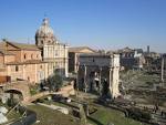
desportoviajar.wordpre...
deste o Monte Capitolino
1600 × 1200 - 639k - jpg |

albumfotos.com
Monte Capitolino
1200 × 775 - 273k - jpg |

turismoemroma.com
do Vittoriano: Roma aos
529 × 351 - 129k - jpg |

youtube.com
-El Monte Capitolino-
480 × 360 - 24k - jpg |
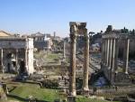
desportoviajar.wordpre...
Vista desde o Monte Capitolino
1600 × 1200 - 689k - jpg |
¿PORQUE FUE EN LA GESTION DE ABRAHAM LINCOLN QUE SE CONTRUYO EL CAPITOLIO O EL DOMO DEL CAPITOLIO EN WASHINGTON D.C? ES UNA OBVIA REFERENCIA ESOTERICA A GALATAS 4:26, EN EL MARCO A SU RELACION CON JUAN 8, CUANDO LOS FARISEOS LE TIRABAN PIEDRAS A LA RAMERA. ABRAHAM TENIA DOS HIJOS, UNA DE SARA Y OTRA DE LA ESCLAVA AGAR (¿PORQUE LA GUERRA CIVIL NORTEAMERICANA TENIA ESA FUERTE CONNOTACION?). OBVIO TODOS SON MENSAJES DEL TODOPODEROSO. ESTO TAMBIEN EXPLICA DEL PORQUE WASHINGTON D.C ESTA DISEÑADO COMO REFERENCIA A LA CONSTELACION DE VIRGO, SPICA (OBELISCO) Y ARTURO (CASA BLANCA). LA RELACION DEL 666 CON EL OBELISCO DE WASHINGTON, ES UN NEXO CON EL RELOJ MASONICO, OSEA LA "MAQUINA DEL TIEMPO" CODIFICADA EN LA SANTA CENA DE NUESTRO SEÑOR ADONDE OBVIAMENTE LOS 12 APOSTOLES, SON UNA REFERENCIA A LAS DOCE HORAS, MESES, CONSTELACIONES E INCLUSO CICLOS PRECESIONALES Y EL PAN Y VINO, AL HOMBRE Y LA MUJER, AL SOL Y LA LUNA, AL ORO Y LA PLATA, AL ALFA Y EL OMEGA, ETC,ETC, OSEA EL MISMO SALMO 119, QUE ES EL MENSAJE, INSISTO DE JUAN 8. LA PIEDRA ANGULAR DE WASHINGTON D.C, QUE FUE UN 13 DE OCTUBRE DE 1792, TIENE UNA RELACION OBVIA CON EL INICIO DEL CALENDARIO GREGORIANO, EN EL CUAL FUE SALTEADO DICHO DIA.
WASHINGTON D.C (ESTADO DE COLUMBIA-ARCA DE NOE-MARYLAND/VIRGINIA/ MERIDIANO 77 OESTE. ¿PORQUE ES UNA CIUDAD DE 7 COLINAS? ¿PORQUE ES UNA NUEVA ROMA? RELACION CON EL SANTO GRIAL)
|
|
|
|
Rispondi |
Messaggio 49 di 52 di questo argomento |
|
|
|
| Reply |
Message 35 of 35 on the subject |
|
Juan 10Nueva Versión Internacional (NVI)
Jesús, el buen pastor
10 »Ciertamente les aseguro que el que no entra por la puerta al redil de las ovejas, sino que trepa y se mete por otro lado, es un ladrón y un bandido. 2 El que entra por la puerta es el pastor de las ovejas. 3 El portero le abre la puerta, y las ovejas oyen su voz. Llama por nombre a las ovejas y las saca del redil. 4 Cuando ya ha sacado a todas las que son suyas, va delante de ellas, y las ovejas lo siguen porque reconocen su voz. 5 Pero a un desconocido jamás lo siguen; más bien, huyen de él porque no reconocen voces extrañas».
6 Jesús les puso este ejemplo, pero ellos no captaron el sentido de sus palabras. 7 Por eso volvió a decirles: «Ciertamente les aseguro que yo soy la puerta de las ovejas. 8 Todos los que vinieron antes de mí eran unos ladrones y unos bandidos, pero las ovejas no les hicieron caso. 9 Yo soy la puerta; el que entre por esta puerta, que soy yo, será salvo. Se moverá con entera libertad, y hallará pastos. 10 El ladrón no viene más que a robar, matar y destruir; yo he venido para que tengan vida, y la tengan en abundancia.
11 »Yo soy el buen pastor. El buen pastor da su vida por las ovejas. 12 El asalariado no es el pastor, y a él no le pertenecen las ovejas. Cuando ve que el lobo se acerca, abandona las ovejas y huye; entonces el lobo ataca al rebaño y lo dispersa. 13 Y ese hombre huye porque, siendo asalariado, no le importan las ovejas.
14 »Yo soy el buen pastor; conozco a mis ovejas, y ellas me conocen a mí, 15 así como el Padre me conoce a mí y yo lo conozco a él, y doy mi vida por las ovejas. 16 Tengo otras ovejas que no son de este redil, y también a ellas debo traerlas. Así ellas escucharán mi voz, y habrá un solo rebaño y un solo pastor. 17 Por eso me ama el Padre: porque entrego mi vida para volver a recibirla. 18 Nadie me la arrebata, sino que yo la entrego por mi propia voluntad. Tengo autoridad para entregarla, y tengo también autoridad para volver a recibirla. Este es el mandamiento que recibí de mi Padre».
19 De nuevo las palabras de Jesús fueron motivo de disensión entre los judíos. 20 Muchos de ellos decían: «Está endemoniado y loco de remate. ¿Para qué hacerle caso?» 21 Pero otros opinaban: «Estas palabras no son de un endemoniado. ¿Puede acaso un demonio abrirles los ojos a los ciegos?»
Génesis
35:1 Dijo Dios a Jacob: Levántate y sube a Bet-el, y quédate allí; y haz allí un altar al Dios que te apareció cuando huías de tu hermano Esaú.
35:2 Entonces Jacob dijo a su familia y a todos los que con él estaban: Quitad los dioses ajenos que hay entre vosotros, y limpiaos, y mudad vuestros vestidos.
35:3 Y levantémonos, y subamos a Bet-el; y haré allí altar al Dios que me respondió en el día de mi angustia, y ha estado conmigo en el camino que he andado.
35:4 Así dieron a Jacob todos los dioses ajenos que había en poder de ellos, y los zarcillos que estaban en sus orejas; y Jacob los escondió debajo de una encina que estaba junto a Siquem.
35:5 Y salieron, y el terror de Dios estuvo sobre las ciudades que había en sus alrededores, y no persiguieron a los hijos de Jacob.
35:6 Y llegó Jacob a Luz, que está en tierra de Canaán (esta es Bet-el), él y todo el pueblo que con él estaba.
35:7 Y edificó allí un altar, y llamó al lugar El-bet-el, porque allí le había aparecido Dios, cuando huía de su hermano.
35:8 Entonces murió Débora, ama de Rebeca, y fue sepultada al pie de Bet-el, debajo de una encina, la cual fue llamada Alón-bacut.
35:9 Apareció otra vez Dios a Jacob, cuando había vuelto de Padan-aram, y le bendijo.
35:10 Y le dijo Dios: Tu nombre es Jacob; no se llamará más tu nombre Jacob, sino Israel será tu nombre; y llamó su nombre Israel.
35:11 También le dijo Dios: Yo soy el Dios omnipotente: crece y multiplícate; una nación y conjunto de naciones procederán de ti, y reyes saldrán de tus lomos.
35:12 La tierra que he dado a Abraham y a Isaac, la daré a ti, y a tu descendencia después de ti daré la tierra.
35:13 Y se fue de él Dios, del lugar en donde había hablado con él.
35:14 Y Jacob erigió una señal en el lugar donde había hablado con él, una señal de piedra, y derramó sobre ella libación, y echó sobre ella aceite.
35:15 Y llamó Jacob el nombre de aquel lugar donde Dios había hablado con él, Bet-el.
35:16 Después partieron de Bet-el; y había aún como media legua de tierra para llegar a Efrata, cuando dio a luz Raquel, y hubo trabajo en su parto. (RAQUEL SIGNIFICA OVEJA. "EL PASTOR", TIENE OBVIAMENTE UN MARCO SEXUAL)
35:17 Y aconteció, como había trabajo en su parto, que le dijo la partera: No temas, que también tendrás este hijo.
35:18 Y aconteció que al salírsele el alma (pues murió), llamó su nombre Benoni; mas su padre lo llamó Benjamín.
35:19 Así murió Raquel, y fue sepultada en el camino de Efrata, la cual es Belén. (EL PATRON SIRIO, TIENE ESTA CONNOTACION, OSEA LA ESTRELLA DE BETHLEHEN, OSEA UNA REFERENCIA A RAQUEL, LA ESPOSA AMADA DE JACOB, MADRE DE BENJAMIN. AQUI TIENE ORIGEN EL MITO DE LA LUNA LLENA Y EL LOBO)
 Génesis 49:27: Benjamín es LOBO arrebatador; A la mañana comerá la presa, Y a la tarde repartirá los despojos.
35:20 Y levantó Jacob un pilar sobre su sepultura; esta es la señal de la sepultura de Raquel hasta hoy.
35:20 Y levantó Jacob un pilar sobre su sepultura; esta es la señal de la sepultura de Raquel hasta hoy.
35:21 Y salió Israel, y plantó su tienda más allá de Migdal-edar. (ALLI CLARAMENTE ESTA EL NEXO CON LA TORRE. INCLUSO EN EL MARCO A GENESIS 37, AL SUEÑO DE JOSE ESPECIFICAMENTE, JACOB ES EL SOL Y RAQUEL, LA LUNA, DANDOLE AL ESPACIO/TIEMPO CLARAMENTE UN MARCO SEXUAL. TORRE/MIGDAL/MAGDALA/BABILONIA/ PUERTA DE DIOS/ PORTAL ESPACIO/TIEMPO)
|
LLAVE DE ORO Y DE PLATA AL IGUAL QUE LA MANZANA
SOL/ORO/JACOB/CRISTO Y PLATA/LUNA/RAQUEL/MAGDALENA
CANAN / CAN (LOBA ROMANA) / VATI-CAN-O
|
|
|
|
|
|
|
|
|
|
|
Rispondi |
Messaggio 50 di 52 di questo argomento |
|
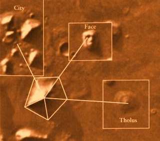  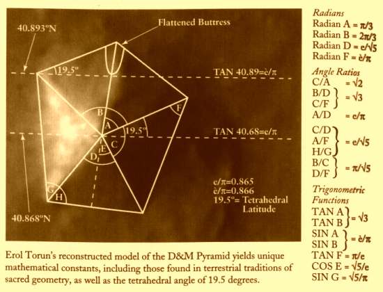


 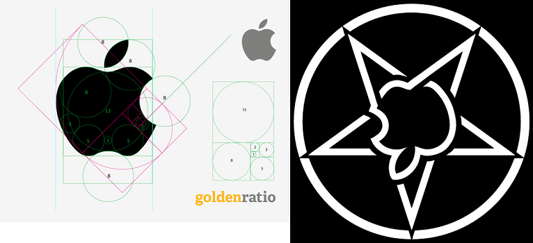
SIRIO ES LA CONSTELACION DEL PERRO/ CAN MAYOR
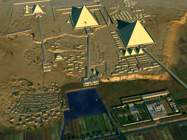 EL MISMO DISEÑO DE ORION EL MISMO DISEÑO DE ORION
99. Ezequiel 22:7: Al padre y a la madre despreciaron en ti; al EXTRANJERO trataron con violencia en medio de ti; al huérfano y a la viuda despojaron en ti.
HECHOS 12:12 (MARCOS/ MARTE / MARZO/ PASCUA)
NOTEN EL NEXO DE DAN, CON LA SERPIENTE (VENECIA) Y EL CABALLO (PLAZA SAN MARCOS)
7. Génesis 49:17 Será Dan SERPIENTE junto al camino, Víbora junto a la senda, Que muerde los talones del caballo, Y hace caer hacia atrás al jinete.
VENECIA=PLAZA SAN MARCOS
11. Proverbios 25:11 MANZANA de oro con figuras de plata Es la palabra dicha como conviene.
12. Cantares 2:5 Sustentadme con pasas, confortadme con MANZANAs; Porque estoy enferma de amor.
13. Cantares 7:8 Yo dije: Subiré a la palmera, Asiré sus ramas. Deja que tus pechos sean como racimos de vid, Y el olor de tu boca como de MANZANAs,
ALLI ESTA LA CONEXION VENUS / VENECIA CON EL 666
VENUS= PENTAGONO= VENECIA= NUMERO DE ORO= 1.618033
LAS MATEMATICAS SON EXACTAS.
GLORIA A DIOS TODOPODEROSO. QUE BELLAS SON LAS MATEMATICAS
|
|
|
|
Rispondi |
Messaggio 51 di 52 di questo argomento |
|
|
|
|
Rispondi |
Messaggio 52 di 52 di questo argomento |
|
|
|
 Primo Primo
 Precedente
38 a 52 de 52
Successivo Precedente
38 a 52 de 52
Successivo
 Ultimo

|

