|
|

salt lake city=alchemy (salt)=dollar=$= LOT S WIFE (SODOMA AND GOMORRA)
Cathedral of the Madeleine
From Wikipedia, the free encyclopedia
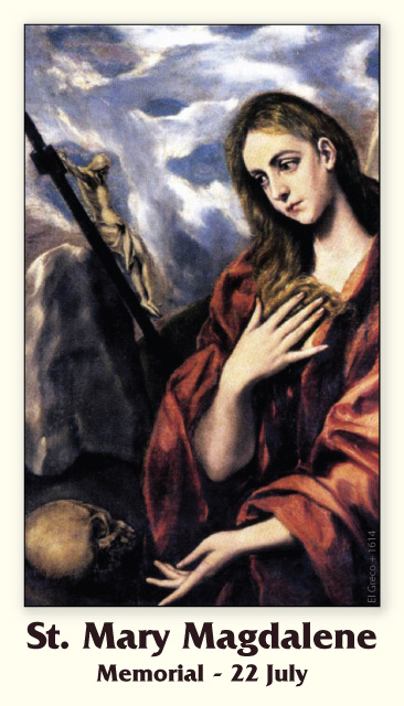
The Cathedral of the Madeleine is a Roman Catholic church in Salt Lake City, Utah, United States. It was completed in 1909 and currently serves as the cathedral, or mother church, of the Diocese of Salt Lake City. It is the only cathedral in the U.S. under the patronage of St. Mary Magdalene.
Description[edit]
The cathedral was built under the direction of Lawrence Scanlan, the first bishop of Salt Lake City, who dedicated it to St. Mary Magdalene.[2] It was designed by architects Carl M. Neuhausen and Bernard O. Mecklenburg. The exterior is predominantly a Neo-Romanesque design, while the inside displays more Neo-Gothic details. Construction began in 1900 and was completed in 1909. It was dedicated by James Cardinal Gibbons, Archbishop of Baltimore.
It is theorized that Bishop Scanlan chose Mary Magdalene as the patron saint of the Diocese of Salt Lake because her feast day is on July 22, two days before Pioneer Day, a celebration commemorating the arrival of the Mormon pioneers in Salt Lake Valley, so that Catholics would have something to celebrate alongside the region's dominant faith.[3]
The interior of the cathedral was created under the direction of Joseph S. Glass, the second bishop of Salt Lake. Bishop Glass enlisted John Theodore Comes, one of the preeminent architects in the country, to decorate the interior of the cathedral. His plans for the interior were largely based upon the Spanish Gothic style. The colorful murals and polychrome were added at this time, as were the ornate shrines. In 1916, Bishop Glass also changed the name of the cathedral to the French spelling after visiting her purported tomb.[2]
In the 1970s, the exterior of the building was restored, and between 1991 and 1993, the interior of the cathedral was renovated and restored under Bishop William K. Weigand. This included not only the removal of dust and dirt and restoration of the interior but also changes to the liturgical elements of the cathedral to bring them into conformity with certain widespread changes in liturgical practice that developed after the Second Vatican Council.
This included constructing a new altar, moving the cathedra, creating a separate chapel for the Blessed Sacrament, and adding an ample baptismal font. The Blessed Sacrament Chapel also contains the tomb of Bishop Scanlan.[4] Resting atop the tomb is a case containing a small relic of Saint Mary Magdalene. The cathedral in Salt Lake City and the Basilica of Saint-Maximin-la-Sainte-Baume in France are the only cathedrals in the world holding first-class relics of the saint and are named in her honor.[5] The major restoration of the interior of the cathedral was accomplished through the vision of Monsignor M. Francis Mannion.[6]
The cathedral is home to the only co-educational Catholic Choir School in the United States. The Madeleine Choir School, established in 1996, now serves over 400 students in Pre-Kindergarten through Grade Eight.[7] The Cathedral Choir has recorded several CDs and routinely tours both nationally and internationally. In addition to singing daily services at the Cathedral of the Madeleine, choristers have sung at St. Peter's Basilica (Vatican City), Notre Dame de Paris (France), and in churches across the United States of America, Spain, Italy, France, Belgium, and Germany, among other places.[8]
Composer Amédée Tremblay notably served as the church's organist from 1920 to 1925.[9]
-
-
Cathedral of the Madeleine, looking east
-
Interior of the cathedral
-
   |
|
|
|
|
Astronomical alignment[edit]
Looking east through nave on 23 June 1976, two days after the summer solstice Mary Magdalene's relics in the crypt
In 1976, Hugues Delautre, one of the Franciscan fathers charged with stewardship of the Vézelay sanctuary, discovered that beyond the customary east-west orientation of the structure, the architecture of La Madeleine incorporates the relative positions of the Earth and the Sun into its design. Every June, just before the feast day of Saint John the Baptist, the astronomical dimensions of the church are revealed as the sun reaches its highest point of the year, at local noon on the summer solstice, when the sunlight coming through the southern clerestory windows casts a series of illuminated spots precisely along the longitudinal center of the nave floor.[13][14][15][16][17]
|
|
|
|
|
Design-rich density coming to east Downtown SLC – meet Masonic Temple Regius Flats
Luke Garrott on July 30, 2020
 Regius Flats, center in white, as envisioned from the SW – Image by Architectural Nexus.
Salt Lake City’s East Central neighborhood is known for its leafy streets, historic buildings, and horizontal mixed use.
South Temple street, an ornamental ribbon sitting atop this gem of a neighborhood east of Downtown, hosts Salt Lake City’s grandest historical mansions, including the Governor’s (Kearns’) Mansion, the Catholic Cathedral of the Madeleine, and the Masonic Temple.
Since 1927 the Masonic Temple has graced 650 E South Temple street. Behind the building, to the south, currently sits ~2.75 acres of surface parking.
 Zoning in the vicinity. The project will encompass the 3 single-family (vacant) parcels to the west of the “New RO Zone.” Image courtesy SLC Planning.
A third of that sun-bleached asphalt will soon be dedicated to a design-rich, 4-story 60 ft, 125-unit market-rate rental project designed by Architectural Nexus.
At 650 E South Temple and 33 S 600 E, local developers dbUrban and Wadsworth have entered into a long-term lease agreement with the owners of the properties, the Masonic Temple Association.
 Rendering from the west, at 600 E. Image by Arch|Nexus.  “Front approach street view,” from the west at 600 E, by Arch|Nexus.
The project has received extra layers of design review due to its location in both the South Temple and Central City local historic districts.
It also sought – and successfully obtained – a master plan zoning map amendment and a zoning change.
Project specs and process
The Historic Landmark Commission (HLC) usually makes sure that design quality is part of the compatibility requirements to receive the “certificate of appropriateness” needed for projects to proceed in local historic districts.
Under the HLC’s discriminating eye, Architectural Nexus has designed a 125-unit, market-rate apartment project parked with 120 stalls, nearly a 1 : 1 ratio.
A 2-level parking garage will be the podium for 4 stories of framed construction. On the west the garage is wrapped by 2-story townhomes, and on the south by stacked 1-story flats.
 Regius Flats from the SW on 600 E, rendering by Arch|Nexus.
The massing of the building is pushed uphill, away from its frontage on 600 E and towards the Masonic Temple.
The developers have committed to move (or reconstruct) the carriage house on the property, and will building a path on the south and east sides of their building. “The mew is intended to draw people into the middle of the block to see the amenity and will hopefully serve as a catalyst for other property owners in the block to create mid-block pedestrian connections in the future,” Dustin Holt, co-founder of DbDUrban, told us.
Bryce Baker of dbUrban told the Downtown Alliance’s downtown development committee this month that the project’s design is “a modern interpretation of the historic elements in the district.”
 Regius Flats from the NW on 600 E, rendering by Arch|Nexus.
The project needed a zoning change and master plan map amendment from I – Institutional to R/O – Residential/Office. Multi-family dwellings are not permitted in the city’s Institutional zoning (but are allowed in the city’s UI – Urban Institutional zone).
Since the change to R/O is essentially a downzone, the zoning and master plan proposals hit few bumps on their way through the planning commission and city council. Maximum height in the Institutional zone is 75 ft, while buildings in R/O are limited to 60 ft. Required setbacks are also greater in the Residential/Office zone.
 The zoning context for the project. Image courtesy SLC Planning.
Members of the Historic Landmarks Commission asked the assigned planner Lex Traughber early in the process whether the Masons’ entire parking lot could be rezoned.
Minutes from the meeting indicate that the “Masonic Temple still needs parking and must meet on-site parking requirements for the Temple use” in the Institutional zone.
Land-lease partnership
Long-term leases are uncommon but not unheard of in Utah. The Church of Jesus Christ of Latter-Day Saints is land-leasing its condominiums in it City Creek Center mixed-use project.
The Colmena Group is land-leasing the Sears Block from it California-based owners.
The Masonic Temple project is dbUrban’s second land-lease project, the newly-completed Quattro the other. Opened in late March, it is currently leased at 30% occupancy, Bryce Baker told the Downtown Alliance.
In non-profit circles, a buzz is forming about California’s proposed legislation to exempt faith-based organizations prohibitive zoning laws if they want to build affordable housing on their property.
Will we see a trend of governments and increasingly churches, leasing their land for affordable housing projects?
As membership numbers for participatory organizations like churches and fraternities continues to decline, those organizations owning medium- to large parcels of real estate have a decided advantage.
 Site plan, Masonic Temple Regius Flats projects. South Temple, top, 700 E, right, 600 E, left. Image courtesy Arch|Nexus.
The Masonic Temple Association, owner of 650 E South Temple, is run by its shareholders – the various lodges who meet in the building. They have been looking for several decades to develop some of their property in a long-term way.
Jason Woodland, the association’s president, told us “We’ve said ‘no’ to selling it multiple times…there was an organization that wanted to do a joint venture and we thought that was too risky. We wanted something consistent and conservative.”
A 99-year land lease with dbUrban, according to Woodland, fit the Board’s goals after disappointment in the 2008 collapse and numerous temptations to sell in the more recent boom.
“Not every builder has experience with land leases. But these guys do, and they were interested in helping preserve the organization and the historical building for years to come. DbUrban is an awesome organization and I’ve been greatly impressed with them – they’ve been a great partner.”
The developers expect to pull permits by the end of July, and be under construction in fall 2020 for a two-year build.
Editor’s note: This post has been updated.
https://buildingsaltlake.com/design-rich-density-coming-to-east-downtown-slc-meet-masonic-temple-regius-flats/
|
|
|
|
|
salt lake city=alchemy (salt)=dollar=$= LOT S WIFE (SODOMA AND GOMORRA)
|
|
|
|
|
Mountain Meadows Massacre descendants meet
BY GERALD CARROLL
Tulare Advance-Register
September 11, 2010
Sept. 11 is a special day for more reasons than the 9/11 terrorist attacks in 2001, say a group of visitors convening this weekend in Tulare On Sept. 11, 1857, an incident known as the Mountain Meadows Massacre took place in southwest Utah when 120 members of an Arkansas-based wagon train bound for Tulare were killed by a violent faction of the Mormon church, experts say.
"You might call it the original 9/11," said former College of the Sequoias history professor Newell Bringhurst, who wrote a biography of Mormon patriarch Brigham Young published in the 1980s. "It was a perfect storm in terms of why such a massacre could happen."
The incident remains buried in political turmoil, even to this day, and was a media sensation for more than 20 years after it happened. However, only in the 21st century is the full accounting of the massacre gaining public attention, foundation members say.
Movie released in 2006
A 2006 movie, "September Dawn," starring Jon Voight, is based on the massacre.
"I was at the premiere," said 83-year-old Dr. Burr "Old Doc" Fancher, an Albany, Ore., resident with Arkansas roots whose life's work in recent years has been piecing together the story and tracking down ancestors of 17 young children who were spared that day.
"Voight encouraged us," said Fancher, the main speaker in today's 5 p.m. dinner and historical presentation. Organizers reported 56 signups as of Friday night, many from other states and many who have never been to Tulare.
Fancher is a direct descendant of Capt. Alexander Fancher, who led the wagon train and who was killed in the attack.
"I lost 30 ancestors that day," Fancher said.
Media attention was widespread in the massacre's aftermath.
"That incident drew just as much media attention for that time in history as the 9/11 attacks did in 2001," said Ron Wright, another descendant of the victims.
Massacre chronology
Militant Mormons in the southwest part of Utah were said to have dressed as Indians and attacked the wagon train on Sept. 7, 1857. However, defenders of the wagon train fought back, and held off the assault until Sept. 11. At that point, the attackers removed their Indian disguises and posed as "white" liberators, only to kill the wagon-train defenders after luring them away from their belongings.
Decades of high-profile litigation followed, with survivors' families accusing the Mormon church of as coverup, and eventually one man was convicted of participating in the massacre and executed by firing squad in 1877.
"The wagon train was crossing Utah at the worst possible time," said Bringhurst, a non-practicing Mormon and local expert in Mormon history. "A U.S. army was heading toward Utah. Mormons considered outsiders enemies."
Fancher said the foundation harbors no ill will toward Mormons and that the primary mission of the group is to "memorialize" the slain wagon-train members and the 17 children — deemed "too young" to bear witness to the tragedy — who were spared.
Fancher said that 15 of the 17 surviving children's graves have been located in various states, and that the foundation is closing in on the other two.
"All the confirmed graves of those surviving children will be marked with a $500 historical memorial," Fancher said.
Tulare's historical museum is one of seven locations around the country where a repository of documentation about the Mountain Meadows Massacre can be found.
"Tulare would have made a great home for those people." Fancher said. "They just didn't make it."
|
|
|
|
|
Expedición de Domínguez y Escalante
 Mural de la expedición Domínguez-Escalante que se encuentra en el Capitolio del Estado de Utah.
La expedición de Domínguez y Escalante, o Domínguez-Escalante, fue una expedición de exploración española que se llevó a cabo en 1776 para encontrar una ruta por tierra desde Santa Fe (hoy Nuevo México) hasta las misiones católicas en California, en particular a la de Monterey. Francisco Atanasio Domínguez y Silvestre Vélez de Escalante, sacerdotes franciscanos, y Bernardo Miera y Pacheco, un cartógrafo, viajaron con ocho hombres desde Santa Fe a través del oeste del actual estado de Colorado hasta el Valle de Utah, ahora en el estado de Utah. A lo largo de la travesía fueron ayudados por tres guías timpanog ute. Debido a las dificultades experimentadas durante el viaje, el grupo no alcanzó las Californias, pero regresó a Santa Fe a través de Arizona. Los mapas y la documentación de su expedición fueron de gran ayuda para futuros viajeros. Con el tiempo, su ruta se convirtió en parte del Viejo Sendero Español.
La expedición[editar]
La expedición Domínguez-Escalante se llevó a cabo en 1776 para encontrar una ruta desde Santa Fe, Nuevo México, hasta las misiones españolas en California, como el presidio en Monterey en Las Californias. El 29 de julio de 1776, Francisco Atanasio Domínguez dirigió la expedición con su compañero fray Silvestre Vélez de Escalante y el cartógrafo Bernardo Miera y Pacheco.1 La parte inicial de su viaje siguió la ruta que había tomada Juan Rivera hacía once años en el país de los ute por el suroeste del actual estado de Colorado.2 Tres guías timpanog ute les llevaron por el norte de Colorado, Utah y de regreso a Santa Fe.1 Fueron los primeros hombres blancos que recorrieron una ruta a través de gran parte de la meseta de Colorado en Utah y regresaron a través de Arizona a Nuevo México.3 Durante el curso de su viaje, documentaron la ruta y proporcionaron información detallada acerca de una «tierra exuberante y montañosa llena caza y madera, extrañas ruinas de ciudades y pueblos de piedra, y ríos que muestran signos de metales preciosos».45
Viaje por el actual Nuevo México[editar]
Santa Rosa de Abiquiú, 30 de julio
- La primera noche del viaje pernoctaron en el Pueblo de Santa Clara, al norte de Santa Fe,6: 133 y de allí «viajamos nueve leguas, más o menos, y llegaron al pueblo de Santa Rosa de Abiquiú, donde a causa de diversas circunstancias permanecimos hasta el 31 sin viajar, y donde mediante una misa solemne de nuevo imploramos la ayuda de nuestros más santos patronos».1
- Desde el pueblo de Santa Rosa de Abiquiú, viajaron al norte y noroeste hasta una localización cercana a la actual Dulce.6: 134–140
Viaje por el actual estado de Colorado[editar]
Mesa Verde, 10 de agosto
- Desde Dulce, se abrieron paso en el actual Colorado a través de Árboles, Ignacio, Durango y Hesperus.6: 134 Acamparon en la base de las montañas de La Plata cerca del actual Parque nacional Mesa Verde, en el suroeste de Colorado. Escalante escribió en su diario: «El padre fray Francisco Atanasio [Domínguez] despertó preocupado por la fiebre reumática que sentía en su cara y cabeza ya el día anterior, y que era deseable que armaramos el campamento aquí hasta que estuviera mejor, pero las continua lluvias, las inclemencias del tiempo, y la gran humedad del lugar nos obligaron a salir de allí. Yendo al norte, y después de haber viajado un poco más de media legua, giramos al noroeste, yendo una legua y entonces caimos al oeste a través de valles de muy hermosa madera y abundantes pastos, rosas, y otras varias flores. Después de pasar dos leguas nos cayó de nuevo una lluvia muy pesada. El padre fray Francisco Atanasio se sintio peor y el camino intransitable, y así, después de haber viajado a duras penas dos leguas más al oeste, tuvimos que acampar en la orilla del primero de dos pequeños ríos que forman el San Lázaro, también llamado río de Los Mancos. El pasto sigue en gran abundancia. Hoy cuatro leguas y media».7
- Los hombres acamparon junto al río de los Mancos, pocos kilómetros por debajo de donde corre en Mesa Verde.7 El río fue nombrado después de que uno de los hombres cayera en un río, y se lesionase la mano.8
Pueblos Escalante y Domínguez, 13 de agosto
- Cerca de la actual Dolores, Escalante y Domínguez encontraron e informaron de las ruinas anasazi en el suroeste de Colorado, los primeros hombres blancos que las vieron. Los Pueblos Escalante y Domínguez fueron nombrados en su memoria y se encuentran en el Centro de Patrimonio Anasazi (Anasazi Heritage Center).8
- Cuando informaba de otros lugares posibles para asentamientos, Escalante señaló las bondades de la zona: hermoso entorno con suministro de agua, pastos, madera y leña. Los hombres viajaron al norte, manteniéndose al oeste de las montañas de San Juan. Cruzaron el río Dolores varias veces y luego acamparon en sus orillas al noreste de la actual Cahone. Se reunieron con dos esclavos nativos americanos, a los que llamaron Genízaro y Coyote. Los hombres dejaron su pueblo sin previo aviso para unirse al grupo. Un hombre fue llamado "Felipe" y el otro "Juan Domingo". A pesar de que no eran necesarios, la expedición se los llevó.6: 141–147
- La expedición continuó al oeste y al noroeste, cruzando el río Dolores. Viajaron a través de un cañón antes de llegar a una zona cercana al actual Egnar y viajaron a lo largo del río San Miguel hasta un área a unos cinco kilómetros al oeste de Nucla. La tierra se volvió cada vez más árida, con menos tierras de pastos e insuficiente agua para los caballos y con difíciles cañones. Después de haber visto signos de asentamientos que llamaron rancherías y al darse cuenta de que necesitaban asistencia, exploraron para dar con utes que les pudieran servir como sus guías.6: 141–147
Nucla, 23 de agosto
- Al noreste de Nucla, donde el río San Miguel se encuentra con el río Dolores, el grupo se reunió con un miembro de una tribu ute. Acamparon junto a un arroyo del río San Miguel y luego viajaron al este a través del actual Bosque Nacional Uncompahgre en la meseta de Uncompahgre. Se dirigieron a una zona cercana a Montrose y se reunieron con un jefe ute. Al enterarse de la ubicación de miembros de la tribu timpanog, reanudaron la marcha en dirección noroeste hasta Olathe, cruzando el ramal Norte del río Gunnison y llegando a lo que hoy es Hotchkiss.6: 147–155
Bowie, 1 de septiembre (obtención de guías)
- Continuando viaje en dirección noreste, la expedición llegó hasta el área de Bowie, encontrándose con ochenta utes en caballos, la mayoría de los cuales eran de la aldea que buscaban Escalante y Domínguez. Algunos miembros del grupo fueron con ellos a la aldea ute donde había una treintena de "tiendas". El padre Domínguez conoció y abrazó al jefe y a sus hijos. Los miembros de la aldea se reunieron y Domínguez, a través de Muñiz, el intérprete, predicó. También expresó su preocupación por el matrimonio plural y el nombrar a los animales como gente, que anunció era una forma de vida más baja que la del hombre. Uno de los guías ute fue nombrado "Silvestre", al que llamaban un laguna, un nativo americano timpanog de la región del lago Utah. Los utes alentaron firmemente a la expedición a dar marcha atrás, dado que se enfrentarían a los comanches en su viaje al oeste, y que del daño que les aconteciese el gobernador español podría culpar a los utes. En respuesta, le dijeron a los utes que los necesitaban para seguir adelante hasta encontrar a un perdido padre Garcés y que Dios estaría con ellos. Violando el acuerdo y el propósito espiritual de la expedición, y con el temor del viaje a través de territorio comanche, el intérprete Andrés Muñiz y su hermano Lucrecio comerciaron bienes adicionales que habían traído por pistolas.6: 155–160
Bowie, 2 (reanudan el viajes hacia el oeste)
- Habiendo arreglado la guía, reanudaron el viaje hacia el oeste, comerciando sus caballos por algunos de los caballos de los utes y llegaron a un acuerdo para continuar la expedición, guiados por "Silvestre" y un niño que llamaron "Joaquín". Los hombres se dirigieron a través de lo que es ahora son tierras de bosque nacional, incluyendo el bosque nacional Grand Mesa, en el lado sur de mesa Battlement. Tres mujeres utes y un niño que encontraron canjearon por piñones algunas bayas que habían estado secando al sol. El grupo cruzó el río Colorado en Una, Colorado, en el punto en el que corre al oeste y suroeste y se reúne con el río Dolores, uno de sus afluentes. El grupo se reunió con algunos utes que ayudaron a resolver una diferencia de opinión con el guía "Silvestre", sobre la mejor ruta a seguir y, para gran alivio de algunos de los hombres, les dijeron a un pequeño campamento ute de comanches moviéndose hacia el este, lejos de la zona en la que estarían viajando. Los hombres llegaron a una alta colina peligrosa de la que "Silvestre" les había advertido; era empinada, con rocas sueltas, que causaron que unos mulos cayesen de lado unos 20 o más pies y requirieron que los hombres hicieran una caminata vigorosa hasta la cima. Habían viajado en la meseta Roan y en el extremo sur del Douglas Canyon. Desde la cima de una alta cordillera "Silvestre" señaló hacia el norte, a la tierra de los comanches, y al oeste, a la tierra de su pueblo en el valle del lago Utah.6: 161–166
Rangely, 10 de septiembre
- Habiendo viajado al norte y al oeste, la expedición se abrió camino en lo que hoy es el condado de Rio Blanco, Colorado, llamado así por el río White, que corre a través del condado en Utah hasta su frontera occidental. Después de semanas de montañas, cañones y mesas, la tierra aquí era más llana y siguieron un sendero de bisontes que se dirigía en la dirección en la que deseaban viajar.6: 167–168
Viaje por el actual estado de Utah[editar]
Meseta de Yampa, 11 de septiembre
- Con sus provisiones menguando, unos pocos hombres persiguieron con éxito y mataron a un bisonte en la meseta de Yampa en el actual condado de Uintah. Viajando al noroeste, nuevamente llegaron sobre el río Green y las montañas Split, que describieron como sigue: «Aquí tiene abundantes prados y buena tierra para el cultivo de cosechas, con instalaciones para la irrigación. Debe tener algo más de una legua de ancho y su longitud puede llegar a cinco leguas. El río entra en esta pradera entre dos altos acantilados que, después de formar una especie de corral, llegan tan juntos que apenas se puede ver la abertura por la que llega el río». Acamparon junto al río Green cerca de la actual Jensen. En un stand de seis álamos, Lain talló su nombre en uno de los árboles, con el año 1776 con una cruz grande y dos pequeñas cruces. Partiendo hacia el suroeste desde Jensen, la expedición se dio cuenta de pistas de caballos frescos que determiron eran comanches siguiendo una partida ute de caza de bisontes. Acamparon en Horseshoe Bend del río Verde y luego siguieron al oeste hasta la actual Myton donde encontraron ruinas de un pueblo. Continuando hacia el oeste, y acamparon cerca de Duchesne, Fruitland, y Soldier Springs. La ruta desde Jensen hasta Soldier Springs siguió más o menos la actual U.S. Highway 40.6: 168-175. Ilustración de la montaña Split y el río Green River en pag. 169.
|
|
|
 Primer Primer
 Anterior
61 a 75 de 120
Siguiente Anterior
61 a 75 de 120
Siguiente Último
|
 Zoning in the vicinity. The project will encompass the 3 single-family (vacant) parcels to the west of the “New RO Zone.” Image courtesy SLC Planning.
 Rendering from the west, at 600 E. Image by Arch|Nexus.
 “Front approach street view,” from the west at 600 E, by Arch|Nexus.
 Regius Flats from the SW on 600 E, rendering by Arch|Nexus.
 Regius Flats from the NW on 600 E, rendering by Arch|Nexus.
 The zoning context for the project. Image courtesy SLC Planning.
 Site plan, Masonic Temple Regius Flats projects. South Temple, top, 700 E, right, 600 E, left. Image courtesy Arch|Nexus.











![That's one small step..." —Neil Armstrong [1024 x 1333] : r/QuotesPorn](https://i.imgur.com/lfLGX.jpg)
























 Regius Flats, center in white, as envisioned from the SW – Image by Architectural Nexus.

