|
|
| Reply |
Message 21 of 33 on the subject |
|
|
|
|
|
|
|
|
|
Archivo:Catedral de Santo Tomás Apóstol (Paraguarí)..jpg
|
|
|
|
|
El centurión Longino entre las cruces de Cristo y los dos ladrones, 1539
|
|
|
|
|
|
|
|
|
El alcalde de esa ciudad de la región de Aysén protagonizó un chascarro.
El régimen militar que encabezó el general Augusto Pinochet entre 1973 y 1990, además de los hechos ampliamente conocidos recogidos por la historia, esconde también un anecdotario que incluye algunos acontecimientos curiosos cuyas consecuencias, en algunos casos, se pueden apreciar hasta el día de hoy.

El general Augusto Pinochet y su esposa Lucía Hiriart durante una visita a la zona austral de nuestro país.
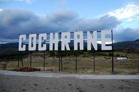
En los ’80, el general Pinochet, convertido por entonces en Presidente de facto de nuestro país, visitó la austral localidad de Cochrane -capital de la provincia de Capitán Prat, en la región de Aysén, al extremo sur de nuestro país-, que comenzaría a configurarse como tal a partir de 1954 cuando se edificó una casa destinada a correos, que luego fue concedida a la Fuerza Aérea de Chile.

Se cuenta que durante esa visita a Cochrane, en su calidad de jefe de Gobierno, Pinochet al pasear por el centro de la pequeña localidad notó que la Plaza de Armas se encontraba bastante descuidada, por lo que hizo algunos comentarios a las autoridades locales sobre el particular.
El alcalde de Cochrane de la época, Lorenzo Ruedas, le preguntó entonces al mandatario qué podía hacer al respecto para remediar la situación. La respuesta de Pinochet fue una típica frase nacional, “¡Ponle pino… hombre!”, que alude, como todo el mundo sabe, a ponerle tesón y ganas a una empresa o acción determinada.
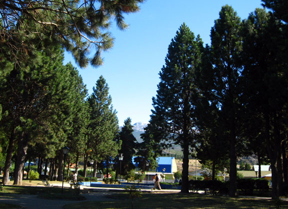
Sin embargo, el alcalde Ruedas interpretó la frase del general Pinochet en forma literal, por lo que cuando el mandatario terminó su visita oficial y se marchó del pueblo, procedió a seguir al pie de la letra su supuesto consejo: Plantó pinos a destajo, en todos los sectores de la Plaza de Armas de Cochrane.

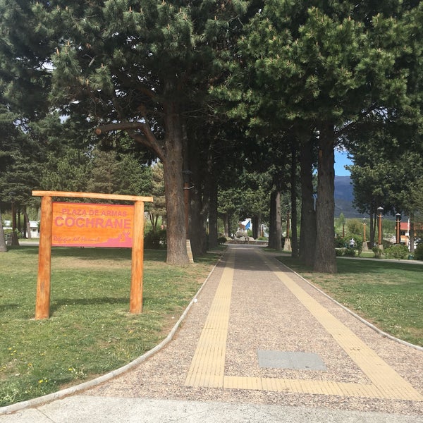
La Plaza de Armas de Cochrane y sus característicos y abundantes pinos.
El ex senador Carlos Kuschel corroboraría la verosimilitud de esta anécdota recordando que “en esa ocasión me tocó ser parte de la delegación que acompañó al Presidente Pinochet en su visita a la ciudad de Cochrane. Cuando el alcalde del pueblo le dijo: ‘general, qué hago con esta plaza’. ‘¡Ponle pino… hombre!’ le contestó el Presidente Pinochet, en la idea que le pusiera fuerza, afán, trabajo… en fin. Pero desde ese momento el alcalde se volvió loco plantando la especie, al punto que hoy parece un bosque de pinos”.

Uno de los accesos peatonales de la Plaza de Armas de Cochrane, rodeada de numerosos pinos.
Esa curiosa anécdota, en todo caso, no sería la única que involucraría al mencionado alcalde Lorenzo Ruedas, pues también se cuenta que una vez, cuando le plantearon al edil la idea de poner teléfono en el pueblo de Cochrane, éste respondió: ” ¿Y para qué, si acá nos conocemos todos?”.
https://www.guioteca.com/los-80/el-vinculo-de-pinochet-con-los-pinos-de-la-plaza-de-cochrane-una-bochornosa-historia/ |
|
|
|
|
La familia Pinochet es una familia chilena de origen francés cuyo genearca fue Guillaume Pinochet, quien llegó en 1720 a Concepción, donde trabajó como comerciante. Wikipedia
|
|
|
|
|
 Primer Primer  Anterior 2 a 3 de 3 Siguiente Anterior 2 a 3 de 3 Siguiente  Último Último  |
|
|
|
|
|
Earth from Space – Arc de Triomphe, Paris
Status Report
May 13, 2022

Arc de Triomphe, Paris.
ESA
This striking, high-resolution image of the Arc de Triomphe, in Paris, was captured by Planet SkySat – a fleet of satellites that have just joined ESA’s Third Party Mission Programme in April 2022.
The Arc de Triomphe, or in full Arc de Triomphe de l’Étoile, is an iconic symbol of France and one of the world’s best-known commemorative monuments. The triumphal arch was commissioned by Napoleon I in 1806 to celebrate the military achievements of the French armies. Construction of the arch began the following year, on 15 August (Napoleon’s birthday).
The arch stands at the centre of the Place Charles de Gaulle, the meeting point of 12 grand avenues which form a star (or étoile), which is why it is also referred to as the Arch of Triumph of the Star. The arch is 50 m high and 45 m wide.
The names of all French victories and generals are inscribed on the arch’s inner and outer surfaces, while the Tomb of the Unknown Soldier from World War I lies beneath its vault. The tomb’s flame is rekindled every evening as a symbol of the enduring nature of the commemoration and respect shown to those who have fallen in the name of France.
The Arc de Triomphe’s location at the Place Charles de Gaulle places it at the heart of the capital and the western terminus of the Avenue des Champs-Élysées (visible in the bottom-right of the image). Often referred to as the ‘most beautiful avenue in the world’, the Champs-Élysées is known for its theatres, cafés and luxury shops, as the finish of the Tour de France cycling race, as well as for its annual Bastille Day military parade.
This image, captured on 9 April 2022, was provided by Planet SkySat – a fleet of 21 very high-resolution satellites capable of collecting images multiple times during the day. SkySat’s satellite imagery, with 50 cm spatial resolution, is high enough to focus on areas of great interest, identifying objects such as vehicles and shipping containers.
SkySat data, along with PlanetScope (both owned and operated by Planet Labs), serve numerous commercial and governmental applications. These data are now available through ESA’s Third Party Mission programme – enabling researchers, scientists and companies from around the world the ability to access Planet’s high-frequency, high-resolution satellite data for non-commercial use.
Within this programme, Planet joins more than 50 other missions to add near-daily PlanetScope imagery, 50 cm SkySat imagery, and RapidEye archive data to this global network.
Peggy Fischer, Mission Manager for ESA’s Third Party Missions, commented, “We are very pleased to welcome PlanetScope and SkySat to ESA’s Third Party Missions portfolio and to begin the distribution of the Planet data through the ESA Earthnet Programme.
“The high-resolution and high-frequency imagery from these satellite constellations will provide an invaluable resource for the European R&D and applications community, greatly benefiting research and business opportunities across a wide range of sectors.”
To find out more on how to apply to the Earthnet Programme and get started with Planet data, click here.
– Download the full high-resolution image.
|
|
|
|
|
| Foundation stone. On August 15, 1806, Emperor Napoleon I's birthday, the foundation stone of the building was laid at a depth of eight meters, between the two southern pillars. |
|
|
|
|
| Enviado: 21/10/2024 10:30 |
|
|
|
|
|
|
|
|
 Primer Primer
 Anterior
338 a 352 de 352
Siguiente Anterior
338 a 352 de 352
Siguiente
 Último

|

