|
|
Pyramid of Austerlitz
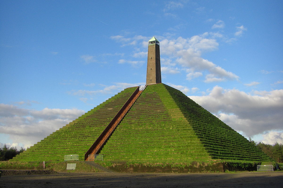
The Pyramid of Austerlitz is a 36-metre-high pyramid of earth, built in 1804 by Napoleon's soldiers on one of the highest points of the Utrecht Hill Ridge, in the municipality of Woudenberg, the Netherlands.[1] Atop the pyramid is a stone obelisk from 1894.
 An 1805 engraving of the Pyramid of Austerlitz by Louis-Pierre Baltard
In 1804, the French General Auguste de Marmont established an army camp (le Camp d'Utrecht) in this central location in the Batavian Republic, the present Netherlands, where over a period of several months he forged together various battalions into a large, well-trained army, capable of beating the British enemy should there be any repetition of the invasion of 1799. In the autumn of 1804, satisfied with the military power of the new army, and to occupy his bored soldiers, Marmont had his soldiers build an earth and turf monument inspired by the Great Pyramid of Giza, which Marmont had seen in 1798 during Napoleon's Egyptian campaign. Even the erosion-exposed stepped surface was imitated. Construction lasted 27 days. The pyramid hill was 36 metres (118 ft) high, and surmounted by a 13-metre (43 ft) wooden obelisk. It was named "Mont Marmont" or "Marmontberg".
In the summer of 1805, Marmont departed with his army to southern Germany to fight in the War of the Third Coalition, which culminated in the Battle of Austerlitz (now Slavkov u Brna), the battle in which Napoleon decisively defeated the Russians and Austrians.
In 1806, despite protests from Marmont, Louis Bonaparte, the new king of Holland, renamed the hill the Pyramid of Austerlitz, and gave the same name to the trading post at the nearby camp of Bois-en-Ville.
After leaving the Netherlands in 1805, Marmont gave the monument and the use of the nearby homestead Henschoten to three soldiers, Louis Faivre, Jean Baptiste La Rouche and Barend Philpsz, who were also to maintain the pyramid. Nevertheless, the wooden obelisk soon deteriorated, and was demolished in 1808. In 1816 the Marmont pyramid and its associated land were sold to the future mayor of Utrecht, Hubert MAJ van Asch van Wijk.
In 1894, Johannes Bernardus de Beaufort, who both owned the Henschoten estate on which the pyramid stood and was mayor of Woudenberg, had the current stone obelisk built on the pyramid. This also began to collapse.
 The Pyramid of Austerlitz in 2002, during its restoration
In view of its 200th anniversary in 2004, the highly dilapidated pyramid was restored between 2001 and 2004. This was done on the initiative of the province of Utrecht, the Den Treek-Henschoten estate and the municipality of Woudenberg, which had previously set up the Austerlitz Pyramid Foundation.
The very dry summer of 2003, followed by heavy rain in 2004, caused further subsidence, and restoration was resumed in 2007. The pyramid was reopened to visitors in 2008, along with a new visitor centre interpreting the period of French rule in the Netherlands. Further piling was carried out in 2010 and 2012 to stabilise the mound.
The Pyramid of Austerlitz is an inspiration for the larger Lion of Waterloo, the pyramid built by King William I as a monument to the Battle of Waterloo where Napoleon was defeated. The mound marks the spot where his son William II was injured.
The Pyramid is a national monument, monument number 39543.
1/3-24/3 =24 DIAS
25/3-17/4=48 DIAS
18/4-11/5=72 DIAS
12/5-4/6 =96 DIAS=24*4
5/6-28/6 =120 DIAS (RADIAN=6.28)=24*5
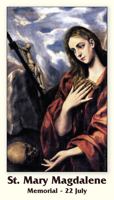
29/6-22/7= 144 DIAS (DIA DE MARIA MAGDALENA 24X6)=HOLY WEEK/HOLY FRIDAY=24*6 REVELATION 21:17
23/7-15/8=168 DIAS (ASUNCION DE LA VIRGEN=227 GREGORIANO)=24*7
16/8-8/9 =192 DIAS =24*8
9/9-2/10= 216 DIAS =24*9
3/10-26/10=240 DIAS=24*10
27/10-19/11=264 DIAS=24*11
20/11-13/12=288 DIAS=24*12
14/12-6/1=312 DIAS=24*13 REYES MAGOS
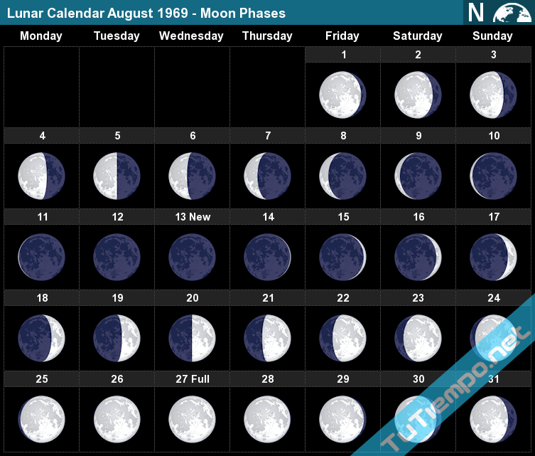
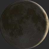
 August 13 New Moon 0% |
 August 14 Waxing Crescent 2%
|
August 15
Waxing Crescent
Illumination: 5% |
 August 16 Waxing Crescent 10%
|
 August 17 Waxing Crescent 17%
|
Moon Phase: August 15, 1969
On this day the Moon was in a Waxing Crescent Phase. Best seen in the west after the sun dips below the horizon at sunset. This is the first Phase after the New Moon and is a great time to see the features of the moon's surface. The moon is close to the sun in the sky and mostly dark except for the right edge of the moon which becomes brighter as the days get closer to the next phase which is a First Quarter with a 50% illumination.
Visit the August 1969 Moon Phases Calendar to see all the daily moon phase for this month.
Waxing Crescent Phase
The Waxing Crescent on August 15 has an illumination of 5%. This is the percentage of the Moon illuminated by the Sun. The illumination is constantly changing and can vary up to 10% a day. On August 15 the Moon is 2.11 days old. This refers to how many days it has been since the last New Moon. It takes 29.53 days for the Moon to orbit the Earth and go through the lunar cycle of all 8 Moon phases.

|
|
|
|
|
"El hombre que enterró a Hitler": el secreto oculto que cambia el curso de la historia oficial
El libro "El hombre que enterró a Hitler" cuestiona la versión histórica oficial de la muerte del líder nazi. La ficción, escrita por los periodistas brasileños Marcelo Netto y Aldo Gama, se basa en una rigurosa investigación que ha llevado 14 años de trabajo, con resultados sorprendentes.
 "El hombre que enterró a Hitler" y el "Sr. Fernando", quien activó la investigación. "El hombre que enterró a Hitler" y el "Sr. Fernando", quien activó la investigación.
La historia oficial presentada en libros, documentales y películas sostiene que Adolf Hitler se pegó un tiro en la cabeza el 30 de abril de 1945, días antes de que los soviéticos tomaran Berlín, donde se encontraba el bunker de Hitler. Pero, ¿y si esta versión no es la verdadera?
¿Qué pasaría si Hitler, al darse cuenta de su inminente derrota, hubiera puesto en marcha un plan de escape ya estructurado y, en la oscuridad de la noche del 28 de abril, escapando de Alemania hacia suelo sudamericano y viviendo desapercibido y sin ser molestado durante 26 años?

Te puede interesar:
Donald Trump apuntó contra Kamala Harris a 3 días de las elecciones: "Habla sobre unidad y luego me llama Hitler"
¿Realidad o ficción?
En “El hombre que enterró a Hitler”, Marcelo Netto y Aldo Gama crean una ficción instigadora , que atrapa al lector de la primera a la última línea. Pero, se puede apreciar, a lo largo de la lectura, que la información contenida en el trabajo se basa en una investigación periodística exhaustiva y coherente, realizada por los propios autores. Información que, de ser probada en el futuro (posiblemente inmediato), podría convertirse en una revelación historiográfica sin precedentes. El narrador de la ficción asegura que no ha podido, hasta el final de la obra, probar los hechos mencionados. Pero presenta suficiente riqueza de detalles para provocar en el lector la conocida “pulga detrás de la oreja”, el beneficio de la duda sobre la versión oficial tan repetida a lo largo de la historia. Marcelo Netto, uno de los autores, dice que él y Aldo Gama se decidieron por el género de ficción, y no por un libro-reportaje, precisamente para que la obra no fuera tratada como una teoría de la conspiración, aunque ambos persisten en la investigación de varias pistas contenidas en el texto.
“Realmente no es fácil creer en una versión que va en contra de la esencia de la historia oficial. Deconstruir el sentido común es complicado. Más aún porque hasta ahora no hay pruebas irrefutables que desmantelen la hipótesis de que Hitler se suicidó. Por otro lado, la gente tampoco cuestiona lo contrario, que tampoco hay evidencia de su suicidio. Queremos, con el libro, al menos darle al lector la posibilidad de cuestionar esto”. Según Marcelo Netto, la saga por confirmar que Hitler habría vivido la mayor parte del tiempo en Brasil, Argentina y Paraguay y habría muerto a los 81 años -el 5 de febrero de 1971- ha durado 14 años y continuará. “Estamos a punto de confirmar que un notable jerarca nazi del círculo íntimo de Hitler, que habría huido de Berlín en el mismo avión que él, terminó sus días en São Paulo”, revela.
Canal 26 habló en ENTREVISTA EXCLUSIVA con Marcelo Netto, uno de los responsables de la investigación que podría revertir el curso mismo de la historia conocida.
 El "Sr. Fernando" reveló detalles del entierro de Hitler en Paraguay. Foto: Jorge Tung. El "Sr. Fernando" reveló detalles del entierro de Hitler en Paraguay. Foto: Jorge Tung.
Canal 26: Marcelo, cuéntenos sobre usted y ¿cómo se vio involucrado en tamaña investigación sobre el entierro de Hitler en Paraguay?
Marcelo Netto: "Soy periodista desde hace 25 años con un máster en Ciencias Sociales. A principios de la década de 2000, trabajé durante un corto período de tiempo para Folha de S.Paulo, considerado uno de los periódicos más prestigiosos de Brasil. Después de unos meses trabajando allí, decidí renunciar al periódico y dejar en suspenso una licenciatura en Ciencias Sociales en la Universidad de São Paulo para vivir con familias del Movimiento de los Sin Tierra. En 2007, cuando ya no vivía en los campamentos y trabajaba para un periódico más pequeño vinculado a los movimientos sociales, un señor vino al periódico para contarnos que había participado en el (segundo) funeral de Hitler en Asunción, Paraguay, el 1 de enero de 1973. Desde entonces, yo y otro amigo periodista (más escéptico que yo) intentamos verificar la historia que nos contó este señor. A lo largo de 14 años, hemos estado cruzando las informaciones con diferentes fuentes y encontrado documentos y vínculos que apoyan considerablemente su testimonio. Es muy difícil llevar adelante este tipo de investigación sin caer en la etiqueta de las teorías de la conspiración. Así que no tuvimos otra opción que contar la historia en una narrativa de ficción".
Canal 26: Como periodista e investigador, comprendo perfectamente lo que es la preservación de la fuente, pero -sin embargo- resulta imposible no preguntarte sobre el informante que activó esta historia. ¿Quién era, cuándo y por qué se presentó a contar esta historia?
Marcelo Netto: "El diferencial de nuestra historia respecto a las demás es que nuestra fuente no nos pide que se preserve su nombre. Además, a diferencia de otros testigos, nos proporciona una dirección concreta donde estaría enterrado Hitler, lo cual también decidimos publicar en el libro. Cuando el "Sr. Fernando" se presenta ante nosotros en mayo de 2007, el Papa Benedicto XVI acababa de terminar su visita a Brasil. El pasado "nazi" de Ratzinger, del que se dice que sirvió a las juventudes hitlerianas, y un comentario de su nieto en el que le preguntaba "por qué él era blanco y no tenía los ojos claros" parecen haber sido los gatillos que faltaban a este sargento retirado del Ejército brasileño para que no se "llevara este secreto al ataúd"".
 Marcelo Netto y Aldo Gama, los responsables de la investigación plasmada en el libro. Marcelo Netto y Aldo Gama, los responsables de la investigación plasmada en el libro.
Canal 26: El informante aportó una dirección precisa e -incluso- hizo una descripción del lugar en el que presuntamente se produjo el entierro de Adolf Hitler. Pudo usted constatar la existencia de ese lugar, y ha iniciado gestiones para llegar a demostrar lo relatado?
Marcelo Netto: "Todo comienza cuando buscamos en Google la dirección que nos dio el Sr. Fernando, que, según él, en 1973 se reducía a un césped con un pequeño edículo en el fondo del terreno, pero que albergaba un bunker a tres pisos bajo tierra. Al principio no encontramos nada. Pero entonces buscamos por una “avenida”, después de todo, habían pasado más de 30 años. Y, ¡bingo! No sólo coincidía la dirección, sino que era un hotel alemán, que descubrimos que se había construido sobre el terreno en 2003. Cuando estuvimos en el hotel, nos llamó la atención su "topografía" muy sospechosa. Al entrar y pasar la recepción, es necesario bajar unos escalones (haciendo que el suelo esté un poco por debajo del nivel de la calle). La cocina, que pudimos ver a través de una ventana mientras caminábamos por el pasillo principal, estaba aún más abajo, prácticamente en el sótano. Algunas habitaciones del hotel rodean un "jardín de invierno" al aire libre con algunas palmeras. Pensamos: "si el búnker está aquí abajo, esta es la razón por la que, en 2003, no pudieron construir habitaciones sobre el césped que el señor Fernando dice haber encontrado 30 años antes, en 1973. Lo mismo ocurre con el propio búnker de Hitler en Berlín, que hoy está escondido bajo un estacionamiento...". También nos llamó la atención el hecho de que la casa vecina, al fondo de un gran estacionamiento abierto literalmente junto al jardín de invierno del hotel, aunque separada por un muro, es una especie de "residencia de ancianos" con enfermeras que van y vienen. ¿Podría haber sido aquí donde los “kameraden” de Hitler en la vejez los llevaron cuando se construyó el hotel? Esto porque el señor Fernando también comenta que en el búnker, durante el funeral, había unos tantos alemanes que parecían ser jerarcas nazis en silla de ruedas. Dicho esto, no hay manera de no plantear la pregunta: “¿No hay nada construido en su superficie precisamente por el búnker que hay debajo?”. Añadido a esto, recientemente nos enteramos por otra fuente (que hasta entonces no conocía nuestra historia) que el "búnker de Hitler en Asunción" se encuentra justo bajo un estacionamiento…"
Canal 26: ¿Y cómo decidió embarcarse en esta aventura, convertido casi en un Quijote contra los molinos de viento de la historia oficial?
Marcelo Netto: "Dos hechos me animaron a no abandonar, además de que la dirección resultó ser la de un hotel alemán. A finales de 2008, unos dos años después de que empezáramos a investigar, lo que se consideraba la "prueba más concreta" de la muerte de Hitler se vino abajo. Una prueba de ADN reveló que su supuesto cráneo conservado durante años por los soviéticos, ahora rusos, es en realidad de una mujer, de unos 40 años. Otro momento emblemático fue que, tras años de búsqueda, encontramos un documento de la Municipalidad de Asunción que demuestra que el hotel es, de hecho, propiedad de la misma asociación germano-paraguaya que nuestra fuente nos había dicho que era dueña del terreno cuando estuvo allí en 1973 para asistir al (segundo) funeral de Hitler. Y, más aún, haber logrado identificar su relación directa con una colonia alemana, a 80 km de Asunción, que fue la sede de la fundación del Partido Nazi en Paraguay en 1928, uno de los primeros partidos, si no el primero, fuera de Alemania. En el caso de Aldo Gama, que suele decir que, como todo buen Sancho Panza, abrazó la causa "con toda la dedicación que permite el cinismo", no se trató de una transformación inmediata, sino del zumbido del rompecabezas que muestra una imagen cuando las piezas encajan. Si tuviéramos que elegir un momento, un clímax, para él, creo que fue una especie de postal de Juscelino Kubitscheck que descubrimos por casualidad al analizar un montón de documentos en una biblioteca de un instituto alemán en São Paulo. Nuestra fuente dice que Juscelino sabía de la presencia de Hitler en el país y que había enviado un general brasileño muy famoso en la época, el general Lott, a la ciudad donde se encontraba la colonia alemana en la que se escondía Hitler para darle un ultimátum. La postal demuestra que Juscelino estaba allí al mismo tiempo. Lo que nos lleva a preguntarnos: “qué estaría haciendo Juscelino en una ciudad prácticamente insignificante para su campaña electoral?” Resulta que el cambio es gradual. Un documento aquí, una declaración allí, una foto... De repente, lo imposible se convierte en improbable, lo que acaba convirtiéndose en una posibilidad."
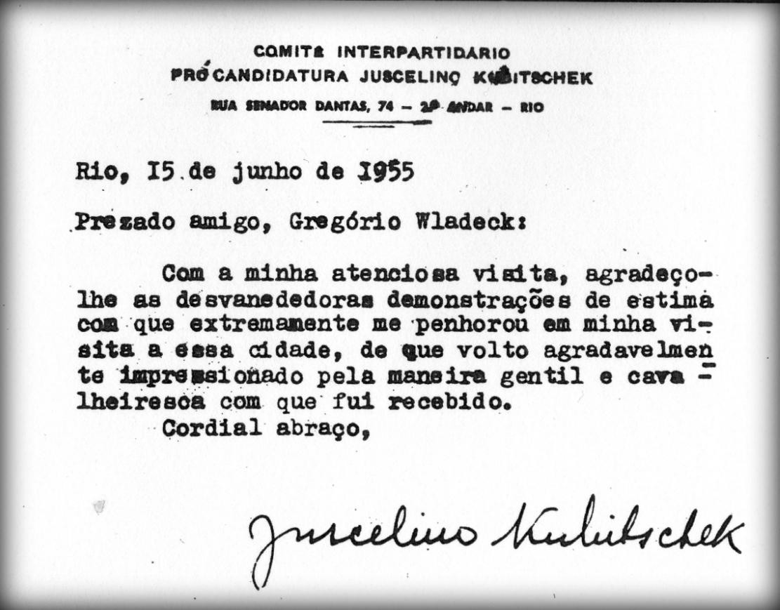 Nota de Juscelino Kubitscheck. 15 de junio de 1955. Nota de Juscelino Kubitscheck. 15 de junio de 1955.
Canal 26: Hasta el momento ¿qué datos pudo efectivamente comprobar y demostrrar de los hechos relatados?
Marcelo Netto: "El libro traza una gigantesca tela de araña que toma forma a través de una interconexión de datos procedentes de diferentes fuentes que nunca han estado en contacto. La declaración del Sr. Fernando, para nosotros, es sólo un punto de partida, el "hilo de Ariadna" y desde el principio nos cuidamos de no asumir que lo que nos dice es verdad. Más aún porque es un personaje muy peculiar, lo que puede llevar a algunos a descartar su historia inmediatamente, sin darse cuenta de que él sigue el mismo patrón de los testigos que dicen haber estado con Hitler después de su supuesto suicidio. En otras palabras, es siempre la empleada de la gasolinera, la criada, el carpintero. Al final, la verdad no sale a la luz más rápido porque nadie se toma en serio la historia de la "gente sencilla", cuando debería ser exactamente lo contrario. Frente a ellos, todos los cuidados son dejados de lado por los nazis que lograron escapar, porque suponen que los "sirvientes" ni siquiera los conocen o porque están seguros de que, además de ser ridiculizados si abren la boca, no tienen poder para hacer nada. Al fin y al cabo, ¿quién les va a hacer caso? Digamos que al menos no hay ninguna incoherencia flagrante que desacredite la historia que el Sr. Fernando nos cuenta, probada a lo largo de 14 años de investigaciones y chequeos. Así que estamos bastante convencidos de que su historia sea verídica. Más aún, en esta misma lógica de seguir el "hilo de Ariadna" que el Sr. Fernando sostiene fuertemente en sus manos, estamos por confirmar que uno de los jerarcas que habría escapado con Hitler de Berlín en la noche del 28 de abril y que, según la historia, murió esa misma noche, en realidad, terminó sus días, ya centenario, en un barrio alejado de la ciudad de de San Pablo, Brasil. El inicio de esta investigación, que sigue en curso, también forma parte del libro."
Canal 26: ¿A qué inconvenientes debió enfrentarse en el curso de esta investigación hoy plasmada en el libro "El hombre que enterró a Hitler"?
Marcelo Netto: "Lo más difícil siempre fue conseguir que quienes escuchaban la historia de nuestra boca de primera mano superaran la "verdad" de que Hitler se suicidó en el búnker, -incluso sin la existencia de un cadáver o de testigos, para poder separar el trigo de la paja de las conspiraciones- y decir que teníamos suficientes pruebas para creer en la historia de un hombre que nos contactó en 2007. A lo largo del camino, hablamos con muchas personas públicas. Incluso nos encargamos de que la información llegara al entonces presidente Fernando Lugo, de Paraguay, a través de su asesor directo cuando estuvimos en Asunción para entrevistar a Lugo sobre otros asuntos. Esto fue apenas unas semanas antes del golpe parlamentario contra él. También tuvimos contacto con algunas productoras. Incluso un contacto más personal con el cineasta Walter Salles, mundialmente famoso por "Estación Central" y "Diarios de motocicleta", que nos ayudó económicamente con parte de la investigación... Después de algunos años insistiendo, la idea del documental se fue alejando. Pero ahora, con la publicación del libro, está más vivo que nunca."
Aldo Gama, co autor de la investigación plasmada en el libro, dice que todo comenzó por cuenta de Marcelo Netto, quien siempre creyó en el relato de su fuente. Aldo dice que, al principio, no le interesaba el tema, principalmente porque estaba convencido de que la versión oficial era la única posible. “Como un Sancho Panza involuntario, terminé persiguiendo este molino por diversión y porque entendí desde el primer momento que era una historia de ficción espectacular. Como la realidad es más absurda que cualquier imaginación, acabé encontrando hechos históricos tan inverosímiles como espectaculares ”, dice.
“Pero mi conversión completa comenzó con un descubrimiento del tipo que solo el azar o la terquedad pueden proporcionar: estaba dormido un domingo por la mañana, escondido en una biblioteca por lealtad al Quijote, y encontré una nota que probaba varias acusaciones en el testimonio. Eso había comenzado todo. Entonces tenía un documento histórico irrefutable que, si no lo probaba, hacía posible la cadena de hechos que perseguíamos”, sigue.
Según Aldo, “por discreción y un poco de burla”, decidieron no aclarar dónde comienza y termina la ficción. “Para el ojo atento, es evidente y no estamos aquí para incentivar la pereza del lector. Hablando Paulocoelhamente, quien busca lo encontrará. Pero prepárate para que el viaje esté lleno de aventuras y el camino esté lleno de baches. ¡Buen batido!"
Por razones directamente relacionadas con el curso de la investigación, y por estrictas medidas de seguridad y confidencialidad, hasta que el lugar sea abierto e inspeccionado por la Justicia, se ha omitido -de manera deliberada- mencionar el nombre y la dirección del hotel en donde se encuentra la cripta funeraria de Adolf Hilter en Paraguay.
"El hombre que enterró a Hitler" (O homen que enterrou Hitler"), Marcelo Netto y Aldo Gama, EditoraContracorrente, Brasil, 2021.
Instagram: @marcelo.garcia.escritor
Notas: El artículo no expresa ideología política, solo investigación histórica.
https://www.canal26.com/historia/el-hombre-que-enterro-a-hitler-el-secreto-oculto-que-cambia-el-curso-de-la-historia-oficial--311088
|
|
|
|
|
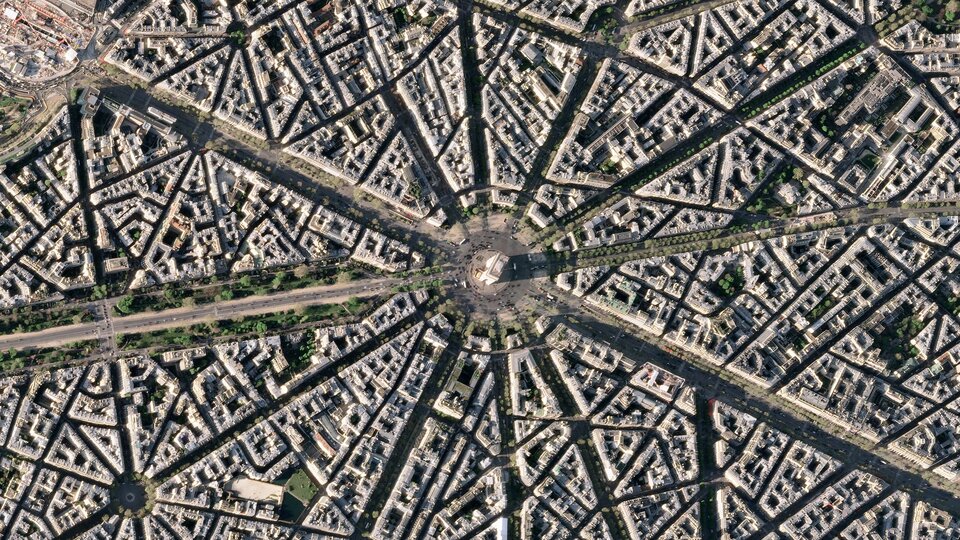
Earth from Space – Arc de Triomphe, Paris
Status Report
May 13, 2022

Arc de Triomphe, Paris.
ESA
This striking, high-resolution image of the Arc de Triomphe, in Paris, was captured by Planet SkySat – a fleet of satellites that have just joined ESA’s Third Party Mission Programme in April 2022.
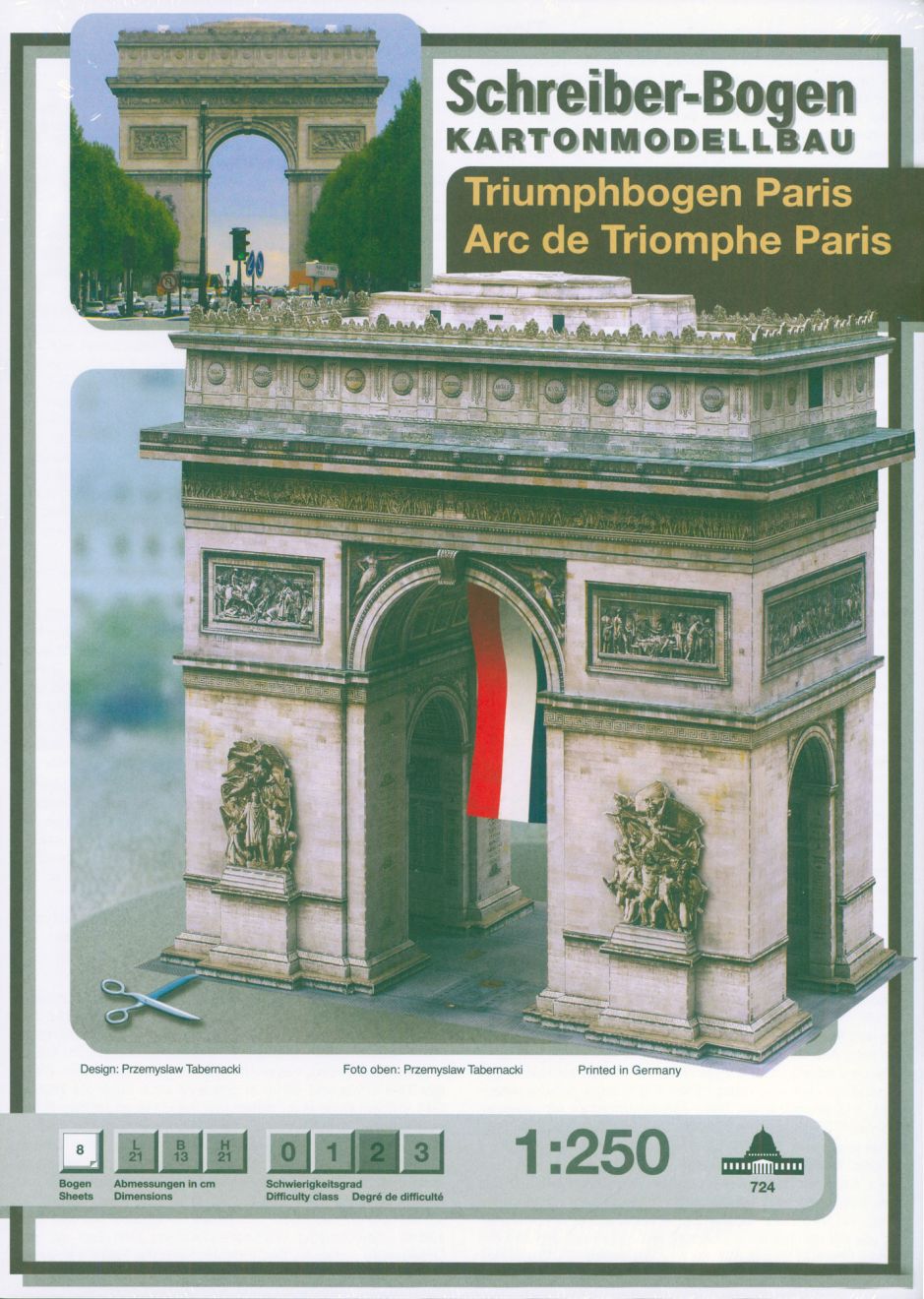
The Arc de Triomphe, or in full Arc de Triomphe de l’Étoile, is an iconic symbol of France and one of the world’s best-known commemorative monuments. The triumphal arch was commissioned by Napoleon I in 1806 to celebrate the military achievements of the French armies. Construction of the arch began the following year, on 15 August (Napoleon’s birthday).
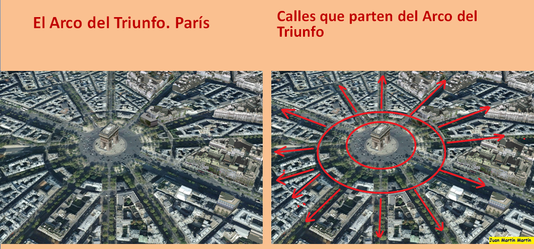
The arch stands at the centre of the Place Charles de Gaulle, the meeting point of 12 grand avenues which form a star (or étoile), which is why it is also referred to as the Arch of Triumph of the Star. The arch is 50 m high and 45 m wide.
The names of all French victories and generals are inscribed on the arch’s inner and outer surfaces, while the Tomb of the Unknown Soldier from World War I lies beneath its vault. The tomb’s flame is rekindled every evening as a symbol of the enduring nature of the commemoration and respect shown to those who have fallen in the name of France.
The Arc de Triomphe’s location at the Place Charles de Gaulle places it at the heart of the capital and the western terminus of the Avenue des Champs-Élysées (visible in the bottom-right of the image). Often referred to as the ‘most beautiful avenue in the world’, the Champs-Élysées is known for its theatres, cafés and luxury shops, as the finish of the Tour de France cycling race, as well as for its annual Bastille Day military parade.
This image, captured on 9 April 2022, was provided by Planet SkySat – a fleet of 21 very high-resolution satellites capable of collecting images multiple times during the day. SkySat’s satellite imagery, with 50 cm spatial resolution, is high enough to focus on areas of great interest, identifying objects such as vehicles and shipping containers.
SkySat data, along with PlanetScope (both owned and operated by Planet Labs), serve numerous commercial and governmental applications. These data are now available through ESA’s Third Party Mission programme – enabling researchers, scientists and companies from around the world the ability to access Planet’s high-frequency, high-resolution satellite data for non-commercial use.
Within this programme, Planet joins more than 50 other missions to add near-daily PlanetScope imagery, 50 cm SkySat imagery, and RapidEye archive data to this global network.
Peggy Fischer, Mission Manager for ESA’s Third Party Missions, commented, “We are very pleased to welcome PlanetScope and SkySat to ESA’s Third Party Missions portfolio and to begin the distribution of the Planet data through the ESA Earthnet Programme.
“The high-resolution and high-frequency imagery from these satellite constellations will provide an invaluable resource for the European R&D and applications community, greatly benefiting research and business opportunities across a wide range of sectors.”
To find out more on how to apply to the Earthnet Programme and get started with Planet data, click here.
– Download the full high-resolution image.
|
|
|
|
|
The Arc de Triomphe, or in full Arc de Triomphe de l’Étoile, is an iconic symbol of France and one of the world’s best-known commemorative monuments. The triumphal arch was commissioned by Napoleon I in 1806 to celebrate the military achievements of the French armies. Construction of the arch began the following year, on 15 August (Napoleon’s birthday).
|
|
|
|
|
Foundation stone. On August 15, 1806, Emperor Napoleon I's birthday, the foundation stone of the building was laid at a depth of eight meters, between the two southern pillars. |
|
|
|
|
Foundation stone
On August 15, 1806, Emperor Napoleon I's birthday, the foundation stone of the building was laid at a depth of eight meters, between the two southern pillars. On the lead sheet covering the stone, the inscription reads:
In 1806, on the fifteenth of August, the anniversary of the birth of his majesty Napoleon the Great, this stone was the first to be laid in the foundation of this monument.
The Minister of the InteriorM. de Champagny |
|
|
|
|
Earth from Space – Arc de Triomphe, Paris
Status Report
May 13, 2022

Arc de Triomphe, Paris.
ESA
This striking, high-resolution image of the Arc de Triomphe, in Paris, was captured by Planet SkySat – a fleet of satellites that have just joined ESA’s Third Party Mission Programme in April 2022.
The Arc de Triomphe, or in full Arc de Triomphe de l’Étoile, is an iconic symbol of France and one of the world’s best-known commemorative monuments. The triumphal arch was commissioned by Napoleon I in 1806 to celebrate the military achievements of the French armies. Construction of the arch began the following year, on 15 August (Napoleon’s birthday).
The arch stands at the centre of the Place Charles de Gaulle, the meeting point of 12 grand avenues which form a star (or étoile), which is why it is also referred to as the Arch of Triumph of the Star. The arch is 50 m high and 45 m wide.
The names of all French victories and generals are inscribed on the arch’s inner and outer surfaces, while the Tomb of the Unknown Soldier from World War I lies beneath its vault. The tomb’s flame is rekindled every evening as a symbol of the enduring nature of the commemoration and respect shown to those who have fallen in the name of France.
The Arc de Triomphe’s location at the Place Charles de Gaulle places it at the heart of the capital and the western terminus of the Avenue des Champs-Élysées (visible in the bottom-right of the image). Often referred to as the ‘most beautiful avenue in the world’, the Champs-Élysées is known for its theatres, cafés and luxury shops, as the finish of the Tour de France cycling race, as well as for its annual Bastille Day military parade.
This image, captured on 9 April 2022, was provided by Planet SkySat – a fleet of 21 very high-resolution satellites capable of collecting images multiple times during the day. SkySat’s satellite imagery, with 50 cm spatial resolution, is high enough to focus on areas of great interest, identifying objects such as vehicles and shipping containers.
SkySat data, along with PlanetScope (both owned and operated by Planet Labs), serve numerous commercial and governmental applications. These data are now available through ESA’s Third Party Mission programme – enabling researchers, scientists and companies from around the world the ability to access Planet’s high-frequency, high-resolution satellite data for non-commercial use.
Within this programme, Planet joins more than 50 other missions to add near-daily PlanetScope imagery, 50 cm SkySat imagery, and RapidEye archive data to this global network.
Peggy Fischer, Mission Manager for ESA’s Third Party Missions, commented, “We are very pleased to welcome PlanetScope and SkySat to ESA’s Third Party Missions portfolio and to begin the distribution of the Planet data through the ESA Earthnet Programme.
“The high-resolution and high-frequency imagery from these satellite constellations will provide an invaluable resource for the European R&D and applications community, greatly benefiting research and business opportunities across a wide range of sectors.”
To find out more on how to apply to the Earthnet Programme and get started with Planet data, click here.
– Download the full high-resolution image.
|
|
|
|
|
| Foundation stone. On August 15, 1806, Emperor Napoleon I's birthday, the foundation stone of the building was laid at a depth of eight meters, between the two southern pillars. |
|
|
|
|
| Enviado: 21/10/2024 10:30 |
|
|
|
|
|
|
|
|
|
|
Para otros usos de este término, véase Austerlitz.
|
|
|
|
|
| Battle of Austerlitz |
| Part of the War of the Third Coalition |

Battle of Austerlitz, 2 December 1805, romanticized painting by French artist François Gérard, c. 1810 |
|
|
| Belligerents |
|
 French Empire French Empire
|
|
| Commanders and leaders |
|
|
|
| Units involved |
|
|
|
| Strength |
| 65,000–75,000[a] |
73,000–89,000[b] |
| Casualties and losses |
- Total: 8,852
- 1,288 killed
- 6,991 wounded
- 573 captured[7]
|
- Total: 27,000–36,000
- 15,000–16,000 killed or wounded[7]
- 12,000–20,000 captured[7]
|
|
|
|
|
|
|
|
ANCIENT EGYPTIAN GEODESY - PART II
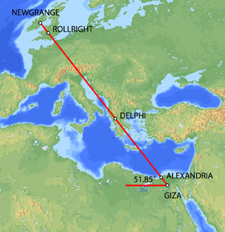
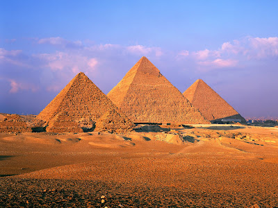
The great circle alignment from Giza to Alexandria has an azimuth of 51.85° north of due west from Giza (the same angle as the slope of the Great Pyramid). Extended beyond Alexandria, this great circle also crosses over Delphi, Rollright and Newgrange, as well as the city of London.
Map image © VectorGlobe
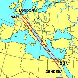
The azimuth of a great circle alignment from Dendera to Paris is also 51.85° north of due west.
Map image - Roger Hedin
Dendera was dedicated to Isis/Sirius. The ancient Egyptian year began on the date of the heliacal rising of Sirius in mid July. The helical rising of Sirius heralded the annual inundation of the Nile that was essential to the welfare of ancient Egypt. The axis of the temple of Isis at Dendera was aligned 20° south of due east, pointing directly at the rising point of Sirius from the latitude of Dendera.
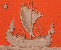
Robert Bauval describes a number of connections between Isis/Sirius and Paris in Talisman (2004). Isis is shown riding on a boat in many ancient Egyptian drawings and carvings. At the direction of Napoleon, Sirius and a statue of Isis were added to the coat of arms for Paris shown below.
During the French revolution, a statue of Isis known as the Fountain of Regeneration was constructed on the former site of the Bastille. The engraving below commemorated this statue.
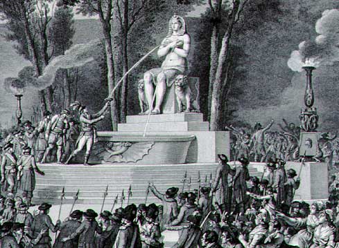
Fountain of Regeneration Engraving
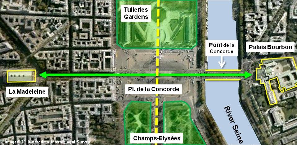
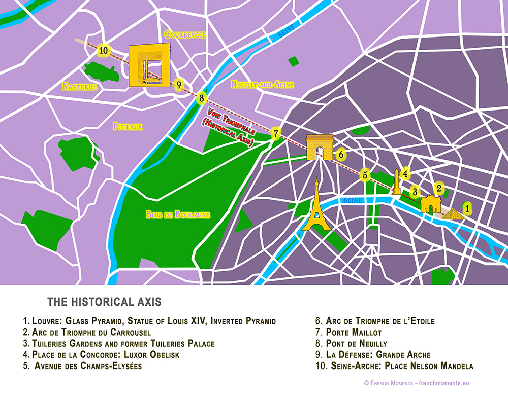
The Elysian Fields is described as a place of eternal salvation in the ancient Egyptian Book of the Dead. Named after the Elysian Fields, the Champs Elysees is the main axis of Paris. The names Elysian and Elysees both suggest an association with Isis. The photograph below is facing southeast. The Arc de Triumphe is visible in the background. Beyond the Arc de Triumphe is the Louvre. The azimuth of the Champs Elysees is 26° south of due east, pointing directly at the rising point of Sirius/Isis from the latitude of Paris.
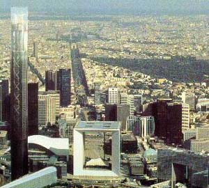
The termination point of the Champs Elysees to the northwest is the Grande Arche, in the foreground of the picture above. The axis of the Grande Arche is offset 6.33° south of the axis of the Champs Elysees. With an azimuth of just over 32° south of due east, the azimuth of the axis of the Grande Arche is the same as the azimuth of the great circle alignment from Paris to Dendera.
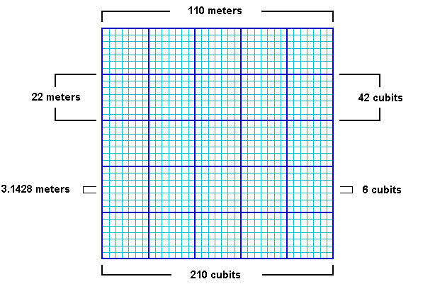
The Grande Arche is a nearly perfect cube with a height of 110 meters, a width of 108 meters and a depth of 112 meters. It is often described as a cube with side lengths of 110 meters. This is equal to 210 ancient Egyptian cubits:
110/210 = .5238
.5238 meters is a precise measure of the ancient Egyptian cubit, equating to 20.6222 inches, well within the ± .005 inches in Petrie's 20.62 inch measure of the ancient Egyptian cubit. Instead of the usual comparisons between the cubit and the meter of .52375/1 or .524/1, the best comparative measure may be the simple fraction of 11/21 that is suggested by the Grande Arche.
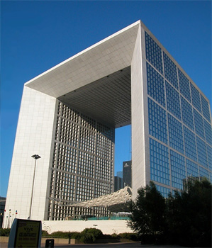
Image © Insecula.com
The sides of the Grande Arche are divided into 5 x 5 large panels and within each large panel are 7 x 7 smaller panels. Side lengths of 110 meters suggest lengths of 22 meters for the sides of the large panels with lengths of 22/7 meters for the sides of the smaller panels. The fraction 22/7 equals 3.1428, an accurate expression of π that is also found in the dimensions of the Great Pyramid. Side lengths of 210 cubits in the Grande Arche suggest lengths of 42 cubits for the sides of the large panels and 6 cubits for the sides of the smaller panels. This also shows that the relationship between the meter and the cubit is 6/π, using the measure of 22/7 for π:
21/11 = 6/π
22/7 x 21/11 = 6
The northern pyramid at Dashur, known as the Red Pyramid, was the first true (smooth sided) pyramid built in Egypt and it was the last pyramid built prior to construction of the Great Pyramid. The baselengths of the Red Pyramid are 420 cubits (220 meters) long, 20x multiples of 21/11.
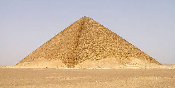
Image by Jon Bodsworth
One of the oldest stone circles in England is at Rollright. The diameter of the Rollright circle is 31.4 meters, an accurate expression of π times 10 meters. Given the 6/π relationship between the meter and the cubit, the diameter of the Rollright circle is also 60 ancient Egyptian cubits.

BACK
http://home.hiwaay.net/~jalison/Art5.html
|
|
|
|
|
TAG: NILE FLOODING SIRIUS
 Looking east from latitude 30 north on August 3rd, 30 minutes before sunrise. (Created by the author in Stellarium).
Can you feel the heat?
It’s not just your imagination. The northern hemisphere is currently in the midst of the Dog Days of Summer. For many, early August means hot, humid days and stagnant, sultry nights.
The actual dates for the Dog Days of Summer vary depending on the source, but are usually quoted as running from mid-July to mid-August. The Old Farmer’s Almanac lists the Dog Days as running from July 3rd through August 11th.
But there is an ancient astronomical observation that ties in with the Dog Days of Summer, one that you can replicate on these early August mornings.
The sky was important to the ancients. It told them when seasons were approaching, when to plant crops, and when to harvest. Ancient cultures were keen observers of the cycles in the sky. Cultures that were “astronomically literate” had a distinct edge over those who seldom bothered to note the goings on overhead.
 The flooded Temple of Isis on the island of Philae circa 1905. ( Credit: Wikimedia Commons under an Attribution-Share Alike 2.5 license. Author H.W. Dunning).
Sirius was a key star for Egyptian astronomers. Identified with the goddess Isis, the Egyptian name for Sirius was Sopdet, the deification of Sothis. There is a line penned by the Greco-Roman scholar Plutarch which states:
“The soul of Isis is called ‘Dog’ by the Greeks.”
Political commentary? A mis-translation by Greek scholars? Whatever the case, the mythological transition from “Isis to Sothis to Dog Star” seems to have been lost in time.
These astronomer-priests noted that Sirius rose with the Sun just prior to the annual flooding of the Nile. The appearance of a celestial object at sunrise is known as a heliacal rising. If you can recover Sirius from behind the glare of the Sun, you know that the “Tears of Isis” are on their way, in the form of life-giving flood waters.
 Sopdet as the personification of Sirius (note the star on the forehead) Wikimedia Commons image under an Attribution Share Alike 3.0 license. Author Jeff Dahl).
In fact, the ancient Egyptians based their calendar on the appearance of Sirius and what is known as the Sothic cycle, which is a span of 1,461 sidereal years (365.25 x 4) in which the heliacal rising once again “syncs up” with the solar calendar.
It’s interesting to note that in 3000 BC, the heliacal rising of Sirius and the flooding of the Nile occurred around June 25th, near the summer solstice. This also marked the Egyptian New Year. Today it occurs within a few weeks of August 15th, owing to precession. (More on that in a bit!)
By the time of the Greeks, we start to see Sirius firmly referred to as the Dog Star. In Homer’s Iliad, King Priam refers to an advancing Achilles as:
“Blazing as the star that cometh forth at Harvest-time, shining forth amid the host of stars in the darkness of the night, the star whose name men call Orion’s Dog”
The Romans further promoted the canine branding for Sirius. You also see references to the “Dog Star” popping up in Virgil’s Aenid.
Over the years, scholars have also attempted to link the dog-headed god Anubis to Sirius. This transition is debated by scholars, and in his Star Names: Their Lore and Meaning, Richard Hinckley Allen casts doubt on the assertion.
 Sirius as the shining “nose” of the constellation Canis Major. (Created by the author using Starry Night).
Ancient cultures also saw the appearance of Sirius as signifying the onset of epidemics. Their fears were well founded, as summer flooding would also hatch a fresh wave of malaria and dengue fever-carrying mosquitoes.
Making a seasonal sighting of Sirius is fun and easy to do. The star is currently low to the southeast in the dawn, and rises successively higher each morning as August rolls on.
The following table can be used to aid your quest in Sirius-spotting.
|
Latitude north
|
Theoretical date when Sirius can 1st be spotted
|
|
32°
|
August 3rd
|
|
33°
|
August 4th
|
|
34°
|
August 5th
|
|
35°
|
August 6th
|
|
36°
|
August 7th
|
|
37°
|
August 8th
|
|
38°
|
August 9th
|
|
39°
|
August 10th
|
|
40°
|
August 11th
|
|
41°
|
August 12th
|
|
42°
|
August 13th
|
|
43°
|
August 14th
|
|
44°
|
August 15th
|
|
45°
|
August 16th
|
|
46°
|
August 17th
|
|
47°
|
August 18th
|
|
48°
|
August 19th
|
|
49°
|
August 20th
|
|
50°
|
August 21st
|
Thanks to “human astronomical computer extraordinaire” Ed Kotapish for the compilation!
Note that the table above is perpetual for years in the first half of the 21st century. Our friend, the Precession of the Equinoxes pivots the equinoctial points to the tune of about one degree every 72 years. The Earth’s axis completes one full “wobble” approximately every 26,000 years. Our rotational pole only happens to be currently pointing at Polaris in our lifetimes. Its closest approach is around 2100 AD, after which the north celestial pole and Polaris will begin to drift apart. Mark your calendars—Vega will be the pole star in 13,727 AD. And to the ancient Egyptians, Thuban in the constellation Draco was the Pole Star!
 The Colossi of Memnon Near Luxor, just one of the amazing architectural projects carried out by the ancient Egyptians. (Photo by author).
Keep in mind, atmospheric extinction is your enemy in this quest, as it will knock normally brilliant magnitude -1.46 Sirius a whopping 40 times in brightness to around magnitude +2.4.
Note that we have a nice line-up of planets in the dawn sky (see intro chart), which are joined by a waning crescent Moon this weekend. Jupiter and Mars ride high about an hour before sunrise, and if you can pick out Mercury at magnitude -0.5 directly below them, you should have a shot at spotting Sirius far to the south.
And don’t be afraid to “cheat” a little bit and use binoculars in your quest… we’ve even managed on occasion to track Sirius into the broad daylight. Just be sure to physically block the Sun behind a building or hill before attempting this feat!
 Sirius as seen via Hubble- can you spy Sirius B? (Credit: NASA/ESA Hubble image).
Of course, the heliacal rising of Sirius prior to the flooding of the Nile was a convenient coincidence that the Egyptians used to their advantage. The ancients had little idea as to what they were seeing. At 8.6 light-years distant, Sirius is the brightest star in Earth’s sky during the current epoch. It’s also the second closest star visible to the naked eye from Earth. Only Alpha Centauri, located deep in the southern hemisphere sky is closer. The light you’re seeing from Sirius today left in early 2005, back before most of us had Facebook accounts.
Sirius also has a companion star, Sirius B. This star is the closest example of a white dwarf. Orbiting its primary once every 50 years, Sirius B has also been the center of a strange controversy we’ve explored in past writings concerning Dogon people of Mali.
Sirius B is difficult to nab in a telescope, owing to dazzling nearby Sirius A. This feat will get easier as Sirius B approaches apastron with a max separation of 11.5 arc seconds in 2025.
Some paleoastronomers have also puzzled over ancient records referring to Sirius as “red” in color. While some have stated that this might overturn current astrophysical models, a far more likely explanation is its position low to the horizon for northern hemisphere observers. Many bright stars can take on a twinkling ruddy hue when seen low in the sky due to atmospheric distortion.
 Let the Dog Days of Summer (& astronomy) begin! (Photo by author).
All great facts to ponder during these Dog Days of early August, perhaps as the sky brightens during the dawn and your vigil for the Perseid meteors draws to an end!
https://www.universetoday.com/tag/nile-flooding-sirius/ |
|
|
 Primer Primer
 Anterior
13 a 27 de 27
Siguiente Anterior
13 a 27 de 27
Siguiente
 Último

|
 The flooded Temple of Isis on the island of Philae circa 1905. (Credit: Wikimedia Commons under an Attribution-Share Alike 2.5 license. Author H.W. Dunning).
 Sopdet as the personification of Sirius (note the star on the forehead) Wikimedia Commons image under an Attribution Share Alike 3.0 license. Author Jeff Dahl).
 Sirius as the shining “nose” of the constellation Canis Major. (Created by the author using Starry Night).
 The Colossi of Memnon Near Luxor, just one of the amazing architectural projects carried out by the ancient Egyptians. (Photo by author).
 Sirius as seen via Hubble- can you spy Sirius B? (Credit: NASA/ESA Hubble image).
 Let the Dog Days of Summer (& astronomy) begin! (Photo by author).














 "El hombre que enterró a Hitler" y el "Sr. Fernando", quien activó la investigación.
 El "Sr. Fernando" reveló detalles del entierro de Hitler en Paraguay. Foto: Jorge Tung.
 Marcelo Netto y Aldo Gama, los responsables de la investigación plasmada en el libro.
 Nota de Juscelino Kubitscheck. 15 de junio de 1955.
