|
|
IGLESIA CATOLICA: ANGELS AND DEMONDS WATER (NILO, GANGES, DANUBIO, PLATA) PIAZZA NAVONA
Elegir otro panel de mensajes |
|
|
Viktor Schauberger: The Man Who Invented Flying Discs For The Nazis
- ENGLISH NEWS
- TECHNOLOGY GAME SCIENCE
VN EN
Some historical figures leave behind little real information, but many secrets and mysteries.
 Ảnh minh họa
One such person was a scientist, thinker, philosopher, and inventor, and the author of innovative technological ideas. He was hired to work for the Third Reich and allegedly built for the Nazis a flying machine that looked like a disc-shaped UFO for the Nazis.
And then this man suddenly disappeared from history as quickly and mysteriously as he appeared. It is officially believed that he died a natural death, but there are many theories that he was either deliberately killed or his death was faked, but in fact was kidnapped for his own purposes.
The Mysterious Disappearance Of Viktor Schauberger
A man named Viktor Schauberger was born in Austria in 1885 and initially had an experience that had nothing to do with his future fame as the inventor of Hitler’s UFOs. He grew up in a hereditary family of foresters living in a vast area of remote wilderness in Holzschlag, Upper Austria, and spent most of his youth and middle years tending more than 10,000 hectares of land.

During this time, constantly being in nature, he began to make many observations that profoundly changed his life and outlook. In particular, he was absolutely fascinated by water, which he regarded as an independent living organism, calling it the “Blood of the Earth” and the source of all living things.
He especially focused on such properties of water as its spiral forms, eddies, fast currents, eddies, and easy harmony with the surrounding world.
He obsessively studied the movements and effects of water, continuing to form many theories, and then he began to craft completely innovative types of spiral-cut water gutters, the design of which was based on his own hydrodynamic system.
According to this system, an inward-moving and swirling water vortex could be used for power and thrust, which was the beginning of his revolutionary new idea for a new type of engine that relied on implosion (an explosion directed inward) rather than conventional explosions.
Viktor Schauberger was completely self-taught, he never took any university courses, but he soon gained international recognition thanks to some of his ideas, patents, and inventions, and controversy. He was critical of the many inventions available in his era, believing that they work against the laws of nature and are destructive.
Instead, he embraced the idea that humanity and nature can live together using alternative energy sources, such as using natural processes and live in harmony with them. His motto was “Kapieren und kopieren” (To comprehend and copy nature). Schauberger believed that many inventions of mankind were contrary to nature, and later he stated that even the propeller was an imperfect invention:
“As nature best demonstrated in the case of the winged maple seed, today’s propeller is a pressure rotor, and therefore a brake rotor, whose purpose is to allow the heavy maple seed to slowly fall to the ground like a parachute and move away from the wind.
No bird has such a rotating object on its head, nor a fish on its tail. This brake rotor was only used by a person for forward propulsion. As the propeller spins, drag increases in proportion to the square of the rotation speed. It is also a sign that this supposed propulsion device is not built naturally and is therefore out of place. “
Schauberger sought to bring his ideas to life by coming up with a detailed theory according to which water vortices can build on each other to create more and more forces, which, in turn, will create a force opposite to gravity. In essence, Schauberger was explaining how to create anti-gravity, which he called diamagnetism.
He used these theories to create fantastic inventions such as a water blast turbine that sucked in air in a spiral, reaching enormous forces. He also invented the machine that created a typhoon-like suction force to control the temperature in a room, and a power generator. These machines created energy from water and air using spiral pipes and nozzles.
All of this worked on the principles of clean energy and working with nature, apparently with little or no pollution and being completely sustainable.
It might seem odd that such a radical promoter of green energy and work with nature caught the attention of the Nazis, who were not particularly concerned with preserving the environment. But he really piqued their interest, and in 1934 the Nazis approached him with a tempting offer to work for them for a good salary. Schauberger agreed.
Furthermore. In 1938, Nazi Party member Julius Streicher allegedly personally ordered him to build an aircraft that could use a vortex engine. This device had to have the shape of a disk and move completely differently from all modern aircraft while hovering in the air in one place (levitation), performing precise maneuvers, and accelerating at high speeds.

Basically, they wanted Schauberger to build a futuristic anti-gravity ship using his own natural theories, and since they were the Nazis, he had no choice but to agree once again, receiving an exorbitant amount of money.
In 1940, Schauberger created the first prototype of his artificial UFO, called Repulsin A, which used friction between vortices and the surrounding air to force the air downward, creating an overall lifting and propelling effect, more or less producing a kind of mini-tornado, on the energy of which this ship moved.
However, it was found that the vortex motor was unstable, and the fan inside the device could not spin as fast as required because the blades were pushing out too much air. At the time, no way was found to circumvent the problem of generating more intense rotational energy, and the device was deemed too impractical.

Indeed, during the testing of the ship, although it could indeed levitate, it was almost impossible to control or move forward, usually quickly spinning out of control or even flying through the roof of the test hangar.
According to rumors, the Nazis were furious at Schauberger’s inability to solve these problems, which caused the inventor to be temporarily imprisoned. But then he came under the personal attention of Heinrich Himmler, who drew Schauberger to work on another miracle of technology – a new type of silent mini-submarine, and then ordered to continue work on a new version of the anti-gravity device called Vril-7.
It is not known how far Schauberger went with the Vril-7, as the end of World War II halted all secret Nazi research (at least official), with most of his work, prototypes, and plans destroyed so that they would not fall into the hands of the Allies.

The Americans, knowing how important Schauberger was to the Germans, arrested him and took him to the United States, intensively interrogating him, but were never able to get much information from him. However, they were able to use all the information they received to the maximum. The fundamental principles that Schauberger used were later applied to several projects, including the Avro Canada VZ-9 Avrocar, which was a vertical takeoff and landing aircraft developed during the Cold War era, and others.
Schauberger, while in the United States, tried for several more years on various civilian vortex technology projects such as generators, water purification systems and air purification devices, before eventually returning to Austria on September 25, 1958, almost penniless.
He died quite suddenly, just five days after his return to his homeland, taking all his secrets with him to the grave.
Since then, various conspiracy theories have regularly emerged about Schauberger, including that his research went much further than anticipated, and that many of the UFOs that were seen during the Second World War were in fact Schauberger’s experimental devices.
But all these are just hypotheses and unverified rumors, for sure no one knows anything. He remains in many ways a ghost person, the true scope of his work is unknown, and his research is enigmatic.
https://www.xaluannews.com/modules.php?name=News&file=article&sid=3296405 |
|
|
|
|
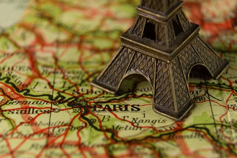
Where is Paris? Paris Latitude and Longitude (& Fun Facts)
Do you want to travel to Paris, but are not sure exactly ‘Where is Paris?’
Stunningly beautiful, the City of Light and the City of Love (and my personal favorite travel destination), is located in Northern France. People from all over the world flock to Paris for its culture, art, romance and food!
With Paris coordinates of 48°51′ N 2°21′ E (48.86 degrees North latitude and 2.35 degrees East longitude), the city lies just within the temperate zone – making it ideal for travelers looking to explore without extreme weather conditions getting in their way.
The moderate climate of Paris makes it possible for tourists to take advantage of all four seasons in this amazing city.
Ready to learn all about Paris latitude and longitude, and how this impacts the weather in Paris? Lace up your shoes and let’s go!
Disclaimer: This page may contain affiliate links. I earn a small commission if you make a purchase through these links (at no additional cost to you).
Where is Paris? Paris latitude and longitude
Where is Paris?
Paris is located in Northern France, in the region known as Ile de France. The Seine River runs through the center of Paris, further enhancing its beauty and charm.
Paris is the capital of France, a country located in Western Europe. The neighboring countries of France are Belgium, Luxembourg, Germany, Switzerland, Italy and Spain.
 City of Light, is located in northern France. Paris France coordinates are 48°51′ N 2°21′ E.
What is the latitude of Paris?
The latitude of Paris France is 48.86 degrees North of the equator. This means that Paris lies about halfway between the North Pole and the Equator.
What is the longitude of Paris?
The longitude of Paris France is 2.35 degrees East of the Prime Meridian. This means that it is located eastward from the reference line of 0 degrees longitude, or the Prime Meridian.
What parallel is Paris France?
Paris France is located in the Northern Hemisphere, so it lies on the 48th parallel north. This means that it is at 48 degrees north of the equator and halfway between the North Pole and Equator.
Paris is located around 15km south of the 49th parallel, and its main airport, the Paris Charles de Gaulle airport, lies on the 49th parallel.
 Where is Paris located? The longitude and latitude of Paris are 48°51′ N 2°21′ E
Does latitude impact hours of daylight?
Yes, latitude does have an impact on hours of daylight. The higher the latitude, the longer the days in summer and the shorter the days in winter.
This is because as you move away from the equator towards either pole, there are more hours of daylight during the day or night depending on which season it is.
So, for Paris, which lies on the 48th parallel north and is located in the Northern Hemisphere, the days are longer in summer and shorter in winter. This is good to keep in mind when making your travel plans so you know how much sightseeing you can squeeze into a day!
(The days in Paris are not as long as those in London, since the latitude of London is higher than Paris.)
Does longitude impact hours of daylight?
No, longitude does not have an impact on hours of daylight. The duration of daylight at any location depends only on its latitude. Longitude is only used to pinpoint the location – it does not change the amount of daylight hours experienced in any given season.
How many hours of daylight are there in Paris in the summer?
In the summer, there are usually around 16 hours of daylight in Paris. This varies slightly from day to day, but overall, you can expect 15-16 hours of daylight during the summer months in Paris.
The longest day is on the summer solstice, which is usually the 20th or 21st of June.
In the summer, you’ll have plenty of time to see the top attractions in Paris!
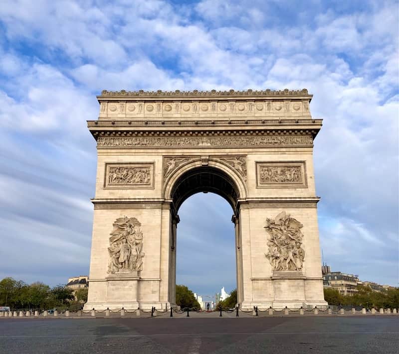 The magnificent Arc de Triomphe, at the heart of the City of Light. The coordinates of Paris are 48°51′ N 2°21′ E.
How many hours of daylight are there in Paris in the winter?
In the winter, there are usually around 8-9 hours of daylight in Paris. This varies slightly from day to day, but overall, you can expect 8-9 hours of daylight during the winter months.
The shortest day is on the winter solstice, which is usually on December 21 or 22.
So, if you’re visiting Paris in the winter, be sure to plan your sightseeing carefully to make the most of those precious daylight hours! (But it does make it easier to see the illuminated monuments and enjoy a Paris by night tour without staying up until midnight!)
Does latitude affect climate?
Yes, latitude does affect climate. As you move away from the equator and closer to the poles, temperatures tend to be cooler in general.
This is why places located on higher latitudes like Paris tend to experience more temperate climates with four distinct seasons.
Places at lower latitudes (closer to the equator), will tend to experience more tropical climates with very little temperature variation. So, latitude definitely plays a role in determining the climate of an area.
Do keep in mind that latitude is not the only factor impacting climate. Climates will also differ due to factors such as elevation or proximity to large bodies of water.
What is the climate in Paris?
The climate in Paris is classified as a temperate oceanic climate.
The summers are warm and humid, while the winters tend to be rainy with cool temperatures. Spring and autumn are generally mild but can vary greatly in temperature.
“It’s Paris. You don’t come here for the weather.”
Adrian Leeds (This is one of the best Paris quotes — funny but so true!)
What is the daily temperature range in Paris?
The daily temperature range in Paris varies greatly depending on the season.
In the summer, Paris temperatures typically range from 19-26°C (66-79°F). Sometimes Paris may get a heat wave, so if you’re visiting in the summer, you’ll want to ensure that your hotel has air conditioning (not all Paris hotels do).
Take a midday break in the shade in one of the lovely gardens of Paris, such as the Luxembourg Gardens. And be sure to drink plenty of water to stay hydrated! Take advantage of the fountains and refill with free drinking water in Paris.
In the winter, Paris temperatures range from 3-12°C (37-54°F) on average. The temperature can also drop down to below 0°C (32°F) in the coldest months of January and February.
It’s important to plan accordingly and bring appropriate clothing for each season when visiting Paris! Temperatures can vary quite a bit beyond yearly averages, so be prepared with layering options.
Our first trip to France was in the month of September. We expected it to be cooler and didn’t pack any shorts. The weather turned out to be unseasonably warm, and we really wished that we had brought more options! It can be hard to predict what to pack for fall in Europe.
Learn more about Paris temperatures and rainfall by month.
Does it snow in Paris?
Yes, it does snow in Paris. On average, Paris gets around 20-30 days of snow each winter, with December being the month when snowfall is most likely. Snow usually falls in small amounts and melts quickly.
What city is on the same latitude as Paris?
Some popular cities in southern Canada are close to the same latitude as Paris. The latitude of Victoria BC is 48.43°N, which is very similar to Paris’ 48.86°N. And the latitude of Vancouver BC is 49.28°N, which is just slightly higher (a smidge further north) than Paris’ 48.86°N.
In Europe, the latitude of Stuttgart Germany is 48.77°N, and Brno Czech Republic is 49.2°N, both of which are fairly close to Paris’ latitude.
 This Paris latitude map shows that Paris is further north than the major cities in the continental United States
What US city is on the same latitude as Paris?
Most of the continental United States is further south than Paris. The state of Alaska is of course much further north than Paris!
The closest US ‘big city’ to the latitude of Paris is Seattle, Washington, which has a latitude of 47.62 degrees north. Rolla, North Dakota has a latitude of 48.09 degrees north, which is very close to the latitude of Paris.
Is Paris the same latitude as NY?
No, Paris is not located at the same latitude as New York City. The latitude of New York City is 40.71° N, which is around 8 degrees south of the 48th parallel north where Paris is located.
People are always surprised to learn the New York is much further south than Paris is!
Paris Longitude and Latitude Fun Facts
What is the Eiffel Tower latitude and longitude?
The latitude of the Eiffel Tower is 48.86° N, and its longitude is 2.29° E. The Eiffel Tower is the most iconic symbol of Paris and a must-see for any visitor to the City of Light!

What is the latitude of Versailles?
The latitude of Versailles is 48.8024° N. The Palace of Versailles is one of my favorite day trips from Paris and can easily be reached by train. The gardens of Versailles are spectacular!
What is the latitude of Disneyland Paris?
The latitude of Disneyland Paris is 48.87 degrees north. Disneyland Paris is a fun day trip from Paris by train.
Latitude and Longitude FAQ
What is latitude?
Latitude is one of the two coordinates of a point on the Earth’s surface, together with longitude. Latitude is measured in degrees north or south of the equator and ranges from 0° at the Equator to 90°N/S at the poles.
What is the equator?
The equator is an imaginary line that circles the Earth and divides it into two hemispheres: the Northern Hemisphere and the Southern Hemisphere. It is located at 0 degrees latitude, halfway between the North Pole and South Pole.
What is longitude?
Longitude is also one of two coordinates used to pinpoint a location on the Earth’s surface, along with latitude. It is measured in degrees east or west of the Prime Meridian and ranges from 0° at the Prime Meridian to 180° east/west. The longitude of Paris is 2.35 degrees East, meaning that it lies 2.35° east of the Prime Meridian.
Knowing both latitude and longitude coordinates lets you accurately pinpoint the location of any place on Earth, including Paris!
What is the Prime Meridian?
The Prime Meridian is an imaginary line that runs through Greenwich, England and marks the reference line for longitude. It was created by the British Royal Observatory in 1851.
The Prime Meridian is located at 0 degrees longitude and divides the Earth into two halves: the Eastern Hemisphere and Western Hemisphere. All other locations on Earth have a specific angle of longitude depending on how far east or west they lie from the Prime Meridian.
What is the difference between latitude and longitude?
Latitude and longitude are two coordinates used to pinpoint a location on the Earth’s surface. Latitude is measured in degrees north or south of the equator, and ranges from 0° at the Equator to 90°N/S at the poles. Longitude measures how far east or west something is of the Prime Meridian, and ranges from 0° at the Prime Meridian to 180° east/west.
What is a parallel?
A parallel is an imaginary line on the Earth’s surface that circles around the globe. It is measured in degrees north or south of the equator and ranges from 0° at the Equator to 90°N/S at the poles. The 48th parallel north, where Paris is located, circles around halfway between the North Pole and Equator.
Is a parallel the same as latitude?
No, a parallel is not the same as latitude.
A parallel is an imaginary line on the Earth’s surface that circles around the globe, whereas latitude is one of two coordinates of a point on the Earth’s surface together with longitude.
Latitude ranges from 0° at the Equator to 90°N/S at the poles, and longitude ranges from 0° at the Prime Meridian to 180° east/west. Knowing both latitude and longitude coordinates lets you accurately pinpoint the location of any place on Earth, including Paris!
Final Thoughts:
There you have it! Now you know everything about the latitude and longitude of Paris.
And you’ll be well informed for what to expect when visiting Paris in different seasons, from seasonal temperatures to hours of daylight (all of which are impacted by the latitude of Paris!)
So, who’s ready to start planning their next trip to Paris? We know we are!
With this helpful information, you’ll be able to make the most of your time in Paris. Bon voyage!
Do you love Paris? Me too! You might enjoy these posts about the City of Light:
|
|
|
|
|
LAST UPDATED: 29 MAY 2024
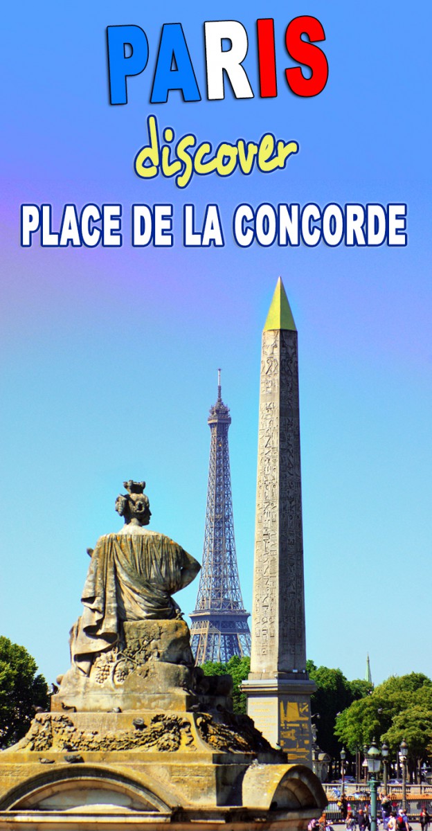
The majestic Place de la Concorde played an essential part in French history. On many occasions, the square has been chosen for happy or sad national gatherings. One of the many prestigious stages of the Historical Axis, the square features a vast and elegant neo-classical ensemble from the 18th century. It connects the Tuileries Garden to the Champs-Elysées and the Madeleine to Palais Bourbon.
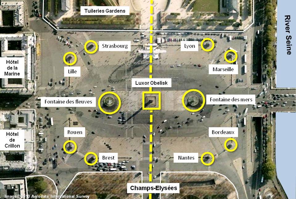
The magnificence of place de la Concorde
The Place de la Concorde plays a significant symbolic part along the Historical Axis. This magnificent vista runs through some of Paris’ most celebrated monuments and squares:
 Fountain of the Rivers on Place de la Concorde © French Moments Fountain of the Rivers on Place de la Concorde © French Moments
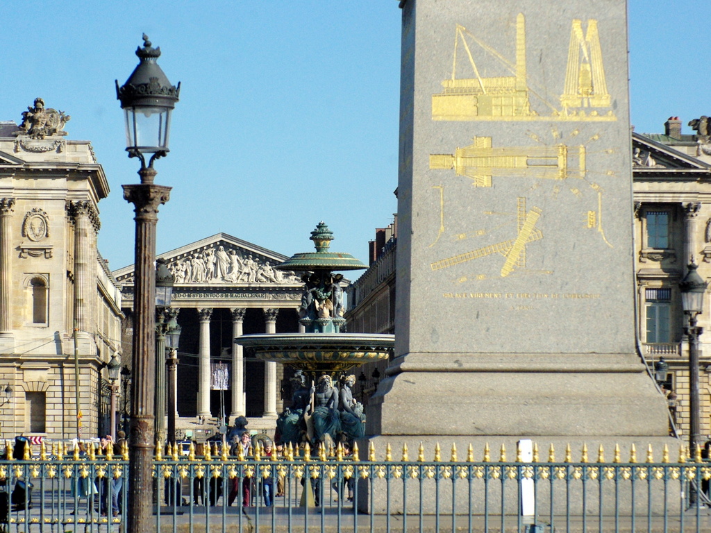
The square takes the form of an octagon measuring 359 by 212 metres. The River Seine borders it to the South, and classical-style buildings to the North. The Egyptian obelisk stands at the centre of the square, flanked by two massive fountains.
The turbulent history of the square
In 1753 it was decided that the site should be designed as a square. This decision was taken during the reign of King Louis XV. At that time, many French cities had started or completed prestigious squares. They were commonly called “Place Royale” to the glory of the King: Montpellier, Nantes, Metz, Dijon or Bordeaux.
For instance, in the then-independent Duchy of Lorraine, the King’s father-in-law, Stanislas Leszczyński, commissioned the beautiful Place Stanislas in Nancy, which was well underway by 1753.
 Place Stanislas, a royal square in Nancy built in 1753-1755 © French Moments Place Stanislas, a royal square in Nancy built in 1753-1755 © French Moments
A grand square dedicated to Louis XV
Gabriel, the King’s architect, was tasked with creating a magnificent square along the Historical Axis. It would stage an equestrian statue of Louis XV in the centre. The two monumental pavilions bordering the square’s northern side and divided by the Rue Royale were built in the Louis XV style: the Hôtel Crillon and the Hôtel de la Marine.
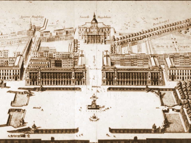 Plan of Gabriel for the Louis XV Square © French Moments Plan of Gabriel for the Louis XV Square © French Moments
The tragic event of 30 May 1770
Misfortune struck the square on the occasion of the marriage of Dauphin Louis and Austrian archduchess Marie-Antoinette. On the 30th May 1770, people assembled for a celebration with much pomp and ceremony. A beautiful firework display was planned. However, following the accidental fall of a rocket, the crowd was panic-stricken, and 133 people were killed, trampled and choked.
During the Reign of Terror
But the worst was yet to come 20 years later with the uprising of the Revolution. Originally called ‘Place Louis XV’, the square was renamed in 1792 as ‘Place de la Révolution’. It became the stage for horrendous public executions by the guillotine.
During the Reign of Terror, the King, Queen Marie-Antoinette, and more than 1,100 victims were beheaded in less than two and a half years.
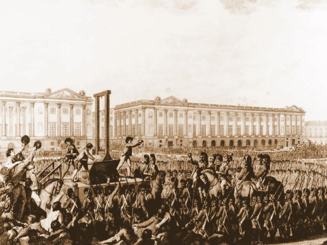 Execution of Louis XVI on Place de la Concorde Execution of Louis XVI on Place de la Concorde
On 21st January 1793, Louis XVI was guillotined at the exact position of the statue of Brest, at the North-West angle.
 The monument of Brest, the spot where the guillotine was placed for Louis XVI’s execution © French Moments The monument of Brest, the spot where the guillotine was placed for Louis XVI’s execution © French Moments
From the 13th of May 1793, the “National Razor” was moved across the square near the railings of the Tuileries Gardens. Many more victims were beheaded: Marie-Antoinette (16th October), Madame du Barry, Danton, Madame Roland and Robespierre.
Place de la Concorde
Following those dreadful events of the Reign of Terror, the Directorate changed the square’s name in 1795 to one of reconciliation and hope: Place de la Concorde.
The Monuments of French cities
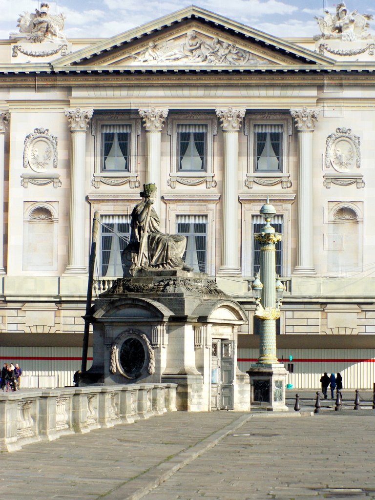
In the 1830s, architect Jacques Ignace Hittorff transformed the square by adding statues and fountains that can be seen today.
At each corner of the octagon formed by the Place, he erected eight stone monuments representing the French cities of:
 The Monument of Bordeaux © French Moments The Monument of Bordeaux © French Moments
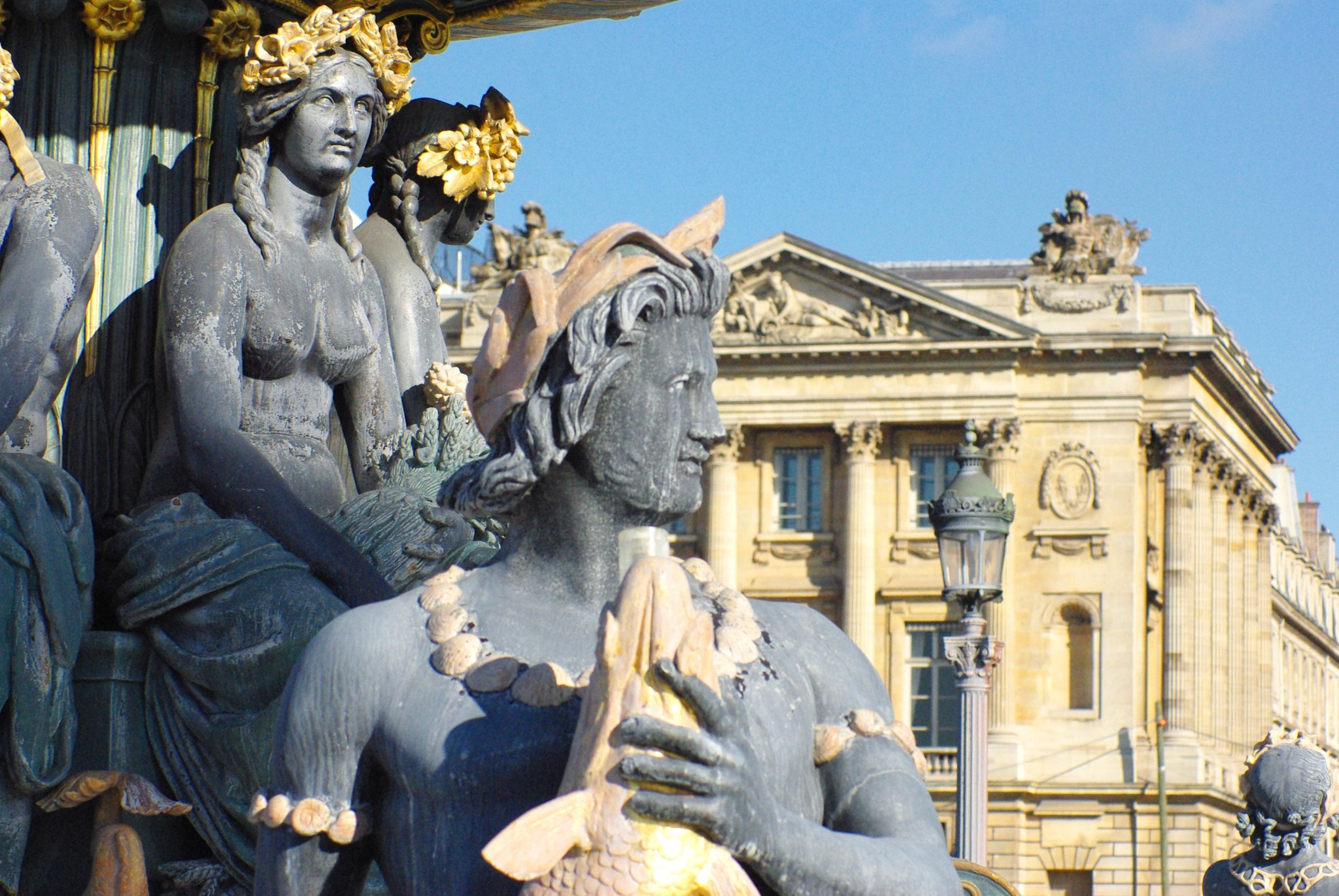
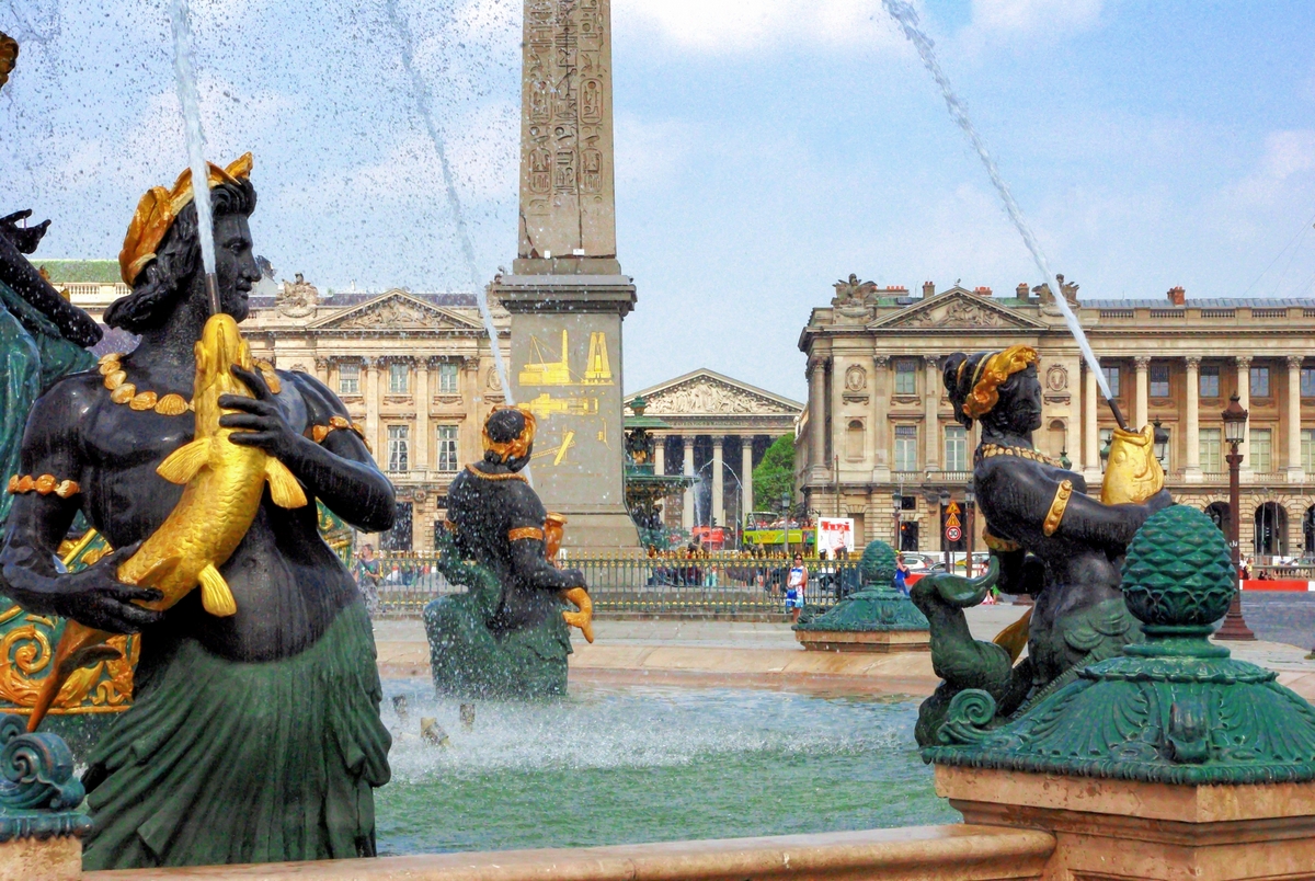
The fountains
Hittorff also added two monumental fountains inspired by those in Piazza Navona in Rome:
- the Maritime Fountain (to the South, portraying the maritime spirit of France) and,
- the Fountain of the Rivers (to the North, representing the Rhône River and the Rhine River).
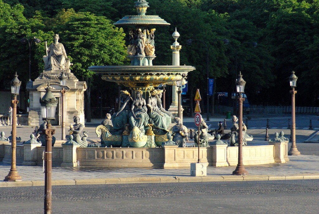 Fountain of the Rivers © French Moments Fountain of the Rivers © French Moments
The Luxor Obelisk, Paris’ oldest monument
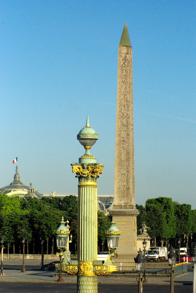 Place de la Concorde © French Moments Place de la Concorde © French Moments
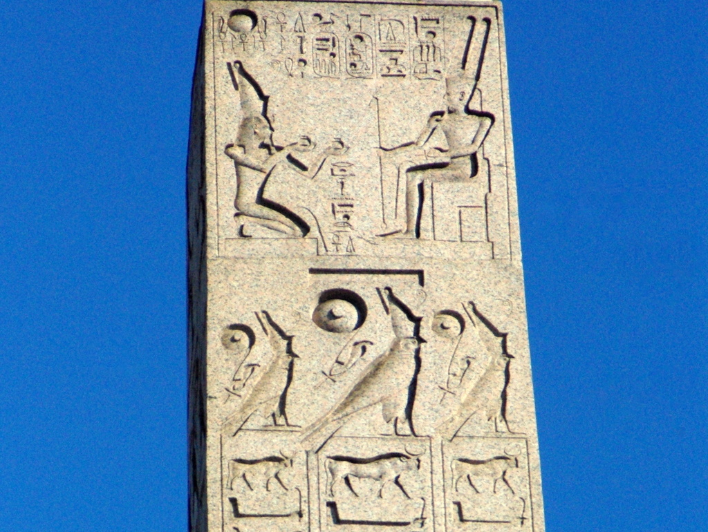
The Obelisk, ideally placed in the middle of the Place de la Concorde, is part of the strange geometrical layouts and alignments along the Historical Axis, evoking the symbols of Ancient Egypt.
Napoleon’s campaign to Egypt
To understand the reasoning that led the French to develop such admiration for Egyptology, let’s go back to Napoleon Bonaparte’s campaign to Egypt in 1798. The French Emperor-to-be attempted to conquer Egypt to counteract the English influence in the Middle East and India. The General was not coming to Egypt with soldiers only. As a newly elected French Academy of Sciences member, he took 167 savants to Egypt in 1798. There he founded the first modern scientific institute in Egypt: the Institut d’Egypte in Cairo.
 Obelisk, Place de la Concorde © French Moments Obelisk, Place de la Concorde © French Moments
The Luxor obelisk on its way to France
King Charles X (1757-1836) showed an interest in Ancient Egypt and commissioned Jean-François Champollion (who deciphered the ancient hieroglyphs) to arrange for an obelisk to be returned to Paris.
In 1831, Mohammed-Ali, Viceroy of Egypt, offered France one of the two obelisks which guarded the entrance of the temple of Luxor in Upper Egypt. Both date back to Pharaoh Ramses II, the most powerful king of Ancient Egypt.
A unique ship, the Luxor, was designed to carry the obelisk to France down the Nile and across the Mediterranean Sea to the port city of Toulon and then by river to Paris.
In Charles X’s plans, the obelisk had to find its place on Place de la Concorde. That is the square built in honour of his grandfather and where his brother and sister-in-law were beheaded.
Raising the Obelisk on place de la Concorde
On the 25th of October 1836, 200,000 people gathered at the square to witness the lifting operation to raise the obelisk onto its pedestal.
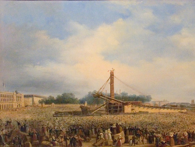 Erection of the Luxor Obelisk on Place de la Concorde in 1836. Painting by François Dubois Erection of the Luxor Obelisk on Place de la Concorde in 1836. Painting by François Dubois
To the relief of supervisor Lebas and the assembled crowd, the event was a success. From that day, the “Obélisque de Louxor” sits enthroned in the centre of the square.
 The Obelisk seen from the entrance to the Tuileries Garden © French Moments The Obelisk seen from the entrance to the Tuileries Garden © French Moments
The oldest monument in Paris
Some 3,500 years old, the obelisk is the oldest monument standing in Paris. It is 23 metres tall and weighs 220 tons. However, the French capital was not the only European city to display an obelisk.
Other Egyptian obelisks in Europe
- The Romans transferred the one standing in Saint Peter’s Square in Rome to decorate the circus.
- Another specimen erected after that of Paris is in London (the obelisk of Tuthmosis III on the Victoria Embankment, better known as Cleopatra’s Needle).
- Without forgetting New York (a twin obelisk to the one in London, erected in Central Park).
The pyramidion
When the obelisk was carried to France in the 19th Century, its original cap had long disappeared. In fact, it was believed to have been stolen in the 6th century BC.
In May 1998, the French authorities decided to refurbish the obelisk by putting a copy of the missing gold-leafed pyramid cap on top, thanks to the initiative of Egyptologist Christiane Desroches Noblecourt. This pyramid cap is called a pyramidion. It is supposed to reflect the rays of the sun.
 The obelisk’s pyramidion © French Moments The obelisk’s pyramidion © French Moments
In 1988, this tremendous Egyptian landmark was joined by another pharaoh-related structure along the Historical Axis: the modern Glass Pyramid in the Louvre, evoking the Great Pyramid of Giza.
A perpendicular perspective on the Historical Axis
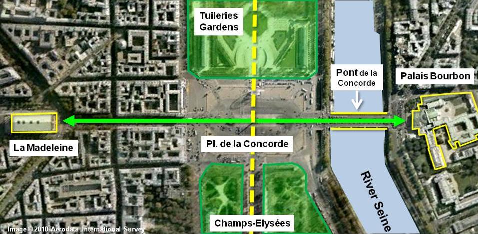
The Place de la Concorde set the stage for another North-South perspective, much shorter, perpendicular to the Historical Axis.
It features, on the South side, beyond the bridge “Pont de la Concorde” across the Seine:
In fact, both monuments match each other across the Place de la Concorde with their grand Classical-style porticos, evoking the design of Roman temples.
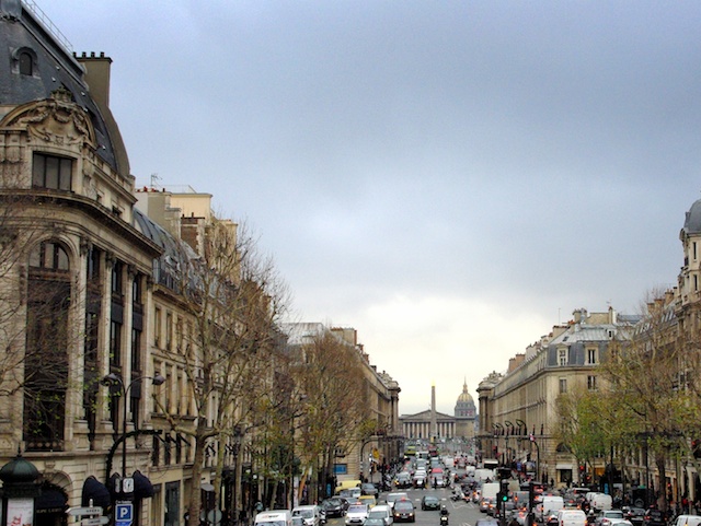 The great perspective from the Madeleine church towards the Bourbon Palace © French Moments The great perspective from the Madeleine church towards the Bourbon Palace © French Moments
The 19th-century Madeleine Church strangely resembles a Roman temple and shares some similarities with the ancient ‘Maison Carrée’ in Nîmes.
 The Madeleine church seen from the square © French Moments The Madeleine church seen from the square © French Moments
The Palais Bourbon housed the National Assembly, and its pedimented, collonaded front was inspired by the Madeleine Church at the far end of the short perspective crossing the Place de la Concorde.
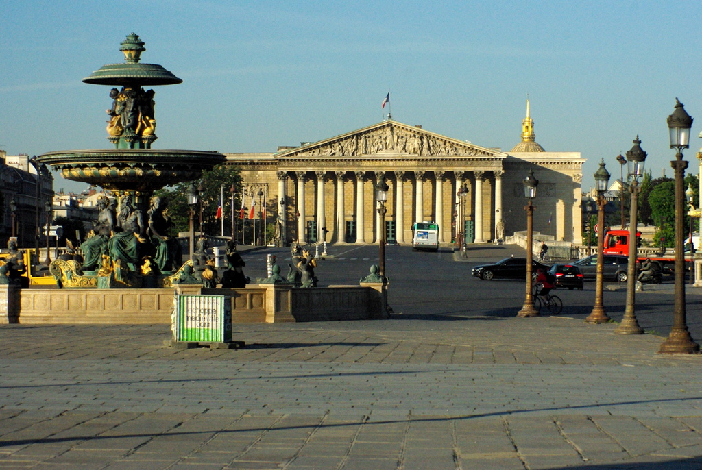 Palais Bourbon from the square © French Moments Palais Bourbon from the square © French Moments
The Pont de la Concorde
 Pont de la Concorde, Paris © French Moments Pont de la Concorde, Paris © French Moments
The Pont de la Concorde, crossing the Seine and linking the Place de la Concorde to the Palais Bourbon, was completed in 1791, with many of its stones taken from the dismantled Bastille fortress. When complete, it was said that the people of Paris could ride roughshod over the ancient fortress.
The view from the bridge stretches to the Eiffel Tower, the Alexandre III Bridge on one side, and the other to the Tuileries Garden and the Louvre.
More photos of Place de la Concorde
 The fountain of the seas in Place de la Concorde © French Moments The fountain of the seas in Place de la Concorde © French Moments The three needles of Paris! © French Moments The three needles of Paris! © French Moments Place de la Concorde © French Moments Place de la Concorde © French Moments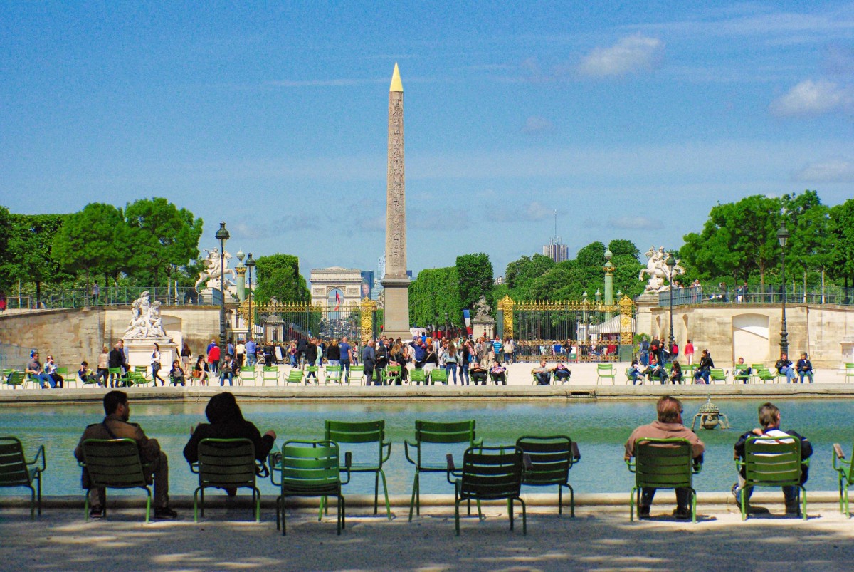 The Historical Axis of Paris in the Tuileries garden near Place de la Concorde © French Moments The Historical Axis of Paris in the Tuileries garden near Place de la Concorde © French Moments Winter in Place de la Concorde, Paris © French Moments Winter in Place de la Concorde, Paris © French Moments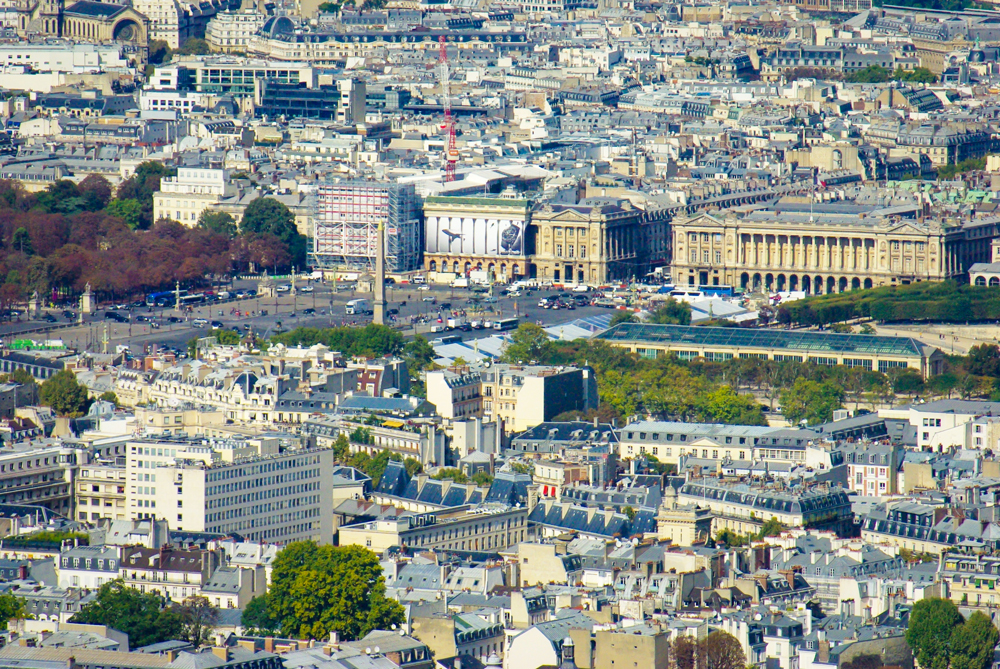 Place de la Concorde © French Moments Place de la Concorde © French Moments
Until the mid-2010s, a Ferris wheel stood in the centre of the square during the Christmas period. It allowed taking beautiful pictures from the beautiful perspective of the Champs-Elysées.
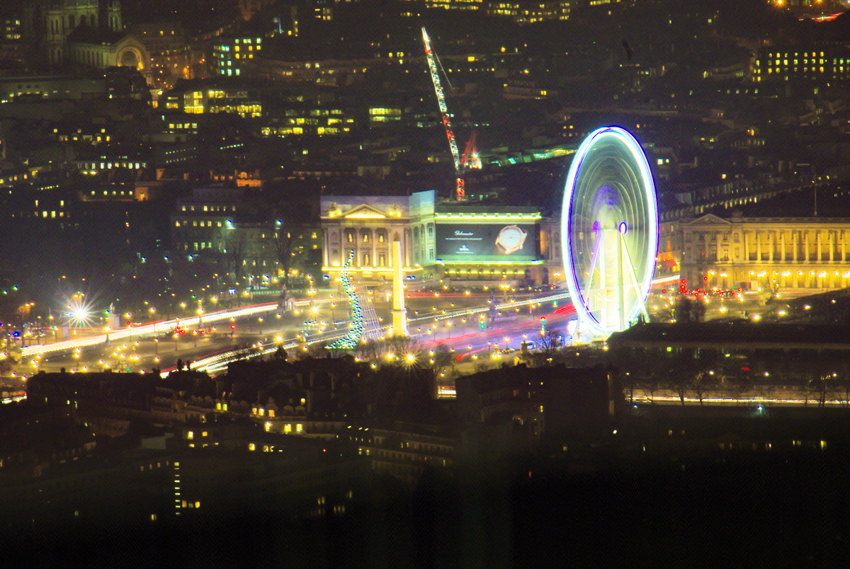 Christmas in Paris – Place de la Concorde © French Moments Christmas in Paris – Place de la Concorde © French Moments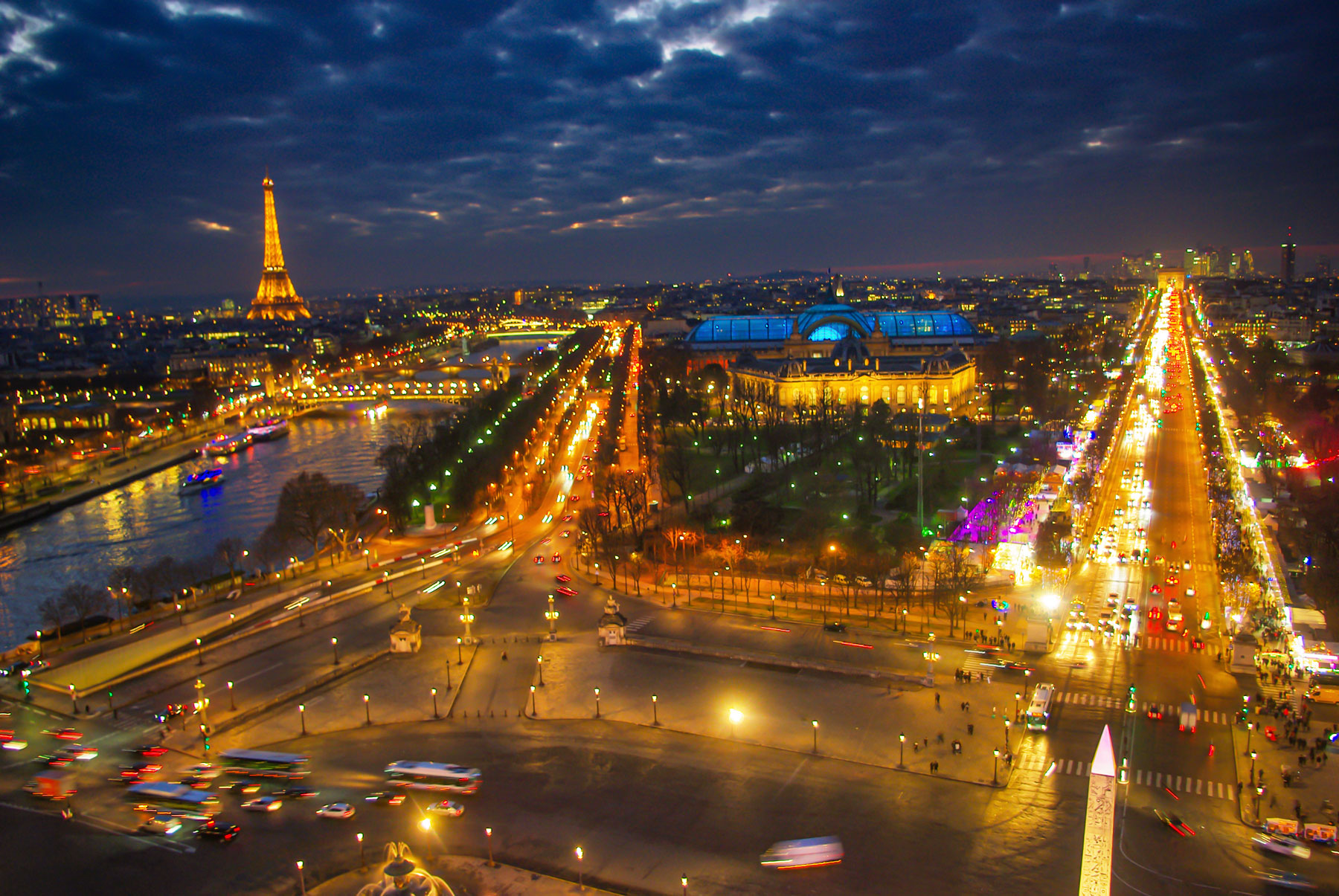 The view from the Ferris wheel © French Moments The view from the Ferris wheel © French Moments The square at night © French Moments The square at night © French Moments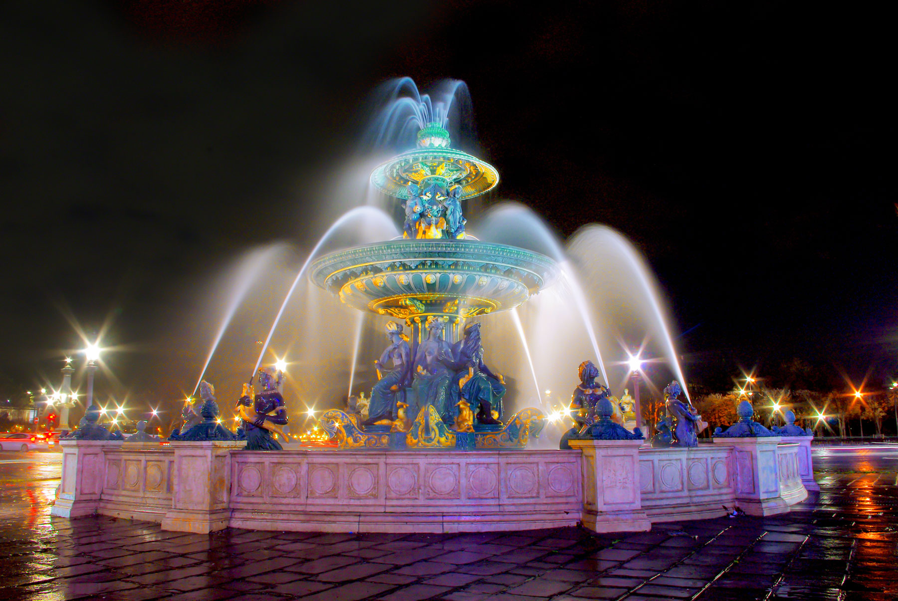 The fountain illuminated © French Moments The fountain illuminated © French Moments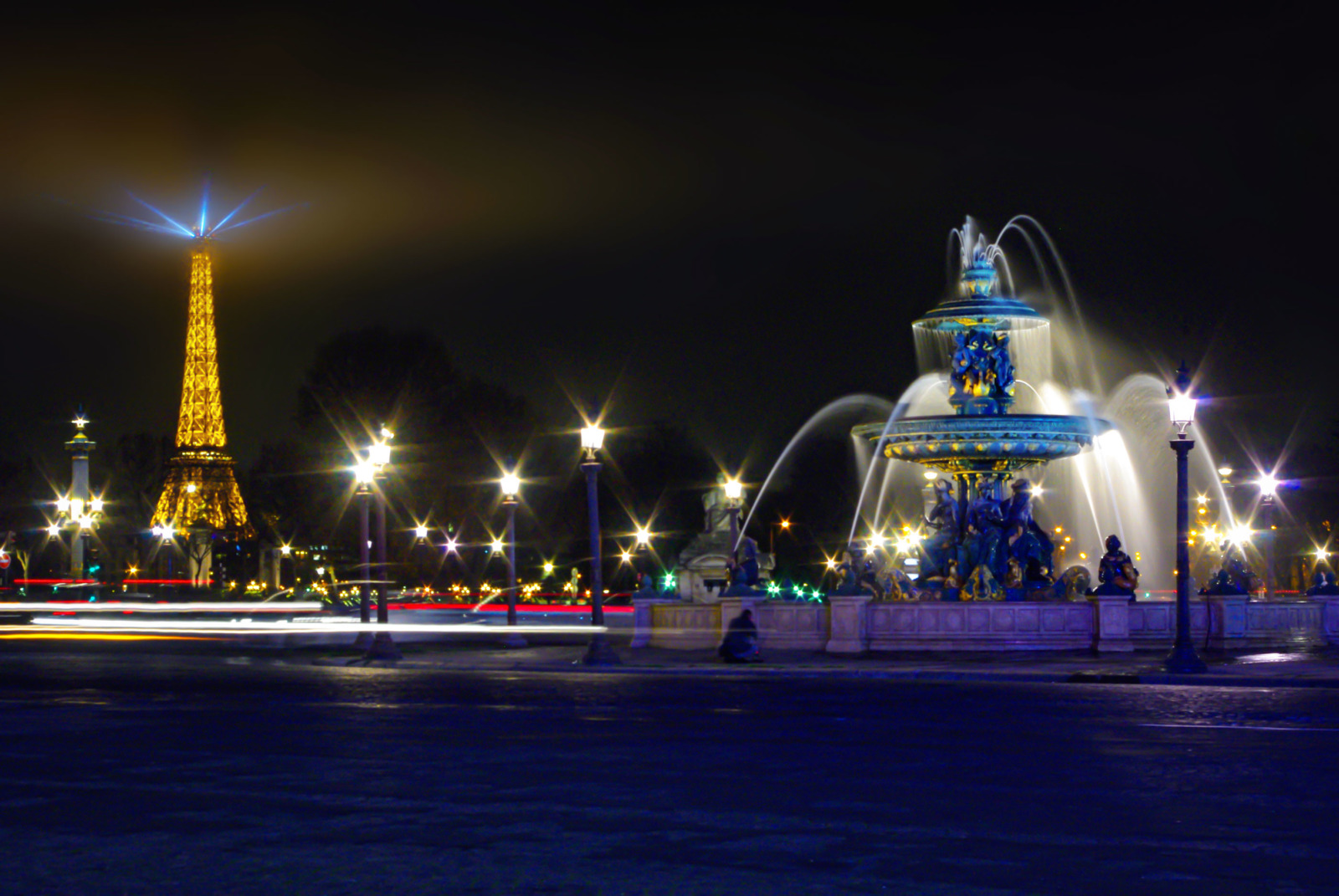 Place de la Concorde by night © French Moments Place de la Concorde by night © French Moments
Pin it for later
Did you like what you read? If so, I invite you to leave a comment below. Tell us what the most exciting thing you learnt from the article was!
Also, make sure to pin the image below on Pinterest:
https://frenchmoments.eu/place-de-la-concorde-paris/ |
|
|
|
|
TAG: NILE FLOODING SIRIUS
 Looking east from latitude 30 north on August 3rd, 30 minutes before sunrise. (Created by the author in Stellarium).
Can you feel the heat?
It’s not just your imagination. The northern hemisphere is currently in the midst of the Dog Days of Summer. For many, early August means hot, humid days and stagnant, sultry nights.
The actual dates for the Dog Days of Summer vary depending on the source, but are usually quoted as running from mid-July to mid-August. The Old Farmer’s Almanac lists the Dog Days as running from July 3rd through August 11th.
But there is an ancient astronomical observation that ties in with the Dog Days of Summer, one that you can replicate on these early August mornings.
The sky was important to the ancients. It told them when seasons were approaching, when to plant crops, and when to harvest. Ancient cultures were keen observers of the cycles in the sky. Cultures that were “astronomically literate” had a distinct edge over those who seldom bothered to note the goings on overhead.
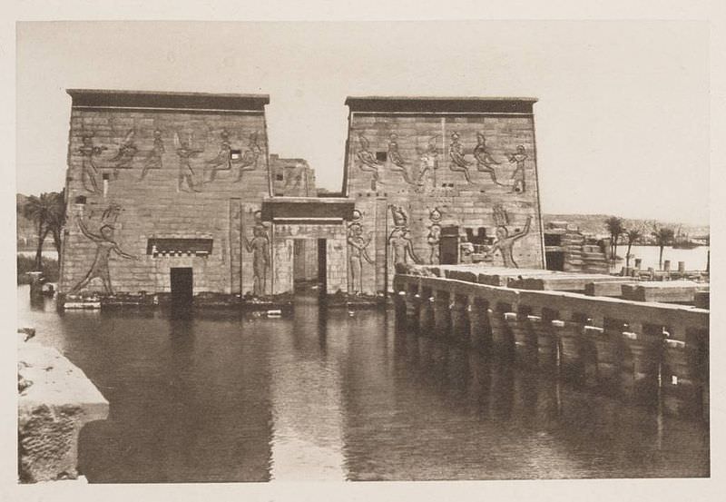
 The flooded Temple of Isis on the island of Philae circa 1905. ( Credit: Wikimedia Commons under an Attribution-Share Alike 2.5 license. Author H.W. Dunning).
Sirius was a key star for Egyptian astronomers. Identified with the goddess Isis, the Egyptian name for Sirius was Sopdet, the deification of Sothis. There is a line penned by the Greco-Roman scholar Plutarch which states:
“The soul of Isis is called ‘Dog’ by the Greeks.”
Political commentary? A mis-translation by Greek scholars? Whatever the case, the mythological transition from “Isis to Sothis to Dog Star” seems to have been lost in time.
These astronomer-priests noted that Sirius rose with the Sun just prior to the annual flooding of the Nile. The appearance of a celestial object at sunrise is known as a heliacal rising. If you can recover Sirius from behind the glare of the Sun, you know that the “Tears of Isis” are on their way, in the form of life-giving flood waters.
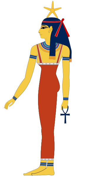
 Sopdet as the personification of Sirius (note the star on the forehead) Wikimedia Commons image under an Attribution Share Alike 3.0 license. Author Jeff Dahl).
In fact, the ancient Egyptians based their calendar on the appearance of Sirius and what is known as the Sothic cycle, which is a span of 1,461 sidereal years (365.25 x 4) in which the heliacal rising once again “syncs up” with the solar calendar.
It’s interesting to note that in 3000 BC, the heliacal rising of Sirius and the flooding of the Nile occurred around June 25th, near the summer solstice. This also marked the Egyptian New Year. Today it occurs within a few weeks of August 15th, owing to precession. (More on that in a bit!)
By the time of the Greeks, we start to see Sirius firmly referred to as the Dog Star. In Homer’s Iliad, King Priam refers to an advancing Achilles as:
“Blazing as the star that cometh forth at Harvest-time, shining forth amid the host of stars in the darkness of the night, the star whose name men call Orion’s Dog”
The Romans further promoted the canine branding for Sirius. You also see references to the “Dog Star” popping up in Virgil’s Aenid.
Over the years, scholars have also attempted to link the dog-headed god Anubis to Sirius. This transition is debated by scholars, and in his Star Names: Their Lore and Meaning, Richard Hinckley Allen casts doubt on the assertion.
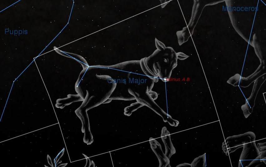
 Sirius as the shining “nose” of the constellation Canis Major. (Created by the author using Starry Night).
Ancient cultures also saw the appearance of Sirius as signifying the onset of epidemics. Their fears were well founded, as summer flooding would also hatch a fresh wave of malaria and dengue fever-carrying mosquitoes.
Making a seasonal sighting of Sirius is fun and easy to do. The star is currently low to the southeast in the dawn, and rises successively higher each morning as August rolls on.
The following table can be used to aid your quest in Sirius-spotting.
|
Latitude north
|
Theoretical date when Sirius can 1st be spotted
|
|
32°
|
August 3rd
|
|
33°
|
August 4th
|
|
34°
|
August 5th
|
|
35°
|
August 6th
|
|
36°
|
August 7th
|
|
37°
|
August 8th
|
|
38°
|
August 9th
|
|
39°
|
August 10th
|
|
40°
|
August 11th
|
|
41°
|
August 12th
|
|
42°
|
August 13th
|
|
43°
|
August 14th
|
|
44°
|
August 15th
|
|
45°
|
August 16th
|
|
46°
|
August 17th
|
|
47°
|
August 18th
|
|
48°
|
August 19th
|
|
49°
|
August 20th
|
|
50°
|
August 21st
|
Thanks to “human astronomical computer extraordinaire” Ed Kotapish for the compilation!
Note that the table above is perpetual for years in the first half of the 21st century. Our friend, the Precession of the Equinoxes pivots the equinoctial points to the tune of about one degree every 72 years. The Earth’s axis completes one full “wobble” approximately every 26,000 years. Our rotational pole only happens to be currently pointing at Polaris in our lifetimes. Its closest approach is around 2100 AD, after which the north celestial pole and Polaris will begin to drift apart. Mark your calendars—Vega will be the pole star in 13,727 AD. And to the ancient Egyptians, Thuban in the constellation Draco was the Pole Star!
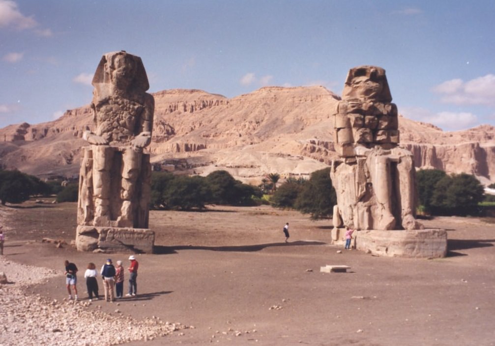
 The Colossi of Memnon Near Luxor, just one of the amazing architectural projects carried out by the ancient Egyptians. (Photo by author).
Keep in mind, atmospheric extinction is your enemy in this quest, as it will knock normally brilliant magnitude -1.46 Sirius a whopping 40 times in brightness to around magnitude +2.4.
Note that we have a nice line-up of planets in the dawn sky (see intro chart), which are joined by a waning crescent Moon this weekend. Jupiter and Mars ride high about an hour before sunrise, and if you can pick out Mercury at magnitude -0.5 directly below them, you should have a shot at spotting Sirius far to the south.
And don’t be afraid to “cheat” a little bit and use binoculars in your quest… we’ve even managed on occasion to track Sirius into the broad daylight. Just be sure to physically block the Sun behind a building or hill before attempting this feat!
 Sirius as seen via Hubble- can you spy Sirius B? (Credit: NASA/ESA Hubble image).
Of course, the heliacal rising of Sirius prior to the flooding of the Nile was a convenient coincidence that the Egyptians used to their advantage. The ancients had little idea as to what they were seeing. At 8.6 light-years distant, Sirius is the brightest star in Earth’s sky during the current epoch. It’s also the second closest star visible to the naked eye from Earth. Only Alpha Centauri, located deep in the southern hemisphere sky is closer. The light you’re seeing from Sirius today left in early 2005, back before most of us had Facebook accounts.
Sirius also has a companion star, Sirius B. This star is the closest example of a white dwarf. Orbiting its primary once every 50 years, Sirius B has also been the center of a strange controversy we’ve explored in past writings concerning Dogon people of Mali.
Sirius B is difficult to nab in a telescope, owing to dazzling nearby Sirius A. This feat will get easier as Sirius B approaches apastron with a max separation of 11.5 arc seconds in 2025.
Some paleoastronomers have also puzzled over ancient records referring to Sirius as “red” in color. While some have stated that this might overturn current astrophysical models, a far more likely explanation is its position low to the horizon for northern hemisphere observers. Many bright stars can take on a twinkling ruddy hue when seen low in the sky due to atmospheric distortion.
 Let the Dog Days of Summer (& astronomy) begin! (Photo by author).
All great facts to ponder during these Dog Days of early August, perhaps as the sky brightens during the dawn and your vigil for the Perseid meteors draws to an end!
https://www.universetoday.com/tag/nile-flooding-sirius/ |
|
|
|
|
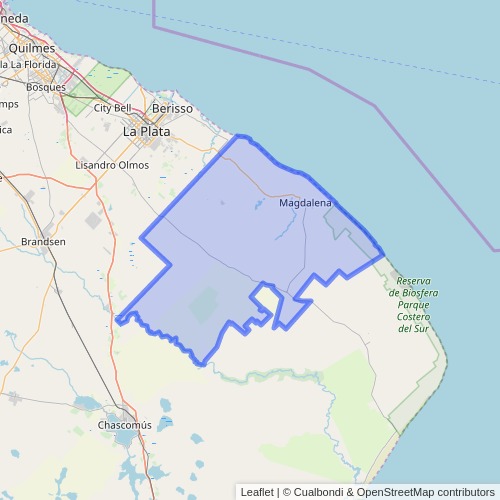
Magdalena (Buenos Aires)
Magdalena es la ciudad cabecera del partido homónimo, ubicada al este de la provincia de Buenos Aires, Argentina, a orillas del Río de la Plata.
La ciudad de Magdalena se halla a 106 km de Buenos Aires y a 49 km de distancia con la ciudad de La Plata.
Se encuentra en la coordenadas:  35°04′00″S 57°32′00″O y a 6 m s. n. m. 35°04′00″S 57°32′00″O y a 6 m s. n. m.
El partido de Magdalena limita al Norte con los existentes partidos de La Plata y Brandsen.
Cuenta con 26,734 habitantes (Indec, 2022), lo que representa un incremento del 39% frente a los 19,301 habitantes (Indec, 2010) del censo anterior.
| Gráfica de evolución demográfica de Magdalena entre 1869 y 2010 |
|
|
|
Fuentes: INDEC34567
|
Está constituido por tierras denominadas llanos, carentes de formaciones elevadas notorias. Pertenece al región de la pampa húmeda. Sus tierras son aptas para el cultivo y la cría de ganado, como así también para el asentamiento de humanos.
El suelo es rico en minerales y las napas subterráneas se encuentran a poca distancia de la superficie, lo que facilita la extracción de agua. En sus orígenes y hasta ahora, las aguas son aptas para el consumo humano.
Templado y húmedo. Lluvia anual: 1000 mm en el ciclo seco; y 1250 en el ciclo húmedo.
La región responde a las subfallas «del Río Paraná», y «del Río de la Plata», y a la falla de «Punta del Este», con sismicidad baja; y su última expresión se produjo el 5 de junio de 1888 (136 años), a las 3.20 UTC-3, con una magnitud aproximadamente de 5,0 en la escala de Richter (terremoto del Río de la Plata de 1888).8
La Defensa Civil municipal debe advertir sobre escuchar y obedecer acerca de
- Área de
- Tormentas severas, poco periódicas, con Alerta Meteorológico
- Baja sismicidad, con silencio sísmico de 136 años
La denominación del pago de la Magdalena se encuentra documentada por primera vez en un acta del Cabildo de Buenos Aires del 21 de marzo de 1611. A partir de la segunda fundación de Buenos Aires por Juan de Garay el 11 de junio de 1580, comienza la colonización de estas tierras, al distribuir parcelas entre quienes secundaron su empresa. Éstas se repartieron tomando como punto de partida el Valle de Santa Ana, que se encontraba en la actual entrada a la Ciudad de Magdalena.
En épocas prehistóricas, un brazo del mar cubría las costas del distrito: el mar Querandino, hace de 10.000 a 7.000 años, se internaba en el actual río Paraná, hasta la Ciudad de Santa Fe. Al retirarse el mar, dejó en seco grandes bancos de conchas marinas, conformando los yacimientos de conchillas, que a los costados de los caminos, hoy se observan a simple vista.
Siendo ésta, la característica principal del subsuelo de Magdalena. La mayoría de los moluscos marinos poseen un esqueleto duro por lo que este fósil se preserva por muchos años. Los fósiles de caracoles más comunes son: Zidona, Mactra, Tagelus, Erodona, Diodora, Ostrea, entre otros. De esas épocas llamadas del Holoceno (nuestros últimos 10 milenios) son los fósiles de mega fauna que se hallaron en el subsuelo magdalenense, como el toxodón (con aspecto de un toro con joroba), gliptodonte (similar a una mulita o peludo gigante), estegomastodón (es el antepasado del elefante), cuyos restos fósiles podemos ver en el Museo Histórico de Magdalena.
El Pago de la Magdalena se extendía desde el riachuelo hasta el río Salado, comprendiendo los actuales municipios de Avellaneda, Lanús, Lomas de Zamora, Quilmes, Esteban Echeverría, Ezeiza, Alte Brown, Berazategui, Florencio Varela, Ensenada, Berisso, La Plata, Chascomús, San Vicente, Gral Paz, Brandsen, Punta Indio y Magdalena. Más partes de los actuales Cañuelas, Monte y Castelli.
En Magdalena hay deportistas destacados en futbol, cómo Francisco Apaolaza, futbolista argentino que actualmente juega en Carabobo F.C (Venezuela). Guido Carrillo, jugador de Estudiantes de La Plata, Matías Pellegrini, actual jugador de Vélez Sarsfield. Cómo así también en sensei Gustavo Tata, supervisor de IOGKF Sudamérica desde 2008, jefe instructor de Karate Do IOGKF-ARGENTINA, Coordinador en Sudamérica en Goju Ryu-Karate Do IOGKF-ARGENTINA desde el 6 de agosto de 1999 hasta la fecha.
El primer edificio municipal fue construido en 1856 y estaba situado en la esquina de las calles Obligado y Pintos (actualmente Brenan e Yrigoyen). En 1877 se resuelve la construcción del actual Palacio Municipal, realizada por Pedro Cavalli, el edificio cuenta con dos plantas, la planta baja destinada a dependencias administrativas y en la planta alta se encuentra el salón de actos o recepciones, donde se realizaban fiestas y actividades sociales, un balcón terraza con techo sostenido por columnas, al igual que el interior del salón. Actualmente funcionan las dependencias y el recinto del Concejo Deliberante, conservando su mobiliario original, con sillones estilo Luis XVI realizados a fines del siglo xix.
Parroquia Santa María Magdalena
[editar]
La Primitiva Capilla, se inauguró el 20 de noviembre de 1776. La piedra fundamental del nuevo templo data del 3 de junio de 1860. En el libro de sesiones de la municipalidad de fecha 8 de mayo de ese año menciona que el padrino será el señor Sixto Fernández, elegido por unanimidad en dicha reunión, cuyo acto (el de la colocación de la piedra fundamental), debe realizarse el día 25 de mayo. Este renunció por razones de salud. Acto continuo se nombró al señor Juan F. Escribano. Del mismo libro, sesión del 28 de mayo de 1860. Se armaron cinco comisiones, una por cada cuartel de Magdalena, para levantar suscripciones de animales entre los vecinos a fin de juntar dinero para la obra del Templo. Cada vecino contribuiría con un animal.
El ilustre párroco que tuvo fue Manuel Máximiliano Alberti, en 1790 se lo nombró cura y vicario interino del partido de la Magdalena (Buenos Aires, 28 de mayo de 1763 – 31 de enero de 1811), fue un sacerdote de Buenos Aires, en los tiempos en que la actual ciudad argentina formaba parte del Virreinato del Río de la Plata. Formó parte de la Primera Junta que reemplazó a las autoridades españolas tras la Revolución de Mayo.
Por Ley 11.512 de 1994, sancionada por el Honorable Senado y Cámara de Diputados de la Provincia de Buenos Aires, se declara Monumento Histórico Provincial al Templo Parroquial de Magdalena, testimonio arquitectónico del curato de la Magdalena.
La Ciudad de la Misericordia
[editar]
La primera «Ciudad de la Divina Misericordia» se encuentra en la Argentina en la localidad de Magdalena, Provincia de Buenos Aires, y fue declarada por el que ahora es San Juan Pablo II (El Papa de la Misericordia y La Familia) fue gracias a los esfuerzos del entonces párroco de la iglesia Santa María Magdalena, Monseñor Ángel Diamante D'Auro; allí se venera la réplica de la imagen original de Jesús Misericordioso que en 1934 pintara Eugeniusz Kazimirowski en Vilnus según las indicaciones de Santa Faustina Kowalska; en un templo de un esplendor maravilloso en el que se respira la espiritualidad y al que se puede llegar fácilmente por la Ruta 11 desde la Ciudad de La Plata, Arquidiócesis a la que pertenece la Parroquia.
El actual cura párroco de Magdalena es el presbítero Alfredo López Morilla.
Inaugurado el 22 de julio de 1899. En realidad es la casa social de la Sociedad Española de Socorros Mutuos. Su primer Presidente fue Pedro Goenaga y en el momento de la construcción del edificio e inauguración la institución fue presidida por Carmelo Egues. La piedra fundamental fue colocada el 1 de enero de 1896, constaba de una caja de hierro que contenía el acta firmada por los padrinos, por la comisión y los socios presentes, más un ejemplar del Correo Español, un periódico local, monedas, medallas, un reglamento y una memoria de la sociedad. Todo esto colocado en otra caja de madera. Esta sociedad se conforma a partir de un grupo de inmigrantes, los que comenzaron a asociarse para “autoformar” la sociedad y reconstruir dos de los más importantes poderes que quedan fuera de la órbita del Estado o del mercado: el poder social que suponen los principios de solidaridad y el mantenimiento de la memoria de los orígenes de la patria que se ha dejado.
Así logran generar, a través de la ayuda mutua entre sus miembros, la reducción de la vulnerabilidad personal, así como paliar la incertidumbre que la inserción en una nueva sociedad ocasiona.
En el momento de la erección de la Capilla (1776), frente a la misma se fue creando un lugar de esparcimiento. Para el año 1826 el Arq. Saubidet realiza el trazado del primer egido, en él la plaza ocupaba dos manzanas, la actual y la que ocupa el Centro Cultural.
Durante la administración de Lázaro Miranda (1869) se colocó una pirámide en alusión a la Pirámide de Mayo.
A comienzos del siglo xx se coloca una fuente de mármol con peces de colores e hipocampos.
Actualmente está rodeada por los principales edificios de la ciudad. Espacio verde con valiosos elementos decorativos como los copones, la fuente, un retoño del olivo de Jerusalén e importante monumento al Gral. José de San Martín inaugurado el 7 de mayo de 1949.
Centro Cultural Municipal
[editar]
Se inaugura el 27 de septiembre de 1997 la primera etapa que incluía el Museo, la oficina de turismo, sala de exposiciones y talleres. Posteriormente en el año 2004 se traslada al mismo la Dirección de Cultura, Prensa y Deporte de la Municipalidad de Magdalena.
Reserva de Biósfera Parque Costero del Sur y Reserva Natural Provincial El Destino
[editar]
En el Partido bonaerense de Magdalena está el Parque Costero Sur de administración estatal nacional, una franja de 23500 hectáreas declarada Reserva Mundial de la Biosfera por la UNESCO, porque conserva relictos de lo que fue el ambiente natural del nordeste bonaerense. Tocando el parque costero en su límite sur, se encuentra La reserva Natural El Destino, una reserva de 1500 hectáreas de administración privada.910
A 17 km de Madgalena, por la R.P. 11 se accede a esta Reserva Ecológica.
Son varias las instituciones sociales y de fomento (Sociedad Italiana, Sociedad Española), deportivas (Club Social Deportivo y Fomento Villa Garibaldi, Club Social Deportivo Unión y Fuerza, Club Sport) y sobre todo folclóricas y tradicionalistas (La Totora y Gauchos de Magdalena) en la ciudad de Magdalena. Otra institución es el Club Social y Deportivo Atalaya, si bien queda en la localidad de Atalaya, es dentro del partido de Magdalena.
|
|
|
|
|
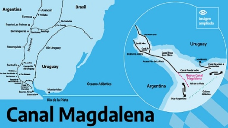
Con la obra del Canal Magdalena, la Argentina avanzará hacia el fortalecimiento de la soberanía nacional y podrá impulsar aún más las economías regionales. Para esa importante tarea, el Gobierno dio el puntapié inicial creando una unidad ejecutora especial con el objetivo de asistir y asesorar en el llamado, adjudicación y firma de contrato de la licitación pública nacional e internacional para la ejecución de las tareas de dragado, señalización y mantenimiento del sistema de esa vía de navegación.
Al respecto, en dialogo con este medio, el presidente del Centro de Ex Combatientes Islas Malvinas de La Plata y profesor del Seminario Malvinas Comunicación y Nación de esta casa de estudios Rodolfo Carrizo consideró: “Venimos participando de diferentes foros y múltiples debates sobre el Canal Magdalena, y entendemos que el dragado, el mantenimiento y posibles mejoras son de una importancia estratégica y geopolítica para el presente y futuro de nuestra Nación”.
El titular del Cecim añadió que “esas acciones cobran mayor importancia si se las piensa en el contexto de consolidar la soberanía marítima y como un vínculo indispensable con las vías navegables de todo el territorio nacional y el Atlántico Sur”.
Cabe señalar que las obras planteadas permitirán a los buques contar con una nueva conexión directa entre el sistema fluvial y el océano, que se desarrollará por aguas de jurisdicción nacional y la traza consistirá en un canal rectilíneo a desarrollarse en un sector del Río de La Plata. De esta forma, el país contará con una salida directa al Atlántico que potenciará el federalismo portuario facilitando el acceso a los puertos nacionales.
“Desde el Cecim La Plata ratificamos la legitimidad de promover este debate para la ejecución de esta importante obra, donde la misma le brindará al pueblo argentino una oportunidad de construir un horizonte previsible de múltiples convenios económicos, trabajo genuino y soberanía económica”, explicó Carrizo.
El docente y titular del Centro agregó que “la Argentina tiene una oportunidad en la construcción del Canal Magdalena que es imperativo capitalizar, divulgar y promocionar por su importancia geoestratégica y geoeconómica, una oportunidad para la integración física de los ríos con el mar y a la vez de los pueblos del Cono Sur”.
La proyección de esta obra, que tiene una inversión millonaria, es de dos años y se constituye en una política pública para el desarrollo de la soberanía argentina.
https://perio.unlp.edu.ar/2021/02/09/canal-de-magdalena-una-salida-estrategica-al-atlantico/ |
|
|
 Primer
Anterior
25 a 39 de 39
Siguiente Primer
Anterior
25 a 39 de 39
Siguiente
 Último
|
|
| |
|
|
©2025 - Gabitos - Todos los derechos reservados | |
|
|


 Flip
Flip