.jpg)

.jpg)


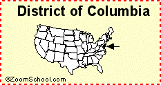
Many wonder about the meaning behind the term ‘District of Columbia’. What does it stand for in Washington, D.C.? Many people don’t know the genesis of the the city on the Potomac River, the seat of our federal government. The ‘District of Columbia’ has a rich history, with its name having significance that many might not be aware of. After you read this, you’ll know how land taken from both Maryland and Virginia became our capital city, now just 68.3 square miles.
The Residence Act passed on July 6th 1790, giving President Washington the task of placing the capital on the Potomac. The cities of Georgetown, Alexandria and other smaller settlements like Carrollsburg, Hamburg, and Tennally’s Town fell into the new capital territory.
Congress recognized that Washington’s family owned significant property in and near Alexandria. To reduce conflicts of interest, they prohibited federal buildings from being erected on land within the new District that was formerly part of Virginia.
Today, we take the city’s name, streets, and layout for granted, but in the late 18th century, it was all just being planned. George Washington referred to the new capital as “the Federal City” until a meeting in Georgetown on September 9, 1791.
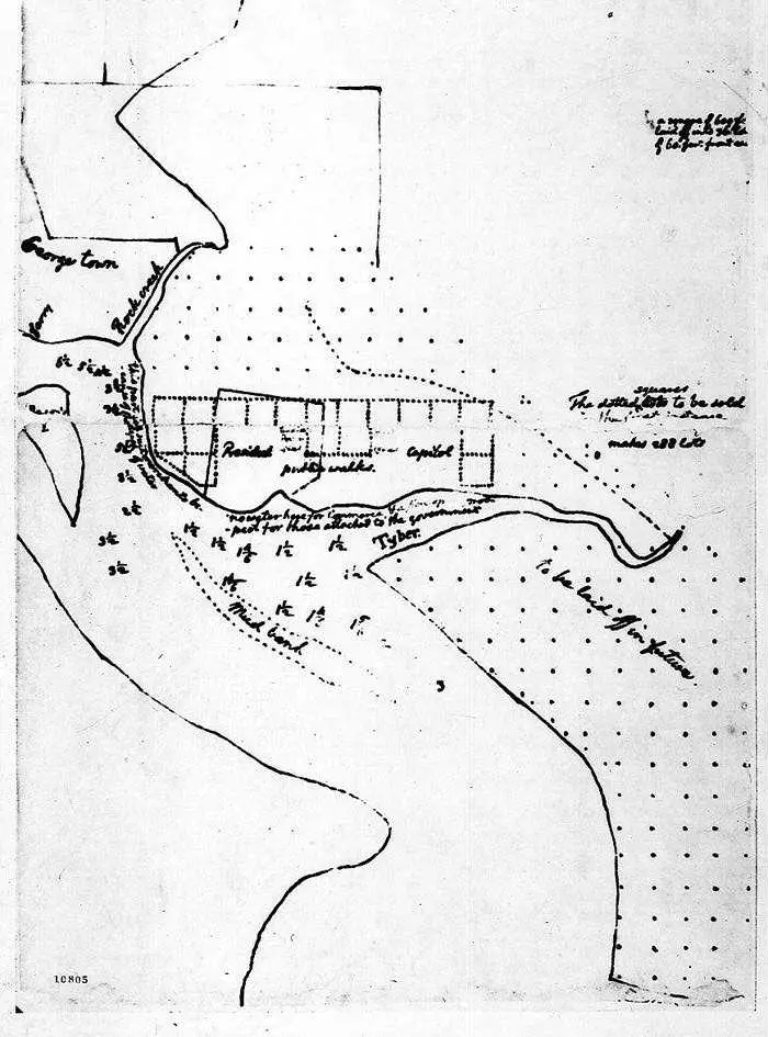 sketch of new federal capital by Thomas Jefferson (March 1791)
First Referred to as “the Federal City”
In attendance were three men important to our history: Thomas Johnson, David Stuart, and Daniel Carroll. Below is a letter that resulted from that meeting, wherein the city received its permanent name. The three men were writing to french born Pierre L’Enfant.
Sir: We have agreed that the Federal District shall be called ‘The Territory of Columbia,’ and the Federal City the ‘City of Washington.’ The title of the map will therefore be, ‘A Map of the City of Washington in the Territory of Columbia.’
We have also agreed that the streets be named alphabetically one way and numerically the other, the former to be divided into north and south, and the latter into east and west numbers from the Capitol. Major Ellicott, with proper assistance, will immediately take, and soon furnish you with, the soundings of the Eastern Branch, to be inserted in the map. We expect he will also furnish you with the proposed post road, which we wish to be noticed in the map.
We are respectfully yours,
Thomas Johnson
David Stuart
Daniel Carroll
Pierre L’Enfant Plans the New Capital
L’Enfant followed his orders, and his resulting design is largely what we see in our city today. Below is his map, titled “Plan of the City intended for the Permanent Seat of the Government of the United States…” Click on the map for greater details. You’ll notice that Rock Creek is labeled Pine Creek on the map.
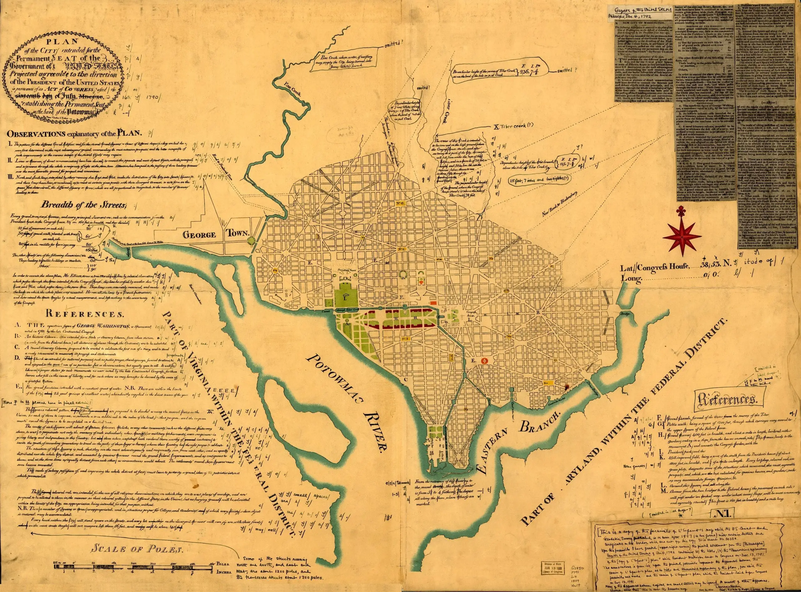 Plan of the city intended for the permanent seat of the government of the United States…
Source: Library of Congress
Why is it Called the ‘District of Columbia’ and Not Washington, TC?
Back to the naming of the City of Washington and the Territory of Columbia. The city was named to honor our first president, George Washington. The latter, you may not know, is for Christopher Columbus, who “discovered” the New World. “Columbia” is the feminine form of Columbus. “Territory” was dropped in favor of “District” when the District of Columbia was incorporated as one entity in 1871 with the Organic Act. That’s why we’re DC, not Washington, TC. That would be weird.
So there you have it, the origins of our city’s name: Washington, D.C.