|
|
General: EL LIBRO DEL MORMON...
Elegir otro panel de mensajes |
|
|
| De: concursante (Mensaje original) |
Enviado: 30/09/2012 19:52 |
|
Para los que les guste leerlo... |
|
|
|
|

salt lake city=alchemy (salt)=dollar=$= LOT S WIFE(SODOMA AND GOMORRA)
Cathedral of the Madeleine
From Wikipedia, the free encyclopedia
The Cathedral of the Madeleine is a Roman Catholic church in Salt Lake City, Utah, United States. It was completed in 1909 and currently serves as the cathedral, or mother church, of the Diocese of Salt Lake City. It is the only cathedral in the U.S. under the patronage of St. Mary Magdalene.
Description[edit]
The cathedral was built under the direction of Lawrence Scanlan, the first bishop of Salt Lake City, who dedicated it to St. Mary Magdalene.[2] It was designed by architects Carl M. Neuhausen and Bernard O. Mecklenburg. The exterior is predominantly a Neo-Romanesque design, while the inside displays more Neo-Gothic details. Construction began in 1900 and was completed in 1909. It was dedicated by James Cardinal Gibbons, Archbishop of Baltimore.
It is theorized that Bishop Scanlan chose Mary Magdalene as the patron saint of the Diocese of Salt Lake because her feast day is on July 22, two days before Pioneer Day, a celebration commemorating the arrival of the Mormon pioneers in Salt Lake Valley, so that Catholics would have something to celebrate alongside the region's dominant faith.[3]
The interior of the cathedral was created under the direction of Joseph S. Glass, the second bishop of Salt Lake. Bishop Glass enlisted John Theodore Comes, one of the preeminent architects in the country, to decorate the interior of the cathedral. His plans for the interior were largely based upon the Spanish Gothic style. The colorful murals and polychrome were added at this time, as were the ornate shrines. In 1916, Bishop Glass also changed the name of the cathedral to the French spelling after visiting her purported tomb.[2]
In the 1970s, the exterior of the building was restored, and between 1991 and 1993, the interior of the cathedral was renovated and restored under Bishop William K. Weigand. This included not only the removal of dust and dirt and restoration of the interior but also changes to the liturgical elements of the cathedral to bring them into conformity with certain widespread changes in liturgical practice that developed after the Second Vatican Council.
This included constructing a new altar, moving the cathedra, creating a separate chapel for the Blessed Sacrament, and adding an ample baptismal font. The Blessed Sacrament Chapel also contains the tomb of Bishop Scanlan.[4] Resting atop the tomb is a case containing a small relic of Saint Mary Magdalene. The cathedral in Salt Lake City and the Basilica of Saint-Maximin-la-Sainte-Baume in France are the only cathedrals in the world holding first-class relics of the saint and are named in her honor.[5] The major restoration of the interior of the cathedral was accomplished through the vision of Monsignor M. Francis Mannion.[6]
The cathedral is home to the only co-educational Catholic Choir School in the United States. The Madeleine Choir School, established in 1996, now serves over 400 students in Pre-Kindergarten through Grade Eight.[7] The Cathedral Choir has recorded several CDs and routinely tours both nationally and internationally. In addition to singing daily services at the Cathedral of the Madeleine, choristers have sung at St. Peter's Basilica (Vatican City), Notre Dame de Paris (France), and in churches across the United States of America, Spain, Italy, France, Belgium, and Germany, among other places.[8]
Composer Amédée Tremblay notably served as the church's organist from 1920 to 1925.[9]
-
-
Cathedral of the Madeleine, looking east
-
Interior of the cathedral
-
   |
|
|
|
|
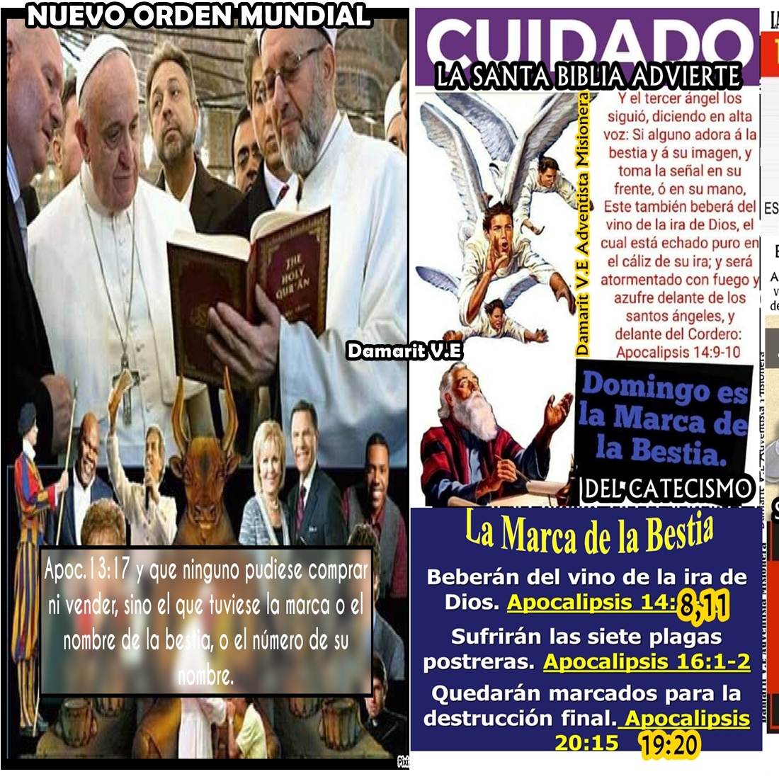
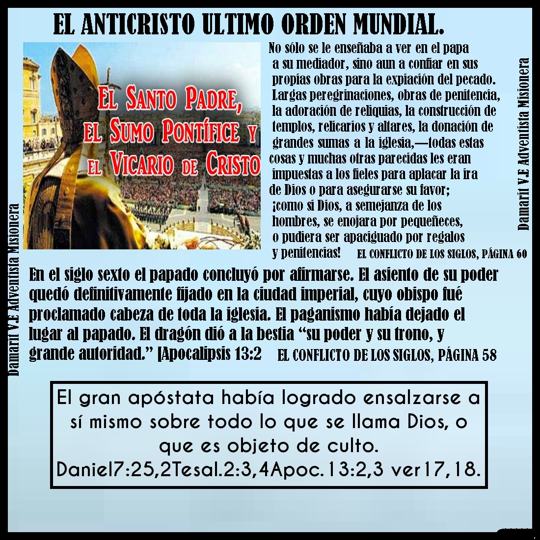
| LIBRO MORMON ES PARTE DE LA GRAN RAMERA VATICANEL PAPADO VATICANO APOCALIPSIS 17:1 Vino entonces uno de los siete ángeles que tenían las siete copas, y habló conmigo diciéndome: Ven acá, y te mostraré la sentencia contra la gran ramera, la que está sentada sobre muchas aguas
Apocalipsis (de Juan) 17-> Ver. 1
[V.1-> Uno de los siete ángeles. Ver com. Ap 1:11; cf. Ap 21:9. La identificación de este ángel, como uno de los ángeles portadores de las siete plagas de los cap. 15 y 16, sugiere que la información que está por darse a Juan se relaciona con las siete últimas plagas. Esta relación se confirma por el hecho de que el tema anunciado para este capítulo -“la sentencia contra la gran ramera”- tendrá lugar durante la séptima plaga (Ap 16:19). Copas. Ver com. Ap 15:7; Ap 16:1. Habló conmigo. La palabra griega traducida “con” (meta) puede entenderse como una relación íntima entre Juan y el ángel. Quizá el ángel se dirigió a Juan antes de transportarlo en visión. Ver com. Ap 1:2; Ap 1:10 Ven acá. La expresión es una orden, un imperativo. Ver com. Ap 17:3. Te mostraré. Ver com. Ap 1:2; Ap 4:1. La sentencia. Gr. kríma, “sentencia”, “decisión”, “veredicto”, “decreto”, en este caso del tribunal divino en cuanto a la “gran ramera” debido a su conducta criminal (ver com. Ap 17:4-6; cf. com. Ap 18:10). Nótese que el ángel no le muestra a Juan la ejecución de la sentencia, pues en tal caso hubiera usado la palabra krísis, que se traduce “ juicio” en el Ap 18:10. Simplemente le informa de lo que sucederá. Krísis puede indicar la investigación de un caso o la ejecución de una sentencia. Ver com. Ap 16:19; Ap 18:5; Ap 19:2; cf. Isa 23:11. El cap. 17 se divide en dos partes: (1) la visión simbólica que Juan contempló, Ap 17:3-6, y (2) lo que se le dijo como explicación, según se registra en los Ap 17:7-18. La primera parte expone los crímenes de Babilonia, y por lo tanto constituye las acusaciones del cielo, o la declaración de por qué se pronuncia sobre ella la sentencia divina (ver com. Ap 17:6). La segunda parte presenta la sentencia y cómo se ejecutará. La carrera criminal de Babilonia llegará a su culminación durante la sexta plaga (ver com. Ap 16:12-16), mientras que la sentencia que se decreta, se ejecutará durante la séptima plaga (ver com. Ap 16:17-19; Ap 17:13-17; Ap 18:4; Ap 18:8; Ap 19:2). Por lo tanto, la primera parte se relaciona más particularmente con los acontecimientos de la sexta plaga, y la segunda parte con los de la séptima. De modo que el cap. 17 es un bosquejo de la crisis final, cuando Satanás dedicará su esfuerzo supremo a la aniquilación del pueblo de Dios (cf. Ap 12:17), cuando todos los poderes de la tierra se pondrán en orden de batalla contra él (cf. CS 692). Dios permitirá que Satanás y sus aliados lleven adelante su 863 plan de aniquilar a los santos y lleguen hasta el punto de casi tener éxito en su empeño; pero cuando llegue el momento de dar el golpe final, Dios intervendrá para librar a su pueblo. Las huestes del mal, que son detenidas en el mismo acto de intentar matar a los santos, quedarán sin excusa delante del tribunal de justicia divina (ver Dan 12:1; cf. PE 282-285; CS 693-694; NB 128-129). No es entonces de extrañarse que Juan se maravillara al contemplar la culminación del gran drama del misterio de iniquidad (ver com. Ap 17:6). Ramera. Gr. pórn’, “prostituta”, “ramera”. Pórn’ quizá tenga su origen en una palabra que significa “vender” o “exportar para la venta” objetos como esclavos. En Grecia las prostitutas generalmente eran esclavas compradas. Los profetas del AT a menudo comparan con una mujer adúltera al Israel apóstata que repetidas veces “fornicaba” yendo tras dioses paganos (Eze 23:30; cf. Isa 23:17; ver com. Eze 16:15). En cuanto a la comparación de la Babilonia simbólica con una ramera, ver com. Ap 17:5 (cf. Ap 17:2; Ap 17:4; Ap 19:2); y en cuanto a pasajes del AT cuyo sentido o palabras sean similares con los de Apoc. 17, ver com. Isa 47:1; Jer 25:12; Jer 50:1; Eze 26:13. Está sentada sobre muchas aguas. O sea que ejerce un poder despótico sobre muchos “pueblos” y “naciones” (Ap 17:15). La flexión del verbo griego presenta a la “gran ramera” ejerciendo su poder en forma continuada. La antigua ciudad de Babilonia estaba situada junto a las aguas del río Eufrates (ver com. Jer 50:12; Jer 50:38), moraba simbólicamente “entre muchas aguas” o pueblos (Jer 51:12-13; cf. Isa 8:7-8; Isa 14:6; Jer 50:23), así también a la Babilonia moderna se la presenta sentada o viviendo sobre los pueblos de la tierra, u oprimiéndoles (cf. com. Ap 16:12), ]
 .jpg)
|
|
|
|
|
|
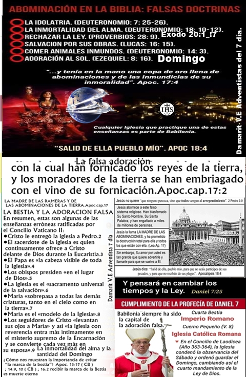 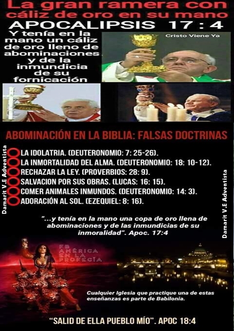 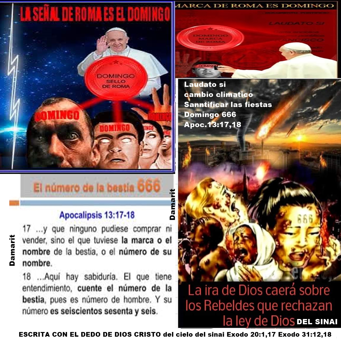  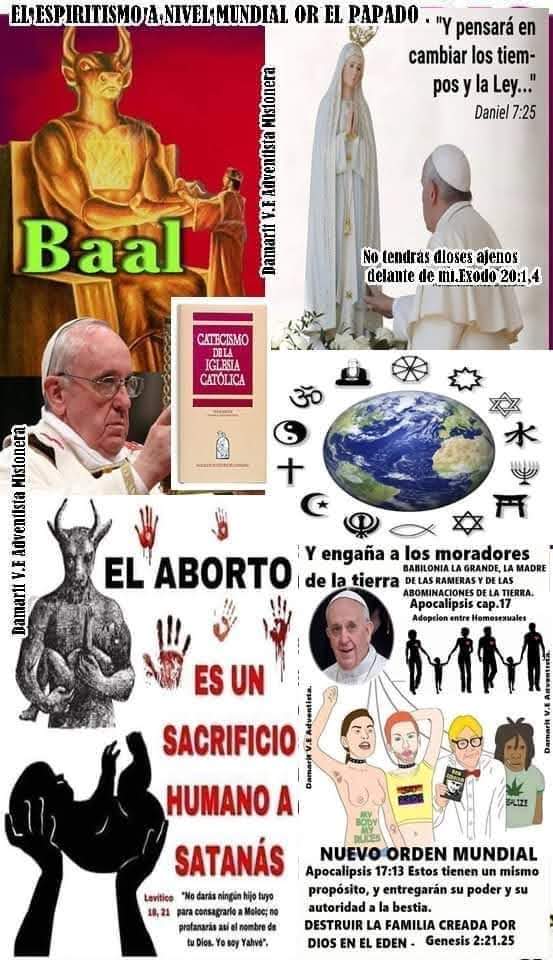
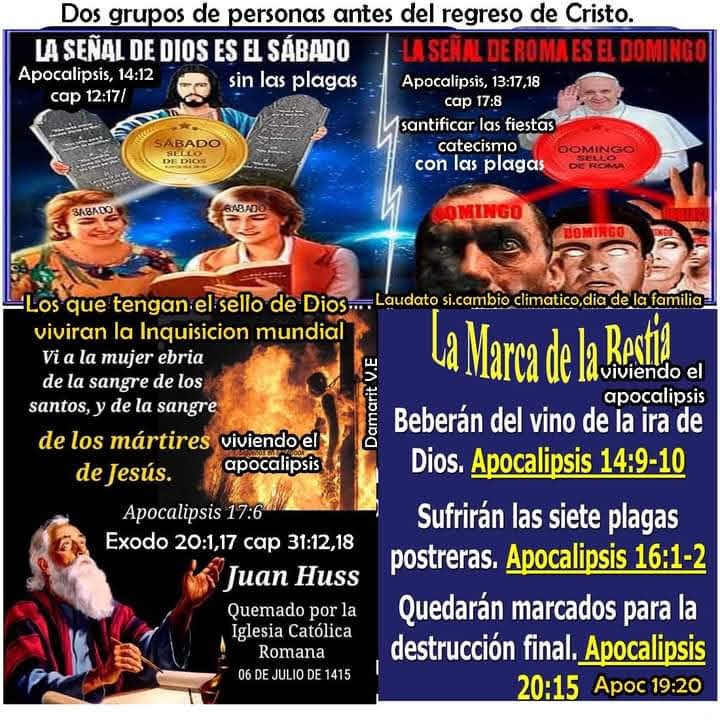 
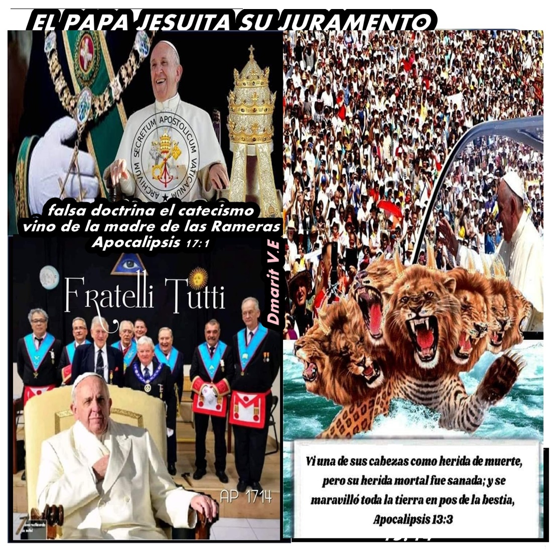
APOCALIPSIS 17: 2 con ella fornicaron los reyes de la tierra, y los habitantes de la tierra se embriagaron con el vino de su prostitución.»
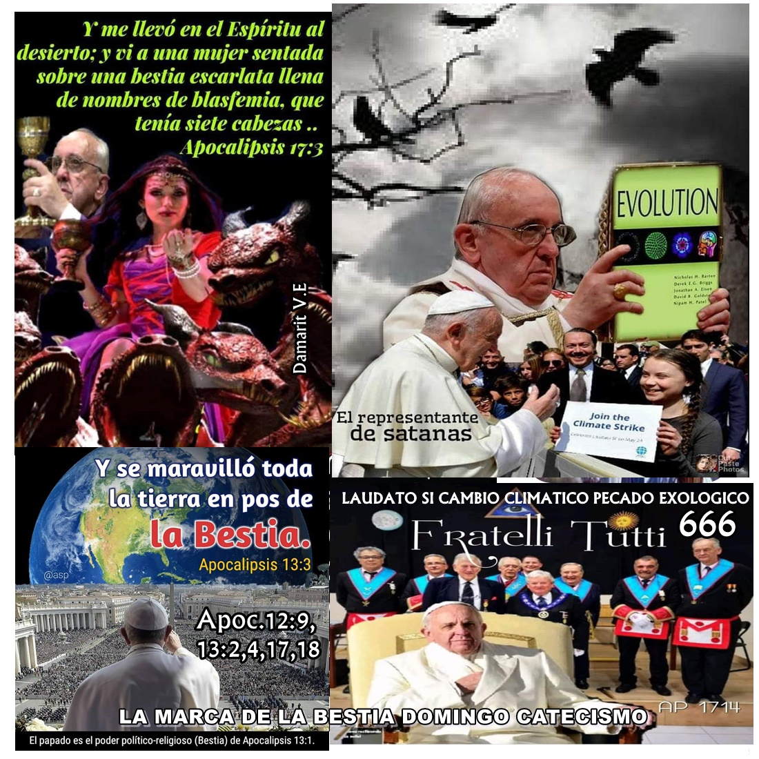
3 Me trasladó en espíritu al desierto. Y vi una mujer, sentada sobre una Bestia de color escarlata, cubierta de títulos blasfemos; la Bestia tenía siete cabezas y diez cuernos.
4 La mujer estaba vestida de púrpura y escarlata, resplandecía de oro, piedras preciosas y perlas; llevaba en su mano una copa de oro llena de abominaciones, y también las impurezas de su prostitución,
5 y en su frente un nombre escrito - un misterio -: «La Gran Babilonia, la madre de las rameras y de las abominaciones de la tierra.
Apocalipsis (de Juan) 17-> Ver. 2
[V.2-> Han fornicado. Gr. pornéuō, verbo afín de pórn’ (ver com. Ap 17:1). Esta expresión equivale a “fornicar” en el AT (cf. Eze 23:30; Ose 4:12). Usada en sentido figurado, como aquí, se refiere a una alianza ilícita de los falsos cristianos con otro señor que no es Cristo. En este caso una unión político- religiosa entre una iglesia apóstata (ver com. Ap 17:5) y las naciones de la tierra. Cf. Isa 23:15; Isa 23:17. Reyes de la tierra. Es decir, poderes políticos (ver com. Ap 17:12) que pondrán su autoridad y sus recursos a disposición de la “gran ramera” (Ap 17:1; ver com. Ap 17:13), y por medio de los cuales ella intentará cumplir su propósito de matar a todo el pueblo de Dios (ver com. Ap 17:6; Ap 17:14) y gobernar a los “moradores de la tierra” (cf. Ap 17:8). Los “reyes de la tierra” serán sus cómplices en ese crimen. Los moradores. Los habitantes de la tierra serán engañados (cf. com. Ap 17:8) para que cooperen con la política de la gran ramera (cf. Ap 13:8). Este engaño se deberá al proceder de los dirigentes religiosos. Embriagado. Una embriaguez completa. Las facultades normales de la razón y el juicio quedarán embotadas y la percepción espiritual entorpecida. Cf. Jer 51:7; 2Ts 2:9-10; Ap 13:3-4; Ap 13:7; Ap 13:18; Ap 14:8; Ap 18:3; Ap 18:23; Ap 19:20. Nótese que esta embriaguez de los moradores de la tierra se menciona después de referirse a la alianza ilícita entre Babilonia y los reyes de la tierra. Sin duda Babilonia obrará por intermedio de los reyes de la tierra para poder dominar a quienes no se han sometido a ella voluntariamente. Son engañados los gobernantes y los gobernados (CS 682). Con el vino. O sea al beber el vino. Este “vino” es la política engañosa de Satanás para someter a todo el mundo bajo su dominio, además de las mentiras y las “señales” con las cuales promueve su política (cf. Ap 13:13-14; Ap 18:23; Ap 19:20). De su fornicación. O, es decir, “su prostitución”. La alianza entre el cristianismo apóstata y los poderes políticos de la tierra, es el medio por el cual Satanás se propone unir al mundo bajo su liderazgo. ]
Apocalipsis (de Juan) 17-> Ver. 3
[V.3-> Me llevó. La sensación de movimiento tenía sin duda el propósito de ayudar a Juan a hacer la transición mental desde su tiempo y lugar hasta el tiempo y lugar del cumplimiento de la visión (cf. Eze 3:12-14; Eze 8:3; Eze 40:2-3; Ap 21:10). En el Espíritu. Literalmente “en espíritu” (ver com. Rev_1 10; cf. Ap 4:2; Ap 21:10). La ausencia del artículo definido destaca la cualidad o naturaleza de esta experiencia. Al desierto. Gr. ér’mos, “lugar desolado” (ver com. Ap 12:6). El verbo afín que se usa en Ap 17:16, significa “desolar”, “desnudar”, “abandonar”. Un “desierto” era una región deshabitado donde un ser humano podía sostenerse con dificultad y peligro, un lugar donde el alimento y aun el agua eran difíciles de obtener y se corría el peligro de fieras y quizá de asaltantes. Por esta razón algunos consideran. 864 que cuando “desierto” se usa simbólicamente como aquí, se refería a una situación llena de dificultades y peligros, evidentemente para el pueblo de Dios (cf Ap 17:6; Ap 17:14). La ausencia del artículo definido antes del sustantivo “desierto”, hace que el término sea claramente cualitativo y descriptivo; en otras palabras, especifica una condición antes que una ubicación particular. En vista de que el cap. 17 parece tratar más particularmente con el tiempo de las siete plagas postreras (ver com. Ap 17:1), algunos sostienen que este “desierto” simboliza la situación del pueblo de Dios durante ese tiempo. La situación que aquí se describe es semejante, aunque no idéntica, a la del “desierto” del Ap 12:6; Ap 12:13-16. Mujer. Los profetas del AT repetidas veces comparan al pueblo de Dios que ha apostatado con una ramera (cf. Eze 16:15-58; Eze 23:2-21; Ose 2:5; Ose 3:1; etc.). Esta “mujer” la “gran ramera” (Ap 17:1), la simbólica “Babilonia la grande” (Ap 17:5) -, es culpable de “la sangre... de todos los que han sido muertos en la tierra” (Ap 18:24) sin duda a través de la historia. La Babilonia simbólica constituye la oposición religiosa organizada contra el pueblo de Dios, probablemente a través de toda la historia pero aquí específicamente en el tiempo del fin (ver com. Ap 17:5). Sentada. La flexión del verbo denota una acción continuada. En el Ap 17:1 se presenta a la “gran ramera” ejerciendo dominio religioso directo sobre los seres humanos; aquí, dirigiendo la política del gobierno civil (ver com. Ap 17:18). Una característica continua del cristianismo apóstata ha sido la de unir la iglesia con el Estado para consolidar el dominio religioso sobre la política (cf. t. IV, p. 863). Compárese con la declaración de nuestro Señor de que su “reino” no es “de este mundo” (Jn 18:36). Bestia. En la profecía bíblica las bestias generalmente representan poderes políticos (Dan 7:3-7; Dan 7:17; Dan 8:3; Dan 8:5; Dan 8:20-21 ; cf. Ap 12:3; Ap 13:1). El color de esta bestia puede insinuar que es el compendio del mal, así como los nombres de blasfemia que la cubren indican que se opone a Dios. Por lo tanto, esta bestia puede ser identificada como Satanás que obra por medio de esos instrumentos políticos, que se han sometido a su dominio a través de la historia. Esta bestia se parece en ciertos aspectos al gran dragón bermejo del Ap 12:3, y en otros, a la bestia semejante a un leopardo del Ap 13:1-2 (ver los comentarios respectivos). El contexto hace parecer más estrecha esta última relación. La diferencia principal entre la bestia del cap. 13 y la del cap. 17 es que en la primera, que se identifica con el papado, no se hace distinción entre los aspectos religioso y político del poder papal, mientras que en la segunda los dos son distintos: la bestia y la mujer representan al poder político y religioso respectivamente. Escarlata. O “carmesí”, un color brillante que llama la atención. En Isa 1:18 el carmesí es el color del pecado. Compárese con el “gran dragón escarlata” de Ap 12:3. Llena. La apostasía y la oposición a Dios serán totales. Nombre de blasfemia. O “nombres blasfemos” (ver com. Mar 2:7; Mar 7:22). En Ap 13:1 (ver el comentario respectivo) los nombres están sobre las siete cabezas; aquí se hallan esparcidos por toda la bestia. Estos nombres indican el carácter de la bestia, intenta usurpar las prerrogativas de la Deidad. El hecho de que esté “llena” de nombres blasfemos, indica que está completamente dedicada a lograr sus propósitos. Cf. Isa 14:13-14; Jer 50:29; Jer 50:31; Dan 7:8; Dan 7:11; Dan 7:20; Dan 7:25; Dan 11:36-37. Siete cabezas. Ver com. Ap 17:9-11. En cuanto a la bestia de siete cabezas en la mitología antigua, ver com. Isa 27:1. Diez cuernos. Ver com. Ap 17:12-14; Ap 17:17. ]
Apocalipsis (de Juan) 17-> Ver.
[V.4-> La mujer. Ver com. Ap 17:3. Púrpura y escarlata. Cf. Eze 27:7; Ap 18:7; Ap 18:12; Ap 18:16-17; Ap 18:19. Estos eran los colores de la realeza (ver com. Mat 27:28) que esta “mujer” pretenderá tener (cf. Ap 18:7). El color escarlata también puede considerarse como el distintivo del pecado y también el de una prostituta (ver com. Ap 17:3). Esta prostituta u organización religiosa apóstata, descrita en todo su carácter seductor, está vestida con ostentación y adorno excesivo. Contrasta agudamente con la “novia” del Cordero, que Juan vio ataviada con lino fino, limpio y blanco (Ap 19:7-8; cf. 1T 136; Ed 242). Ver com. Luc 16:19. Abominaciones y de la inmundicia de su fornicación. O “actos inmundos, es decir la suciedad que es su fornicación”. El oro del cáliz engañará a los seres humanos en cuanto a la naturaleza de su contenido. Ver com. Ap 17:2. ]
Apocalipsis (de Juan) 17-> Ver.
[V.5-> Frente. El carácter que refleja el nombre 865 “Babilonia” ha sido escogido deliberadamente por la mujer. Esto puede deducirse porque el nombre aparece en su frente. Cf. com. Ap 13:16. Un nombre escrito. O “un nombre que queda escrito”; había sido escrito allí en el pasado, y allí permanece. El nombre refleja su carácter. Misterio. Esta palabra describe el título, no es el título; de allí lo apropiado del término “Babilonia simbólica” (ver com. Ap 1:20). BABILONIA LA GRANDE. La Babilonia simbólica puede considerarse en cierto sentido como una representación de los sistemas religiosos apóstatas a través de la historia; pero “Babilonia la grande” simboliza en un sentido especial a las religiones apóstatas que se unirán en el tiempo del fin (ver com. Ap 14:8; Ap 16:13-14; Ap 18:24). En el Ap 17:18 se llama a la Babilonia simbólica “la gran ciudad” (cf. Ap 16:19; Ap 18:18); pero ahora es llamada “la grande” porque este capítulo trata más particularmente con el gran esfuerzo final de Satanás para lograr la lealtad de la raza humana por medio de la religión. “Babilonia la grande” es el nombre con el que la Inspiración se refiere a la gran triple unión religiosa del papado, el protestantismo apóstata y el espiritismo (ver com. Ap 16:13; Ap 16:18-19; cf. com. Ap 14:8; Ap 18:2; cf. CS 645;Dan 4:30; Zac 10:2-3; Zac 11:3-9). El nombre “Babilonia” se refiere a las organizaciones y a sus dirigentes, y no tanto a sus miembros, los cuales son llamados “muchas aguas” (Ap 17:1; Ap 17:15) y los “moradores de la tierra” (Ap 17:2; cf. Ap 17:8). MADRE DE LAS RAMERAS. Como ya se hizo notar, “Babilonia la grande” incluye al protestantismo apóstata en el tiempo que aquí se considera; por lo tanto, las hijas de esta “madre” son las diversas organizaciones religiosas que componen el protestantismo apóstata. ABOMINACIONES. Ver com. Ap 17:4. ] BABILONIA APOCALIPSIS 16:13,14 .
Apocalipsis (de Juan) 16-> Ver.
[V.13-> Vi. Ver com. Ap 1:1. De la boca. La boca es el instrumento del habla. Estos “tres espíritus inmundos” que salen de las bocas del “dragón”, de la “bestia” y del “falso profeta”, representan la política que esta triple unión religiosa proclamará al mundo, la cual se menciona en el Ap 17:2 como el “vino” de Babilonia (ver com. Ap 16:14; Ap 17:2; Ap 17:6). Dragón. Ver com. Ap 12:3; Ap 13:1. El primer miembro de esta triple unión religiosa se identifica generalmente con el espiritismo o con el paganismo. Este último consiste principalmente en la adoración de espíritus maléficos, y por eso se parece esencialmente al espiritismo moderno tal como se practica en los países cristianos. La bestia. Ver com. Ap 13:1; Ap 17:3; Ap 17:8. Falso profeta. Evidentemente debe identificarse con la segunda bestia del Ap 13:11-17 (ver com. Ap 16:11), que apoya a la primera bestia de los Ap 16:1-10, y que por medio de los milagros que tiene el poder de hacer en presencia de la bestia (Ap 16:12-14), engaña a los hombres para que le hagan a ésta una “imagen”. Cf. Ap 19:20; Ap 20:10. Tres espíritus inmundos. Los defensores de ambas opiniones concuerdan en identificar al “dragón”, la “bestia” y el “falso profeta”, con el espiritismo moderno (CS 645) o paganismo, el papado, y el protestantismo apóstata (cf. Ap 13:4; Ap 13:14-15; Ap 19:20; Ap 20:10), respectivamente. Los “tres espíritus inmundos” evidentemente simbolizan o representan a este trío maléfico de poderes religiosos, que juntos constituyen la “gran Babilonia” de los últimos días (Ap 16:13-14; Ap 16:18-19; ver com. Ap 16:19; Ap 17:5). A manera de ranas. Tal vez no deba atribuirse ningún significado a esta comparación, que quizá sólo tiene el propósito de destacar lo repulsivo que son los “tres espíritus inmundos” delante de Dios. ]
Apocalipsis (de Juan) 16-> Ver. 14
[V.14-> Espíritus de demonios. En los Evangelios el término “espíritu inmundo” se usa como equivalente de “diablo” (Mar 1:27; Mar 1:34; Mar 3:11; Mar 3:15; Mar 6:7; etc.). Ver Ap 18:2; cf. 2JT 176-177. Hacen señales. O “hacen milagros”, es decir, “señales y prodigios mentirosos” (ver com. 2Ts 2:9) con el propósito de confirmar el poder y la autoridad de la persona que los hace (ver t. V, pp. 198-199). Estos milagros también se mencionan en Ap 13:13-14; Ap 19:20. Las manifestaciones sobrenaturales de varias clases son el medio por el cual Satanás- obrando mediante diversos instrumentos humanos- logrará unir al mundo con el propósito de exterminar a los que constituyen la única barrera que se opondrá a su dominio indiscutido sobre la humanidad. Reyes de la tierra. La evidencia textual establece (cf. p. 10) el texto “reyes de todo el mundo”. Los “reyes” son los poderes políticos de la tierra, en contraste con la triple unión religiosa del Ap 16:13 (ver el comentario respectivo) que congrega a las naciones de la tierra para que se unan en una cruzada con el fin de destruir al pueblo de Dios (3JT 285; CS 618, 682). Esta liga mundial político-religiosa (ver com. Ap 17:3) aspirará a gobernar todo el mundo. De acuerdo con el primer punto de vista, estos “reyes” representan las naciones del Occidente en contraste con los “reyes del oriente” (Ap 16:12), es decir, las naciones del Oriente. Según el segundo punto de vista, la frase “reyes de la tierra y de todo el mundo” incluye a las naciones del Oriente y del Occidente (ver com. Ap 16:12). Hay más información en cuanto a la identidad de los “reyes de la tierra” y al éxito transitorio de esta unión, en Ap 17:2; Ap 17:12; Ap 17:14; ver com. Ap 16:12; cf. 3JT 171. Reunirlos. Según la primera opinión, este acto de congregarlos consistirá en los preparativos políticos y militares de los “reyes de la tierra en todo el mundo”. Según la segunda, se refiere a los esfuerzos que hará la triple unión religiosa para concertar una acción unificada de los poderes políticos de la tierra con el propósito de luchar contra el remanente del pueblo de Dios. La batalla. Los defensores de ambas interpretaciones concuerdan en que se describen distintos aspectos de la misma batalla en los Ap 14:14-20; Ap 16:12-19; Ap 17:14-17; Ap 19:11-21; cf. 6T 406. Según el primer punto de vista, ésta es principalmente una batalla político - militar que se librará entre las naciones de Oriente y Occidente en el valle de Meguido (ver com. Ap 16:12-13). De acuerdo con la segunda opinión, en esta batalla las naciones se unen para destruir al pueblo de Dios, y por lo tanto es ante todo un conflicto religioso. Aquel gran día. Es decir, el día de la ira de Dios (ver com. Ap 16:1). La evidencia textual establece (cf. p. 10) el texto “del gran día de Dios Todopoderoso”. Ver com. Isa 2:12. Dios Todopoderoso. Ver com. Ap 1:8. ]
|
|
|
|
|

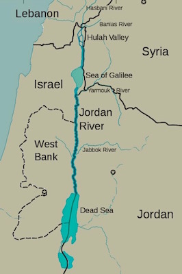
Jordan River (Utah)
From Wikipedia, the free encyclopedia
The Jordan River, in the state of Utah, United States, is a river about 51 miles (82 km) long. Regulated by pumps at its headwaters at Utah Lake, it flows northward through the Salt Lake Valley and empties into the Great Salt Lake. Four of Utah's six largest cities border the river: Salt Lake City, West Valley City, West Jordan, and Sandy. More than a million people live in the Jordan Subbasin, part of the Jordan River watershed that lies within Salt Lake and Utah counties. During the Pleistocene, the area was part of Lake Bonneville.
Members of the Desert Archaic Culture were the earliest known inhabitants of the region; an archaeological site found along the river dates back 3,000 years. Mormon pioneers led by Brigham Young were the first European American settlers, arriving in July 1847 and establishing farms and settlements along the river and its tributaries. The growing population, needing water for drinking, irrigation, and industrial use in an arid climate, dug ditches and canals, built dams, and installed pumps to create a highly regulated river.
Although the Jordan was originally a cold-water fishery with 13 native species, including Bonneville cutthroat trout, it has become a warm-water fishery where the common carp is most abundant. It was heavily polluted for many years by raw sewage, agricultural runoff, and mining wastes. In the 1960s, sewage treatment removed many pollutants. In the 21st century, pollution is further limited by the Clean Water Act, and, in some cases, the Superfund program. Once the home of bighorn sheep and beaver, the contemporary river is frequented by raccoons, red foxes, and domestic pets. It is an important avian resource, as are the Great Salt Lake and Utah Lake, visited by more than 200 bird species.
Big Cottonwood, Little Cottonwood, Red Butte, Mill, Parley's, and City creeks, as well as smaller streams like Willow Creek at Draper, Utah, flow through the sub-basin. The Jordan River Parkway along the river includes natural areas, botanical gardens, golf courses, and a 40-mile (64 km) bicycle and pedestrian trail, completed in 2017.[6]
The Jordan River is Utah Lake's only outflow. It originates at the northern end of the lake between the cities of Lehi and Saratoga Springs. It then meanders north through the north end of Utah Valley for approximately 8 miles (13 km) until it passes through a gorge in the Traverse Mountains, known as the Jordan Narrows. The Utah National Guard base at Camp Williams lies on the western side of the river through much of the Jordan Narrows.[7][8] The Turner Dam, located 41.8 miles (67.3 km) from the river's mouth (or at river mile 41.8) and within the boundaries of the Jordan Narrows, is the first of two dams of the Jordan River. Turner Dam diverts the water to the right or easterly into the East Jordan Canal and to the left or westerly toward the Utah and Salt Lake Canal. Two pumping stations situated next to Turner Dam divert water to the west into the Provo Reservoir Canal, Utah Lake Distribution Canal, and Jacob-Welby Canal. The Provo Reservoir Canal runs north through Salt Lake County, Jacob-Welby runs south through Utah County. The Utah Lake Distribution Canal runs both north and south, eventually leading back into Utah Lake.[9] Outside the narrows, the river reaches the second dam, known as Joint Dam, which is 39.9 miles (64.2 km) from the river's mouth. Joint Dam diverts water to the east for the Jordan and Salt Lake City Canal and to the west for the South Jordan Canal.[10][11][12]
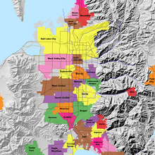
Map of the Salt Lake Valley
The river then flows through the middle of the Salt Lake Valley, initially moving through the city of Bluffdale and then forming the border between the cities of Riverton and Draper.[7] The river then enters the city of South Jordan where it merges with Midas Creek from the west. Upon leaving South Jordan, the river forms the border between the cities of West Jordan on the west and Sandy and Midvale on the east. From the west, Bingham Creek enters West Jordan. Dry Creek, an eastern tributary, combines with the main river in Sandy. The river then forms the border between the cities of Taylorsville and West Valley City on the west and Murray and South Salt Lake on the east. The river flows underneath Interstate 215 in Murray. Little and Big Cottonwood Creeks enter from the east in Murray, 21.7 miles (34.9 km) and 20.6 miles (33.2 km) from the mouth respectively. Mill Creek enters on the east in South Salt Lake, 17.3 miles (27.8 km) from the mouth. The river runs through the middle of Salt Lake City, where the river travels underneath Interstate 80 a mile west of downtown Salt Lake City and again underneath Interstate 215 in the northern portion of Salt Lake City. Interstate 15 parallels the river's eastern flank throughout Salt Lake County. At 16 miles (26 km) from the mouth, the river enters the Surplus Canal channel. The Jordan River physically diverts from the Surplus Canal through four gates and heads north with the Surplus Canal heading northwest. Parley's, Emigration, and Red Butte Creeks converge from the east through an underground pipe, 14.2 miles (22.9 km) from the mouth.[7] City Creek also enters via an underground pipe, 11.5 miles (18.5 km) from the river's mouth. The length of the river and the elevation of its mouth varies year to year depending on the fluctuations of the Great Salt Lake caused by weather conditions. The lake has an average elevation of 4,200 feet (1,300 m) which can deviate by 10 feet (3.0 m).[3] The Jordan River then continues for 9 to 12 miles (14 to 19 km) with Salt Lake County on the west and North Salt Lake and Davis County on the east until it empties into the Great Salt Lake.[7][8][11]
Discharge[edit]
The United States Geological Survey maintains a stream gauge in Salt Lake City that shows annual runoff from the period 1980–2003 is just over 150,000 acre-feet (190,000,000 m3) per year or 100 percent of the total 800,000 acre-feet (990,000,000 m3) of water entering the Jordan River from all sources. The Surplus Canal carries almost 60 percent of the water into the Great Salt Lake, with various irrigation canals responsible for the rest. The amount of water entering the Jordan River from Utah Lake is just over 400,000 acre-feet (490,000,000 m3) per year. Inflow from the 11 largest streams feeding the Jordan River, sewage treatment plants, and groundwater each account for approximately 15 percent of water entering the river.[13]
Watershed[edit]
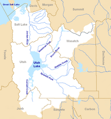
Map of the entire Jordan River Basin
|
|
|
|
|

Understanding Hebrew Directions – Part IV
Continuing with the previous post on how we can understand Hebrew words and their meaning in order to better understand what Mormon is writing, specifically as it relates to the many directions and his usage of compass directions to describe the Land of Promise, as well as the Point of View of the writer or the subject of the writing. When trying to understand the writing of the ancients, such as Mormon, Nephi, et al., modern man simply cannot seem to come to grips with their point of view, but insists on putting his own thinking into the matter that is so out of alignment with that of the ancients.
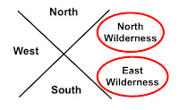
Left: The ancient Hebrews directional system contained eight compass points; Right: Our compass system today contains 32 directions. It is not just that they did not have these divisions, they did not think in terms of such minute directions
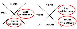
As an example, when it comes to directions, we think in far more divisions of a cardinal point than they did. Their view of their world in the sense of directions was very limited. They had limited need for anything more than the four cardinal directions, north-east-south-west, while we today use far more because we have a far greater geographical setting in our world than did the ancients. Thus, when Mormon describes an East Sea or an East Wilderness, we need to understand that it was in the east and not somewhere else. The same is true with the South Wilderness or a West Wilderness. Consequently, we need to place an East Wilderness and a South Wilderness within their proper north, east, south, and west orientation to the Point of View of the writer, which is the Land of Zarahemla.
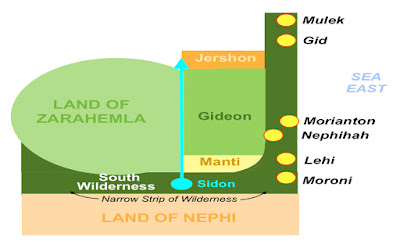
Left: Correct usage of east and west wildernesses; Right: Incorrect. When someone places both the East and South Wilderness in the East, it is simply not something the Hebrews or Nephites would have ever done and never did do
Even if we were more accurate to directions and labeled the east wilderness above as the north wilderness and the south wilderness above as the east wilderness, it would not fit Hebrew thinking.
The problem is, and always is, that the Hebrews/Jews/Nephites did not think the way we think today. First of all, they would never put a north or south anything in the east—the East was a pure direction. It was their entire being, their entire religion base, the way they drew maps, and thought of their universe. Nor would they have doubled up on two directions in a single direction, like the Mesoamericanists’ seas above or the Venice Priddis’ map. It simply would never happen—it simply is not within the Hebrew/Jewish/Nephite mindset to think that way. East of Zarahemla would be an East Wilderness, not a South Wilderness. In fact, everything to the East of Zarahemla (or even Bountiful and Nephi) would be East in Hebrew directional thinking—never anything else.
After the Lamanites were driven out of the “east wilderness” Moroni caused that the Nephites possess the land and build cities in the “east wilderness”
If a theorist places something there, then they are wrong. And if they are going to follow the overall comments of Mormon, the Nephites drove the Lamanites “out of the east wilderness” and shortly after, Mormon states: “when Moroni had driven all the Lamanites out of the east wilderness, which was north of the lands of their own possessions, he caused that the inhabitants who were in the land of Zarahemla and in the land round about should go forth into the east wilderness, even to the borders by the seashore, and possess the land” (Alma 50:9). Mormon then goes on to write: “And thus he cut off all the strongholds of the Lamanites in the east wilderness, yea, and also on the west, fortifying the line between the Nephites and the Lamanites, between the land of Zarahemla and the land of Nephi, from the west sea, running by the head of the river Sidon—the Nephites possessing all the land northward, yea, even all the land which was northward of the land Bountiful, according to their pleasure” (Alma 50:11).

Isn’t it interesting that Mormon does not mention anything about a “south wilderness” where these cities were built and from which Moroni drove out the Lamanites, yet that is exactly where some claim the South Wilderness was located. Also, in the Nephites building a city where the Lamanites had been driven out named “Moroni,” which was near the Land of Nephi, how would the Nephites drive the Lamanites out of the East Wilderness that was unattached to the Land of Nephi, with a “south wilderness” in between. Or build cities along the eastern seacoast just north of the narrow strip of land and the Land of Nephi without a mention of a south wilderness there? Of course, that is not the main point here. The point is and needs to be the basis of anything regarding directions, is the fact, and irrefutable fact, and not one of someone’s interpretation, the Hebrews and Jews, therefore the Nephites who were from that stock, and spoke and wrote Hebrew, would simply not have placed names to wildernesses as some have done. It would have violated their entire thinking process and their entire vision of the world around them. Consider someone living in Los Angeles claiming the Pacific Ocean was to their east. They woud simply laugh at you. Or someone in Salt Lake City claiming the Great Salt Lake was to the southwest, or that St. George was located in northern Utah, or Toole was located in southeast Utah. Claiming that any of these were correct, would simply be rejected by any Utahn, and most anyone else with any knowledge of the state. It would be like someone returning from a visit to Jerusalem and saying that the Muslim Quarter was in the southwestern quadrant of the city, the Dome of the Rock on the Temple Mount was beyond the New Gate into the Christian Quarter, or that the Cathedral of St. James was in the Jewish Quarter. Unless you had been there, lived there, or studied the city, you might accept those comments—but they would be completely incorrect, as any resident of Jerusalem would readily know. What if someone wrote a book about Jerusalem and listed Zion’s Gate as being in the Armenian Quarter, Tanner’s Gate being in the Christian Quarter, Lion’s Gate being in the Muslim Quarter, and the Dung Gate being in the Jewish Quarter? Or stated that Jesus went to the Pool of Siloam in the Upper City, walked along the wall of the Lower City? Would you know if those geographical statements were correct or incorrect? Actually six of those eight statements are geographically wrong. But how would you know that without study? Yet, people pick up a book written by someone, read their theory about the Great Lakes, the Heartland, or eastern U.S. and accept what they say without knowing how inaccurate they are. Some get so interested, they parrot the comments and the beliefs without ever coming to a knowledge of their inaccuracy. When it comes to the directions in the scriptural record, it is imperative to understand that in the ancient world, names did not carry much weight in meaning to a lone traveler or to an individual trying to find his way around an unknown city. However, directional names were readily apparent. You can call something the “water gate,” but calling it the “southeast gate,” means far more. Just like the “Road to the East Sea,” meant far more to someone than “Hezekiah’s Road,” and would be far more likely to know where it was located. The same is true of calling it Nehemiah’s Wall or the “north wall.” The point is, ancient directions are not something to playh around with and make all sorts of absurd claims that might make sense to a modern thinker, but would have been simply unusable and, therefore, not accurate, to the ancient world and ancient-thinking people. Directions were critical to survival, or at least in understanding the world around them. The ancients built elaborate structures and systems in order to simply know what any modern child can learn by looking at a calendar or acquiring a rudimentary understanding of planting cycles. Therefore, when Mormon used directions, he was not only thinking in terms of the way things were called and understood anciently, but he was also providing us with a better understanding of the directions of the Land of Promise and the location of lands and areas within it. There is simply no question that before the Hebrews and many other ancient peoples came into a more modern and mobile world, their vision of their land and the world around them was very limited and direction-driven. Everything about their language, their words, the scriptural meaning, the work of uncounted rabbis continually studying the ancient language and to understand it and its deeper meanings, all support the understanding of singular directional placement and naming. It simply cannot be violated because of modern ideas and modern interpretation of ancient writings. For this or that theorist to make such ridiculous claims about directions that runs contrary to that understanding and the Hebrew mindset about directions and his ancient understanding of his world is so without merit, that it is not only confusing to modern man, but downright fallacious and unworthily misleading.
http://nephicode.blogspot.com/2018/04/understanding-hebrew-directions-part-iv.html
|
|
|
|
|
Deseret y la creación del Territorio de Utah[editar]
 Salt Lake City Salt Lake City en 1850
En 1849, los mormones crearon un estado provisional, al que denominaron Deseret, una extensión gigantesca que incluía territorio que actualmente forma parte de Colorado, Idaho, Wyoming, Nevada, Oregón, Arizona, Nuevo México y California. En el mismo año, los mormones también crearon la Compañía de Fondo Perpetuo para la Emigración. El fondo sufragaba el traslado de familias mormonas de otros países a Utah. Esto ayudó a aproximadamente 26 000 inmigrantes —aproximadamente el 36 % de los aproximadamente 73 000 mormones que emigraron de Europa a los Estados Unidos entre 1852 y 1887.8
A lo largo de 1849 y de 1850, los mormones presionaron al gobierno estadounidense para que Deseret fuera elevado a la categoría de estado, pero el Congreso rechazó estas peticiones; sin embargo, a causa de cuestiones relativas a la esclavitud en el país, el gobierno de los Estados Unidos creó el Territorio de Utah (con una extensión mucho menor) en 1850, denominado así por la tribu ute que vivía en la región. Aunque de mayor extensión que el actual estado, este territorio ya tenía por entonces los actuales límites norte y sur. Young se convirtió en el primer gobernador del territorio.
Hasta la década de 1850, las relaciones entre los nativos americanos de Utah y los mormones fueron buenas. Sin embargo, en 1853, un jefe indígena ute, Walkara (también llamado Walker), comenzó a atacar comunidades mormonas, iniciando la guerra de Walker, que se desarrolló durante un año, hasta que Young consiguió convencer a Walker de que terminara con los ataques.9
La guerra de Utah y la masacre de Mountain Meadows[editar]
Gran parte del Congreso estadounidense, así como el propio presidente en la época, James Buchanan, querían remover a los mormones del gobierno de Utah. Llegaron rumores hasta Washington de que todo el territorio estaba sublevándose. El presidente Buchanan, en 1857, decidió nombrar a Alfred Cumming de Georgia como nuevo gobernador del territorio.10 Fueron enviadas tropas para garantizar el cumplimiento de la sustitución, iniciando la guerra de Utah (también conocida en inglés como Utah Expedition o Buchanan's Blunder). Ante la ausencia de una notificación formal o de declaración de intenciones, Young y otros líderes mormones interpretaron el envío de tropas como una persecución religiosa y adoptaron una postura defensiva.11
En septiembre de ese mismo año, un grupo de mormones, junto con un grupo de aliados nativos americanos, atacaron un grupo de unas 140 personas, de Arkansas y de Misuri, que se dirigían hacia California. Se suponía por los agresores que estas personas eran en su mayoría anti-mormones. Mataron a todos los viajeros, con excepción de los niños, a los que enviaron a vivir con familias mormonas (dos años después, reclamados por sus familiares, regresaron a Arkansas).12 Este incidente se conoce nacionalmente como la masacre de Mountain Meadows y es uno de las actos más controvertidos cometidos por miembros de la Iglesia. Algunos afirman que los oficiales de Salt Lake, incluido Young, ordenaron la masacre, mientras otros aseveran que Salt Lake no se enteró de la masacre hasta cuando fue demasiado tarde.
El presidente Buchanan había sido criticado por el Congreso estadounidense y por la población porque fracasó al no advertir a Young de su destitución, proveer de víveres adecuados a las tropas, o incluso de no investigar si era necesario el envío de tropas. El presidente quería acabar con la situación, y empezó a negociar con Young. Este aceptó su remoción y Cumming asumió el puesto. Aunque Young no fuera ya el gobernador de Utah, todavía era considerado como tal por los habitantes del territorio. Existieron grandes tensiones entre la población mormona y las tropas que ocuparon Utah durante tres años, y que abandonaron el territorio en 1861 con el advenimiento de la guerra civil estadounidense.11
Utah adquiere sus fronteras actuales. La década de 1860[editar]
A lo largo de la década de 1860, el gobierno estadounidense cedió parte del Territorio de Utah a otros nuevos territorios recién creados, como Colorado, Nevada y Wyoming. En 1868, Utah adquirió sus actuales límites territoriales. En 1865, se inició la guerra de Halcón Negro, un nuevo conflicto entre los mormones y la tribu nativo americana ute, liderada por el jefe indígena Halcón Negro. La guerra perduró por dos años, hasta 1867, periodo en el cual otras tribus nativas americanas se unieron a la causa de los utes: reconquistar las tierras capturadas por los mormones. En 1867, Halcón Negro, viendo que no tenía ninguna posibilidad de victoria, acordó rendirse ante el gobierno estadounidense. La mayoría de los nativos americanos de Utah fueron entonces ingresados en reservas indígenas. Ocasionales ataques de los nativos perduraron hasta 1873.13
 Mapa del Pony Express del Servicio Nacional de Parques.
Salt Lake City se convirtió en un centro de comunicaciones en 1860, con el inicio del transporte de correos del Pony Express entre Saint Joseph (Misuri) y Sacramento (California), con escala en Salt Lake City. El 24 de octubre de 1861 dos líneas de telégrafo, una procedente de Washington D. C. y la otra de San Francisco, fueron conectadas en Salt Lake City, inaugurando la primera línea de telégrafo transcontinental del país.14
En 1862, el Congreso de los Estados Unidos aprobó una ley, válida para todo el país, que prohibía la práctica de la poligamia. El gobierno estadounidense envió este año un regimiento de voluntarios de California bajo el mando de Patrick E. Connor, quien en Utah, incentivó a sus soldados a buscar metales preciosos en la región. Connor, un anti-mormón, esperaba que dicho descubrimiento en la región, pudiera atraer a miles de no mormones a la zona, reduciendo así el poder de los mormones en Utah. En 1863, fueron descubiertos oro y plata, aunque la inexistencia de una vía férrea en el territorio hizo que la extracción de estos metales fuera muy costosa. Pocas empresas se interesaron en la minería de estas reservas, y pocas personas se instalaron en Utah. En 1863, dos compañías ferroviarias iniciaron la construcción de dos vías férreas. La Central Pacific inició el tendido de una línea férrea partiendo de Sacramento en dirección al este y la Union Pacific inició la construcción de otra vía férrea, partiendo de Omaha (Nebraska) en dirección al oeste. El 10 de mayo de 1869, estas dos líneas se unieron en Promontory, completando la primera línea férrea transcontinental de los Estados Unidos. Rápidamente, otras vías férreas fueron construidas en Utah, la minería de metales preciosos explotó, y la población de Utah comenzó a crecer rápidamente.15 En 1870, Utah fue el segundo territorio en los Estados Unidos en conceder el derecho al voto a las mujeres, después de Wyoming, que lo hizo en 1869. Este derecho fue eliminado or el Congreso en 1887 mediante la Edmunds-Tucker Act, pues se temía que las esposas de los polígamos votarían como su esposo les ordenara, y que crearan un estado en el que, parafraseando el conocido lema de «un hombre, un voto», se convirtiera en «un hombre, cinco votos». En 1895, las mujeres del estado recuperaron su derecho al sufragio.16
El estado de Utah[editar]
Con el crecimiento de la población de Utah, la región comenzó a presionar al Congreso estadounidense para que Utah fuera elevado a la categoría de estado. Estas peticiones fueron nuevamente rechazadas, a causa de las costumbres polígamas del territorio (aunque realmente no todos los mormones tenían esa costumbre, que oscilaba entre el 5 y el 40 % de sus miembros, según la época y la zona). Durante la década de 1880 el gobierno estadounidense inició el cumplimiento de las leyes antipoligamia en Utah, con penas de cinco años de cárcel y fuertes sanciones económicas, y proporcionado un mecanismo para adquirir las propiedades de la Iglesia.17 Todos estos factores hicieron que en 1890, el líder de la Iglesia, Wilford Woodruff, declarara oficialmente que sus miembros no practicaban la poligamia.18 Según los mormones, su profeta Wilford Woodruff recibió una revelación venida de Dios de que la boda plural debería suspenderse.19
En 1895, el gobierno territorial de Utah creó una nueva constitución, sujeta a la aprobación del Congreso de Estados Unidos. Esta nueva constitución declaraba ilegal la práctica de la poligamia. Además, impedía el control del gobierno de Utah por parte de cualquier asociación religiosa. Bajo estos términos, el Congreso ratificó la nueva constitución, y Utah se convirtió en el 45° estado estadounidense, el 4 de enero de 1896.
|
|
|
|
|
KING DAVID / JOSEPH / SOLOMON
|
|
|
|
|
https://www.4biddenknowledge.tv/videos/ep-6
https://www.4biddenknowledge.tv/videos/ep-6
|
|
|
 Primer Primer
 Anterior
29 a 43 de 43
Siguiente Anterior
29 a 43 de 43
Siguiente
 Último

|
|
| |
|
|
©2025 - Gabitos - Todos los derechos reservados | |
|
|





.jpg)


