|
|
General: PARA LA BIBLIA DINERO=CAPITALISMO=VATICANO=MUJER (PACTO DE ABRAHAM)
إختار ملف آخر للرسائل |
|
جواب |
رسائل 1 من 20 في الفقرة |
|
SARA=SERPIENTE=$
DINOSAURIO
DINO / DINA / DIANA / DAN (TRANSFIGURACION DE CRISTO EN EL MONTE HERMON EN LA TRIBU DE DAN)
SAURIO / SAR (PRINCIPE EN HEBREO)
LA TRANSFIGURACION DE CRISTO EN EL MONTE HERMON, CERCA DE CESAREA DE FILIPO
C-SAR ES LA CLAVE DE LA TRASLACION EN EL TIEMPO
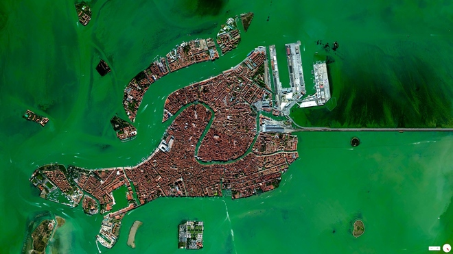
NOTEN EL NEXO DE DAN, CON LA SERPIENTE (VENECIA) Y EL CABALLO (PLAZA SAN MARCOS)
|
|
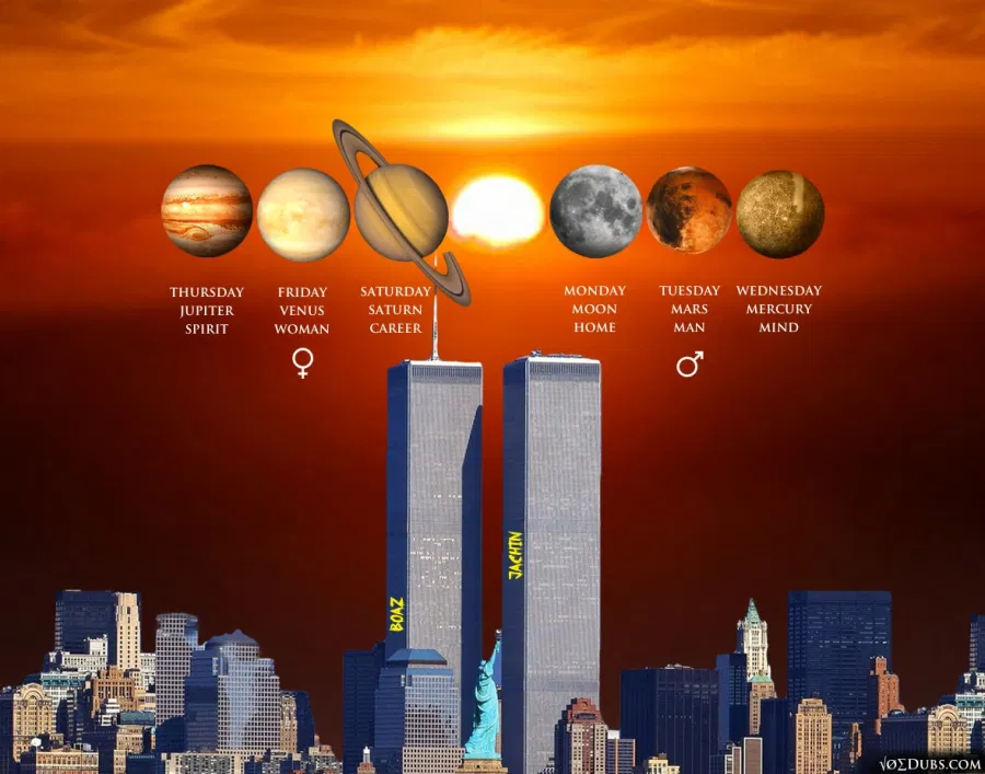
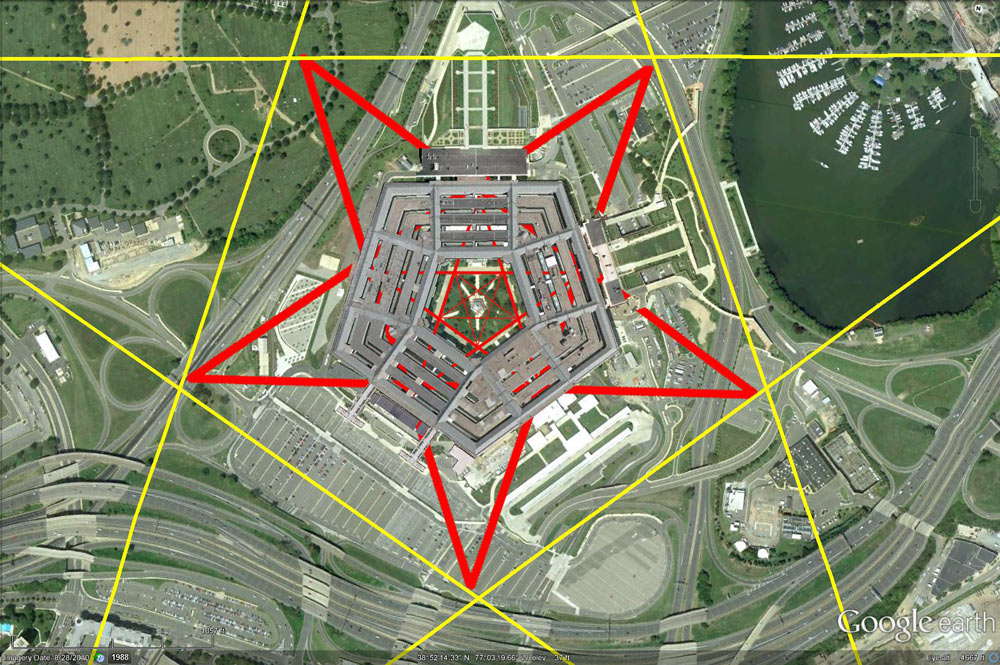
Génesis 8:22 Mientras la tierra permanezca, no cesarán la sementera y la siega, el frío y el calor, el verano y el invierno, y el día y la noche. (EL MISMO DISEÑO DEL VATICANO-OCHO PUNTAS-PLAZA DE SAN PEDRO)
DINERO=MUJER=$=SARA
EL PSEUDOCRISTIANISMO LE TIENE PANICO A LA MUJER.
|
|
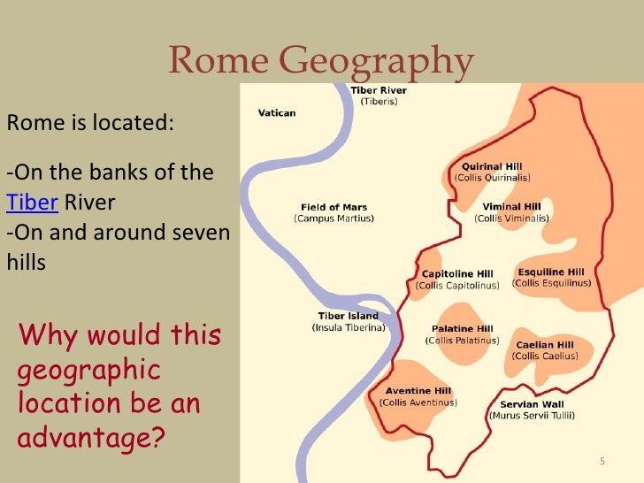
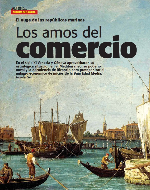
EN VENECIA ESTA EL SECRETO
|
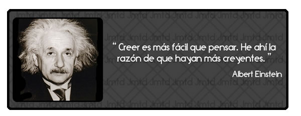
Obviamente que Dios es Dios de vivos..
Puesto que en la fe nadie muere..
Y los patriarcas Abraham, Isaac, Jacob ..
Caminaron por fe..
Dios le cambio el nombre de abram a abraham..
Porque es el primer viviente según el pacto de la circuncisión..
El primer hombre de fe, el padre de naciones..
Y ese pacto de Dios con Abraham sigue vigente hasta hoy..
Porque en la fe de Abraham son salvas todas las naciones..
Y para dejar tranquilo a Barilochense le digo :
Dios también le cambió el nombre a la mujer de Abraham..
De Saraí ( princesa ) pasó a llamarse Sara que significa madre de naciones..
16. Y la bendeciré, y también te daré de ella hijo; sí, la bendeciré, y vendrá a ser madre de naciones; reyes de pueblos vendrán de ella.
Para que no diga que Dios no ama a sus hijas..
Saludos
El Ungido
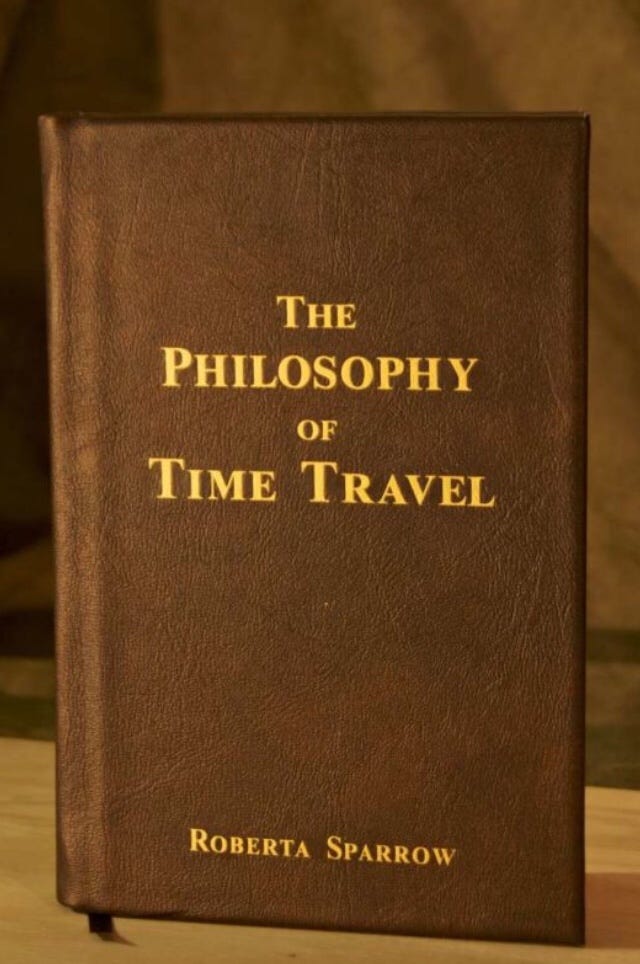
LA CLAVE DEL EXPERIMENTO FILADELFIA
|
|
EN VENECIA ESTA EL SECRETO
RAMERA=$ =SERPIENTE= SABADO= SABIDURIA= LETRA S= SOPHIA=SNAKE =SERPENT
S=SERPIENTE
|
|
|
|
|
|
|
جواب |
رسائل 6 من 20 في الفقرة |
|

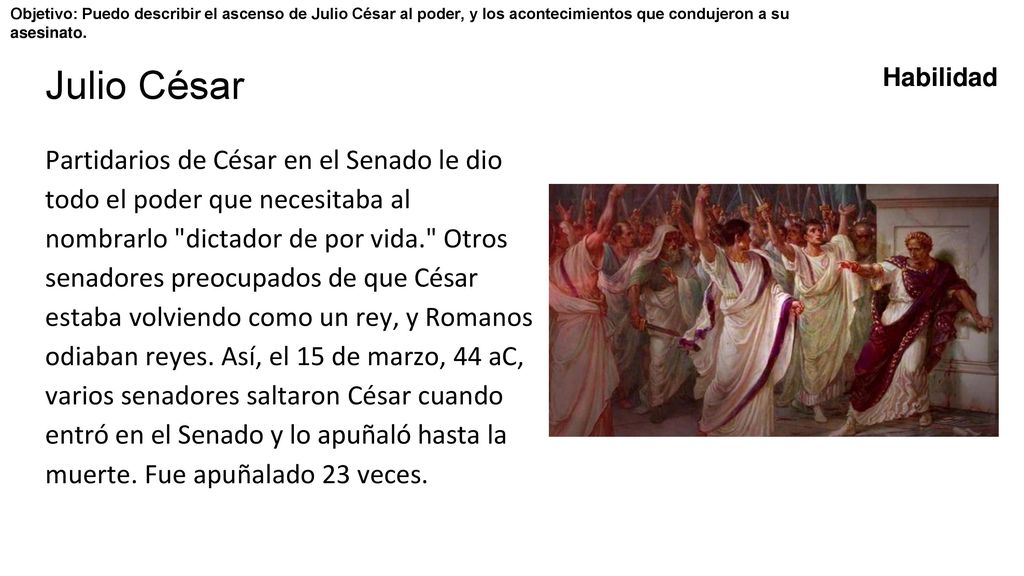
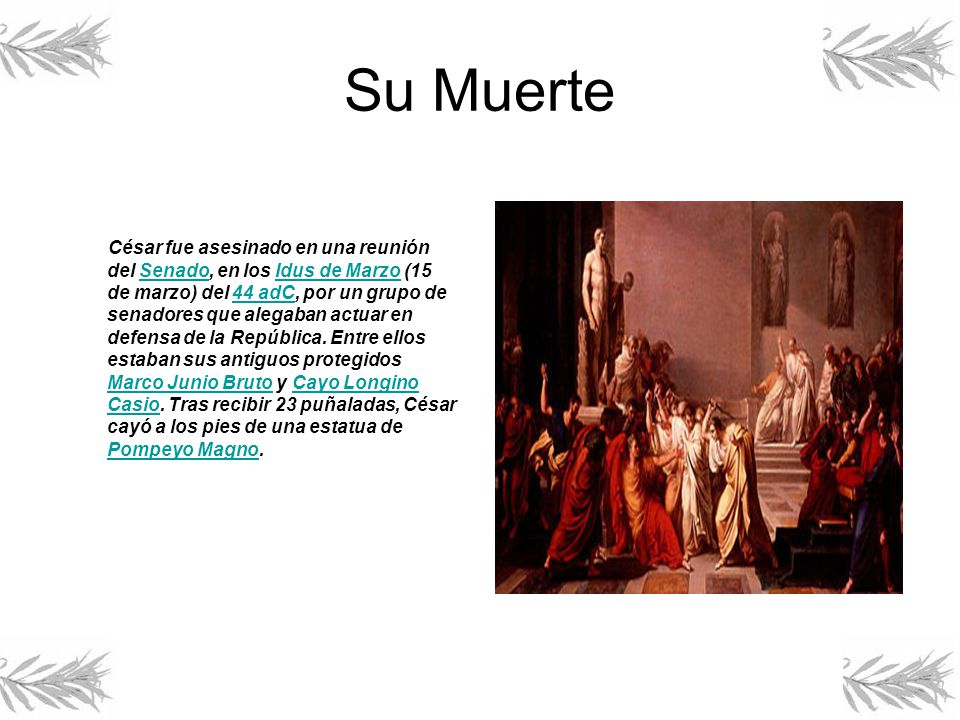
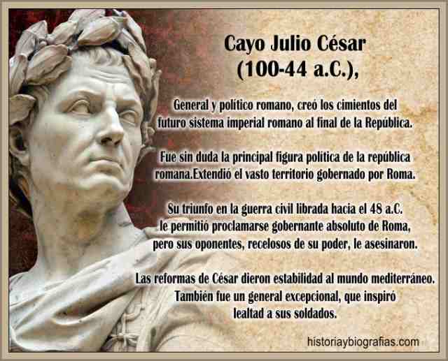
NE-CESAR-IO
C-SAR
S=CONSTELACION DE DRACO=$ = SARA (ESPOSA DE ABRAHAM)= GALATAS 4:26
DRACO=S-ARA

|
|
La Puerta de Istar (o de Ishtar) fue una de las 8 puertas monumentales (10 metros de altura por 14 de ancho) de la muralla interior de Babilonia, a través de la cual se accedía al templo de Marduk, donde se celebraban las fiestas del año nuevo. El nombre de Istar lo recibe de la diosa a la que estaba consagrada.1
Fue construida en el año 575 a. C. por Nabucodonosor II en el lado norte de la ciudad.1 Se compone de adobe y cerámica vidriada, la mayoría de color azul debido al lapislázuli (lo que la hacía contrastar fuertemente con todos los edificios de su alrededor), mientras que otros son dorados o rojizos. Estos últimos se disponen dibujando la silueta de dragones, toros, leones y seres mitológicos. La parte inferior y el arco de la puerta están decorados por filas de grandes flores semejantes a margaritas. La Puerta de Istar contaba también originariamente con dos esfinges dentro del arco de la puerta, que se han perdido hoy en día.
Los restos de la puerta original fueron descubiertos en Babilonia durante las campañas arqueológicas alemanas de 1902 a 1914.1 La mayoría se trasladó a Alemania, donde se reconstruyó la puerta en el Museo de Pérgamo de Berlín, en 1930, lugar en el que actualmente se expone. Algunos de los relieves originales de leones, dragones y toros se encuentran actualmente en el Museo Arqueológico de Estambul, el Instituto de Artes de Detroit, el Museo Metropolitano de Arte de Nueva York, el Instituto Oriental de Chicago, el Museo de la Escuela de Diseño de Rhode Island y el Museo de Bellas Artes de Boston.
Durante el gobierno de Saddam Hussein en Irak, se comenzaron a reconstruir grandes zonas de la vieja Babilonia, entre ellas la Puerta de Istar, cuya réplica se levantó sobre el antiguo emplazamiento de la original. El plan era convertirla en la puerta de acceso a un nuevo museo arqueológico iraquí que nunca llegó a construirse. Actualmente, la réplica se encuentra bajo la responsabilidad de la 155ª Brigada de Combate del Ejército de Estados Unidos, cuyo campamento se encuentra dentro de las murallas de Babilonia.
BABILONIA=BERLIN
|
|
|
|
|
|
|
جواب |
رسائل 7 من 20 في الفقرة |
|
ROMA=AMOR
ROMA=AMOR
ROLMENCITO, LA VIDA NO SOLO ES NETFLIX
CON TODO RESPETO
|
|
|
|
جواب |
رسائل 8 من 20 في الفقرة |
|
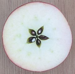
EL SILICIO Y EL GERMANIO SE LOS ENCUENTRA EN LA ARENA, QUE TIENE FUERTE RELACION CON EL PACTO ABRAHAMICO DEL LINAJE, EN EL CONTEXTO A LAS ESTRELLAS- MARIA / MIRYAM ( MARES, PUEBLOS, NACIONES Y LENGUAS)
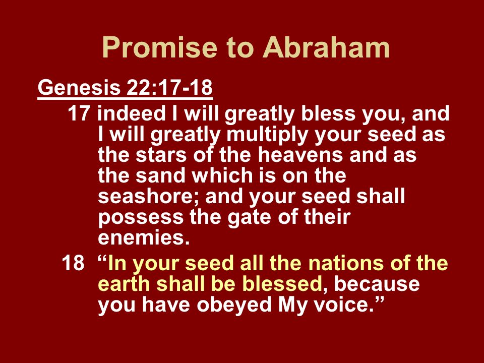
1. Génesis 22:17 de cierto te bendeciré, y multiplicaré tu descendencia como las estrellas del cielo y como la ARENA que está a la orilla del mar; y tu descendencia poseerá las puertas de sus enemigos.
2. Génesis 32:12 Y tú has dicho: Yo te haré bien, y tu descendencia será como la ARENA del mar, que no se puede contar por la multitud.
3. Génesis 41:49 Recogió José trigo como ARENA del mar, mucho en extremo, hasta no poderse contar, porque no tenía número.
3. Génesis 15:5 Y lo llevó fuera, y le dijo: Mira ahora los cielos, y cuenta las ESTREllas, si las puedes contar. Y le dijo: Así será tu descendencia.
4. Génesis 22:17 de cierto te bendeciré, y multiplicaré tu descendencia como las ESTREllas del cielo y como la arena que está a la orilla del mar; y tu descendencia poseerá las puertas de sus enemigos.
|
|
|
|
جواب |
رسائل 9 من 20 في الفقرة |
|
GEMATRIA EN INGLES DE SEED=33
GEMATRIA EN INGLES DE GATE=33
SARA (CE-SAREA DE FILIPO)=PARALELO 33
 the Apple
| milky way in Simple Gematria Equals: 119 |
( |
m 13 |
i9 |
l 12 |
k 11 |
y 25 |
0 |
w 23 |
a1 |
y 25 |
) |
| queen mary in Simple Gematria Equals: 119 |
( |
q 17 |
u 21 |
e5 |
e5 |
n 14 |
0 |
m 13 |
a1 |
r 18 |
y 25 |
|
| hebrew calendar in Simple Gematria Equals: 119 |
( |
h8 |
e5 |
b2 |
r 18 |
e5 |
w 23 |
0 |
c3 |
a1 |
l 12 |
e5 |
n 14 |
d4 |
a1 |
r 18 |
| mary magdalene in Simple Gematria Equals: 119 |
( |
m 13 |
a1 |
r 18 |
y 25 |
0 |
m 13 |
a1 |
g7 |
d4 |
a1 |
l 12 |
e5 |
n 14 |
e5 |
|
|
|
|
|
جواب |
رسائل 10 من 20 في الفقرة |
|
| De: Rolmen |
Enviado: 18/05/2019 02:55 |
|
|
|
|
جواب |
رسائل 11 من 20 في الفقرة |
|
|
|
|
جواب |
رسائل 12 من 20 في الفقرة |
|
|
|
|
جواب |
رسائل 13 من 20 في الفقرة |
|
EL SANTURRON, NO LOGRA DISCERNIR EL NEXO MASONICO, CON SARA, LA MUJER DE ABRAHAM. |
|
|
|
جواب |
رسائل 14 من 20 في الفقرة |
|
|
|
|
جواب |
رسائل 15 من 20 في الفقرة |
|
|
|
|
جواب |
رسائل 16 من 20 في الفقرة |
|
|
|
|
جواب |
رسائل 17 من 20 في الفقرة |
|
|
|
|
جواب |
رسائل 18 من 20 في الفقرة |
|
|
|
|
جواب |
رسائل 19 من 20 في الفقرة |
|
 Primer Anterior 2 a 2 de 2 Siguiente Primer Anterior 2 a 2 de 2 Siguiente  Último Último |
|
|
|
|
جواب |
رسائل 20 من 20 في الفقرة |
|

Jordan River (Utah)
From Wikipedia, the free encyclopedia
The Jordan River, in the state of Utah, United States, is a river about 51 miles (82 km) long. Regulated by pumps at its headwaters at Utah Lake, it flows northward through the Salt Lake Valley and empties into the Great Salt Lake. Four of Utah's six largest cities border the river: Salt Lake City, West Valley City, West Jordan, and Sandy. More than a million people live in the Jordan Subbasin, part of the Jordan River watershed that lies within Salt Lake and Utah counties. During the Pleistocene, the area was part of Lake Bonneville.
Members of the Desert Archaic Culture were the earliest known inhabitants of the region; an archaeological site found along the river dates back 3,000 years. Mormon pioneers led by Brigham Young were the first European American settlers, arriving in July 1847 and establishing farms and settlements along the river and its tributaries. The growing population, needing water for drinking, irrigation, and industrial use in an arid climate, dug ditches and canals, built dams, and installed pumps to create a highly regulated river.
Although the Jordan was originally a cold-water fishery with 13 native species, including Bonneville cutthroat trout, it has become a warm-water fishery where the common carp is most abundant. It was heavily polluted for many years by raw sewage, agricultural runoff, and mining wastes. In the 1960s, sewage treatment removed many pollutants. In the 21st century, pollution is further limited by the Clean Water Act, and, in some cases, the Superfund program. Once the home of bighorn sheep and beaver, the contemporary river is frequented by raccoons, red foxes, and domestic pets. It is an important avian resource, as are the Great Salt Lake and Utah Lake, visited by more than 200 bird species.
Big Cottonwood, Little Cottonwood, Red Butte, Mill, Parley's, and City creeks, as well as smaller streams like Willow Creek at Draper, Utah, flow through the sub-basin. The Jordan River Parkway along the river includes natural areas, botanical gardens, golf courses, and a 40-mile (64 km) bicycle and pedestrian trail, completed in 2017.[6]
The Jordan River is Utah Lake's only outflow. It originates at the northern end of the lake between the cities of Lehi and Saratoga Springs. It then meanders north through the north end of Utah Valley for approximately 8 miles (13 km) until it passes through a gorge in the Traverse Mountains, known as the Jordan Narrows. The Utah National Guard base at Camp Williams lies on the western side of the river through much of the Jordan Narrows.[7][8] The Turner Dam, located 41.8 miles (67.3 km) from the river's mouth (or at river mile 41.8) and within the boundaries of the Jordan Narrows, is the first of two dams of the Jordan River. Turner Dam diverts the water to the right or easterly into the East Jordan Canal and to the left or westerly toward the Utah and Salt Lake Canal. Two pumping stations situated next to Turner Dam divert water to the west into the Provo Reservoir Canal, Utah Lake Distribution Canal, and Jacob-Welby Canal. The Provo Reservoir Canal runs north through Salt Lake County, Jacob-Welby runs south through Utah County. The Utah Lake Distribution Canal runs both north and south, eventually leading back into Utah Lake.[9] Outside the narrows, the river reaches the second dam, known as Joint Dam, which is 39.9 miles (64.2 km) from the river's mouth. Joint Dam diverts water to the east for the Jordan and Salt Lake City Canal and to the west for the South Jordan Canal.[10][11][12]

Map of the Salt Lake Valley
The river then flows through the middle of the Salt Lake Valley, initially moving through the city of Bluffdale and then forming the border between the cities of Riverton and Draper.[7] The river then enters the city of South Jordan where it merges with Midas Creek from the west. Upon leaving South Jordan, the river forms the border between the cities of West Jordan on the west and Sandy and Midvale on the east. From the west, Bingham Creek enters West Jordan. Dry Creek, an eastern tributary, combines with the main river in Sandy. The river then forms the border between the cities of Taylorsville and West Valley City on the west and Murray and South Salt Lake on the east. The river flows underneath Interstate 215 in Murray. Little and Big Cottonwood Creeks enter from the east in Murray, 21.7 miles (34.9 km) and 20.6 miles (33.2 km) from the mouth respectively. Mill Creek enters on the east in South Salt Lake, 17.3 miles (27.8 km) from the mouth. The river runs through the middle of Salt Lake City, where the river travels underneath Interstate 80 a mile west of downtown Salt Lake City and again underneath Interstate 215 in the northern portion of Salt Lake City. Interstate 15 parallels the river's eastern flank throughout Salt Lake County. At 16 miles (26 km) from the mouth, the river enters the Surplus Canal channel. The Jordan River physically diverts from the Surplus Canal through four gates and heads north with the Surplus Canal heading northwest. Parley's, Emigration, and Red Butte Creeks converge from the east through an underground pipe, 14.2 miles (22.9 km) from the mouth.[7] City Creek also enters via an underground pipe, 11.5 miles (18.5 km) from the river's mouth. The length of the river and the elevation of its mouth varies year to year depending on the fluctuations of the Great Salt Lake caused by weather conditions. The lake has an average elevation of 4,200 feet (1,300 m) which can deviate by 10 feet (3.0 m).[3] The Jordan River then continues for 9 to 12 miles (14 to 19 km) with Salt Lake County on the west and North Salt Lake and Davis County on the east until it empties into the Great Salt Lake.[7][8][11]
Discharge[edit]
The United States Geological Survey maintains a stream gauge in Salt Lake City that shows annual runoff from the period 1980–2003 is just over 150,000 acre-feet (190,000,000 m3) per year or 100 percent of the total 800,000 acre-feet (990,000,000 m3) of water entering the Jordan River from all sources. The Surplus Canal carries almost 60 percent of the water into the Great Salt Lake, with various irrigation canals responsible for the rest. The amount of water entering the Jordan River from Utah Lake is just over 400,000 acre-feet (490,000,000 m3) per year. Inflow from the 11 largest streams feeding the Jordan River, sewage treatment plants, and groundwater each account for approximately 15 percent of water entering the river.[13]
Watershed[edit]

Map of the entire Jordan River Basin
|
|
|
 أول
سابق
6 a 20 de 20
لاحق أول
سابق
6 a 20 de 20
لاحق
 آخر
آخر
|
|
| |
|
|
©2025 - Gabitos - كل الحقوق محفوظة | |
|
|


:format(.JPG)/f.elconfidencial.com/original/416/fa7/b21/416fa7b21dc4ebe3d8558e3bfe83bb94.jpg)


![Hitler y la lanza del destino - [PDF Document]](https://demo.fdocumentos.tips/img/378x509/reader024/reader/2021011008/579057871a28ab900c9db633/r-1.jpg)