|
|
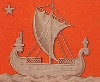
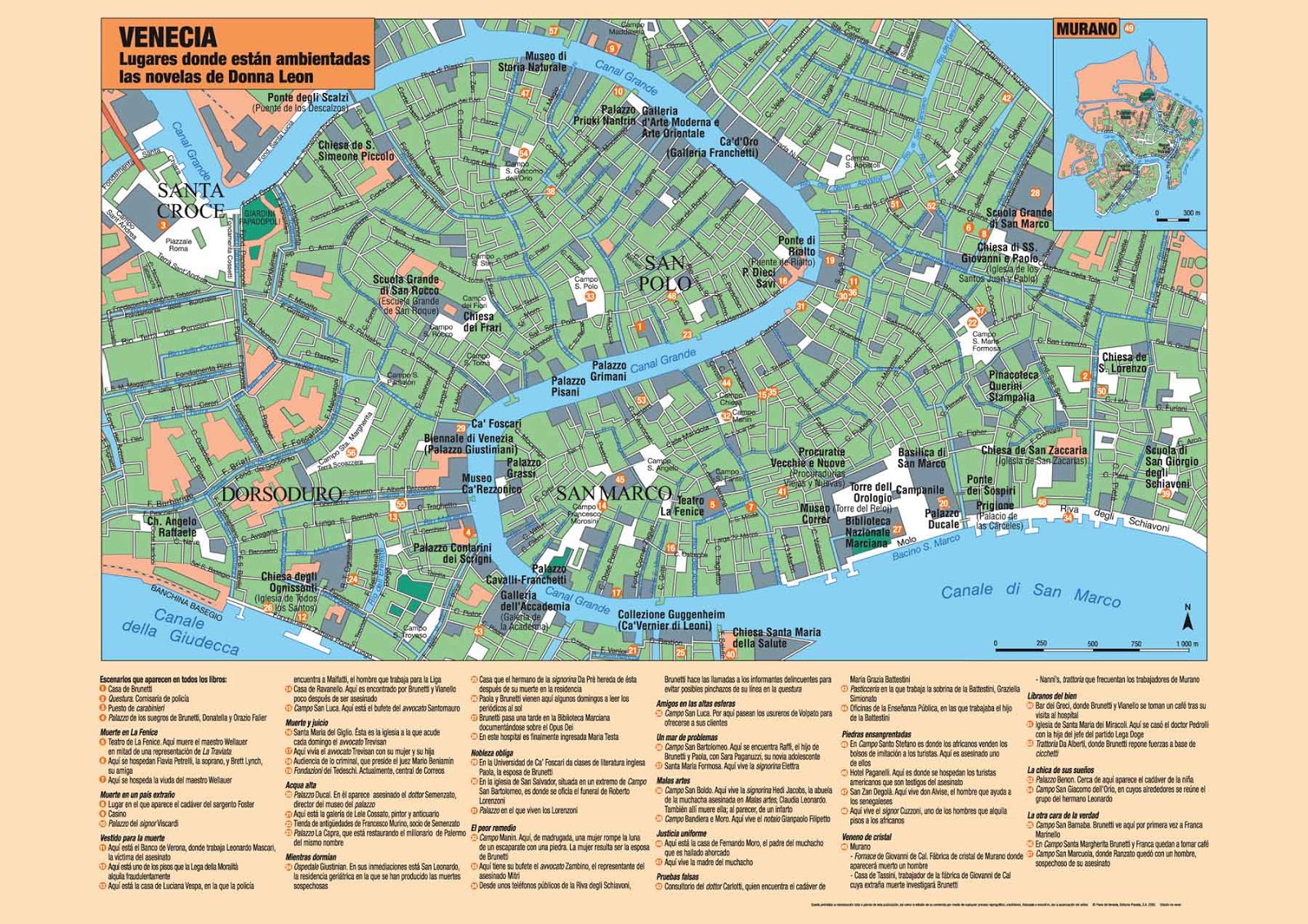
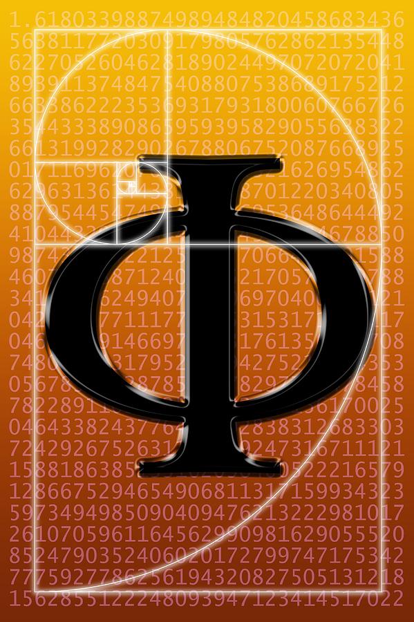
General: VENICE=SEINE RIVER=LETTER S=$=ALCHEMY (GOLD AND SILVER)=HOLY GRAIL=MADELEINE
Scegli un’altra bacheca |
|
Rispondi |
Messaggio 1 di 13 di questo argomento |
|
Earth from Space – Arc de Triomphe, Paris
Status Report
May 13, 2022

Arc de Triomphe, Paris.
ESA
This striking, high-resolution image of the Arc de Triomphe, in Paris, was captured by Planet SkySat – a fleet of satellites that have just joined ESA’s Third Party Mission Programme in April 2022.
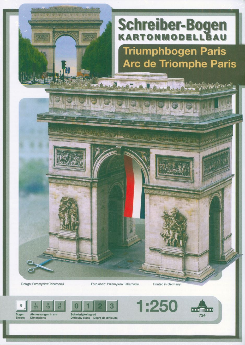
The Arc de Triomphe, or in full Arc de Triomphe de l’Étoile, is an iconic symbol of France and one of the world’s best-known commemorative monuments. The triumphal arch was commissioned by Napoleon I in 1806 to celebrate the military achievements of the French armies. Construction of the arch began the following year, on 15 August (Napoleon’s birthday).
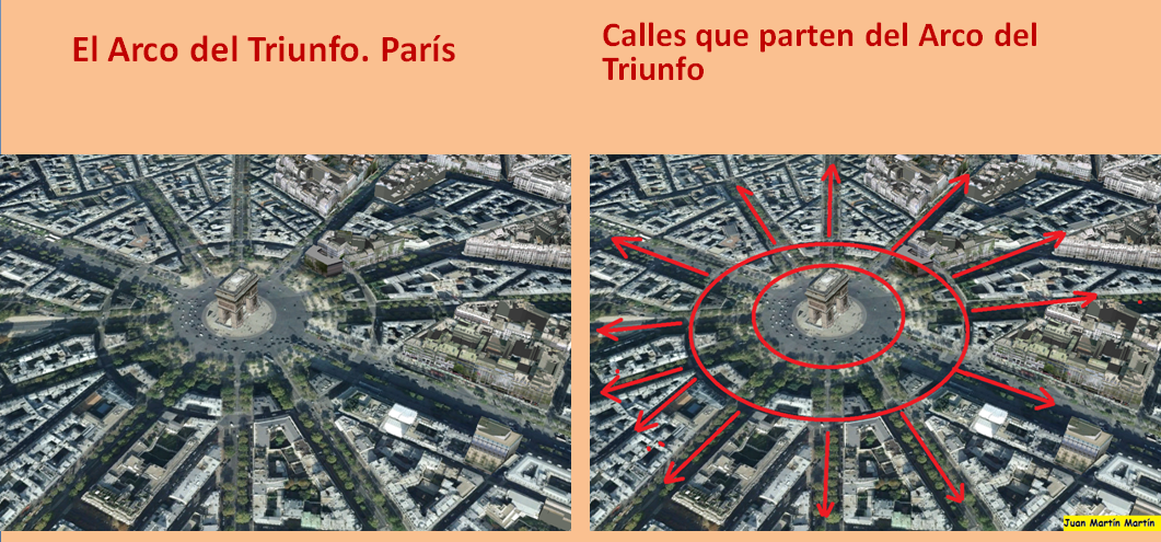
The arch stands at the centre of the Place Charles de Gaulle, the meeting point of 12 grand avenues which form a star (or étoile), which is why it is also referred to as the Arch of Triumph of the Star. The arch is 50 m high and 45 m wide.
The names of all French victories and generals are inscribed on the arch’s inner and outer surfaces, while the Tomb of the Unknown Soldier from World War I lies beneath its vault. The tomb’s flame is rekindled every evening as a symbol of the enduring nature of the commemoration and respect shown to those who have fallen in the name of France.
The Arc de Triomphe’s location at the Place Charles de Gaulle places it at the heart of the capital and the western terminus of the Avenue des Champs-Élysées (visible in the bottom-right of the image). Often referred to as the ‘most beautiful avenue in the world’, the Champs-Élysées is known for its theatres, cafés and luxury shops, as the finish of the Tour de France cycling race, as well as for its annual Bastille Day military parade.
This image, captured on 9 April 2022, was provided by Planet SkySat – a fleet of 21 very high-resolution satellites capable of collecting images multiple times during the day. SkySat’s satellite imagery, with 50 cm spatial resolution, is high enough to focus on areas of great interest, identifying objects such as vehicles and shipping containers.
SkySat data, along with PlanetScope (both owned and operated by Planet Labs), serve numerous commercial and governmental applications. These data are now available through ESA’s Third Party Mission programme – enabling researchers, scientists and companies from around the world the ability to access Planet’s high-frequency, high-resolution satellite data for non-commercial use.
Within this programme, Planet joins more than 50 other missions to add near-daily PlanetScope imagery, 50 cm SkySat imagery, and RapidEye archive data to this global network.
Peggy Fischer, Mission Manager for ESA’s Third Party Missions, commented, “We are very pleased to welcome PlanetScope and SkySat to ESA’s Third Party Missions portfolio and to begin the distribution of the Planet data through the ESA Earthnet Programme.
“The high-resolution and high-frequency imagery from these satellite constellations will provide an invaluable resource for the European R&D and applications community, greatly benefiting research and business opportunities across a wide range of sectors.”
To find out more on how to apply to the Earthnet Programme and get started with Planet data, click here.
– Download the full high-resolution image.
|
|
|
|
|
| Foundation stone. On August 15, 1806, Emperor Napoleon I's birthday, the foundation stone of the building was laid at a depth of eight meters, between the two southern pillars. |
|
|
|
|
| Enviado: 21/10/2024 10:30 |
|
|
|
|
|
|
|
|
 Primo
Precedente
2 a 13 di 13
Successivo
Primo
Precedente
2 a 13 di 13
Successivo
 Ultimo
|
|
Rispondi |
Messaggio 2 di 13 di questo argomento |
|
|
|
|
Rispondi |
Messaggio 3 di 13 di questo argomento |
|
salt lake city=alchemy (salt)=dollar=$= LOT S WIFE (SODOMA AND GOMORRA)
|
|
|
|
Rispondi |
Messaggio 4 di 13 di questo argomento |
|
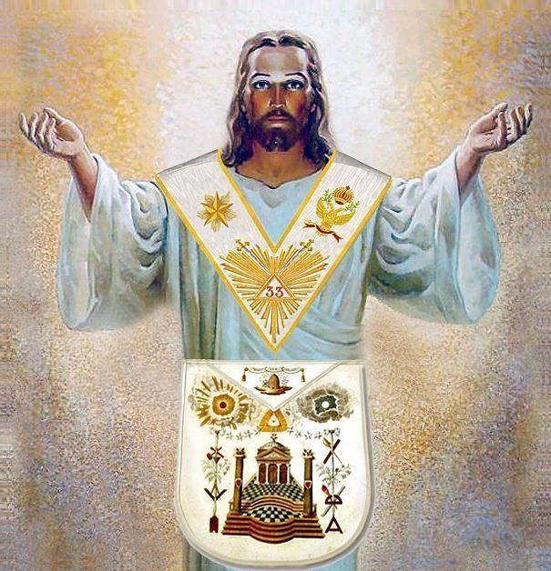
ISLA SAN GIORGIO (VENECIA)=GEORGE LEMAITRE
Qué relación hay entre Albert Einstein, los ríos y el famoso número Pi? Hoy en Derivando te lo vamos a explicar ... |
|
|
|
|
|
|
Rispondi |
Messaggio 5 di 13 di questo argomento |
|
|
|
|
Rispondi |
Messaggio 6 di 13 di questo argomento |
|
|
|
|
Rispondi |
Messaggio 7 di 13 di questo argomento |
|
ANCIENT EGYPTIAN GEODESY - PART II
The great circle alignment from Giza to Alexandria has an azimuth of 51.85° north of due west from Giza (the same angle as the slope of the Great Pyramid). Extended beyond Alexandria, this great circle also crosses over Delphi, Rollright and Newgrange, as well as the city of London.
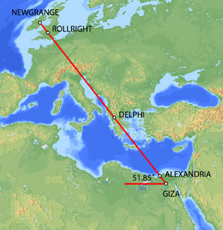
Map image © VectorGlobe
The azimuth of a great circle alignment from Dendera to Paris is also 51.85° north of due west.
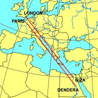
Map image - Roger Hedin
Dendera was dedicated to Isis/Sirius. The ancient Egyptian year began on the date of the heliacal rising of Sirius in mid July. The helical rising of Sirius heralded the annual inundation of the Nile that was essential to the welfare of ancient Egypt. The axis of the temple of Isis at Dendera was aligned 20° south of due east, pointing directly at the rising point of Sirius from the latitude of Dendera.
Robert Bauval describes a number of connections between Isis/Sirius and Paris in Talisman (2004). Isis is shown riding on a boat in many ancient Egyptian drawings and carvings. At the direction of Napoleon, Sirius and a statue of Isis were added to the coat of arms for Paris shown below.
During the French revolution, a statue of Isis known as the Fountain of Regeneration was constructed on the former site of the Bastille. The engraving below commemorated this statue.
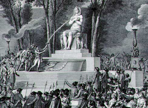
Fountain of Regeneration Engraving
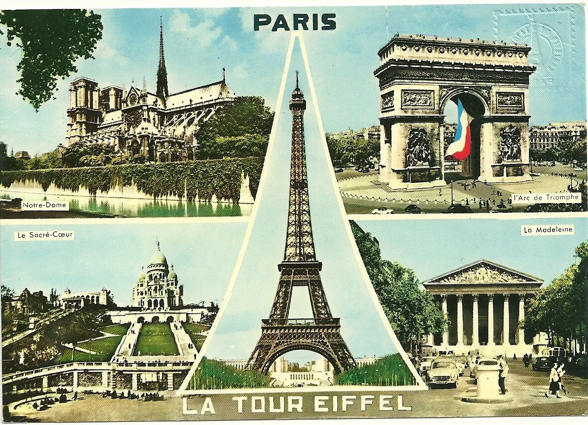
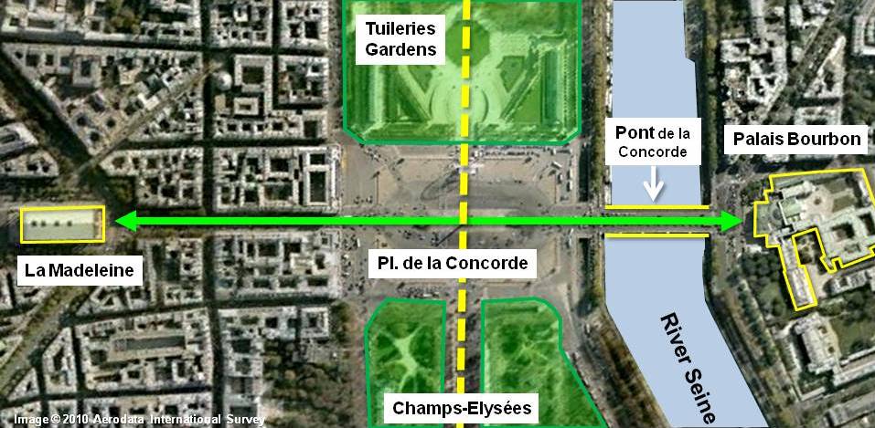
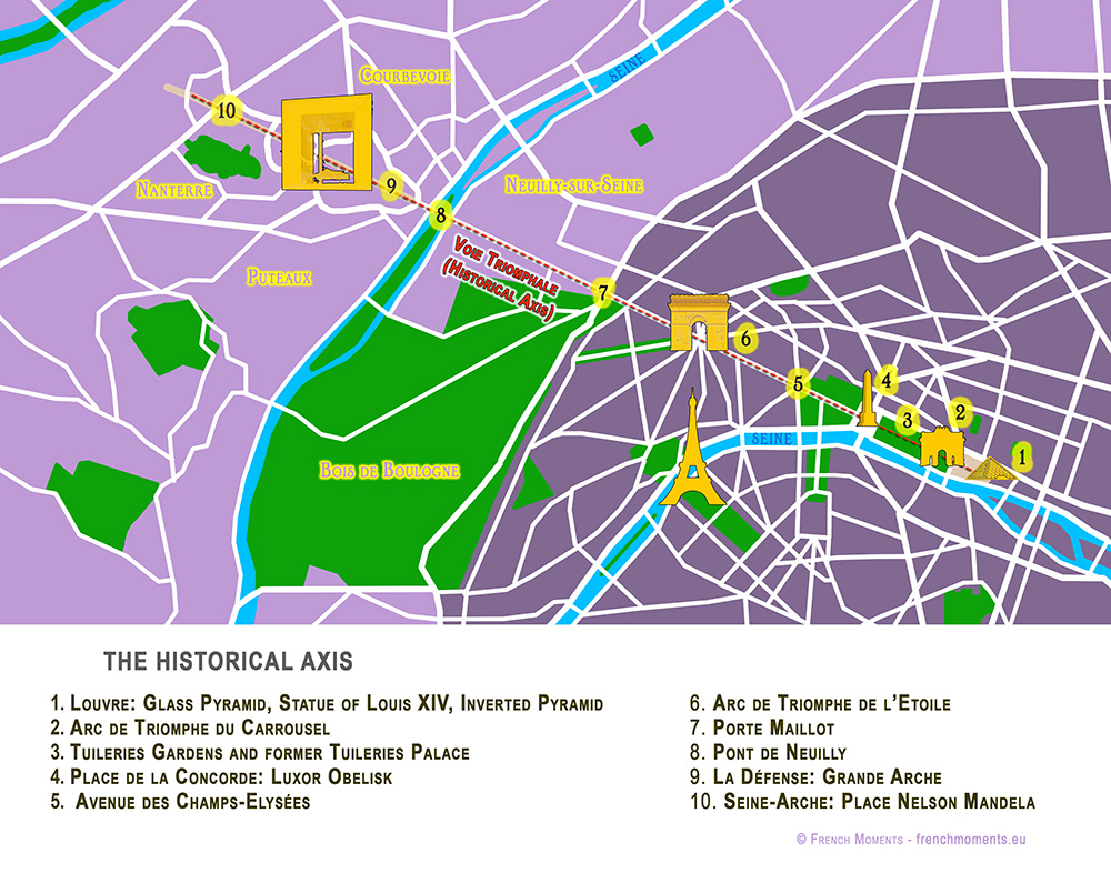
The Elysian Fields is described as a place of eternal salvation in the ancient Egyptian Book of the Dead. Named after the Elysian Fields, the Champs Elysees is the main axis of Paris. The names Elysian and Elysees both suggest an association with Isis. The photograph below is facing southeast. The Arc de Triumphe is visible in the background. Beyond the Arc de Triumphe is the Louvre. The azimuth of the Champs Elysees is 26° south of due east, pointing directly at the rising point of Sirius/Isis from the latitude of Paris.
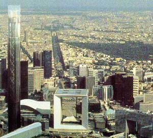
The termination point of the Champs Elysees to the northwest is the Grande Arche, in the foreground of the picture above. The axis of the Grande Arche is offset 6.33° south of the axis of the Champs Elysees. With an azimuth of just over 32° south of due east, the azimuth of the axis of the Grande Arche is the same as the azimuth of the great circle alignment from Paris to Dendera.
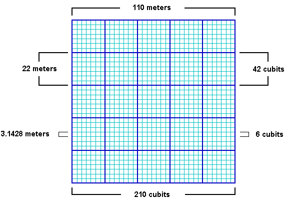
The Grande Arche is a nearly perfect cube with a height of 110 meters, a width of 108 meters and a depth of 112 meters. It is often described as a cube with side lengths of 110 meters. This is equal to 210 ancient Egyptian cubits:
110/210 = .5238
.5238 meters is a precise measure of the ancient Egyptian cubit, equating to 20.6222 inches, well within the ± .005 inches in Petrie's 20.62 inch measure of the ancient Egyptian cubit. Instead of the usual comparisons between the cubit and the meter of .52375/1 or .524/1, the best comparative measure may be the simple fraction of 11/21 that is suggested by the Grande Arche.
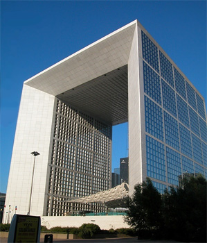
Image © Insecula.com
The sides of the Grande Arche are divided into 5 x 5 large panels and within each large panel are 7 x 7 smaller panels. Side lengths of 110 meters suggest lengths of 22 meters for the sides of the large panels with lengths of 22/7 meters for the sides of the smaller panels. The fraction 22/7 equals 3.1428, an accurate expression of π that is also found in the dimensions of the Great Pyramid. Side lengths of 210 cubits in the Grande Arche suggest lengths of 42 cubits for the sides of the large panels and 6 cubits for the sides of the smaller panels. This also shows that the relationship between the meter and the cubit is 6/π, using the measure of 22/7 for π:
21/11 = 6/π
22/7 x 21/11 = 6
The northern pyramid at Dashur, known as the Red Pyramid, was the first true (smooth sided) pyramid built in Egypt and it was the last pyramid built prior to construction of the Great Pyramid. The baselengths of the Red Pyramid are 420 cubits (220 meters) long, 20x multiples of 21/11.
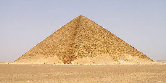
Image by Jon Bodsworth
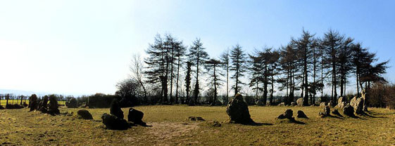
One of the oldest stone circles in England is at Rollright. The diameter of the Rollright circle is 31.4 meters, an accurate expression of π times 10 meters. Given the 6/π relationship between the meter and the cubit, the diameter of the Rollright circle is also 60 ancient Egyptian cubits.
BACK
http://home.hiwaay.net/~jalison/Art5.html
|
|
|
|
Rispondi |
Messaggio 8 di 13 di questo argomento |
|
|
|
|
Rispondi |
Messaggio 9 di 13 di questo argomento |
|
TAG: NILE FLOODING SIRIUS
 Looking east from latitude 30 north on August 3rd, 30 minutes before sunrise. (Created by the author in Stellarium).
Can you feel the heat?
It’s not just your imagination. The northern hemisphere is currently in the midst of the Dog Days of Summer. For many, early August means hot, humid days and stagnant, sultry nights.
The actual dates for the Dog Days of Summer vary depending on the source, but are usually quoted as running from mid-July to mid-August. The Old Farmer’s Almanac lists the Dog Days as running from July 3rd through August 11th.
But there is an ancient astronomical observation that ties in with the Dog Days of Summer, one that you can replicate on these early August mornings.
The sky was important to the ancients. It told them when seasons were approaching, when to plant crops, and when to harvest. Ancient cultures were keen observers of the cycles in the sky. Cultures that were “astronomically literate” had a distinct edge over those who seldom bothered to note the goings on overhead.
 The flooded Temple of Isis on the island of Philae circa 1905. ( Credit: Wikimedia Commons under an Attribution-Share Alike 2.5 license. Author H.W. Dunning).
Sirius was a key star for Egyptian astronomers. Identified with the goddess Isis, the Egyptian name for Sirius was Sopdet, the deification of Sothis. There is a line penned by the Greco-Roman scholar Plutarch which states:
“The soul of Isis is called ‘Dog’ by the Greeks.”
Political commentary? A mis-translation by Greek scholars? Whatever the case, the mythological transition from “Isis to Sothis to Dog Star” seems to have been lost in time.
These astronomer-priests noted that Sirius rose with the Sun just prior to the annual flooding of the Nile. The appearance of a celestial object at sunrise is known as a heliacal rising. If you can recover Sirius from behind the glare of the Sun, you know that the “Tears of Isis” are on their way, in the form of life-giving flood waters.
 Sopdet as the personification of Sirius (note the star on the forehead) Wikimedia Commons image under an Attribution Share Alike 3.0 license. Author Jeff Dahl).
In fact, the ancient Egyptians based their calendar on the appearance of Sirius and what is known as the Sothic cycle, which is a span of 1,461 sidereal years (365.25 x 4) in which the heliacal rising once again “syncs up” with the solar calendar.
It’s interesting to note that in 3000 BC, the heliacal rising of Sirius and the flooding of the Nile occurred around June 25th, near the summer solstice. This also marked the Egyptian New Year. Today it occurs within a few weeks of August 15th, owing to precession. (More on that in a bit!)
By the time of the Greeks, we start to see Sirius firmly referred to as the Dog Star. In Homer’s Iliad, King Priam refers to an advancing Achilles as:
“Blazing as the star that cometh forth at Harvest-time, shining forth amid the host of stars in the darkness of the night, the star whose name men call Orion’s Dog”
The Romans further promoted the canine branding for Sirius. You also see references to the “Dog Star” popping up in Virgil’s Aenid.
Over the years, scholars have also attempted to link the dog-headed god Anubis to Sirius. This transition is debated by scholars, and in his Star Names: Their Lore and Meaning, Richard Hinckley Allen casts doubt on the assertion.
 Sirius as the shining “nose” of the constellation Canis Major. (Created by the author using Starry Night).
Ancient cultures also saw the appearance of Sirius as signifying the onset of epidemics. Their fears were well founded, as summer flooding would also hatch a fresh wave of malaria and dengue fever-carrying mosquitoes.
Making a seasonal sighting of Sirius is fun and easy to do. The star is currently low to the southeast in the dawn, and rises successively higher each morning as August rolls on.
The following table can be used to aid your quest in Sirius-spotting.
|
Latitude north
|
Theoretical date when Sirius can 1st be spotted
|
|
32°
|
August 3rd
|
|
33°
|
August 4th
|
|
34°
|
August 5th
|
|
35°
|
August 6th
|
|
36°
|
August 7th
|
|
37°
|
August 8th
|
|
38°
|
August 9th
|
|
39°
|
August 10th
|
|
40°
|
August 11th
|
|
41°
|
August 12th
|
|
42°
|
August 13th
|
|
43°
|
August 14th
|
|
44°
|
August 15th
|
|
45°
|
August 16th
|
|
46°
|
August 17th
|
|
47°
|
August 18th
|
|
48°
|
August 19th
|
|
49°
|
August 20th
|
|
50°
|
August 21st
|
Thanks to “human astronomical computer extraordinaire” Ed Kotapish for the compilation!
Note that the table above is perpetual for years in the first half of the 21st century. Our friend, the Precession of the Equinoxes pivots the equinoctial points to the tune of about one degree every 72 years. The Earth’s axis completes one full “wobble” approximately every 26,000 years. Our rotational pole only happens to be currently pointing at Polaris in our lifetimes. Its closest approach is around 2100 AD, after which the north celestial pole and Polaris will begin to drift apart. Mark your calendars—Vega will be the pole star in 13,727 AD. And to the ancient Egyptians, Thuban in the constellation Draco was the Pole Star!
 The Colossi of Memnon Near Luxor, just one of the amazing architectural projects carried out by the ancient Egyptians. (Photo by author).
Keep in mind, atmospheric extinction is your enemy in this quest, as it will knock normally brilliant magnitude -1.46 Sirius a whopping 40 times in brightness to around magnitude +2.4.
Note that we have a nice line-up of planets in the dawn sky (see intro chart), which are joined by a waning crescent Moon this weekend. Jupiter and Mars ride high about an hour before sunrise, and if you can pick out Mercury at magnitude -0.5 directly below them, you should have a shot at spotting Sirius far to the south.
And don’t be afraid to “cheat” a little bit and use binoculars in your quest… we’ve even managed on occasion to track Sirius into the broad daylight. Just be sure to physically block the Sun behind a building or hill before attempting this feat!
 Sirius as seen via Hubble- can you spy Sirius B? (Credit: NASA/ESA Hubble image).
Of course, the heliacal rising of Sirius prior to the flooding of the Nile was a convenient coincidence that the Egyptians used to their advantage. The ancients had little idea as to what they were seeing. At 8.6 light-years distant, Sirius is the brightest star in Earth’s sky during the current epoch. It’s also the second closest star visible to the naked eye from Earth. Only Alpha Centauri, located deep in the southern hemisphere sky is closer. The light you’re seeing from Sirius today left in early 2005, back before most of us had Facebook accounts.
Sirius also has a companion star, Sirius B. This star is the closest example of a white dwarf. Orbiting its primary once every 50 years, Sirius B has also been the center of a strange controversy we’ve explored in past writings concerning Dogon people of Mali.
Sirius B is difficult to nab in a telescope, owing to dazzling nearby Sirius A. This feat will get easier as Sirius B approaches apastron with a max separation of 11.5 arc seconds in 2025.
Some paleoastronomers have also puzzled over ancient records referring to Sirius as “red” in color. While some have stated that this might overturn current astrophysical models, a far more likely explanation is its position low to the horizon for northern hemisphere observers. Many bright stars can take on a twinkling ruddy hue when seen low in the sky due to atmospheric distortion.
 Let the Dog Days of Summer (& astronomy) begin! (Photo by author).
All great facts to ponder during these Dog Days of early August, perhaps as the sky brightens during the dawn and your vigil for the Perseid meteors draws to an end!
https://www.universetoday.com/tag/nile-flooding-sirius/ |
|
|
|
Rispondi |
Messaggio 10 di 13 di questo argomento |
|
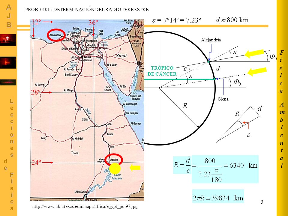
Eratóstenes
Eratóstenes de Cirene (en griego antiguo Ἐρατοσθένης, Eratosthénēs) (Cirene, 276 a. C.1-Alejandría, 194 a. C.) fue un matemático, astrónomo y geógrafo griego de origen cirenaico.
Eratóstenes era hijo de Aglaos. Estudió en Alejandría y durante algún tiempo en Atenas. Fue discípulo de Aristón de Quíos, de Lisanias de Cirene y del poeta Calímaco y también gran amigo de Arquímedes. En el año 236 a. C., Ptolomeo III le llamó para que se hiciera cargo de la Biblioteca de Alejandría, puesto que ocupó hasta el fin de sus días. La Suda afirma que, tras perder la vista, se dejó morir de hambre a la edad de 80 años; sin embargo, Luciano dice que llegó a la edad de 82 años; también Censorinosostiene que falleció cuando tenía 82 años.
Esfera armilar[editar]
A Eratóstenes se le atribuye la invención, hacia 255 a. C., de la esfera armilar que aún se empleaba en el siglo XVII. Aunque debió de usar este instrumento para diversas observaciones astronómicas, sólo queda constancia de la que le condujo a la determinación de la oblicuidad de la eclíptica. Determinó que el intervalo entre los trópicos (el doble de la oblicuidad de la eclíptica) equivalía a los 11/83 de la circunferencia terrestre completa, resultando para dicha oblicuidad 23º 51' 19", cifra que posteriormente adoptaría el astrónomo Claudio Ptolomeo.
Según algunos historiadores, Eratóstenes obtuvo un valor de 24º y el refinamiento del resultado se debió hasta 11/83 al propio Ptolomeo. Además, según Plutarco, de sus observaciones astronómicas durante los eclipses dedujo que la distancia al Sol era de 804 000 000 estadios, la distancia a la Luna 780 000 estadios y, según Macrobio, que el diámetro del Sol era 27 veces mayor que el de la Tierra. Realmente el diámetro del Sol es 109 veces el de la Tierra y la distancia a la Luna es casi tres veces la calculada por Eratóstenes, pero el cálculo de la distancia al Sol, admitiendo que el estadio empleado fuera de 185 metros, fue de 148 752 060 km, muy similar a la unidad astronómica actual. A pesar de que se le atribuye frecuentemente la obra Katasterismoi, que contiene la nomenclatura de 44 constelaciones y 675 estrellas, los críticos niegan que fuera escrita por él, por lo que se suele designar Pseudo-Eratóstenes a su autor.
Medición de las dimensiones de la Tierra[editar]

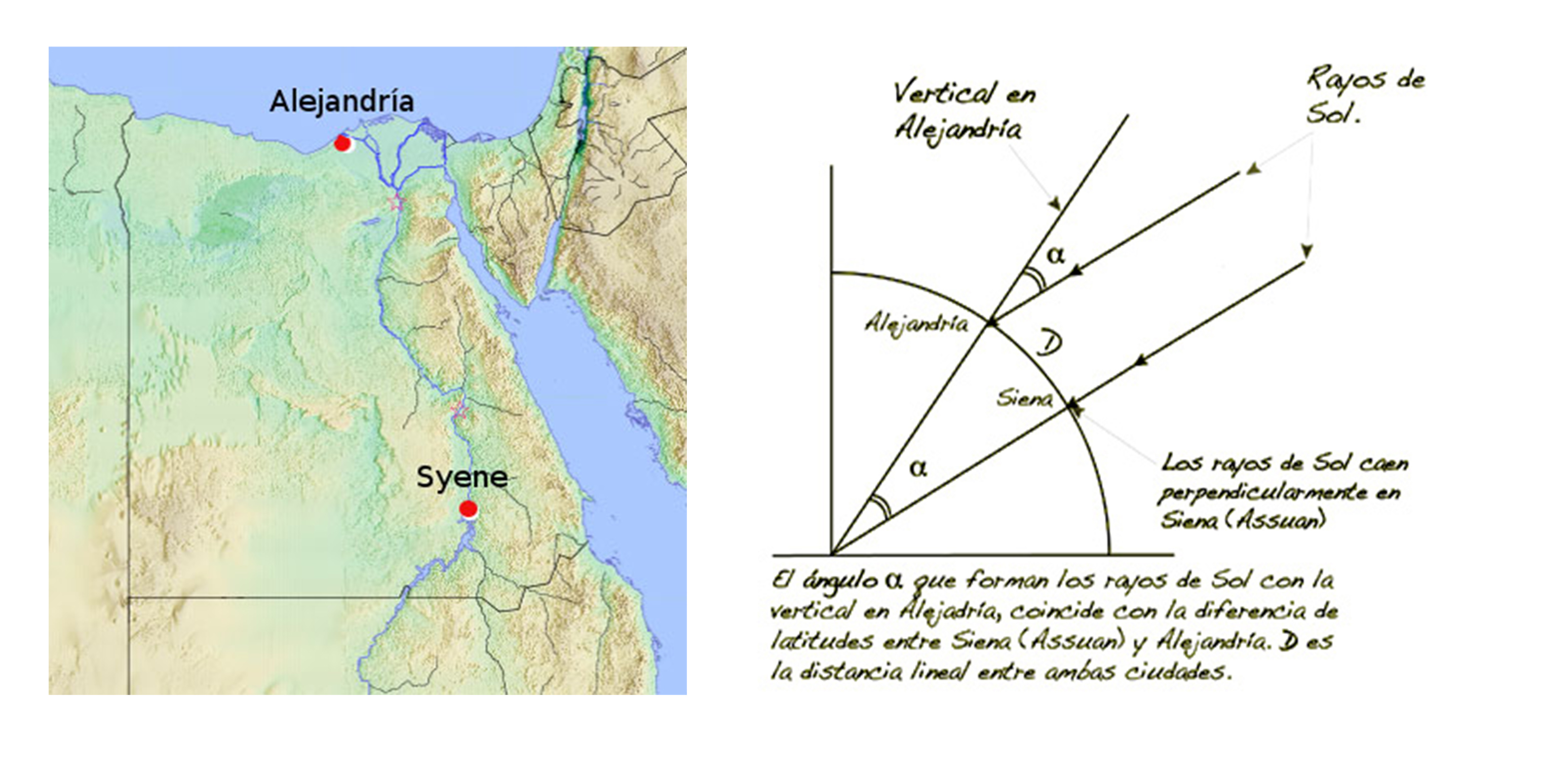
En el solsticio de verano, los rayos solares inciden perpendicularmente sobre Siena ( Asuán). En Alejandría, más al norte, midiendo la altura de un edificio y la longitud de la sombra que proyecta, se puede determinar el ángulo formado con el plano de la eclíptica, en el que se encuentran el Sol y la ciudad de Siena, ángulo que es precisamente la diferencia de latitud entre ambas ciudades. Conocida ésta, basta medir el arco de circunferencia y extrapolar el resultado a la circunferencia completa (360º).

Reconstrucción del siglo XIX (según Bunbury) del mapa de Eratóstenes del mundo conocido en su época.
Sin embargo, el principal motivo de su celebridad es sin duda la determinación del tamaño de la Tierra. Para ello inventó y empleó un método trigonométrico, además de las nociones de latitud y longitud, al parecer ya introducidas por Dicearco, por lo que bien merece el título de padre de la geodesia.
Por referencias obtenidas de un papiro de su biblioteca, sabía que en Siena (hoy Asuán, Egipto) el día del solsticio de verano los objetos verticales no proyectaban sombra alguna y la luz alumbraba el fondo de los pozos; esto significaba que la ciudad estaba situada justamente sobre la línea del trópico y su latitud era igual a la de la eclíptica que ya conocía. Eratóstenes, suponiendo que Siena y Alejandría tenían la misma longitud (realmente distan 3º) y que el Sol se encontraba tan alejado de la Tierra que sus rayos podían suponerse paralelos, midió la sombra en Alejandría el mismo día del solsticio de verano al mediodía, demostrando que el cenit de la ciudad distaba 1/50 parte de la circunferencia, es decir, 7º 12' del de Alejandría. Según Cleomedes, Eratóstenes se sirvió del scaphium o gnomon (un protocuadrante solar) para el cálculo de dicha cantidad.
Posteriormente, tomó la distancia estimada por las caravanas que comerciaban entre ambas ciudades, aunque bien pudo obtener el dato en la propia Biblioteca de Alejandría, fijándola en 5000 estadios, de donde dedujo que la circunferencia de la Tierra era de 250 000 estadios, resultado que posteriormente elevó hasta 252 000 estadios, de modo que a cada grado correspondieran 700 estadios. También se afirma que Eratóstenes, para calcular la distancia entre las dos ciudades, se valió de un regimiento de soldados que diera pasos de tamaño uniforme y los contara.
Admitiendo que Eratóstenes usase el estadio ático-italiano de 184.8 m, que era el que solía utilizarse por los griegos de Alejandría en aquella época, el error cometido sería de 6.192 kilómetros (un 15 %). Sin embargo, hay quien defiende que empleó el estadio egipcio (300 codos de 52,4 cm), en cuyo caso la circunferencia polar calculada hubiera sido de 39614 km, frente a los 40008 km considerados en la actualidad, es decir, un error de menos del 1%.
Ahora bien, es imposible que Eratóstenes diera con la medida exacta de la circunferencia de la Tierra debido a errores en los supuestos que calculó. Tuvo que haber tenido un margen de error considerable y por lo tanto no pudo haber usado el estadio egipcio:2
- Supuso que la Tierra es perfectamente esférica, lo que no es cierto. Un grado de latitud no representa exactamente la misma distancia en todas las latitudes, sino que varía ligeramente de 110,57 km en el Ecuador hasta 111,7 km en los Polos. Por eso no podemos suponer que 7º entre Alejandría y Siena representen la misma distancia que 7º en cualquier otro lugar a lo largo de todo el meridiano.
- Supuso que Siena y Alejandría se encontraban situadas sobre un mismo meridiano, lo cual no es así, ya que hay una diferencia de 3 grados de longitud entre ambas ciudades.
- La distancia real entre Alejandría y Siena (hoy Asuán) no es de 924 km (5000 estadios ático-italiano de 184,8 m por estadio), sino de 843 km (distancia aérea y entre los centros de las dos ciudades), lo que representa una diferencia de 81 km.
- Realmente Siena no está ubicada exactamente sobre el paralelo del trópico de cáncer (los puntos donde los rayos del sol caen verticalmente a la tierra en el solsticio de verano). Actualmente se encuentra situada a 72 km (desde el centro de la ciudad). Pero debido a que las variaciones del eje de la Tierra fluctúan entre 22,1 y 24,5º en un período de 41000 años, hace 2000 años se encontraba a 41 km.
- La medida de la sombra que se proyectó sobre la vara de Eratóstenes hace 2.200 años debió ser de 7,5º o 1/48 parte de una circunferencia y no 7,2º o 1/50 parte. Puesto que en aquella época no existía el cálculo trigonométrico, para calcular el ángulo de la sombra, Eratóstenes pudo haberse valido de un compás,3 para medir directamente dicho ángulo, lo que no permite una medida tan precisa.
https://es.wikipedia.org/wiki/Erat%C3%B3stenes
|
|
|
|
Rispondi |
Messaggio 11 di 13 di questo argomento |
|
|
|
|
Rispondi |
Messaggio 12 di 13 di questo argomento |
|
|
|
|
Rispondi |
Messaggio 13 di 13 di questo argomento |
|
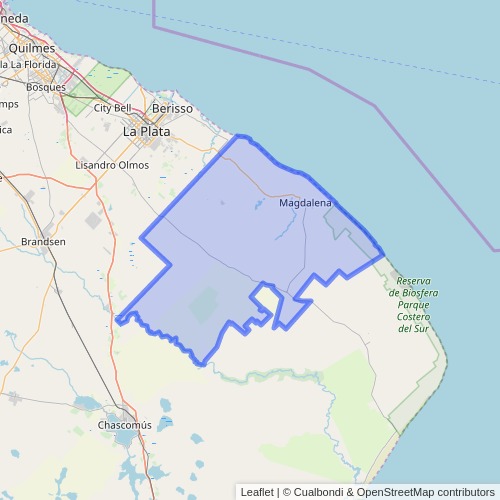
Milei abandona el estratégico Canal Magdalena: el comercio exterior argentino obligado a pasar por Uruguay
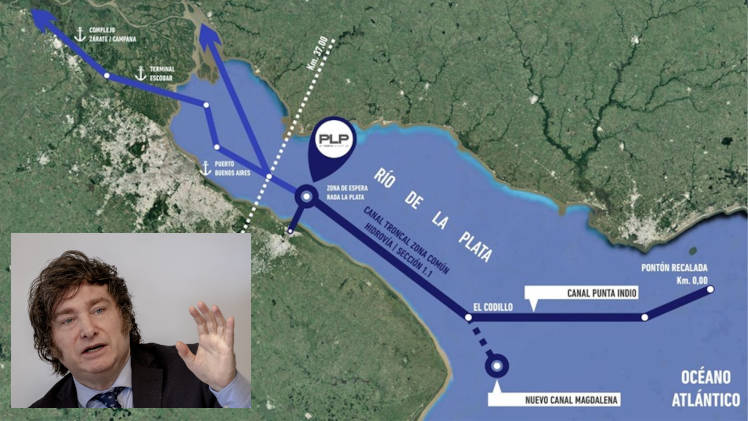
El presidente de la Argentina, Javier Milei, dejó sin efecto la realización de la obra del dragado en el canal Magdalena, una obra estratégica para el comercio exterior y la defensa nacional. En paralelo, su par uruguayo, Luis Lacalle Pou, anunció recientemente que el mandatario argentino aprobó los planes que permitirán expandir el puerto de Montevideo.
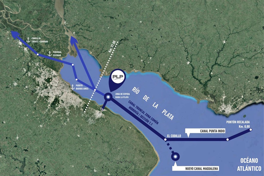
De haberse concretado la obra mencionada en el canal Magdalena, la Argentina se hubiera asegurado la salida directa de las exportaciones nacionales y la integración del litoral marítimo patagónico, creando una conexión marítima entre los puertos del Río de la Plata y del litoral marítimo de las provincias argentinas directamente con el Océano Atlántico estableciendo un corredor logístico nacional y soberano para el comercio exterior.
El proyecto uruguayo implica la profundización del calado hasta 14 metros, permitiendo el acceso de buques de carga más grandes, lo que permitirá un mayor desarrollo y aumento de la competitividad para Montevideo, en detrimento especialmente de los puertos bonaerenses de La Plata y Bahía Blanca. Los buques que bajan y suben por el Paraná y Buenos Aires, seguirán teniendo que pasar por Uruguay.
Esa decisión del gobierno de La Libertad Avanza, impacta de manera negativa en el país implicando pérdida de soberanía, subordinación ante el país vecino, riesgo en la seguridad portuaria y un claro golpe en la economía nacional.
Lacalle Pou celebró la decisión del mandatario argentino en su cuenta de X (Twitter) y resaltó la “buena voluntad” del presidente Milei y su canciller Diana Mondino.
En torno a la decisión del gobierno libertario, Luciano Orellano, referente del Foro por la Recuperación del Paraná y autor del libro “Argentina sangra por las barrancas del río Paraná” (investigación sobre la pérdida de soberanía), alertó en una entrevista radial: “Esto, en primer lugar, es un tema de defensa; no solo de comercio. Esto es una locura sobre todo cuando tenemos una parte nuestro territorio ocupado por extranjeros como son las islas Malvinas y toda la plataforma continental. Lo otro es renunciar a tener un puerto testigo como el de Buenos Aires”.
Y agregó: “Además, el puerto no lo tiene Montevideo; ese es un caso muy parecido a lo que pasa aquí en la ciudad de Rosario; que son enclaves coloniales, o sea son puertos públicos que han sido concesionados a empresas extranjeras y ahora se está habilitando un puerto pesquero con una inversión de 100 millones de dólares. Todo lo que se roban del mar argentino en cuestión de pesca va al puerto de Montevideo, desde ahí se integra el mundo sin explicar el origen y sin dejarle un peso a los queridos hermanos uruguayos”.
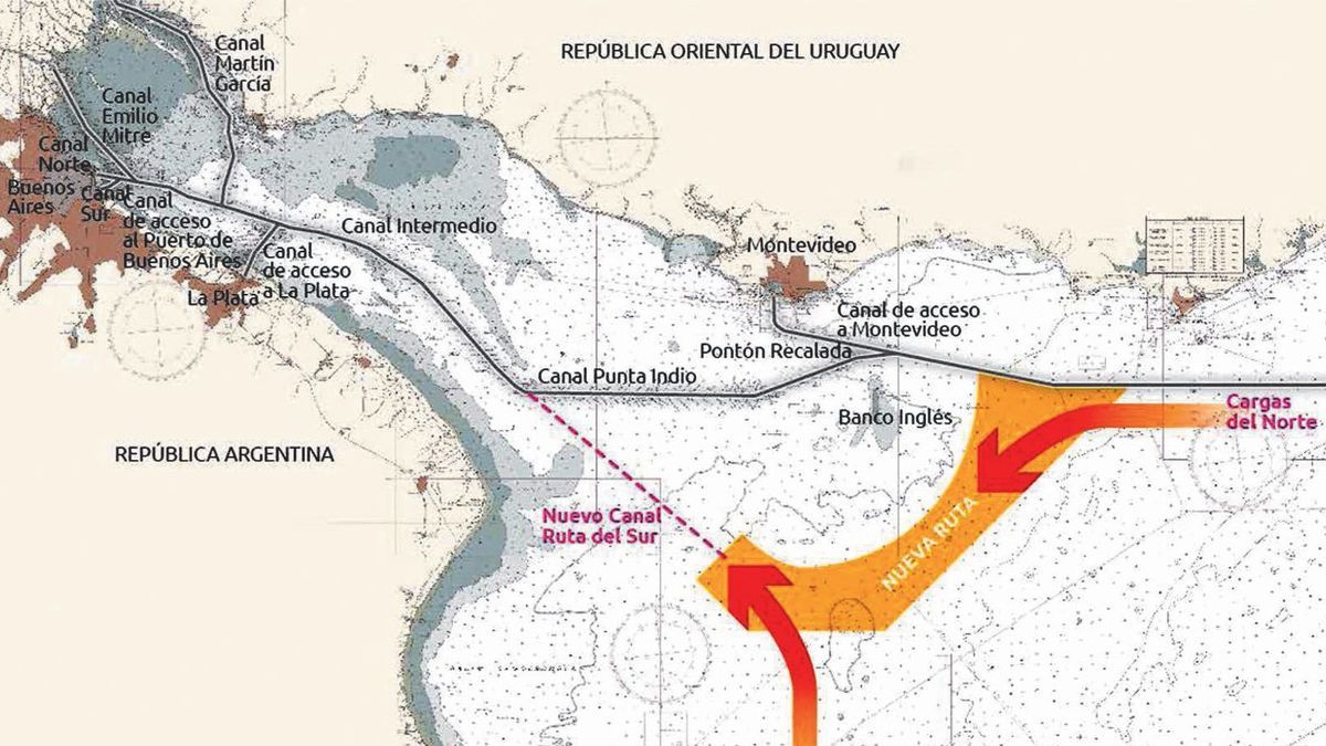
Orellano, advirtió finalmente: “Desde el gran Rosario salen 6000 buques que tienen que ir a Montevideo para poder salir al mar, eso es una locura; yo nunca lo escuché desde que nos fundamos como Nación”. “Renunciar a tener el puerto director de Buenos Aires, fundacional del Estado argentino, es una claudicación total al pueblo y a la patria; no se puede concebir”.

https://noticiasholisticas.com.ar/milei-abandona-el-estrategico-canal-magdalena-el-comercio-exterior-argentino-obligado-a-pasar-por-uruguay/ |
|
|
Primo
Precedente
2 a 13 de 13
Successivo
Ultimo
|
|
| |
|
|
©2025 - Gabitos - Tutti i diritti riservati | |
|
|


![How To Embed Google Maps in WordPress [2 Methods!]](https://formidableforms.com/wp-content/uploads/2025/01/eiffel-tower-google-maps-example.png)


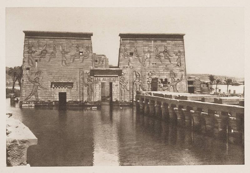 The flooded Temple of Isis on the island of Philae circa 1905. (Credit: Wikimedia Commons under an Attribution-Share Alike 2.5 license. Author H.W. Dunning).
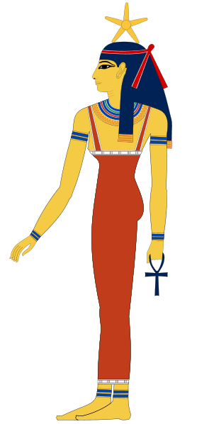 Sopdet as the personification of Sirius (note the star on the forehead) Wikimedia Commons image under an Attribution Share Alike 3.0 license. Author Jeff Dahl).
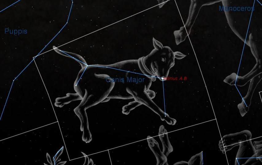 Sirius as the shining “nose” of the constellation Canis Major. (Created by the author using Starry Night).
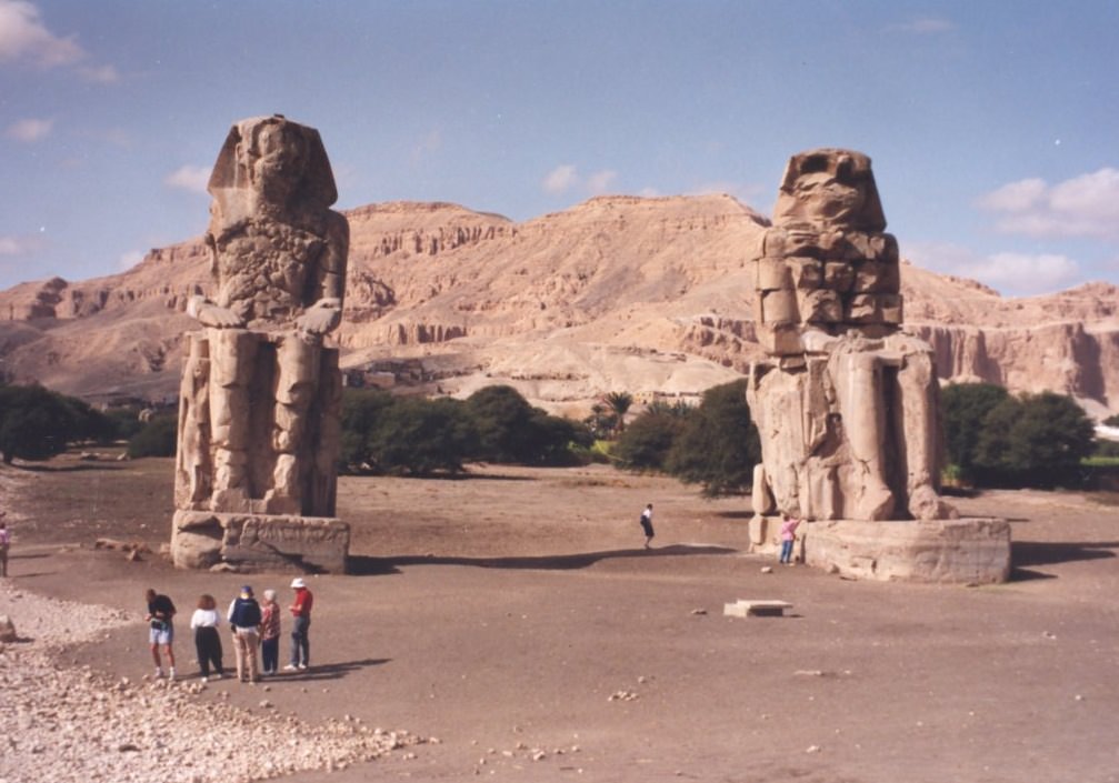 The Colossi of Memnon Near Luxor, just one of the amazing architectural projects carried out by the ancient Egyptians. (Photo by author).
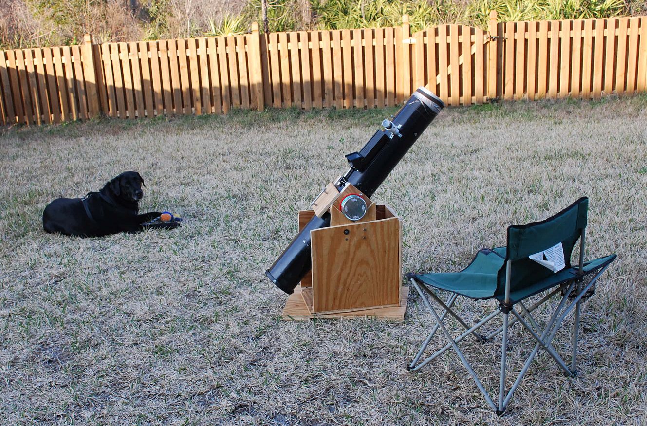 Let the Dog Days of Summer (& astronomy) begin! (Photo by author).