|
|
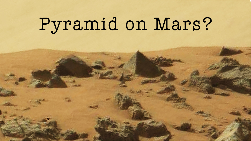
General: PIRAMIDE EN MARTE-RELACION CON EL SANTO GRIAL-SECRETO MASONICO
Triar un altre plafó de missatges |
|
|


SIRIO ES LA CONSTELACION DEL PERRO/ CAN MAYOR
 EL MISMO DISEÑO DE ORION EL MISMO DISEÑO DE ORION
99. Ezequiel 22:7: Al padre y a la madre despreciaron en ti; al EXTRANJERO trataron con violencia en medio de ti; al huérfano y a la viuda despojaron en ti.
HECHOS 12:12 (MARCOS/ MARTE / MARZO/ PASCUA)
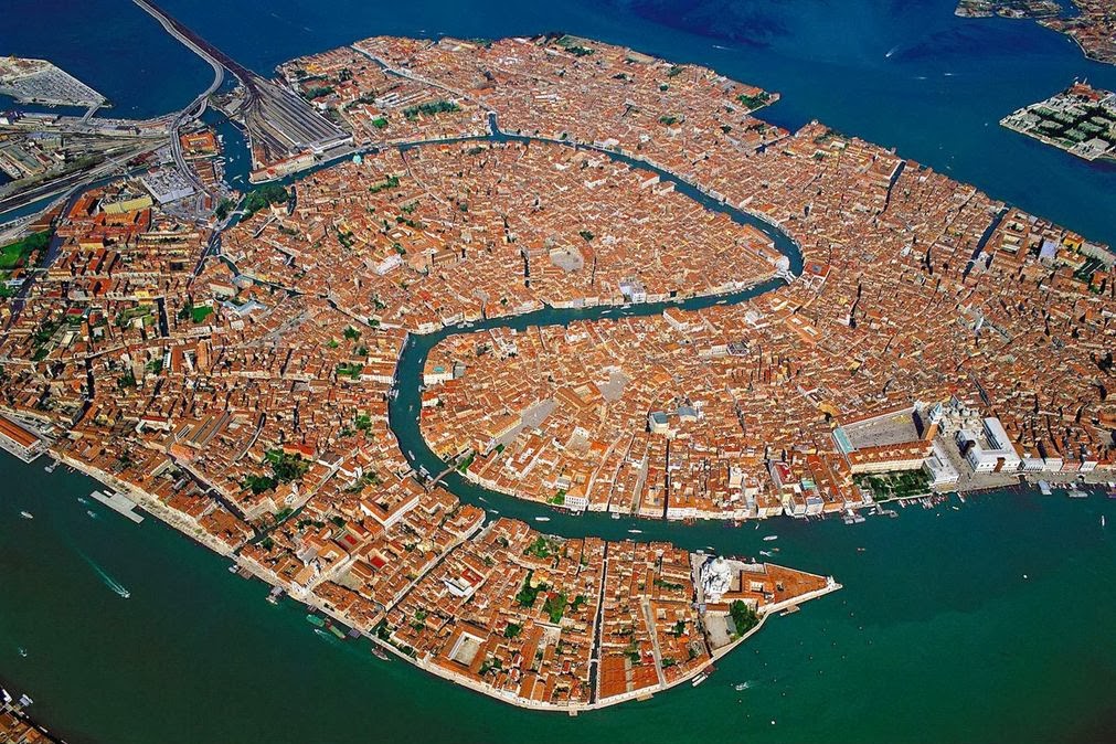
NOTEN EL NEXO DE DAN, CON LA SERPIENTE (VENECIA) Y EL CABALLO (PLAZA SAN MARCOS)
7. Génesis 49:17 Será Dan SERPIENTE junto al camino, Víbora junto a la senda, Que muerde los talones del caballo, Y hace caer hacia atrás al jinete.
VENECIA=PLAZA SAN MARCOS
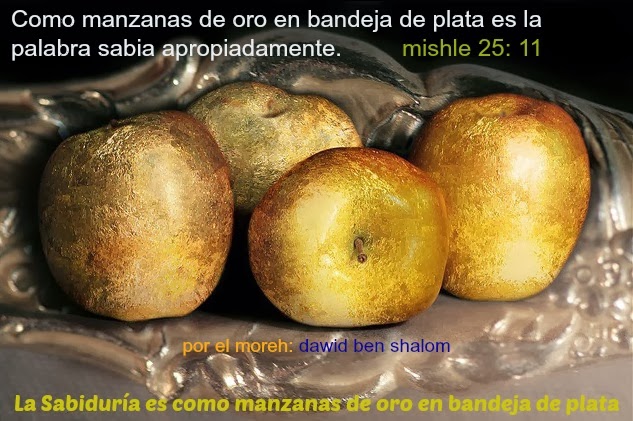
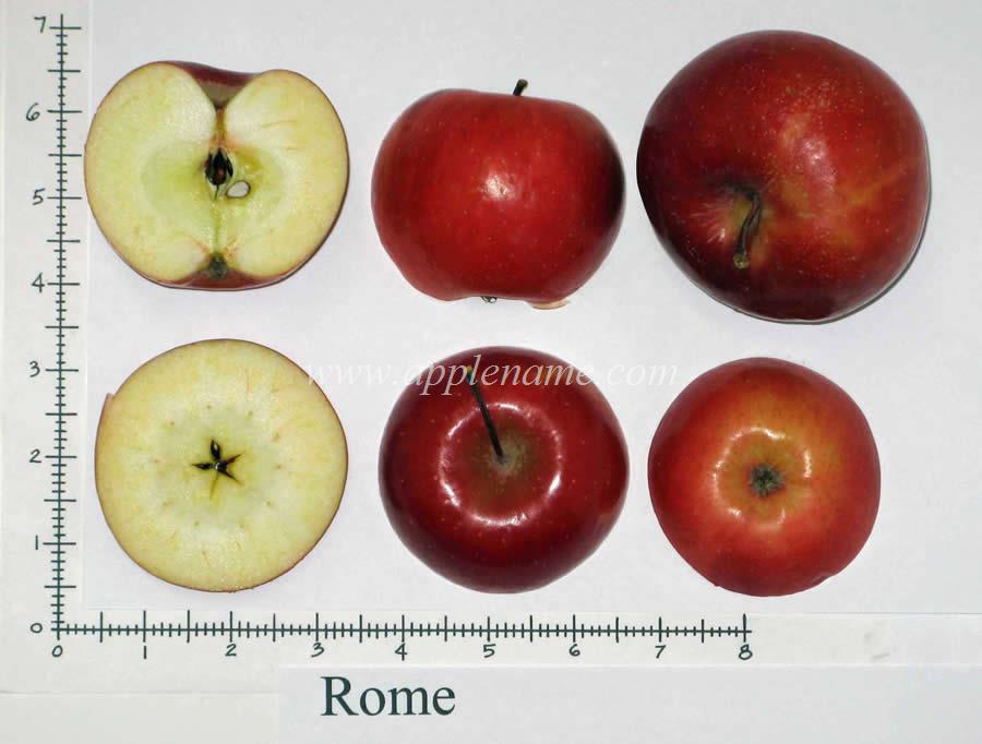
11. Proverbios 25:11 MANZANA de oro con figuras de plata Es la palabra dicha como conviene.
12. Cantares 2:5 Sustentadme con pasas, confortadme con MANZANAs; Porque estoy enferma de amor.
13. Cantares 7:8 Yo dije: Subiré a la palmera, Asiré sus ramas. Deja que tus pechos sean como racimos de vid, Y el olor de tu boca como de MANZANAs,
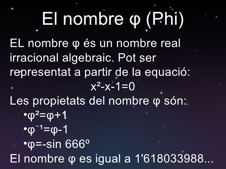
ALLI ESTA LA CONEXION VENUS / VENECIA CON EL 666
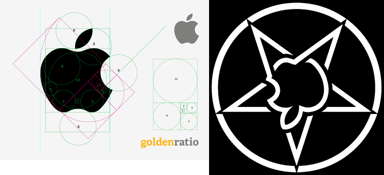
VENUS= PENTAGONO= VENECIA= NUMERO DE ORO= 1.618033
LAS MATEMATICAS SON EXACTAS.
GLORIA A DIOS TODOPODEROSO. QUE BELLAS SON LAS MATEMATICAS
|
|
|
|
|
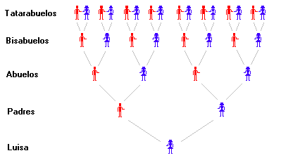
Noten la fuerte relacion del MUNDIAL CON EL LINAJE. COMIENZAN 32 EQUIPOS, CLASIFICAN 16, LUEGO SIGUEN 8, LUEGO 4, LUEGO 2 Y EL CAMPEON MUNDIAL ES EL GRIAL MISMO.
MASONERIA PURA.
LA COPA ES EL GRIAL MISMO, OSEA LA SANTA CENA
NO HAY PEOR NARCISISTA QUE EL QUE VIENDO NO QUIERE CREER.
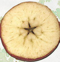
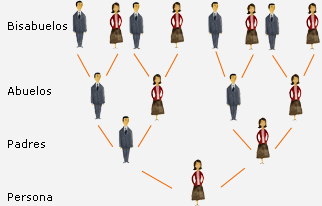
ES OBVIA LA CONNOTACION MASONICA CON EL LINAJE O EL ARBOL GENEALOGICO. UN HIJO TIENE DOS PADRES, CUATRO ABUELOS, 8 BISABUELOS, 16 TATARAABUELOS OSEA UNA REFERENCIA A 2 ELEVADO A LA N en el marco a que N=1,2,3,4,5,6,7,......,INFINITO. N ES OBVIAMENTE TIENE REFERENCIA AL NUMERO DE GENERACION. EL ARBOL, OBVIAMENTE, ES LA MISMA MANZANA.
MUNDO MISOGINO, QUE NO QUIERE CREER QUE CRISTO TUVO UN MUJER.
LA MUJER TIENE QUE HACERSE CARGO, DE QUE LA RELIGION SEA MACHISTA Y MISOGINA.
EL MISMO ARBOL GENEALOGICO
|
|
|
|
|
|
|
|
|
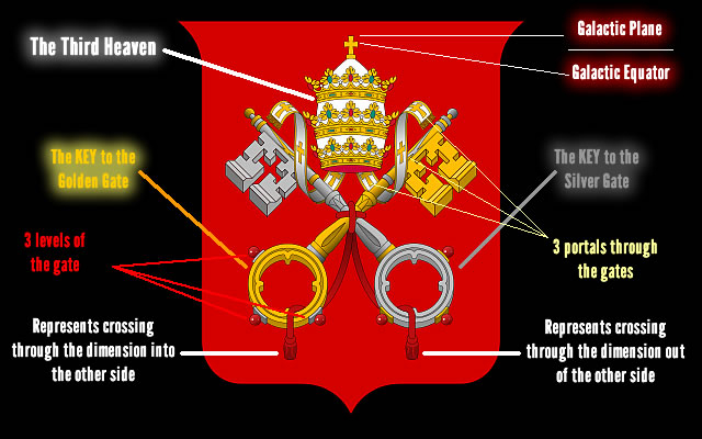
LLAVE DE ORO Y DE PLATA AL IGUAL QUE LA MANZANA
|
|
|
|
|
|
AMIGO ROLMEN, NO PEGAS UNA. TODOS LOS CAMINOS CONDUCEN A ROMA.
SALUDOS
|
|
|
|
|
|
ROMA ES UNA GEMATRIA DE AMOR AMIGO ROLMEN
HAY QUE ESTUDIAR ANTES DE HABLAR O DEMONIZAR.
CON TODO RESPETO
|
|
|
|
|
|
HAY QUE BAJAR EL EGO AMIGO ROLMEN
EMPEZAR DE BIEN ABAJO. NO QUEDA OTRA
CON TODO RESPETO
|
|
|
|
|
|
El estudiar amigo, ROLMEN, con todo respeto, ayuda a bajar el ego. ES DE TERROR AMIGO. TODO ESTA CODIFICADO. Te lo aseguro. Hay que volver a hacerse como un niño amigo y empezar de bien abajo.
|
|
|
|
|
|
La referencia del mundial en el contexto al ARBOL GENEALOGICO, tiene una referencia A MARTE, EN EL CONTEXTO AL TERCER DIA, en que fueron creados la tierra, el mar, las semillas, los arboles y los frutos. Esto explica LA RELACION DEL TERCER DIA CON REFERENCIA A LA CREACION DIVINA, EN EL CONTEXTO AL SEPTIMO DIA, EN LAS BODAS DE CANA E INCLUSO EN LA RESURRECCION.
MARTES=TERCER DIA (DOMINGO=PRIMER DIA Y LUNES=SEGUNDO DIA)
CONCRETAMENTE EL MUNDIAL TAMBIEN TIENE UN NEXO CON MARTE/MARCOS
|
|
|
|
|
|
|
|
|
EL MISMO VATICANO EN MARTE |
|
|
|
|
The Similarity of the Mayan Tikal Pyramids, Pleiades Stars and Mysterious Pyramids on Mars
The Mayan Tikal pyramids ruins mirror the Pleiades Stars
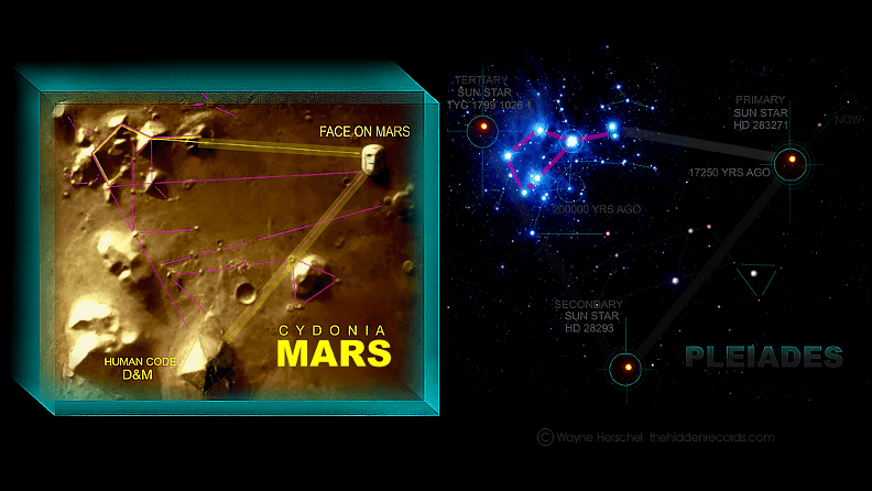
The image below shows the layout pattern of Tikal and the Pleiades Stars . There are 2 additional lines drawn to connect the Pleiades to 2 sun-like stars (A and B) found nearby. After linking the 2 sun-like stars, with another line, we can see the similarity of the Tikal layout and Pleiades (plus the 2 sun-like stars). They mirror each other!
The Mayan Tikal pyramids / Pleiades Stars layouts match the group of pyramids on Mars!
Now we take the Tikal layout, and put on the "group of pyramids" found on Mars..
Left: Mars pyramids with Tikal layout. Right: Mars pyramids with Pleiades layout
Amazingly..it shows that the Tikal site map and pyramids on Mars match on their own.
Now compare all these three - Tikal, Pleiades and Mars. The result - they have same layouts! Is this just a coincidence?
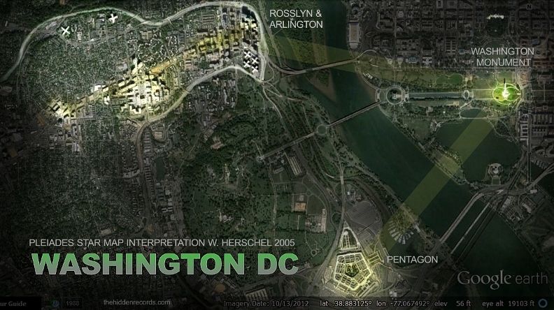
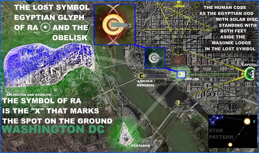
There is more. Every little anomaly in the Mars image has its counterpart in Pleiades star group. Below are photos - taken from thehiddenrecords.com - to show the correlations..
Left: Mars pyramids Right: Pleiades counterparts. They matched to each other.
Comparing both - there are a spectacular 21 correlations for the small stars matching small anomalies. There are six large magnitude stars correlating with six medium sized anomalies..
Now, if we look at the full layout, as shown in the 1st image above (including the sun-like stars A and B), there are 28 spectacular correlations where the Mars presentation still has one major piece of evidence that makes it far beyond just coincidence. It presents a perfectly geometry adjusted layout, altered fractionally not to make it a poor correlation, but ever so slightly adjusted to suggest it is constructed by advanced perfectionist beings... our ancestors. Note the parallel fine lines in yellow, the main shape between the cluster forming a trapezium, and a right angled triangle with two 45 degree angles.
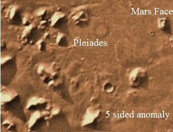
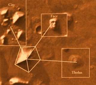
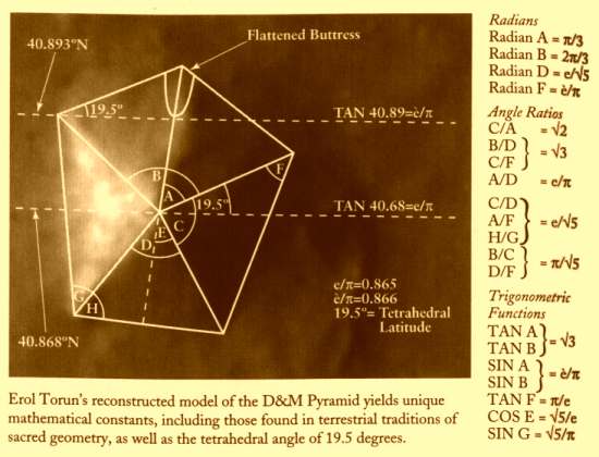
Now, how about this? - There is a five sided anomaly (like pyramid shape). It is located at the same position on sun-like stars B.
Image of the five sided anomaly on Mars
and..the following is more interesting.....the Mars Face at Mars Cydonia region - correlating with another sun-like stars (A)..
Photo of Mars Face - taken by the Viking 1 orbiter and released by NASA/JPL on July 25, 1976
Below are the images of the 'face', taken in different years by the space orbitors.
Side by side: A Viking 1 photo from 1976, a Mars Global Surveyor (MGS) image from 1998, and the latest MGS image from 2001.
Wayne Herschel, of thehiddenrecords.com, had done a 3D sun angle interpretation on the original black and white image, by using an art program - to produce the scientifically valid colored images. As a result - a 'face' clearly seen in the 3rd image.
Credit : Wayne Herschel, of thehiddenrecords.com
Note: The sun-like stars A is no more at the position as shown above - now. The existence of this star - at the position, as explained above - was back 17,000 years ago. See the analysis video below..
Image taken by a space orbitor - showing the position of the anomalies on Mars
Now, we have 3 similar layouts - Tikal site, Pleiades Stars and pyramids on Mars. With 28 major correlations between the Mars pyramids and Pleiades Stars, spectacular 5 sided anomaly and mysterious face on Mars - and accurately reflects each actual positions of the stars in the sky...it may be just coincidence..or may be not...
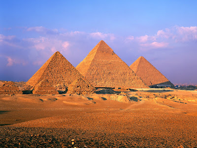
We know that the sun-like stars represent 5 sided anomaly (like pyramid) and Mars Face. The word "pyramid" brings us to the famous Egypt Giza pyramids.
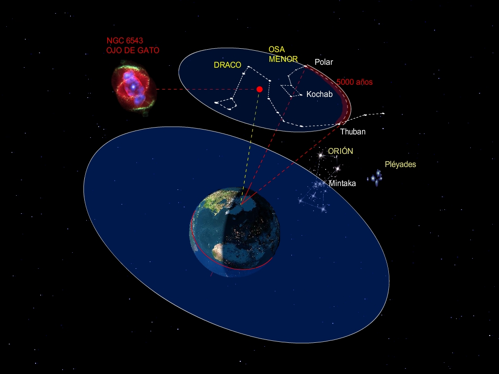
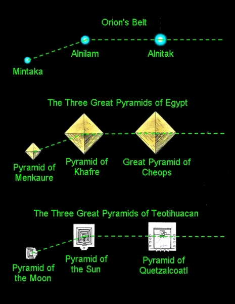
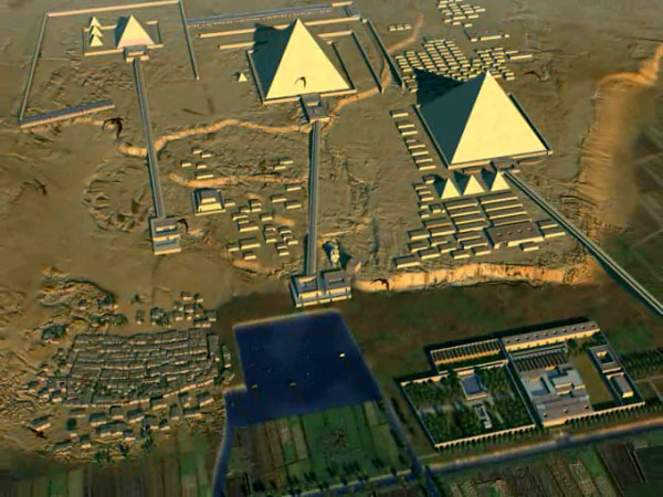
May be another coincidence (?), this pyramids positions is said to be aligned with the "Orion's Belt" star - which show the direction towards the sun-like stars A and B (linked to Pleiades Stars) - as shown below.
A - Giza Pyramids photo from ground, B - Giza Pyramids photo from above, C - Orion's Belt Star in sky. A,B and C show the pyramids' position reflect the Orion's Belt's. D - Star map showing the Orion's Belt's direction toward Pleiades and sun-like star A & B.
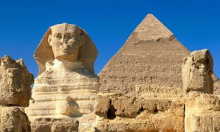
Do Egypt Sphinx and Pyramids also give some indications on the Mars Face and pyramids? Maybe pointing to "somebody" home? No proof...but still interesting stuff :)..more to find out..
Sphinx and Pyramid in Egypt
Comment :
Yes agreed. If there is too many coincidence - it may not a coincidence!
I would like to add some..
It is recorded that the Tikal site dates back as far as the 4th century BC. It means that Tikal site was built about 2,400 years ago. In 2,400 years ago, the sun-like stars A was not at the position of the "Temple 4" of Tikal (which "represents" sun-like stars A and Mars Face).
The interesting question comes - How do Tikal people know the position of sun-like star A (to build "Temple 4"), after 14,600 years movement (17,000yrs - 2,400yrs) of the star A. In 14,600 years - the star A was already far away from its "original" position. Eventhough they can see the star from earth, but it is impossible that someone had watch (or recorded) the star since 14,600 years ago.
Or did they have some technology to calculate the movement (and accurately located the position as modern science can do today)? If it is true, what kind of technology they have? From where?
If 2nd option taken into cosideration - i.e they built the Tikal site based on Mars layout instead of Pleiades Stars, how they can see the Mars from earth? Or "someone" helped them?
Or otherwise...if we take the option that Mars pyramids were built based on Tikal site or Pleiades Stars. There is simple question comes out, but with very difficult answer..again..- Who built them on Mars??
These are unanswered questions...that leads to..A.L.I.E.N.S... :)
|
|
|
|
|
 First First  Previous 2 to 5 of 5 Next Previous 2 to 5 of 5 Next  Last Last  |
|
|
|
|
|
 |
| Reply |
Message 142 of 142 on the subject |
|
|
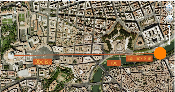
A similar symbolic view occurs at the Vatican: viewed from the Vatican at the Equinox sunrise the obelisk aligns with the Sun over the Tiber River, again symbolizing the Sun on the Milky Way!
|
|
Equinox Sun over the River Tiber.
|
|
|
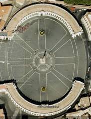
St Peter’s Square contains the eight-pointed cross symbol of the Great Celestial Conjunction.
|
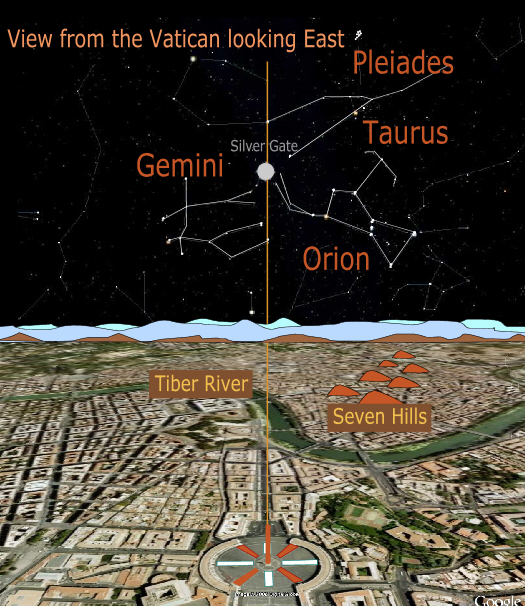
On the Key of Solomon website, Herschel presents an image looking east from the Vatican on the night of December 25th`. The Pope is standing on his balcony watching the night sky. Wayne has suggested that the Seven Hills of Rome represent the Pleiades, a sharp observation that both authors agree with. In his picture, Herschel has placed the Orion constellation, or his rendition and interpretation of the eight-pointed cross, exactly over St. Peter’s Square where the eight-pointed cross occurs. Orion now resides perfectly East. The problem, however, is that the Pleiades now also reside East instead of over the Seven Hills of Rome!
When Herschel’s picture is corrected and the Pleiades are shifted to their correct place in the sky over the Seven Hills, a completely different result is obtained. Now, the Silver Gate resides perfectly East! The Silver Gate is of course the place where Solstice Sun crosses the Milky Way.
Notice how all of the symbols of the Great Celestial Conjunction align: the Pleiades are now correctly found above their symbolic Seven Hills, and the eight-pointed cross of St. Peter’s Square aligns with the Tiber River and the Silver Gate!
|
|
St. Peter’s Square, when the Pleiades are placed correctly over the Seven Hills of Rome, the Silver Gate resides perfectly East and aligns with the eight-pointed cross on St Peter’s Square.
|
|
|
|
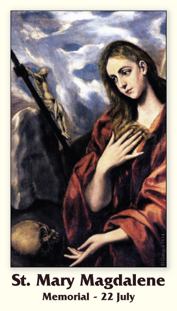
Comparen las dos figuras anteriores y noten que la LUZ SOLAR PENETRA, en este caso EN LA PUERTA DE TIWANAKU (BOLIVIA) en los equinoccios, osea el 20/21 de marzo y los 21/22 de septiembre. CONCRETAMENTE LA FIESTA DE LOS TABERNACULOS ES PRIMA HERMANA DE LA FIESTA PASCUAL. EN ESTE MARCO, INSISTO, EL SOL, SI USTED COMPARA CON LA FIGURA SUPERIOR, EN LOS MISMOS EQUINOCCIOS LA LUZ SOLAR CHOCA CON LA PIRAMIDE VATICANA E INCLUSO INGRESA O PENETRA ADENTRO DEL TEMPLO DE SAN PEDRO. PREGUNTO: ¿SI LA PLAZA DE MARIA DE LA VICTORIA ESTA UBICADA EN LA MISMA LINEA EQUINOCCIAL, QUIEN ES EN ESTE MARCO LA MISMA, EN EL CONTEXTO QUE LA PASCUA TAMBIEN TIENE ESA REFERENCIA? CUALQUIER PERSONA QUE TIENE TRES DEDOS DE FRENTE SE DA CUENTA QUE ES MARIA LA MAGDALENA. SI NO ES ASI PREGUNTO:
¿PORQUE CRISTO SE PRESENTO SIENDO VENCEDOR EL 17 DE NISSAN, OSEA EN EL EQUINOCCIO FRENTE A MARIA MAGDALENA?
CONCLUYO:
MARIA LA VICTORIA ES MARIA MAGDALENA= $=RIO TIBER
|
|
|
|
|
|
|
|
|
|
|
|
|
|
|
|
|

by Mike Bara
from DarkMission Website
Note: This article was originally intended for inclusion in our current book “Dark Mission: The Secret History of NASA” but had to be removed due to space considerations.
It appears here in a modified version to accommodate Internet publication
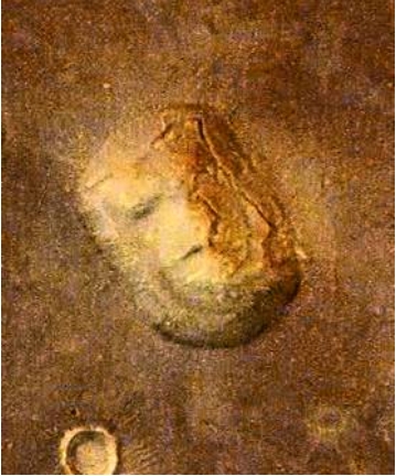
Gee, what a surprise.
Finally, after more than 20 years of waiting, we’ve been given the first legitimate color images of Cydonia. On September 21st, 2006 the European Space Agency released the latest HRSC (High Resolution Stereo Camera) color imagery of the Cydonia region of Mars. Unlike their earlier release, which was taken in December 2004 under less than ideal conditions, this one came captioned and with a politicized article that emphasized the usual non-arguments against the Face on Mars.
Taken on July 22nd 2006 under much better lighting conditions and from straight overhead, these 13.7 meter per pixel images (designated 305-230906-3253-6-co1 and co2) provide the best overview yet of the area that has come to be known as the “Cydonia complex.” What they reveal is a stunning landscape that is strongly confirmative of almost all of this investigation’s previous predictions. In many ways, because they are color, these two stereo images are far better than supposedly higher resolution images generated by MGS.
In fact, what’s quite clear from examining these new images is that the previous Mars Global Surveyor images of the Face (and Cydonia) leave a lot – quite a lot – to be desired.
Let’s start with a brief review of the concept of spatial resolution in remote sensing data. Most of us assume that an image with a stated resolution of 1.2 meters per pixel is automatically “better” than an image of 13.7 mpp, such as these new Mars Express images. Most of the time, that’s true. But there is a lot more to it than that. If the 1.2 mpp image is grayscale, meaning 8-bit data, it by definition carries less information than a 16 or 32-bit color image.
Further, all kinds of conditions - atmospheric haze, lighting (sun) angles,, camera settings, the optical properties of the camera, the filters being used, the incidence angle of a nadir-pointing camera - can all dramatically affect the quality of the resulting image.
A good case in point would be the infamous “Catbox” image of the Face on Mars.
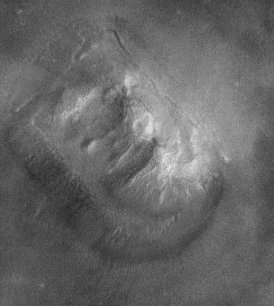
The example above is the so-called “TJP enhancement” of the “Catbox” image of the Face, taken in 1998. While it is unquestionably the best enhancement of this image to date, it is of very poor quality.
According to the Malin Space Science Systems website, the image has a spatial resolution of 4.3 mpp, making it by far the best image of the Face to that point. However, this stated resolution only takes into account the maximum possible resolution, based on the camera optics and the altitude above the target.
The image was in fact taken after the spacecraft had already passed over the Face, from a 45 degree angle to the west, and with the sun at a fairly low morning sun angle of 25 degrees above the horizon, lighting the Face from below. In addition, MSSS had stripped out at least 50% of the data by using an exceptionally large image swath (see “Honey, I shrunk the Face” 1998), and haze and cloud cover made for very poor lighting conditions.
The result was an extremely dark, low contrast image which didn’t come close to the imaging capabilities of the MGS camera. Vince Dipetro, an early pioneer of Face research, concluded that with all the factors included, the effective spatial resolution of the image was 14 mpp, as opposed to the stated 4.3 or the optimum 1.2 mpp capability of the camera under ideal conditions and altitude.
By contrast, the new ESA images were taken from directly overhead, at close to minimum altitude, under full daylight conditions with virtually no cloud cover, and in 24-bit color. Beyond that, unlike any of the previous missions, the HRSC is able to take images almost side-by-side, one after the other. The results were impressive.
The two stereo images, taken just moments apart, provide the best overview of the Face and City we have received from any mission so far. Both frames capture the Face, Fort, D&M and the City in high resolution color.
The first image (305-230906-3253-6-co1) provides the added bonus of capturing the Cliff in the lower portion of the frame, and a substantial amount of the anomalous “mesas” north of the Face first noted by Hoagland in Monuments. What this all amounts to is that these images are without a doubt the best wide-angle view we have ever gotten of Cydonia.
https://www.bibliotecapleyades.net/marte/esp_marte_37.htm
|
|
|
|
|
|
|
| : Cajeli |
Enviado: 23/06/2018 15:53 |
VESICA PISCIS
|
|
|
|
|
mágenes | 22 de julio de 2006
Dunas de primavera

22 de julio de 2006
Esta imagen de la Mars Orbiter Camera (MOC) del Mars Global Surveyor (MGS) muestra dunas en la región polar polar de Marte. En esta escena, las dunas y la llanura en la que residen las dunas están, al menos en parte, cubiertas por una brillante helada de dióxido de carbono. Las manchas oscuras indican áreas donde la escarcha ha comenzado a cambiar, ya sea sublimando para exponer la arena oscura, cambiando a un tamaño de partícula más grueso, o ambos. Los vientos responsables de la formación de estas dunas volaron desde la parte inferior izquierda (suroeste) hacia la parte superior derecha (noreste).
Ubicación cerca de : 76.3 ° N, 261.2 ° W
Ancho de imagen : ~ 3 km (~ 1.9 mi)
Iluminación desde abajo a la izquierda
Temporada : Northern Spring
|
|
|
|
|
https://www.jpl.nasa.gov/spaceimages/details.php?id=PIA08624
22 July 2006. This Mars Global Surveyor (MGS) Mars Orbiter Camera (MOC) image shows dunes in the north polar region of Mars. In this scene, the dunes, and ... |
|
|
|
|
Características técnicas[editar]
El Tlachihualtepetl fue producto de siete pirámides superpuestas, cada una de las cuales cubría la totalidad de la pirámide anterior. Ello motivó el agrandamiento paulatino de la base, que llegó hasta los cuatrocientos cincuenta metros de lado, alcanzando una altura de sesenta y seis metros.
La apariencia actual de la gran pirámide es la de un cerro en cuya cima se encuentra una iglesia católica, dedicada a la Virgen de los Remedios. Ésta fue construida en 1594, después de tres intentos de los españoles por destruirla en su totalidad durante décadas previas. El templo católico en la actualidad es un importante destino de las peregrinaciones de los creyentes católicos de la región, y también es empleado para la celebración de ritos indígenas. Debido a que el templo católico ha sido declarado patrimonio histórico de la nación mexicana, la pirámide prehispánica no ha podido ser excavada en su totalidad, ya que dicha pirámide fue hecha de tierra. Lo que se puede observar es el núcleo central de lo que fue la gran pirámide de la última cultura, solo existen adosamientos aislados de piedra caliza, el restó fue deteriorándose por el abandono de más de 200 años. Sin embargo, los arqueólogos han excavado en la construcción cerca de ocho kilómetros de túneles que permiten la observación de las diferentes fases constructivas de la pirámide y que pertenecen a otras culturas distintas a la Teotihuacana, siendo relevante los murales de los bebedores de pulque, el de los chapulines y el dedicado a Chiconaquiahuitl.
Véase también[editar]
|
|
|
 Primer Primer
 Anterior
62 a 76 de 196
Següent Anterior
62 a 76 de 196
Següent Darrer
|
|
| |
|
|
©2025 - Gabitos - Tots els drets reservats | |
|
|


