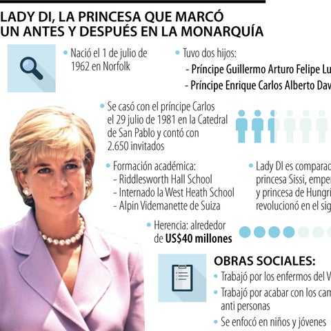
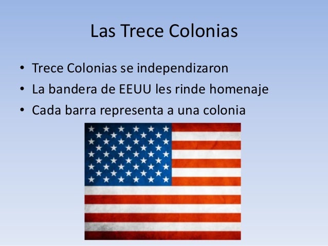
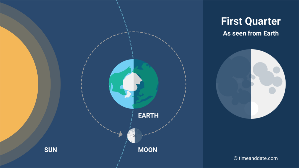
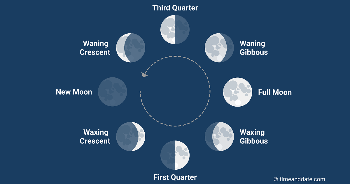
The Jordan River, in the state of Utah, United States, is a river about 51 miles (82 km) long. Regulated by pumps at its headwaters at Utah Lake, it flows northward through the Salt Lake Valley and empties into the Great Salt Lake. Four of Utah's six largest cities border the river: Salt Lake City, West Valley City, West Jordan, and Sandy. More than a million people live in the Jordan Subbasin, part of the Jordan River watershed that lies within Salt Lake and Utah counties. During the Pleistocene, the area was part of Lake Bonneville.
Members of the Desert Archaic Culture were the earliest known inhabitants of the region; an archaeological site found along the river dates back 3,000 years. Mormon pioneers led by Brigham Young were the first European American settlers, arriving in July 1847 and establishing farms and settlements along the river and its tributaries. The growing population, needing water for drinking, irrigation, and industrial use in an arid climate, dug ditches and canals, built dams, and installed pumps to create a highly regulated river.
Although the Jordan was originally a cold-water fishery with 13 native species, including Bonneville cutthroat trout, it has become a warm-water fishery where the common carp is most abundant. It was heavily polluted for many years by raw sewage, agricultural runoff, and mining wastes. In the 1960s, sewage treatment removed many pollutants. In the 21st century, pollution is further limited by the Clean Water Act, and, in some cases, the Superfund program. Once the home of bighorn sheep and beaver, the contemporary river is frequented by raccoons, red foxes, and domestic pets. It is an important avian resource, as are the Great Salt Lake and Utah Lake, visited by more than 200 bird species.
The Jordan River is Utah Lake's only outflow. It originates at the northern end of the lake between the cities of Lehi and Saratoga Springs. It then meanders north through the north end of Utah Valley for approximately 8 miles (13 km) until it passes through a gorge in the Traverse Mountains, known as the Jordan Narrows. The Utah National Guard base at Camp Williams lies on the western side of the river through much of the Jordan Narrows.[7][8] The Turner Dam, located 41.8 miles (67.3 km) from the river's mouth (or at river mile 41.8) and within the boundaries of the Jordan Narrows, is the first of two dams of the Jordan River. Turner Dam diverts the water to the right or easterly into the East Jordan Canal and to the left or westerly toward the Utah and Salt Lake Canal. Two pumping stations situated next to Turner Dam divert water to the west into the Provo Reservoir Canal, Utah Lake Distribution Canal, and Jacob-Welby Canal. The Provo Reservoir Canal runs north through Salt Lake County, Jacob-Welby runs south through Utah County. The Utah Lake Distribution Canal runs both north and south, eventually leading back into Utah Lake.[9] Outside the narrows, the river reaches the second dam, known as Joint Dam, which is 39.9 miles (64.2 km) from the river's mouth. Joint Dam diverts water to the east for the Jordan and Salt Lake City Canal and to the west for the South Jordan Canal.[10][11][12]
Map of the Salt Lake Valley
The river then flows through the middle of the Salt Lake Valley, initially moving through the city of Bluffdale and then forming the border between the cities of Riverton and Draper.[7] The river then enters the city of South Jordan where it merges with Midas Creek from the west. Upon leaving South Jordan, the river forms the border between the cities of West Jordan on the west and Sandy and Midvale on the east. From the west, Bingham Creek enters West Jordan. Dry Creek, an eastern tributary, combines with the main river in Sandy. The river then forms the border between the cities of Taylorsville and West Valley City on the west and Murray and South Salt Lake on the east. The river flows underneath Interstate 215 in Murray. Little and Big Cottonwood Creeks enter from the east in Murray, 21.7 miles (34.9 km) and 20.6 miles (33.2 km) from the mouth respectively. Mill Creek enters on the east in South Salt Lake, 17.3 miles (27.8 km) from the mouth. The river runs through the middle of Salt Lake City, where the river travels underneath Interstate 80 a mile west of downtown Salt Lake City and again underneath Interstate 215 in the northern portion of Salt Lake City. Interstate 15 parallels the river's eastern flank throughout Salt Lake County. At 16 miles (26 km) from the mouth, the river enters the Surplus Canal channel. The Jordan River physically diverts from the Surplus Canal through four gates and heads north with the Surplus Canal heading northwest. Parley's, Emigration, and Red Butte Creeks converge from the east through an underground pipe, 14.2 miles (22.9 km) from the mouth.[7] City Creek also enters via an underground pipe, 11.5 miles (18.5 km) from the river's mouth. The length of the river and the elevation of its mouth varies year to year depending on the fluctuations of the Great Salt Lake caused by weather conditions. The lake has an average elevation of 4,200 feet (1,300 m) which can deviate by 10 feet (3.0 m).[3] The Jordan River then continues for 9 to 12 miles (14 to 19 km) with Salt Lake County on the west and North Salt Lake and Davis County on the east until it empties into the Great Salt Lake.[7][8][11]
The United States Geological Survey maintains a stream gauge in Salt Lake City that shows annual runoff from the period 1980–2003 is just over 150,000 acre-feet (190,000,000 m3) per year or 100 percent of the total 800,000 acre-feet (990,000,000 m3) of water entering the Jordan River from all sources. The Surplus Canal carries almost 60 percent of the water into the Great Salt Lake, with various irrigation canals responsible for the rest. The amount of water entering the Jordan River from Utah Lake is just over 400,000 acre-feet (490,000,000 m3) per year. Inflow from the 11 largest streams feeding the Jordan River, sewage treatment plants, and groundwater each account for approximately 15 percent of water entering the river.[13]
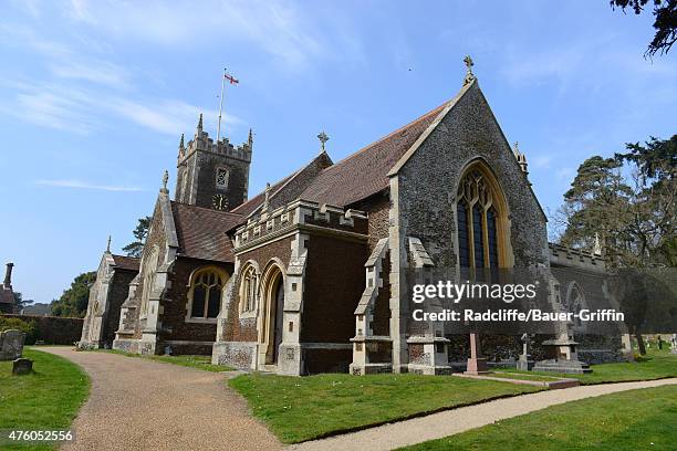
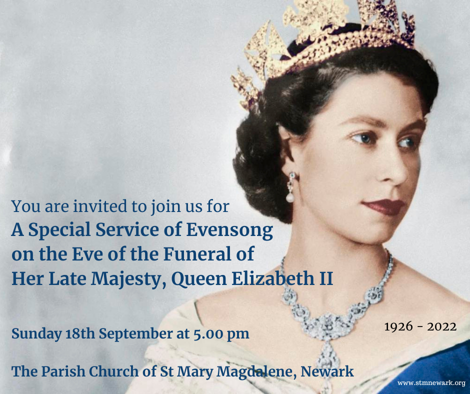
St Mary Magdalene Church is a church in Sandringham, Norfolk, England, located just to the southwest of Sandringham House. Members of the British Royal Family attend services when in residence at Sandringham, which normally includes Christmas.[1] The church is dedicated to Mary Magdalene, a disciple of Jesus. The rector is the Reverend Canon Paul Williams.[2]
Much of the decoration and the church's stained glass in the east window was created by Charles Eamer Kempe whom King Edward VII had also commissioned in 1903 to create a stained glass window for Buckingham Palace of his eldest son, Prince Albert, Duke of Clarence.[9][10] The church's silver altar and reredos, created by the silversmiths Barkentin & Krall, were presented to Queen Alexandra by the American department store owner Rodman Wanamaker as a tribute to Edward VII. He also presented her with the silver pulpit and a silver 17th-century Spanish processional cross. Of note also is a Florentine marble font and a Greek font dating to the 9th-century.[7][11]
There are memorials to many members and relations of the Royal Family in the church and churchyard. Prince John (12 July 1905 – 18 January 1919) is buried here. After his death in February 1952, the body of King George VI was placed in the church for two days prior to its lying in state in Westminster Hall.[12]
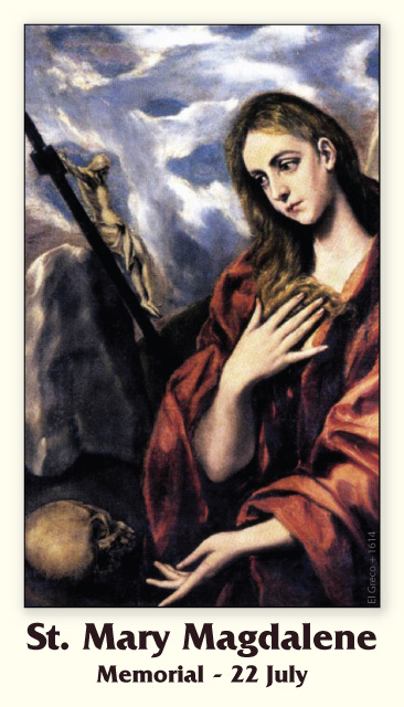
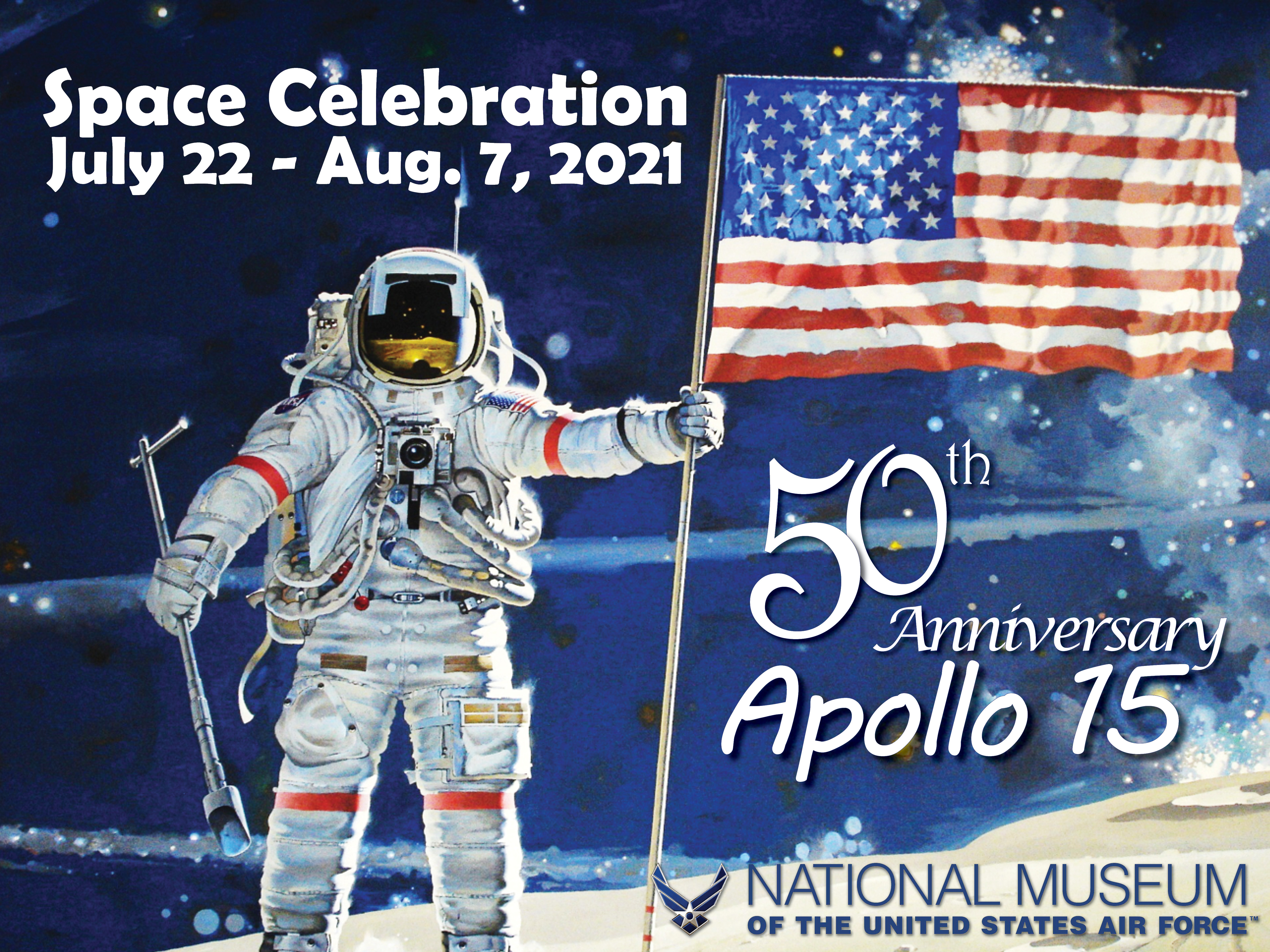
Mary Magdalene is considered to be a saint by the Catholic, Eastern Orthodox, Anglican, and Lutheran denominations. In 2016, Pope Francis raised the level of liturgical memory on July 22 from memorial to feast, and for her to be referred to as the "Apostle of the apostles".
To prepare for his future role as commander-in-chief of the Armed Forces, Felipe joined the Spanish Army in 1985. During the next two years, he completed his military training in the Navy and Air Force. After completing his civil and military studies, he undertook official duties representing his father in different social and institutional events, such as chairing charity foundations or attending inaugurations of Latin American leaders. At one of these events with the press, Felipe met TV news journalist Letizia Ortiz Rocasolano, whom he married in 2004. They have two daughters, Leonor, Princess of Asturias, and Infanta Sofía.
Shortly after his birth Felipe was styledinfante. The dictator Francisco Franco died just over two months before Felipe's eighth birthday, and Felipe's father ascended the throne, as the latter had been appointed as Prince of Spain back in 1969. In his first official appearance, Felipe attended his father's proclamation as king on 22 November 1975.[11]
Juan Carlos, Prince of Spain (left), with his son Felipe and his brother-in-law Constantine II of Greece (right) with his son Pavlos, 1968
In 1977, Felipe was formally proclaimed Prince of Asturias.[15][16][17] In May, nine-year-old Felipe was made an honorary soldier of the 1st King's Inmemorial Infantry Regiment.[18] The occasion was marked on 28 May and was attended by the king, the prime minister and several other ministers in a ceremony at the infantry's barracks.[19][20] On 1 November the same year, he was ceremoniously paid homage as Prince of Asturias in Covadonga.[21] In 1981 Felipe received the Collar of the Order of the Golden Fleece from his father, the Chief and Sovereign of the Order.[14][22] On his 18th birthday on 30 January 1986, Felipe swore allegiance to the Constitution and to the King in the Spanish Parliament as required by the constitution, fully accepting his role as successor to the Crown.[11][23]


_met_zoon_Felipe_en_Koning_Constantijn_met_zijn_zoon_Pa,_Bestanddeelnr_921-9796.jpg)