|
|
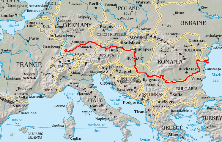
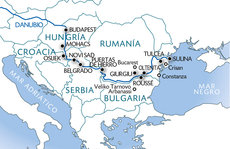
General: DAN BROWN, EL RIO DANUBIO/DINERO/DENARIO/DAN Y LOS "VIAJES EN EL TIEMPO"
Escolher outro painel de mensagens |
|
|

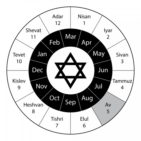
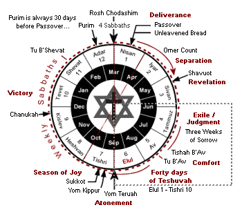
BABILONIA LA RAMERA ES UNA MUJER Y ES LA MISMA BESTIA
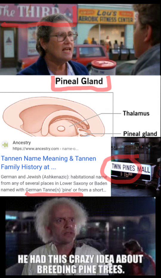
ESTA EN LA GRAFICA

https://www.kienyke.com/historias/enigmatico-viajar-en-el-tiempo-cuantico
8 ene. 2018 - ... Kurt Gödel un brillante matemático amigo de Einstein, sugirió que para ir al pasado era necesario desdoblar el tiempo a través de un atajo y llegar a cualquier parte antes que la luz. Basados en esta hipótesis, algunos físicos cuánticos de la actualidad descubrieron que los agujeros de gusanos pueden ...
https://matap.dmae.upm.es/cienciaficcion/narraciones/.../agujerosdegusano.htm
Entre éstas se destacan el cilindro de longitud infinita y compuesto de polvo en rotación rápida de Van Stockum, y el universo en rotación propuesto por Kurt Gödel. La matemática de estas soluciones muestra que ambas contienen trayectorias en el espacio-tiempo que permiten viajar hacia el pasado y retornar al ...
www.aecomunicacioncientifica.org/que-dice-la-fisica-sobre-los-viajes-en-el-tiempo/
5 may. 2016 - El viaje se realizaría a través de un wormhole (literalmente, un agujero de gusano), un túnel a través del espacio-tiempo. ... Para terminar, citaré que el famoso matemático Kurt Gödelpropuso en 1949 un modelo cosmológico compatible con la relatividad general, en el que los viajes en el tiempo serían ...
https://books.google.com.ar/books?isbn=6073137427
Kurt Gödel 1 y Kip Thorne2 han demostrado que los agujeros de gusano podrían engendrar unos nudos temporales, unos pasajes del presente hacia el pasado. Así se vuelven verdaderas máquinas para pasear por el tiempo pasado. Si la entrada del agujero de gusano (el agujero negro) es inmóvil en relación con ...
www.lehman.edu/faculty/anchordoqui/tuneles2.htm
Entre estas se destacan el cilindro de longitud infinita y compuesto de polvo en rotación rápida de Van Stockum, y el universo en rotación propuesto por Kurt Gödel. ... Supongamos (figura 3) que existe unagujero de gusano atravesable cuyas bocas, separadas por una distancia mucho mayor que el radio de su garganta, ...
blogs.publico.es/kaostica/2014/11/06/interstellar/
6 nov. 2014 - Antes de adentrarnos en los agujeros de gusano, es preciso entender qué son los agujeros negros y, sobre todo, los menos conocidos agujeros blancos. ... En 1949, Kurt Gödel, buen amigo de Albert Einstein, planteó un modelo cosmológico para un universo en rotación consistente con la Relatividad ...
https://books.google.com.ar/books?isbn=8483230755
Yervant Terzian (ed.), Elizabeth Bilson (ed.) - 1999 - Science
En el lado del agujero de gusano que ocupa Carolee es domingo (aunque solo haya envejecido una hora hasta llegar a este punto). ... gran matemático Kurt Gódel (1949), el universo aparece girando a alta velocidad y dotado de una constante cosmológica, con lo que se convierte en una máquina gigantesca del tiempo.
historiadeltiempo-edgardo.blogspot.com/.../capitulo-10-agujeros-de-gusano-y-viajes.h...
5 may. 2011 - viajes en el tiempo se produjo en 1949 cuando Kurt Gödel descubrió un nuevo. espacio-tiempo permitido por la teoría de la relatividad. Gödel fue un matemático. que se hizo famoso al demostrar que es imposible probar todas las afirmaciones. verdaderas, incluso si nos limitáramos a tratar de probar las ...
 
|
|
|
|
|

Jordan River (Utah)
From Wikipedia, the free encyclopedia
The Jordan River, in the state of Utah, United States, is a river about 51 miles (82 km) long. Regulated by pumps at its headwaters at Utah Lake, it flows northward through the Salt Lake Valley and empties into the Great Salt Lake. Four of Utah's six largest cities border the river: Salt Lake City, West Valley City, West Jordan, and Sandy. More than a million people live in the Jordan Subbasin, part of the Jordan River watershed that lies within Salt Lake and Utah counties. During the Pleistocene, the area was part of Lake Bonneville.
Members of the Desert Archaic Culture were the earliest known inhabitants of the region; an archaeological site found along the river dates back 3,000 years. Mormon pioneers led by Brigham Young were the first European American settlers, arriving in July 1847 and establishing farms and settlements along the river and its tributaries. The growing population, needing water for drinking, irrigation, and industrial use in an arid climate, dug ditches and canals, built dams, and installed pumps to create a highly regulated river.
Although the Jordan was originally a cold-water fishery with 13 native species, including Bonneville cutthroat trout, it has become a warm-water fishery where the common carp is most abundant. It was heavily polluted for many years by raw sewage, agricultural runoff, and mining wastes. In the 1960s, sewage treatment removed many pollutants. In the 21st century, pollution is further limited by the Clean Water Act, and, in some cases, the Superfund program. Once the home of bighorn sheep and beaver, the contemporary river is frequented by raccoons, red foxes, and domestic pets. It is an important avian resource, as are the Great Salt Lake and Utah Lake, visited by more than 200 bird species.
Big Cottonwood, Little Cottonwood, Red Butte, Mill, Parley's, and City creeks, as well as smaller streams like Willow Creek at Draper, Utah, flow through the sub-basin. The Jordan River Parkway along the river includes natural areas, botanical gardens, golf courses, and a 40-mile (64 km) bicycle and pedestrian trail, completed in 2017.[6]
The Jordan River is Utah Lake's only outflow. It originates at the northern end of the lake between the cities of Lehi and Saratoga Springs. It then meanders north through the north end of Utah Valley for approximately 8 miles (13 km) until it passes through a gorge in the Traverse Mountains, known as the Jordan Narrows. The Utah National Guard base at Camp Williams lies on the western side of the river through much of the Jordan Narrows.[7][8] The Turner Dam, located 41.8 miles (67.3 km) from the river's mouth (or at river mile 41.8) and within the boundaries of the Jordan Narrows, is the first of two dams of the Jordan River. Turner Dam diverts the water to the right or easterly into the East Jordan Canal and to the left or westerly toward the Utah and Salt Lake Canal. Two pumping stations situated next to Turner Dam divert water to the west into the Provo Reservoir Canal, Utah Lake Distribution Canal, and Jacob-Welby Canal. The Provo Reservoir Canal runs north through Salt Lake County, Jacob-Welby runs south through Utah County. The Utah Lake Distribution Canal runs both north and south, eventually leading back into Utah Lake.[9] Outside the narrows, the river reaches the second dam, known as Joint Dam, which is 39.9 miles (64.2 km) from the river's mouth. Joint Dam diverts water to the east for the Jordan and Salt Lake City Canal and to the west for the South Jordan Canal.[10][11][12]
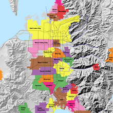
Map of the Salt Lake Valley
The river then flows through the middle of the Salt Lake Valley, initially moving through the city of Bluffdale and then forming the border between the cities of Riverton and Draper.[7] The river then enters the city of South Jordan where it merges with Midas Creek from the west. Upon leaving South Jordan, the river forms the border between the cities of West Jordan on the west and Sandy and Midvale on the east. From the west, Bingham Creek enters West Jordan. Dry Creek, an eastern tributary, combines with the main river in Sandy. The river then forms the border between the cities of Taylorsville and West Valley City on the west and Murray and South Salt Lake on the east. The river flows underneath Interstate 215 in Murray. Little and Big Cottonwood Creeks enter from the east in Murray, 21.7 miles (34.9 km) and 20.6 miles (33.2 km) from the mouth respectively. Mill Creek enters on the east in South Salt Lake, 17.3 miles (27.8 km) from the mouth. The river runs through the middle of Salt Lake City, where the river travels underneath Interstate 80 a mile west of downtown Salt Lake City and again underneath Interstate 215 in the northern portion of Salt Lake City. Interstate 15 parallels the river's eastern flank throughout Salt Lake County. At 16 miles (26 km) from the mouth, the river enters the Surplus Canal channel. The Jordan River physically diverts from the Surplus Canal through four gates and heads north with the Surplus Canal heading northwest. Parley's, Emigration, and Red Butte Creeks converge from the east through an underground pipe, 14.2 miles (22.9 km) from the mouth.[7] City Creek also enters via an underground pipe, 11.5 miles (18.5 km) from the river's mouth. The length of the river and the elevation of its mouth varies year to year depending on the fluctuations of the Great Salt Lake caused by weather conditions. The lake has an average elevation of 4,200 feet (1,300 m) which can deviate by 10 feet (3.0 m).[3] The Jordan River then continues for 9 to 12 miles (14 to 19 km) with Salt Lake County on the west and North Salt Lake and Davis County on the east until it empties into the Great Salt Lake.[7][8][11]
Discharge[edit]
The United States Geological Survey maintains a stream gauge in Salt Lake City that shows annual runoff from the period 1980–2003 is just over 150,000 acre-feet (190,000,000 m3) per year or 100 percent of the total 800,000 acre-feet (990,000,000 m3) of water entering the Jordan River from all sources. The Surplus Canal carries almost 60 percent of the water into the Great Salt Lake, with various irrigation canals responsible for the rest. The amount of water entering the Jordan River from Utah Lake is just over 400,000 acre-feet (490,000,000 m3) per year. Inflow from the 11 largest streams feeding the Jordan River, sewage treatment plants, and groundwater each account for approximately 15 percent of water entering the river.[13]
Watershed[edit]
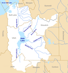
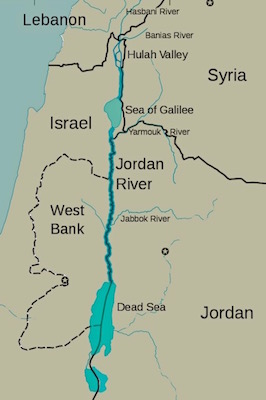
Map of the entire Jordan River Basin
|
|
|
|
|
Jordan River (Utah)
From Wikipedia, the free encyclopedia
The Jordan River, in the state of Utah, United States, is a river about 51 miles (82 km) long. Regulated by pumps at its headwaters at Utah Lake, it flows northward through the Salt Lake Valley and empties into the Great Salt Lake. Four of Utah's six largest cities border the river: Salt Lake City, West Valley City, West Jordan, and Sandy. More than a million people live in the Jordan Subbasin, part of the Jordan River watershed that lies within Salt Lake and Utah counties. During the Pleistocene, the area was part of Lake Bonneville.
Members of the Desert Archaic Culture were the earliest known inhabitants of the region; an archaeological site found along the river dates back 3,000 years. Mormon pioneers led by Brigham Young were the first European American settlers, arriving in July 1847 and establishing farms and settlements along the river and its tributaries. The growing population, needing water for drinking, irrigation, and industrial use in an arid climate, dug ditches and canals, built dams, and installed pumps to create a highly regulated river.
Although the Jordan was originally a cold-water fishery with 13 native species, including Bonneville cutthroat trout, it has become a warm-water fishery where the common carp is most abundant. It was heavily polluted for many years by raw sewage, agricultural runoff, and mining wastes. In the 1960s, sewage treatment removed many pollutants. In the 21st century, pollution is further limited by the Clean Water Act, and, in some cases, the Superfund program. Once the home of bighorn sheep and beaver, the contemporary river is frequented by raccoons, red foxes, and domestic pets. It is an important avian resource, as are the Great Salt Lake and Utah Lake, visited by more than 200 bird species.
Big Cottonwood, Little Cottonwood, Red Butte, Mill, Parley's, and City creeks, as well as smaller streams like Willow Creek at Draper, Utah, flow through the sub-basin. The Jordan River Parkway along the river includes natural areas, botanical gardens, golf courses, and a 40-mile (64 km) bicycle and pedestrian trail, completed in 2017.[6]
The Jordan River is Utah Lake's only outflow. It originates at the northern end of the lake between the cities of Lehi and Saratoga Springs. It then meanders north through the north end of Utah Valley for approximately 8 miles (13 km) until it passes through a gorge in the Traverse Mountains, known as the Jordan Narrows. The Utah National Guard base at Camp Williams lies on the western side of the river through much of the Jordan Narrows.[7][8] The Turner Dam, located 41.8 miles (67.3 km) from the river's mouth (or at river mile 41.8) and within the boundaries of the Jordan Narrows, is the first of two dams of the Jordan River. Turner Dam diverts the water to the right or easterly into the East Jordan Canal and to the left or westerly toward the Utah and Salt Lake Canal. Two pumping stations situated next to Turner Dam divert water to the west into the Provo Reservoir Canal, Utah Lake Distribution Canal, and Jacob-Welby Canal. The Provo Reservoir Canal runs north through Salt Lake County, Jacob-Welby runs south through Utah County. The Utah Lake Distribution Canal runs both north and south, eventually leading back into Utah Lake.[9] Outside the narrows, the river reaches the second dam, known as Joint Dam, which is 39.9 miles (64.2 km) from the river's mouth. Joint Dam diverts water to the east for the Jordan and Salt Lake City Canal and to the west for the South Jordan Canal.[10][11][12]

Map of the Salt Lake Valley
The river then flows through the middle of the Salt Lake Valley, initially moving through the city of Bluffdale and then forming the border between the cities of Riverton and Draper.[7] The river then enters the city of South Jordan where it merges with Midas Creek from the west. Upon leaving South Jordan, the river forms the border between the cities of West Jordan on the west and Sandy and Midvale on the east. From the west, Bingham Creek enters West Jordan. Dry Creek, an eastern tributary, combines with the main river in Sandy. The river then forms the border between the cities of Taylorsville and West Valley City on the west and Murray and South Salt Lake on the east. The river flows underneath Interstate 215 in Murray. Little and Big Cottonwood Creeks enter from the east in Murray, 21.7 miles (34.9 km) and 20.6 miles (33.2 km) from the mouth respectively. Mill Creek enters on the east in South Salt Lake, 17.3 miles (27.8 km) from the mouth. The river runs through the middle of Salt Lake City, where the river travels underneath Interstate 80 a mile west of downtown Salt Lake City and again underneath Interstate 215 in the northern portion of Salt Lake City. Interstate 15 parallels the river's eastern flank throughout Salt Lake County. At 16 miles (26 km) from the mouth, the river enters the Surplus Canal channel. The Jordan River physically diverts from the Surplus Canal through four gates and heads north with the Surplus Canal heading northwest. Parley's, Emigration, and Red Butte Creeks converge from the east through an underground pipe, 14.2 miles (22.9 km) from the mouth.[7] City Creek also enters via an underground pipe, 11.5 miles (18.5 km) from the river's mouth. The length of the river and the elevation of its mouth varies year to year depending on the fluctuations of the Great Salt Lake caused by weather conditions. The lake has an average elevation of 4,200 feet (1,300 m) which can deviate by 10 feet (3.0 m).[3] The Jordan River then continues for 9 to 12 miles (14 to 19 km) with Salt Lake County on the west and North Salt Lake and Davis County on the east until it empties into the Great Salt Lake.[7][8][11]
Discharge[edit]
The United States Geological Survey maintains a stream gauge in Salt Lake City that shows annual runoff from the period 1980–2003 is just over 150,000 acre-feet (190,000,000 m3) per year or 100 percent of the total 800,000 acre-feet (990,000,000 m3) of water entering the Jordan River from all sources. The Surplus Canal carries almost 60 percent of the water into the Great Salt Lake, with various irrigation canals responsible for the rest. The amount of water entering the Jordan River from Utah Lake is just over 400,000 acre-feet (490,000,000 m3) per year. Inflow from the 11 largest streams feeding the Jordan River, sewage treatment plants, and groundwater each account for approximately 15 percent of water entering the river.[13]
Watershed[edit]

Map of the entire Jordan River Basin
|
|
|
|
|

Jordan River (Utah)
From Wikipedia, the free encyclopedia
The Jordan River, in the state of Utah, United States, is a river about 51 miles (82 km) long. Regulated by pumps at its headwaters at Utah Lake, it flows northward through the Salt Lake Valley and empties into the Great Salt Lake. Four of Utah's six largest cities border the river: Salt Lake City, West Valley City, West Jordan, and Sandy. More than a million people live in the Jordan Subbasin, part of the Jordan River watershed that lies within Salt Lake and Utah counties. During the Pleistocene, the area was part of Lake Bonneville.
Members of the Desert Archaic Culture were the earliest known inhabitants of the region; an archaeological site found along the river dates back 3,000 years. Mormon pioneers led by Brigham Young were the first European American settlers, arriving in July 1847 and establishing farms and settlements along the river and its tributaries. The growing population, needing water for drinking, irrigation, and industrial use in an arid climate, dug ditches and canals, built dams, and installed pumps to create a highly regulated river.
Although the Jordan was originally a cold-water fishery with 13 native species, including Bonneville cutthroat trout, it has become a warm-water fishery where the common carp is most abundant. It was heavily polluted for many years by raw sewage, agricultural runoff, and mining wastes. In the 1960s, sewage treatment removed many pollutants. In the 21st century, pollution is further limited by the Clean Water Act, and, in some cases, the Superfund program. Once the home of bighorn sheep and beaver, the contemporary river is frequented by raccoons, red foxes, and domestic pets. It is an important avian resource, as are the Great Salt Lake and Utah Lake, visited by more than 200 bird species.
Big Cottonwood, Little Cottonwood, Red Butte, Mill, Parley's, and City creeks, as well as smaller streams like Willow Creek at Draper, Utah, flow through the sub-basin. The Jordan River Parkway along the river includes natural areas, botanical gardens, golf courses, and a 40-mile (64 km) bicycle and pedestrian trail, completed in 2017.[6]
The Jordan River is Utah Lake's only outflow. It originates at the northern end of the lake between the cities of Lehi and Saratoga Springs. It then meanders north through the north end of Utah Valley for approximately 8 miles (13 km) until it passes through a gorge in the Traverse Mountains, known as the Jordan Narrows. The Utah National Guard base at Camp Williams lies on the western side of the river through much of the Jordan Narrows.[7][8] The Turner Dam, located 41.8 miles (67.3 km) from the river's mouth (or at river mile 41.8) and within the boundaries of the Jordan Narrows, is the first of two dams of the Jordan River. Turner Dam diverts the water to the right or easterly into the East Jordan Canal and to the left or westerly toward the Utah and Salt Lake Canal. Two pumping stations situated next to Turner Dam divert water to the west into the Provo Reservoir Canal, Utah Lake Distribution Canal, and Jacob-Welby Canal. The Provo Reservoir Canal runs north through Salt Lake County, Jacob-Welby runs south through Utah County. The Utah Lake Distribution Canal runs both north and south, eventually leading back into Utah Lake.[9] Outside the narrows, the river reaches the second dam, known as Joint Dam, which is 39.9 miles (64.2 km) from the river's mouth. Joint Dam diverts water to the east for the Jordan and Salt Lake City Canal and to the west for the South Jordan Canal.[10][11][12]

Map of the Salt Lake Valley
The river then flows through the middle of the Salt Lake Valley, initially moving through the city of Bluffdale and then forming the border between the cities of Riverton and Draper.[7] The river then enters the city of South Jordan where it merges with Midas Creek from the west. Upon leaving South Jordan, the river forms the border between the cities of West Jordan on the west and Sandy and Midvale on the east. From the west, Bingham Creek enters West Jordan. Dry Creek, an eastern tributary, combines with the main river in Sandy. The river then forms the border between the cities of Taylorsville and West Valley City on the west and Murray and South Salt Lake on the east. The river flows underneath Interstate 215 in Murray. Little and Big Cottonwood Creeks enter from the east in Murray, 21.7 miles (34.9 km) and 20.6 miles (33.2 km) from the mouth respectively. Mill Creek enters on the east in South Salt Lake, 17.3 miles (27.8 km) from the mouth. The river runs through the middle of Salt Lake City, where the river travels underneath Interstate 80 a mile west of downtown Salt Lake City and again underneath Interstate 215 in the northern portion of Salt Lake City. Interstate 15 parallels the river's eastern flank throughout Salt Lake County. At 16 miles (26 km) from the mouth, the river enters the Surplus Canal channel. The Jordan River physically diverts from the Surplus Canal through four gates and heads north with the Surplus Canal heading northwest. Parley's, Emigration, and Red Butte Creeks converge from the east through an underground pipe, 14.2 miles (22.9 km) from the mouth.[7] City Creek also enters via an underground pipe, 11.5 miles (18.5 km) from the river's mouth. The length of the river and the elevation of its mouth varies year to year depending on the fluctuations of the Great Salt Lake caused by weather conditions. The lake has an average elevation of 4,200 feet (1,300 m) which can deviate by 10 feet (3.0 m).[3] The Jordan River then continues for 9 to 12 miles (14 to 19 km) with Salt Lake County on the west and North Salt Lake and Davis County on the east until it empties into the Great Salt Lake.[7][8][11]
Discharge[edit]
The United States Geological Survey maintains a stream gauge in Salt Lake City that shows annual runoff from the period 1980–2003 is just over 150,000 acre-feet (190,000,000 m3) per year or 100 percent of the total 800,000 acre-feet (990,000,000 m3) of water entering the Jordan River from all sources. The Surplus Canal carries almost 60 percent of the water into the Great Salt Lake, with various irrigation canals responsible for the rest. The amount of water entering the Jordan River from Utah Lake is just over 400,000 acre-feet (490,000,000 m3) per year. Inflow from the 11 largest streams feeding the Jordan River, sewage treatment plants, and groundwater each account for approximately 15 percent of water entering the river.[13]
Watershed[edit]

Map of the entire Jordan River Basin
|
|
|
|
|
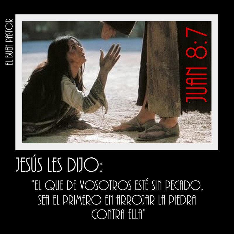
Mary Magdalene is considered to be a saint by the Catholic, Eastern Orthodox, Anglican, and Lutheran denominations. In 2016, Pope Francis raised the level of liturgical memory on July 22 from memorial to feast, and for her to be referred to as the "Apostle of the apostles".
|
|
|
|
|

Jordan River (Utah)
From Wikipedia, the free encyclopedia
The Jordan River, in the state of Utah, United States, is a river about 51 miles (82 km) long. Regulated by pumps at its headwaters at Utah Lake, it flows northward through the Salt Lake Valley and empties into the Great Salt Lake. Four of Utah's six largest cities border the river: Salt Lake City, West Valley City, West Jordan, and Sandy. More than a million people live in the Jordan Subbasin, part of the Jordan River watershed that lies within Salt Lake and Utah counties. During the Pleistocene, the area was part of Lake Bonneville.
Members of the Desert Archaic Culture were the earliest known inhabitants of the region; an archaeological site found along the river dates back 3,000 years. Mormon pioneers led by Brigham Young were the first European American settlers, arriving in July 1847 and establishing farms and settlements along the river and its tributaries. The growing population, needing water for drinking, irrigation, and industrial use in an arid climate, dug ditches and canals, built dams, and installed pumps to create a highly regulated river.
Although the Jordan was originally a cold-water fishery with 13 native species, including Bonneville cutthroat trout, it has become a warm-water fishery where the common carp is most abundant. It was heavily polluted for many years by raw sewage, agricultural runoff, and mining wastes. In the 1960s, sewage treatment removed many pollutants. In the 21st century, pollution is further limited by the Clean Water Act, and, in some cases, the Superfund program. Once the home of bighorn sheep and beaver, the contemporary river is frequented by raccoons, red foxes, and domestic pets. It is an important avian resource, as are the Great Salt Lake and Utah Lake, visited by more than 200 bird species.
Big Cottonwood, Little Cottonwood, Red Butte, Mill, Parley's, and City creeks, as well as smaller streams like Willow Creek at Draper, Utah, flow through the sub-basin. The Jordan River Parkway along the river includes natural areas, botanical gardens, golf courses, and a 40-mile (64 km) bicycle and pedestrian trail, completed in 2017.[6]
The Jordan River is Utah Lake's only outflow. It originates at the northern end of the lake between the cities of Lehi and Saratoga Springs. It then meanders north through the north end of Utah Valley for approximately 8 miles (13 km) until it passes through a gorge in the Traverse Mountains, known as the Jordan Narrows. The Utah National Guard base at Camp Williams lies on the western side of the river through much of the Jordan Narrows.[7][8] The Turner Dam, located 41.8 miles (67.3 km) from the river's mouth (or at river mile 41.8) and within the boundaries of the Jordan Narrows, is the first of two dams of the Jordan River. Turner Dam diverts the water to the right or easterly into the East Jordan Canal and to the left or westerly toward the Utah and Salt Lake Canal. Two pumping stations situated next to Turner Dam divert water to the west into the Provo Reservoir Canal, Utah Lake Distribution Canal, and Jacob-Welby Canal. The Provo Reservoir Canal runs north through Salt Lake County, Jacob-Welby runs south through Utah County. The Utah Lake Distribution Canal runs both north and south, eventually leading back into Utah Lake.[9] Outside the narrows, the river reaches the second dam, known as Joint Dam, which is 39.9 miles (64.2 km) from the river's mouth. Joint Dam diverts water to the east for the Jordan and Salt Lake City Canal and to the west for the South Jordan Canal.[10][11][12]

Map of the Salt Lake Valley
The river then flows through the middle of the Salt Lake Valley, initially moving through the city of Bluffdale and then forming the border between the cities of Riverton and Draper.[7] The river then enters the city of South Jordan where it merges with Midas Creek from the west. Upon leaving South Jordan, the river forms the border between the cities of West Jordan on the west and Sandy and Midvale on the east. From the west, Bingham Creek enters West Jordan. Dry Creek, an eastern tributary, combines with the main river in Sandy. The river then forms the border between the cities of Taylorsville and West Valley City on the west and Murray and South Salt Lake on the east. The river flows underneath Interstate 215 in Murray. Little and Big Cottonwood Creeks enter from the east in Murray, 21.7 miles (34.9 km) and 20.6 miles (33.2 km) from the mouth respectively. Mill Creek enters on the east in South Salt Lake, 17.3 miles (27.8 km) from the mouth. The river runs through the middle of Salt Lake City, where the river travels underneath Interstate 80 a mile west of downtown Salt Lake City and again underneath Interstate 215 in the northern portion of Salt Lake City. Interstate 15 parallels the river's eastern flank throughout Salt Lake County. At 16 miles (26 km) from the mouth, the river enters the Surplus Canal channel. The Jordan River physically diverts from the Surplus Canal through four gates and heads north with the Surplus Canal heading northwest. Parley's, Emigration, and Red Butte Creeks converge from the east through an underground pipe, 14.2 miles (22.9 km) from the mouth.[7] City Creek also enters via an underground pipe, 11.5 miles (18.5 km) from the river's mouth. The length of the river and the elevation of its mouth varies year to year depending on the fluctuations of the Great Salt Lake caused by weather conditions. The lake has an average elevation of 4,200 feet (1,300 m) which can deviate by 10 feet (3.0 m).[3] The Jordan River then continues for 9 to 12 miles (14 to 19 km) with Salt Lake County on the west and North Salt Lake and Davis County on the east until it empties into the Great Salt Lake.[7][8][11]
Discharge[edit]
The United States Geological Survey maintains a stream gauge in Salt Lake City that shows annual runoff from the period 1980–2003 is just over 150,000 acre-feet (190,000,000 m3) per year or 100 percent of the total 800,000 acre-feet (990,000,000 m3) of water entering the Jordan River from all sources. The Surplus Canal carries almost 60 percent of the water into the Great Salt Lake, with various irrigation canals responsible for the rest. The amount of water entering the Jordan River from Utah Lake is just over 400,000 acre-feet (490,000,000 m3) per year. Inflow from the 11 largest streams feeding the Jordan River, sewage treatment plants, and groundwater each account for approximately 15 percent of water entering the river.[13]
Watershed[edit]

Map of the entire Jordan River Basin
|
|
|
|
|
Viktor Schauberger: The Man Who Invented Flying Discs For The Nazis
- ENGLISH NEWS
- TECHNOLOGY GAME SCIENCE
VN EN
Some historical figures leave behind little real information, but many secrets and mysteries.
 Ảnh minh họa
One such person was a scientist, thinker, philosopher, and inventor, and the author of innovative technological ideas. He was hired to work for the Third Reich and allegedly built for the Nazis a flying machine that looked like a disc-shaped UFO for the Nazis.
And then this man suddenly disappeared from history as quickly and mysteriously as he appeared. It is officially believed that he died a natural death, but there are many theories that he was either deliberately killed or his death was faked, but in fact was kidnapped for his own purposes.
The Mysterious Disappearance Of Viktor Schauberger
A man named Viktor Schauberger was born in Austria in 1885 and initially had an experience that had nothing to do with his future fame as the inventor of Hitler’s UFOs. He grew up in a hereditary family of foresters living in a vast area of remote wilderness in Holzschlag, Upper Austria, and spent most of his youth and middle years tending more than 10,000 hectares of land.

During this time, constantly being in nature, he began to make many observations that profoundly changed his life and outlook. In particular, he was absolutely fascinated by water, which he regarded as an independent living organism, calling it the “Blood of the Earth” and the source of all living things.
He especially focused on such properties of water as its spiral forms, eddies, fast currents, eddies, and easy harmony with the surrounding world.
He obsessively studied the movements and effects of water, continuing to form many theories, and then he began to craft completely innovative types of spiral-cut water gutters, the design of which was based on his own hydrodynamic system.
According to this system, an inward-moving and swirling water vortex could be used for power and thrust, which was the beginning of his revolutionary new idea for a new type of engine that relied on implosion (an explosion directed inward) rather than conventional explosions.
Viktor Schauberger was completely self-taught, he never took any university courses, but he soon gained international recognition thanks to some of his ideas, patents, and inventions, and controversy. He was critical of the many inventions available in his era, believing that they work against the laws of nature and are destructive.
Instead, he embraced the idea that humanity and nature can live together using alternative energy sources, such as using natural processes and live in harmony with them. His motto was “Kapieren und kopieren” (To comprehend and copy nature). Schauberger believed that many inventions of mankind were contrary to nature, and later he stated that even the propeller was an imperfect invention:
“As nature best demonstrated in the case of the winged maple seed, today’s propeller is a pressure rotor, and therefore a brake rotor, whose purpose is to allow the heavy maple seed to slowly fall to the ground like a parachute and move away from the wind.
No bird has such a rotating object on its head, nor a fish on its tail. This brake rotor was only used by a person for forward propulsion. As the propeller spins, drag increases in proportion to the square of the rotation speed. It is also a sign that this supposed propulsion device is not built naturally and is therefore out of place. “
Schauberger sought to bring his ideas to life by coming up with a detailed theory according to which water vortices can build on each other to create more and more forces, which, in turn, will create a force opposite to gravity. In essence, Schauberger was explaining how to create anti-gravity, which he called diamagnetism.
He used these theories to create fantastic inventions such as a water blast turbine that sucked in air in a spiral, reaching enormous forces. He also invented the machine that created a typhoon-like suction force to control the temperature in a room, and a power generator. These machines created energy from water and air using spiral pipes and nozzles.
All of this worked on the principles of clean energy and working with nature, apparently with little or no pollution and being completely sustainable.
It might seem odd that such a radical promoter of green energy and work with nature caught the attention of the Nazis, who were not particularly concerned with preserving the environment. But he really piqued their interest, and in 1934 the Nazis approached him with a tempting offer to work for them for a good salary. Schauberger agreed.
Furthermore. In 1938, Nazi Party member Julius Streicher allegedly personally ordered him to build an aircraft that could use a vortex engine. This device had to have the shape of a disk and move completely differently from all modern aircraft while hovering in the air in one place (levitation), performing precise maneuvers, and accelerating at high speeds.

Basically, they wanted Schauberger to build a futuristic anti-gravity ship using his own natural theories, and since they were the Nazis, he had no choice but to agree once again, receiving an exorbitant amount of money.
In 1940, Schauberger created the first prototype of his artificial UFO, called Repulsin A, which used friction between vortices and the surrounding air to force the air downward, creating an overall lifting and propelling effect, more or less producing a kind of mini-tornado, on the energy of which this ship moved.
However, it was found that the vortex motor was unstable, and the fan inside the device could not spin as fast as required because the blades were pushing out too much air. At the time, no way was found to circumvent the problem of generating more intense rotational energy, and the device was deemed too impractical.

Indeed, during the testing of the ship, although it could indeed levitate, it was almost impossible to control or move forward, usually quickly spinning out of control or even flying through the roof of the test hangar.
According to rumors, the Nazis were furious at Schauberger’s inability to solve these problems, which caused the inventor to be temporarily imprisoned. But then he came under the personal attention of Heinrich Himmler, who drew Schauberger to work on another miracle of technology – a new type of silent mini-submarine, and then ordered to continue work on a new version of the anti-gravity device called Vril-7.
It is not known how far Schauberger went with the Vril-7, as the end of World War II halted all secret Nazi research (at least official), with most of his work, prototypes, and plans destroyed so that they would not fall into the hands of the Allies.

The Americans, knowing how important Schauberger was to the Germans, arrested him and took him to the United States, intensively interrogating him, but were never able to get much information from him. However, they were able to use all the information they received to the maximum. The fundamental principles that Schauberger used were later applied to several projects, including the Avro Canada VZ-9 Avrocar, which was a vertical takeoff and landing aircraft developed during the Cold War era, and others.
Schauberger, while in the United States, tried for several more years on various civilian vortex technology projects such as generators, water purification systems and air purification devices, before eventually returning to Austria on September 25, 1958, almost penniless.
He died quite suddenly, just five days after his return to his homeland, taking all his secrets with him to the grave.
Since then, various conspiracy theories have regularly emerged about Schauberger, including that his research went much further than anticipated, and that many of the UFOs that were seen during the Second World War were in fact Schauberger’s experimental devices.
But all these are just hypotheses and unverified rumors, for sure no one knows anything. He remains in many ways a ghost person, the true scope of his work is unknown, and his research is enigmatic.
https://www.xaluannews.com/modules.php?name=News&file=article&sid=3296405 |
|
|
 Primeira Primeira
 Anterior
14 a 28 de 28
Seguinte Anterior
14 a 28 de 28
Seguinte
 Última

|
|
| |
|
|
©2025 - Gabitos - Todos os direitos reservados | |
|
|































 Ảnh minh họa
