Página principal  |  Contacto  

Correo electrónico:

Contraseña:

Registrarse ahora!

¿Has olvidado tu contraseña?

Secreto Masonico
 
Novedades
  Únete ahora
  Panel de mensajes 
  Galería de imágenes 
 Archivos y documentos 
 Encuestas y Test 
  Lista de Participantes
 EL SECRETO DE LA INICIACIÓN 
 Procesos Secretos del Alma 
 Estructura Secreta del Ritual Masónico 
 Los extraños Ritos de Sangre 
 Cámara de Reflexiones 
 
 
  Herramientas
 
General: APOLLO 11=FRANCE=MARY MAGDALENE S DAY JULY 14TH 1969 (BASTILLE DAY)=NEW MOON
Elegir otro panel de mensajes
Tema anterior  Tema siguiente
Respuesta  Mensaje 1 de 38 en el tema 
De: BARILOCHENSE6999  (Mensaje original) Enviado: 24/07/2024 02:13
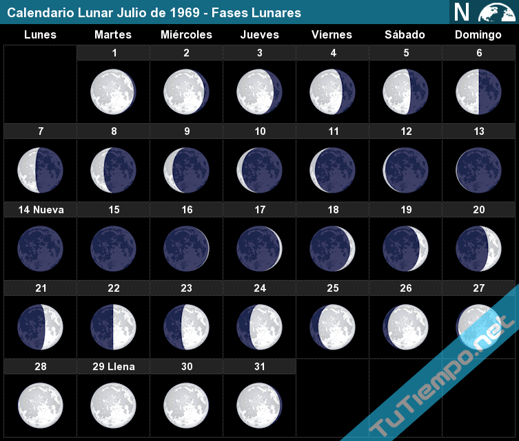
Calendario Lunar Julio de 1969 - Fases Lunares
Happy bastille day july 14 viva france s Vector Image
Moon Phases 50th Anniversary Apollo 11 1969 Moon Landing Tees Digital by  Tony Rubino | Saatchi Art


Primer  Anterior  24 a 38 de 38  Siguiente   Último  
Respuesta  Mensaje 24 de 38 en el tema 
De: BARILOCHENSE6999 Enviado: 25/09/2024 01:38
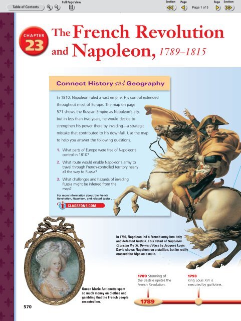
French Revolution and Napoleon

Respuesta  Mensaje 25 de 38 en el tema 
De: BARILOCHENSE6999 Enviado: 25/09/2024 01:43
A picture is worth a thousand words.” -Napoleon Bonaparte How does this  picture reflect the ideas of this quote? - ppt download

Respuesta  Mensaje 26 de 38 en el tema 
De: BARILOCHENSE6999 Enviado: 25/09/2024 01:48

Napoleon’s Forgotten First Battle: La Maddalena, 1793

Napoleon got his first taste of battle in February 1793 at the siege of La Maddalena. By the year’s end, Napoleon was a general and a hero.

Jun 6, 2024 • By Dale Pappas, PhD Modern European History, MA History, BA History, Italian Studies


napoleon first battle la maddalena


Napoleon’s name is synonymous with French history. But before Napoleon rose to power in France, he dreamed of becoming influential in his native Corsica. In fact, Napoleon made many decisions in his early life, believing that it could help further his career in Corsica rather than France. However, Napoleon’s participation in the failed attempt to seize La Maddalena in February 1793 contributed to a shift in his thinking about Corsica. By the end of 1793, this Corsican patriot had emerged as a rising star of the French Republic.


Napoleon’s Homeland: Corsica 

map corsica levasseur 1861
Decorative Map of Corsica by Victor Levasseur, 1861. Source: Wikipedia Commons


In his book The Social Contract (1762), Genevan philosopher Jean-Jacques Rousseau wrote of Corsica, “I have a presentiment that one day this small island will astonish Europe.” Indeed, the rebellion launched by the islanders against Genoese rule in the 1760s captured Europe’s attention. Even people in distant Boston and Philadelphia admired Corsica’s rebellious spirit. They tried to emulate it in opposing British policies on the eve of the American Revolution.


Corsican rebels continued their fight against the French, who purchased the north Mediterranean island of Corsica from Genoa in 1768. France formally annexed Corsica the following year and appointed Charles Louis de Marbeuf as the island’s governor.


But Rousseau’s statement equally applies to the life of Napoleon Bonaparte, born in Ajaccio, Corsica, on August 15, 1769. He was the second son of Carlo and Letizia Buonaparte. Despite aristocratic lineage, Napoleon’s parents were Corsican revolutionaries determined to upend Genoese rule. At first, they also backed resistance to the French, but soon realized loyalty presented opportunities for the family.

Get the latest articles delivered to your inbox

Sign up to our Free Weekly Newsletter


Napoleon’s Youth 

napoleon studying francois flameng
Napoleon Studying at Auxonne, 1788, by François Flameng. Source: Wikipedia Commons


Thanks to his family’s close ties to Marbeuf, Napoleon received admission to one of France’s military academies. Napoleon started school in France at age nine, first in Autun and then in Brienne. The young Napoleon impressed his instructors as he advanced through different academies.


Although initially recommended for naval service because of his knack for mathematics, Napoleon was soon placed on track for a career in the prestigious artillery branch of the French army. In 1785, he received his first commission in the French army as a lieutenant.


However, Napoleon longed to return to Corsica and found adjusting to life in France difficult. Indeed, at this point, Napoleon still signed his name “Napoleone di Buonaparte” rather than the Napoleon Bonaparte. Despite his promising academic record and French military commission, Napoleon spent most of the years 1786-1788 on leave from his regiment. Most of that time was spent in Corsica.


Napoleon grew interested in and supported republican ideals as the French Revolution unfolded. But at this stage, Napoleon saw the French Revolution as an opportunity for Corsica’s independence. In other words, Napoleon still saw his future in Corsica rather than Paris.

https://www.thecollector.com/napoleon-first-battle-la-maddalena/

Respuesta  Mensaje 27 de 38 en el tema 
De: BARILOCHENSE6999 Enviado: 25/09/2024 02:14
captive dreamer on X: "Just got reminded by a friend that Europa: The Last  Battle opens with a quote from Dan Brown's "The Da Vinci Code." ????  https://t.co/dSFEbPCnbn" / X

Respuesta  Mensaje 28 de 38 en el tema 
De: BARILOCHENSE6999 Enviado: 25/09/2024 02:43
Did Napoleon Ever Exist?: Pérès, Jean Baptiste : r/CulturalLayer

Respuesta  Mensaje 29 de 38 en el tema 
De: BARILOCHENSE6999 Enviado: 25/09/2024 03:44

Batalla de las Pirámides


Batalla de las Pirámides
Guerras napoleónicas
Parte de guerras napoleónicascampaña napoleónica en Egipto y Siria y Guerras revolucionarias francesas

Batalla de las Pirámides, óleo de Louis-François Lejeune.
Fecha 21 de julio de 1798
Lugar Embabeh, cerca de El CairoEgipto
Coordenadas 30°05′00″N 31°12′00″E
Resultado Decisiva victoria francesa
Beligerantes
Bandera de Francia. República Francesa  Imperio otomano
 Mamelucos
Comandantes
Napoleón Bonaparte Murad Bey
Ibrahim Bey
Fuerzas en combate
Total: 20.00012​ -25.0003
3.000 jinetes, 17.000 infantes y 42 cañones12
Total: 12.5004​ -40.0005
Bajas
32 o 300 muertos y heridos5 1.2006​ -8.0005​ muertos
(posiblemente 2.0006​-7.000)5

La batalla de las Pirámides tuvo lugar el 21 de julio de 1798 entre el ejército francés en Egipto bajo las órdenes de Napoleón Bonaparte y las fuerzas locales mamelucas.

En julio de 1798, Napoleón iba dirección El Cairo, después de invadir y capturar Alejandría. En el camino se encontró a dos fuerzas de mamelucos a 15 kilómetros de las pirámides, y a solo 6 de El Cairo. Los mamelucos estaban comandados por Murad Bey e Ibrahim Bey y tenían una poderosa caballería. Los mamelucos, a pesar de ser superiores en número, estaban equipados con una tecnología primitiva, tan solo tenían espadas, arcos y flechas; además, sus fuerzas quedaron divididas por el Nilo, con Murad atrincherado en Embabeh e Ibrahim a campo abierto.

Napoleón se dio cuenta de que la única tropa egipcia de cierto valor era la caballería. Él tenía poca caballería a su cargo y era superado en número por el doble o el triple. Se vio pues forzado a ir a la defensiva, y formó su ejército en cuadrados huecos con artillería, caballería y equipajes en el centro de cada uno, dispersando con fuego de artillería de apoyo el ataque de la caballería mameluca, que intentaba aprovechar los espacios entre los cuadros franceses. Entonces atacó el campamento egipcio de Embebeh, provocando la huida del ejército egipcio.

Tras la batalla, Francia obtuvo El Cairo y el bajo Egipto. Después de oír las noticias de la derrota de su legendaria caballería, el ejército mameluco de El Cairo se dispersó a Siria para reorganizarse. La batalla también puso fin a 700 años de mandato mameluco en Egipto. A pesar de este gran comienzo, la victoria del almirante Horatio Nelson diez días después en la batalla del Nilo acabó con las esperanzas de Bonaparte de conquistar Oriente Medio.

Representaciones culturales

[editar]

La batalla fue representada por François-André Vincent en un boceto,7​ y por varios otros artistas.


Respuesta  Mensaje 30 de 38 en el tema 
De: BARILOCHENSE6999 Enviado: 19/10/2024 06:08
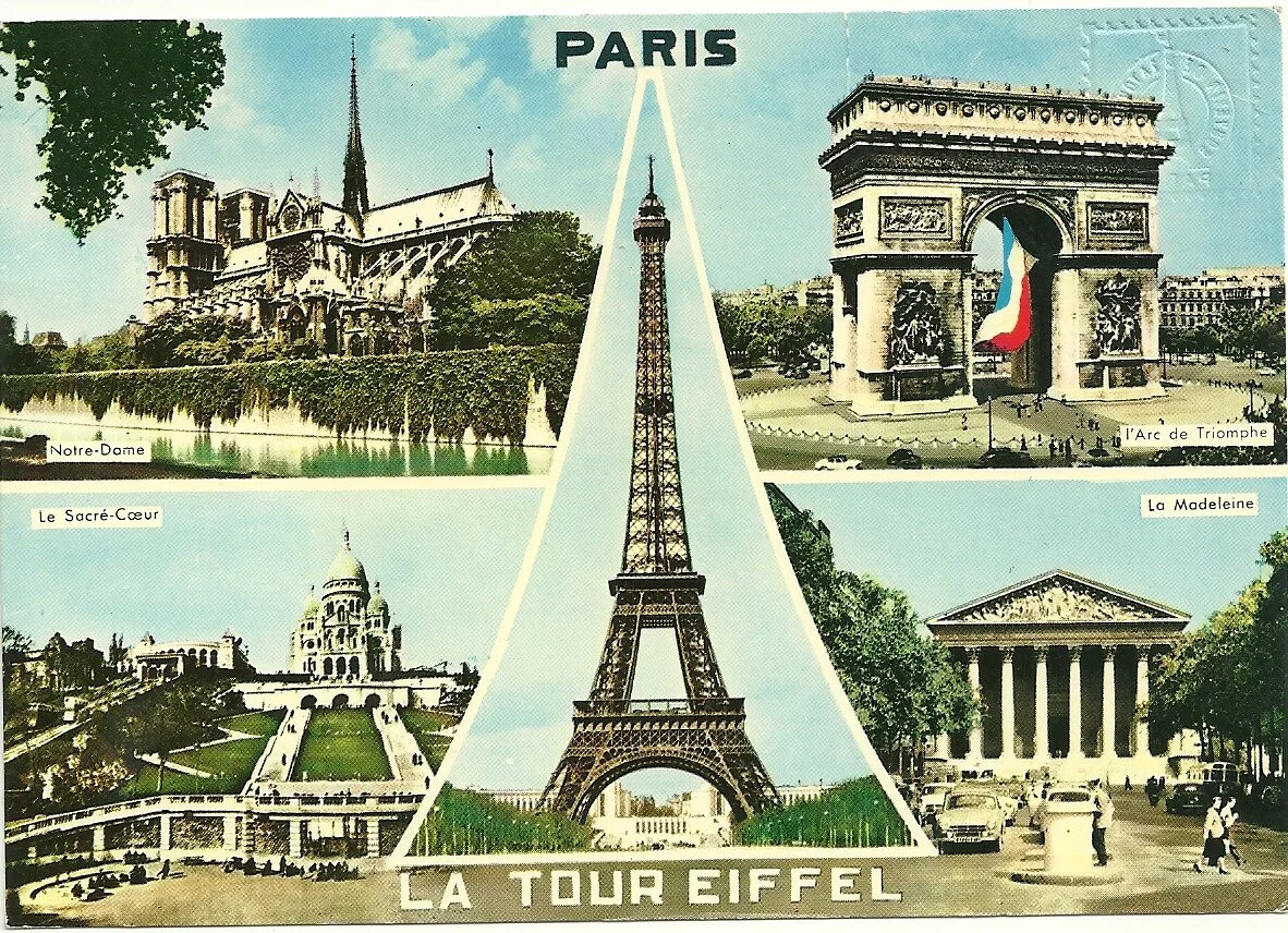
Torre De París Y Arco De Triunfo PNG ,dibujos Arco Del Triunfo, Día  Nacional De Francia, Fuegos Artificiales PNG y Vector para Descargar Gratis  | Pngtree

Respuesta  Mensaje 31 de 38 en el tema 
De: BARILOCHENSE6999 Enviado: 21/10/2024 13:59
Code Name Madeleine: A Sufi Spy in Nazi-Occupied Paris by Arthur J. Magida  | Goodreads
Longview HS Lobo Choir group takes final bow after week in Paris, France
My Favorite Top 12 Experiences in Europe — Dream Destinations
16 ideas de GEOGRAFÍA URBANA | urbano, geografía, ciudades

Respuesta  Mensaje 32 de 38 en el tema 
De: BARILOCHENSE6999 Enviado: 22/10/2024 05:27

Oak Island – the Templar and Viking connection!

Since the mid-nineteenth century, Oak Island has been claimed as the site for a vast, secretly hidden store of Templar treasure. Possibly the location of priceless items they discovered under the Temple of Solomon in Jerusalem.

Vast amounts of money have been spent excavating below ground to find millions of dollars worth of medieval booty. Companies have been set up with the sole task of getting to the treasure left behind by these enigmatic warrior knights. So – is the wealth of the Templars actually there?

Of course the answer is – we don’t know. But let’s try and figure out how the story has come about and why it still exercises such a tremendous hold on the popular imagination.

The Viking link to Oak Island

I think a good starting point are the claims made in the 20th century that the Vikings had got to the New World long before Christopher Columbus. Why is this important? Because if the Vikings could have got there – then why not the Templars?

This theory has been supported by the so-called Vinland map (dating from the 15th century), that seems to show our Viking ancestors touched down in north America. Trouble is, the map is just a little too good to be true and even though scholars from the British Museum and Yale backed it up in the 1960s, the evidence (for example dating of the ink) suggests it could be a forgery.

If it was true, the Vinland map would establish the feasibility of Europeans sailing across the Atlantic to the American coastline. It’s not beyond the realms of possibility because the Vikings did get to Iceland and Greenland. Some Templar conspiracy theorists suggest the knights or those who helped them had access to Viking navigation charts.

TEMPLAR EXCLUSIVE: Do you want to find your Templar ancestors?

The Templars and Oak Island

Moving away from the Vikings now, let’s shift our focus to the Knights Templar. In 1307, their number was up. Philip, king of France, had ordered the arrest of all the knights and they were interrogated under torture in various dungeons. But if the king had hoped to find lots of loot at the Paris Temple, their headquarters, he was to be severely disappointed. Only empty shelves greeted his soldiers.

We then get the story of Templar treasure being spirited away from Paris in wagons bound for the port of La Rochelle and from there on to Scotland (and/or maybe Portugal, see my other blog posts on that option). And then – the wealth of the Templars simply evaporates into thin air!

In his book Lost Treasure of the Knights Templar: Solving the Oak Island Mystery, Steven Sora claims that the Templars’ treasure – gold, silver, jewels and sacred relics of immense power – were firstly hidden away in the crypt at Rosslyn chapel by the Sinclair family. The Sinclairs are central to the whole Templar getaway-via-Scotland theory.

The Sinclair connection

Quick detour on the Sinclair family then. They are an ancient Scottish family that includes Henry, the first earl, who fought alongside the first Grand Master of the Templars, Hugh de Payens (or Payns) in the Holy Land in the early 12th century. So, we have an early association between this family and the order of knights.

Fast forward to the early 14th century and Sir William Sinclair (sometimes spelt St Clair or Saint-Clair) is sometimes held up to have been the last Templar Grand Master before his death in 1330. Trouble is, he also appears to have given evidence at their trials AGAINST the Templars – somewhat scuppering that theory unless he was involved in some kind of complex double bluff!

Then we have another Henry Sinclair who in the late 14th century allegedly explores the coast of north America with an Italian navigator called Antonio Zeno. This establishes the idea that the Sinclair family know all about the New World so are ready for a subsequent very important voyage.

According to Steven Sora, the Sinclairs leave the Templar treasure under Rosslyn until the 16th century. But then along comes the Protestant Reformation. The Sinclairs are devout Catholics. Fearing that that the Templar treasure might be seized, they set sail with it and land on…Oak Island!

Daniel McGinnis on Oak Island

Now, nothing more gets said about this – obviously, being a secret mission – until the 19th century. Then stories circulate in newspapers of discoveries made on the island by a man called Daniel McGinnis in the 1790s. I’ve read different versions of the McGinnis story. In one account, he found a curious depression in the ground while setting up his farm. Or, he saw unusual lights on the island one evening and sailed across, discovering the pit when he got there.

The story of McGinnis and his excavations only emerges fifty years later in a paper called the Liverpool Transcript. By the mid-nineteenth century, tales of pirates and their hidden treasure had become the stuff of boys’ magazines. In 1881, the author Robert Louis Stevenson would publish Treasure Island in a boys’ magazine called Young Folks. The Oak Island booty came to be associated with both the Templars and notorious pirates like Captain Kidd and Blackbeard.

This was also an era of gold rushes – speculators dashing to reputed finds of the precious metal. So, maybe not entirely surprising that Oak Island was soon swarming with diggers. The main attention was the Oak Island Money Pit. This was a curious shaft with what appeared to be booby traps set at different levels.

Most intriguing was the discovery of a stone slab that allegedly has carved on it the message: Forty feet below, two million pounds lay buried. That line is best said if you impersonate Nicholas Cage in the movie National Treasure. More seriously, at least six people have died investigating the very deep money pit due to flooding and in one case, a boiler exploding.

The Franklin Roosevelt connection

One well known Oak Island devotee was the US president Franklin Roosevelt (pictured above). The Democrat occupant of the White House through the 1930s was a Freemason and from his youth until his death in 1945, retained an abiding interest in the site. One feature that apparently gripped him was the rumour that the jewels of the last queen of France, Marie Antoinette, had been squirrelled away on the island.

Which brings us to the 21st century! Such is the level of interest in Oak Island that the History channel has just commissioned a whopping 30 hours for season six of its series The Curse of Oak IslandThis runaway success of a documentary series features two Michigan brothers Rick and Marty Lagina who have bought much of Oak Island to pursue the treasure hunt. They are accompanied by local expert, Dan Blankenship.

Rick is a retired US postal worker who passionately believes something lurks under the surface. His brother Marty is the sceptical foil raising doubts every so often about their enterprise. However, as the digs proceed, Marty is seen to convert by degrees to the cause.

The programme has attracted an impressive four million views. And it’s spawned two spin-offs: The Curse of Civil War Gold and Yamashita’s Gold. The first spin-off speaks for itself. The second is the alleged burial of treasure by Japanese soldiers in the closing days of World War II in the Philippine jungle.

In case you missed my recent outing on the History channel – I appeared in episode four of the Templar documentary series Buried earlier this year. Together with presenters Mikey Kay and Garth Baldwin, we looked for Templar treasure in the ancient citadel of Tomar in Portugal.

Respuesta  Mensaje 33 de 38 en el tema 
De: BARILOCHENSE6999 Enviado: 21/12/2024 17:01
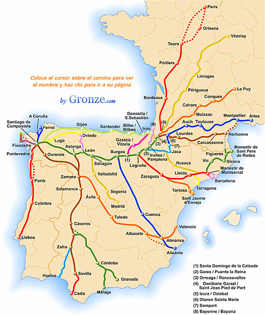
The Way of St James ~ A Pilgrimage on the Camino de Santiago

Respuesta  Mensaje 34 de 38 en el tema 
De: BARILOCHENSE6999 Enviado: 26/12/2024 16:26
Santa Maria Magdalena de Vezelay - Romanesque Architecture
Vezelay, Church and Hill - UNESCO World Heritage Site
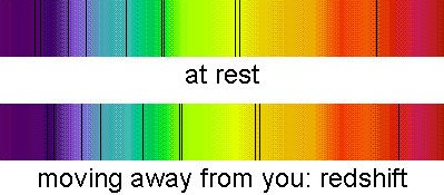
Doppler effect
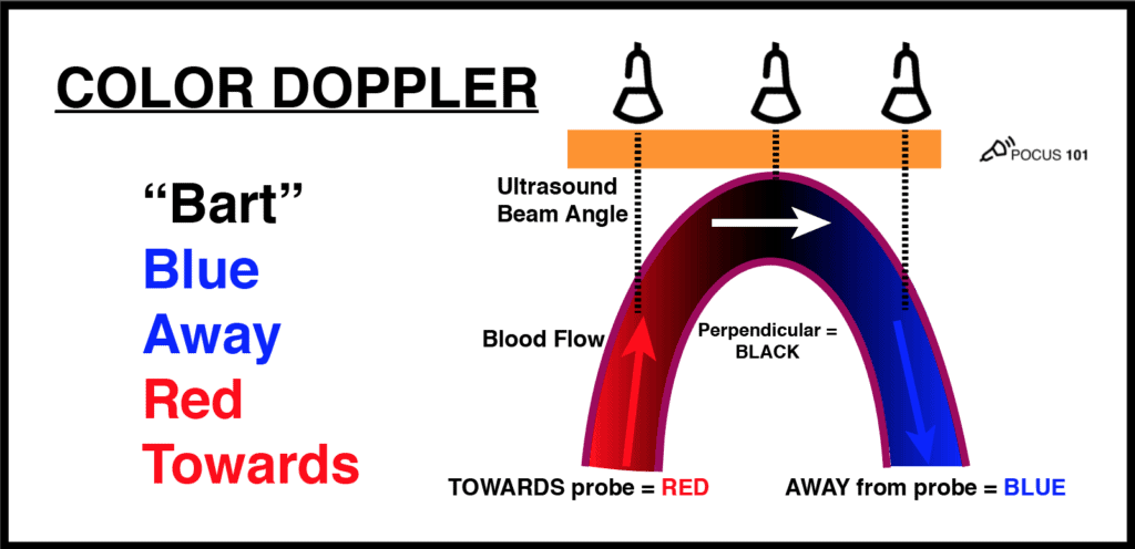
Basic Principles of Ultrasound Physics and Artifacts Made Easy - POCUS 101
Doppler Effect - StickMan Physics
Doppler Shift Equation and Redshift - GCSE Physics
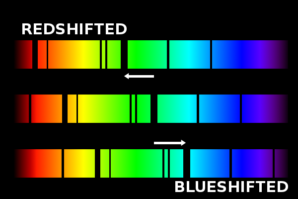
Explain doppler effect in light distinguish between redshift and blue shift
Doppler Effect grade 12: Red and Blue Shift - YouTube
Have astronomers ever observed a violet shift like they have blue shifts  and red shifts? | Science Questions with Surprising Answers
Doppler Shift

Respuesta  Mensaje 35 de 38 en el tema 
De: BARILOCHENSE6999 Enviado: 13/01/2025 18:31

Earth from Space – Arc de Triomphe, Paris

By Marc Boucher
Status Report
May 13, 2022
Filed under 
Earth from Space – Arc de Triomphe, Paris
Arc de Triomphe, Paris.
ESA

This striking, high-resolution image of the Arc de Triomphe, in Paris, was captured by Planet SkySat – a fleet of satellites that have just joined ESA’s Third Party Mission Programme in April 2022.
The Arc de Triomphe, or in full Arc de Triomphe de l’Étoile, is an iconic symbol of France and one of the world’s best-known commemorative monuments. The triumphal arch was commissioned by Napoleon I in 1806 to celebrate the military achievements of the French armies. Construction of the arch began the following year, on 15 August (Napoleon’s birthday).

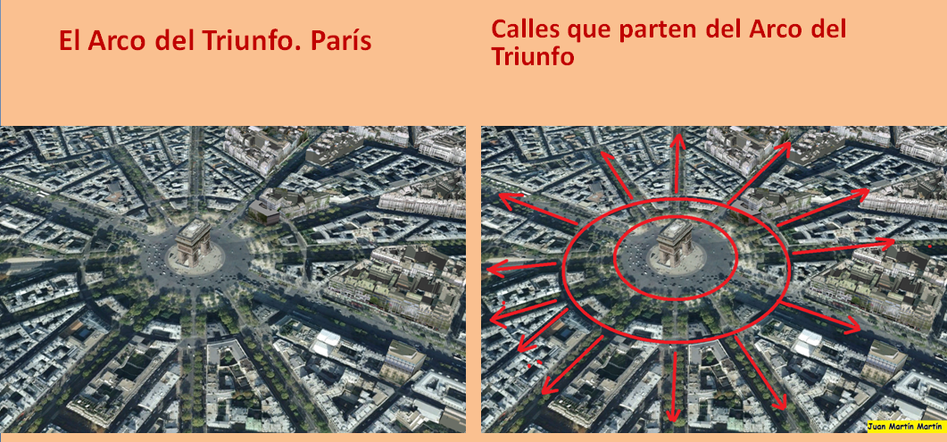
The arch stands at the centre of the Place Charles de Gaulle, the meeting point of 12 grand avenues which form a star (or étoile), which is why it is also referred to as the Arch of Triumph of the Star. The arch is 50 m high and 45 m wide.

The names of all French victories and generals are inscribed on the arch’s inner and outer surfaces, while the Tomb of the Unknown Soldier from World War I lies beneath its vault. The tomb’s flame is rekindled every evening as a symbol of the enduring nature of the commemoration and respect shown to those who have fallen in the name of France.

The Arc de Triomphe’s location at the Place Charles de Gaulle places it at the heart of the capital and the western terminus of the Avenue des Champs-Élysées (visible in the bottom-right of the image). Often referred to as the ‘most beautiful avenue in the world’, the Champs-Élysées is known for its theatres, cafés and luxury shops, as the finish of the Tour de France cycling race, as well as for its annual Bastille Day military parade.


This image, captured on 9 April 2022, was provided by Planet SkySat – a fleet of 21 very high-resolution satellites capable of collecting images multiple times during the day. SkySat’s satellite imagery, with 50 cm spatial resolution, is high enough to focus on areas of great interest, identifying objects such as vehicles and shipping containers.

SkySat data, along with PlanetScope (both owned and operated by Planet Labs), serve numerous commercial and governmental applications. These data are now available through ESA’s Third Party Mission programme – enabling researchers, scientists and companies from around the world the ability to access Planet’s high-frequency, high-resolution satellite data for non-commercial use.

Within this programme, Planet joins more than 50 other missions to add near-daily PlanetScope imagery, 50 cm SkySat imagery, and RapidEye archive data to this global network.

Peggy Fischer, Mission Manager for ESA’s Third Party Missions, commented, “We are very pleased to welcome PlanetScope and SkySat to ESA’s Third Party Missions portfolio and to begin the distribution of the Planet data through the ESA Earthnet Programme.

“The high-resolution and high-frequency imagery from these satellite constellations will provide an invaluable resource for the European R&D and applications community, greatly benefiting research and business opportunities across a wide range of sectors.”

To find out more on how to apply to the Earthnet Programme and get started with Planet data, click here.

– Download the full high-resolution image.

https://spaceref.com/earth/earth-from-space-arc-de-triomphe-paris/

Respuesta  Mensaje 36 de 38 en el tema 
De: BARILOCHENSE6999 Enviado: 14/01/2025 17:05

 
Batalla de Austerlitz
Tercera Coalición
Parte de guerras napoleónicas

Napoleón en la batalla de Austerlitz, óleo de François Gérard.
Fecha 2 de diciembre de 1805
Lugar Bandera de Imperio austríaco AusterlitzImperio austríaco
(actual Slavkov u BrnaBandera de República Checa República Checa)
Coordenadas 49°07′41″N 16°45′45″E
Resultado Bandera de Francia Decisiva victoria francesa
Consecuencias
Beligerantes
Bandera de Francia Imperio francés Bandera de Imperio austríaco Imperio austríaco
Bandera de Rusia Imperio ruso
Comandantes
 Napoleón I
Bandera de Francia Jean-Baptiste Bessières
 Francisco I
Bandera de Imperio austríaco Von Weyrother
 Alejandro I
Bandera de Rusia Mijaíl Kutúzov
Fuerzas en combate
Bandera de Francia 72 000N 1 Bandera de Imperio austríacoBandera de Rusia 85 000N 2
Bajas
1305 muertos,
6940 heridos,
573 capturados,
1 estandarte perdido1
15 000 muertos y heridos,
12 000 capturados,
180 cañones y
50 estandartes perdidos1

Respuesta  Mensaje 37 de 38 en el tema 
De: BARILOCHENSE6999 Enviado: 20/01/2025 14:54
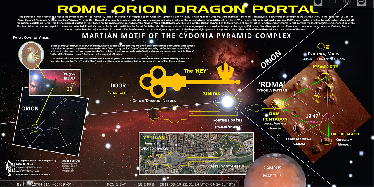
Resultado de imagen para cydonia mars number 33

ANCIENT EGYPTIAN GEODESY - PART II

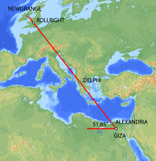
The great circle alignment from Giza to Alexandria has an azimuth of 51.85° north of due west from Giza (the same angle as the slope of the Great Pyramid). Extended beyond Alexandria, this great circle also crosses over Delphi, Rollright and Newgrange, as well as the city of London.

Map image © VectorGlobe

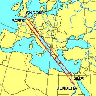
The azimuth of a great circle alignment from Dendera to Paris is also 51.85° north of due west.

Map image - Roger Hedin

Dendera was dedicated to Isis/Sirius. The ancient Egyptian year began on the date of the heliacal rising of Sirius in mid July. The helical rising of Sirius heralded the annual inundation of the Nile that was essential to the welfare of ancient Egypt. The axis of the temple of Isis at Dendera was aligned 20° south of due east, pointing directly at the rising point of Sirius from the latitude of Dendera.

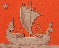
Robert Bauval describes a number of connections between Isis/Sirius and Paris in Talisman (2004). Isis is shown riding on a boat in many ancient Egyptian drawings and carvings. At the direction of Napoleon, Sirius and a statue of Isis were added to the coat of arms for Paris shown below.

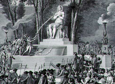
During the French revolution, a statue of Isis known as the Fountain of Regeneration was constructed on the former site of the Bastille. The engraving below commemorated this statue.

Fountain of Regeneration Engraving

The Elysian Fields is described as a place of eternal salvation in the ancient Egyptian Book of the Dead. Named after the Elysian Fields, the Champs Elysees is the main axis of Paris. The names Elysian and Elysees both suggest an association with Isis. The photograph below is facing southeast. The Arc de Triumphe is visible in the background. Beyond the Arc de Triumphe is the Louvre. The azimuth of the Champs Elysees is 26° south of due east, pointing directly at the rising point of Sirius/Isis from the latitude of Paris.

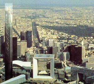
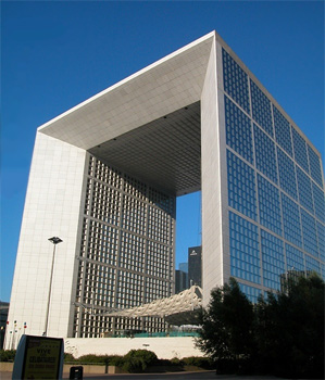
The termination point of the Champs Elysees to the northwest is the Grande Arche, in the foreground of the picture above. The axis of the Grande Arche is offset 6.33° south of the axis of the Champs Elysees. With an azimuth of just over 32° south of due east, the azimuth of the axis of the Grande Arche is the same as the azimuth of the great circle alignment from Paris to Dendera.

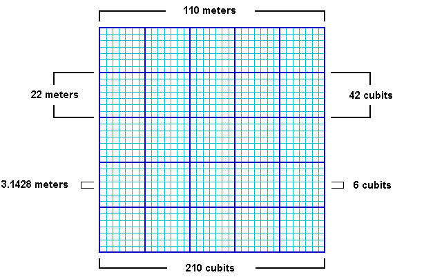
The Grande Arche is a nearly perfect cube with a height of 110 meters, a width of 108 meters and a depth of 112 meters. It is often described as a cube with side lengths of 110 meters. This is equal to 210 ancient Egyptian cubits:

110/210 = .5238

.5238 meters is a precise measure of the ancient Egyptian cubit, equating to 20.6222 inches, well within the ± .005 inches in Petrie's 20.62 inch measure of the ancient Egyptian cubit. Instead of the usual comparisons between the cubit and the meter of .52375/1 or .524/1, the best comparative measure may be the simple fraction of 11/21 that is suggested by the Grande Arche.

Image © Insecula.com

The sides of the Grande Arche are divided into 5 x 5 large panels and within each large panel are 7 x 7 smaller panels. Side lengths of 110 meters suggest lengths of 22 meters for the sides of the large panels with lengths of 22/7 meters for the sides of the smaller panels. The fraction 22/7 equals 3.1428, an accurate expression of π that is also found in the dimensions of the Great Pyramid. Side lengths of 210 cubits in the Grande Arche suggest lengths of 42 cubits for the sides of the large panels and 6 cubits for the sides of the smaller panels. This also shows that the relationship between the meter and the cubit is 6/π, using the measure of 22/7 for π:

21/11 = 6/π

22/7 x 21/11 = 6

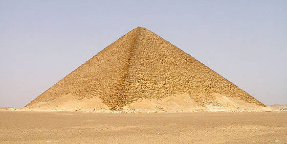
The northern pyramid at Dashur, known as the Red Pyramid, was the first true (smooth sided) pyramid built in Egypt and it was the last pyramid built prior to construction of the Great Pyramid. The baselengths of the Red Pyramid are 420 cubits (220 meters) long, 20x multiples of 21/11.

Image by Jon Bodsworth

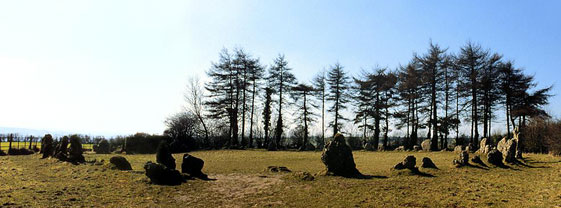
One of the oldest stone circles in England is at Rollright. The diameter of the Rollright circle is 31.4 meters, an accurate expression of π times 10 meters. Given the 6/π relationship between the meter and the cubit, the diameter of the Rollright circle is also 60 ancient Egyptian cubits.

BACK

http://home.hiwaay.net/~jalison/Art5.html

Respuesta  Mensaje 38 de 38 en el tema 
De: BARILOCHENSE6999 Enviado: 20/01/2025 15:46


Primer  Anterior  24 a 38 de 38  Siguiente   Último  
Tema anterior  Tema siguiente
 
©2025 - Gabitos - Todos los derechos reservados