|
|
General: WASHINGTON DC (UNITED STATES) 77 WEST NEW DELHI (INDIA) 77 EAST PENTAGRAM
Triar un altre plafó de missatges |
 Primer
Anterior
2 a 16 de 16
Següent
Primer
Anterior
2 a 16 de 16
Següent
 Darrer
|
|
|
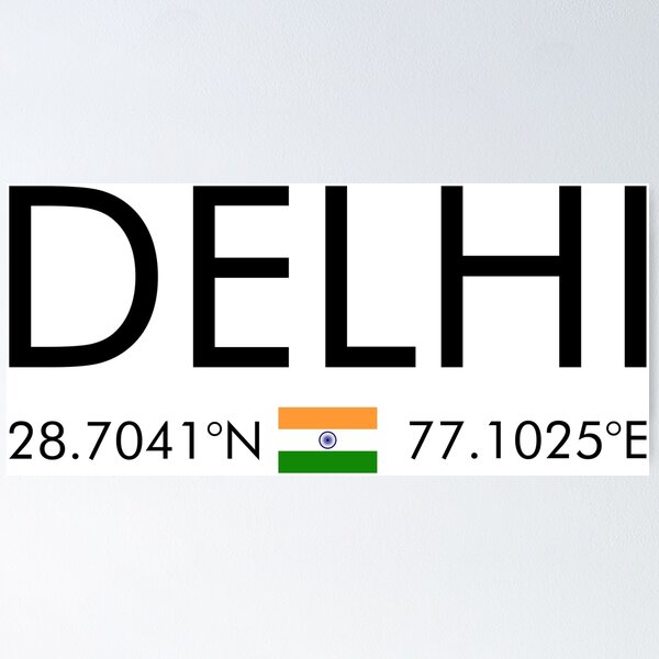
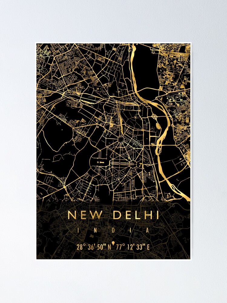
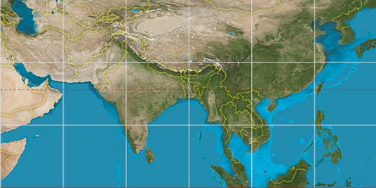
New Delhi, India latitude longitude
Decimal latitude and longitude coordinates for New Delhi (India): 28.63576, 77.22445
MORE ABOUT NEW DELHI LAT-LONG POSITION
New Delhi is located in India country, in Asia continent (or region). DMS latitude longitude coordinates for New Delhi are: 28°38'8.74"N, 77°13'28.02"E.
• Latitude position: Equator ⇐ 3184km (1978mi) ⇐ New Delhi ⇒ 6823km (4240mi) ⇒ North pole.
• Longitude position: Prime meridian ⇒ 7385km (4589mi) ⇒ New Delhi. GMT: +5.5h.
• Local time in New Delhi: Monday 8:23 pm, March 24, 2025. [*time info]
75°
30°
Step for grid lines is 15°. On second map 30° latitude and 75° longitude line is numbered. Map pointer shows the 28.64, 77.22 lat-long coordinates.
[*time info] Shown time is in moment when this page is generated. For more accurate time in New Delhi visit timein.org (new window).
https://latitudelongitude.org/in/new-delhi/ |
|
|
|
|
(Unit 1-Topic 1) About India
12SaturdayMay 2018
Indian Geography (Unit 1)
Content :
- Latitudes and Longitudes
- Standard Time and Time Zones
- India and its neighbourhood-relations
- Indian States and Union Territories
_______________________________________________________________
1. Latitudes and Longitudes
- Latitudes and Longitudes are imaginary lines used to determine the location of a place on earth.
- The shape of the earth is ‘Geoid’. And the location of a place on the earth can be mentioned in terms of latitudes and longitudes.
- Example: The location of New Delhi is 28° N, 77° E.

Latitude
- Latitude is the angular distance of a point on the earth’s surface, measured in degrees from the center of the earth.
- As the earth is slightly flattened at the poles, the linear distance of a degree of latitude at the pole is a little longer than that at the equator.
- For example at the equator (0°) it is 68.704 miles, at 45° it is 69.054 miles and at the poles it is 69.407 miles. The average is taken as 69 miles (111km).
- 1 mile = 1.607 km.
Important parallels of latitudes
- Besides the equator (0°), the north pole (90°N) and the south pole (90° S), there are four important parallels of latitudes–
- Tropic of Cancer (23½° N) in the northern hemisphere.
- Tropic of Capricorn (23½° S) in the southern hemisphere.
- Arctic circle at 66½° north of the equator.
- Antarctic circle at 66½° south of the equator.
Latitudinal Heat zones of the earth
- The mid-day sun is exactly overhead at least once a year on all latitudes in between the Tropic of Cancer and the Tropic of Capricorn. This area, therefore, receives the maximum heat and is called the torrid zone.
- The mid-day sun never shines overhead on any latitude beyond the Tropic of Cancer and the Tropic of Capricorn. The angle of the sun’s rays goes on decreasing towards the poles. As such, the areas bounded by the Tropic of Cancer and the Arctic circle in the northern hemisphere, and the Tropic of Capricorn and the Antarctic circle in the southern hemisphere, have moderate temperatures. These are, therefore, called temperate zones.
- Areas lying between the Arctic circle and the north pole in the northern hemisphere and the Antarctic circle and the south pole in the southern hemisphere, are very cold. It is because here the sun does not raise much above the horizon. Therefore, its rays are always slanting. These are, therefore, called frigid zones.
Longitude
- Longitude is an angular distance, measured in degrees along the equator east or west of the Prime (or First) Meridian.
- On the globe longitude is shown as a series of semi-circles that run from pole to pole passing through the equator. Such lines are also called
- Unlike the equator which is centrally placed between the poles, any meridian could have been taken to begin the numbering of longitude. It was finally decided in 1884, by international agreement, to choose as the zero meridian the one which passes through the Royal Astronomical Observatory at Greenwich, near London.
- This is the Prime Meridian (0°) from which all other meridians radiate eastwards and westwards up to 180°.
- As the parallels of latitude become shorter poleward, so the meridians of longitude, which converge at the poles, enclose a narrower space.
- They have one very important function, they determine local time in relation to G.M.T. or Greenwich Mean Time, which is sometimes referred to as World Time.
Longitude and Time
- Since the earth makes one complete revolution of 360° in one day or 24 hours, it passes through 15° in one hour or 1° in 4 minutes.
- The earth rotates from west to east, so every 15° we go eastwards, local time is advanced by 1 hour. Conversely, if we go westwards, local time is retarded by 1 hour.
- We may thus conclude that places east of Greenwich see the sun earlier and gain time, whereas places west of Greenwich see the sun later and lose time.
- If we know G.M.T., to find local time, we merely have to add or subtract the difference in the number of hours from the given longitude.
________________________________________________________________________________
2. Standard Time and Time Zones
- If each town were to keep the time of its own meridian, there would be much difference in local time between one town and the other.
- Travelers going from one end of the country to the other would have to keep changing their watches if they wanted to keep their appointments. This is impractical and very inconvenient.
- To avoid all these difficulties, a system of standard time is observed by all countries.
- Most countries adopt their standard time from the central meridian of their countries.
- In larger countries such as Canada, U.S.A., China, and U.S.S.R, it would be inconvenient to have single time zone. So these countries have multiple time zones.
- Both Canada and U.S.A. have five time zones—the Atlantic, Eastern, Central, Mountain and Pacific Time Zones. The difference between the local time of the Atlantic and Pacific coasts is nearly five hours.
- S.S.R had eleven time zones before its disintegration. Russia now has nine time zones.
The International Date Line
- A traveler going eastwards gains time from Greenwich until he reaches the meridian 180°E, when he will be 12 hours ahead of G.M.T.
- Similarly in going westwards, he loses 12 hours when he reaches 180°W. There is thus a total difference of 24 hours or a whole day between the two sides of the 180° meridian.
- This is the International Date Line where the date changes by exactly one day when it is crossed. A traveler crossing the date line from east to west loses a day (because of the loss in time he has made); and while crossing the dateline from west to east he gains a day (because of the gain in time he encountered).
- The International Date Line in the mid-Pacific curves from the normal 180° meridian at the Bering Strait, Fiji, Tonga and other islands to prevent confusion of day and date in some of the island groups that are cut through by the meridian.
- Some of them keep Asiatic or New Zealand standard time, others follow the American date and time.
 Why is the international dateline drawn in a zigzag manner?
- The International Date Line (IDL) passes through the Pacific Ocean. It is an imaginary line, like longitudes and latitudes.
- The time difference on either side of this line is 24 hours. So, the date changes as soon as one crosses this line.
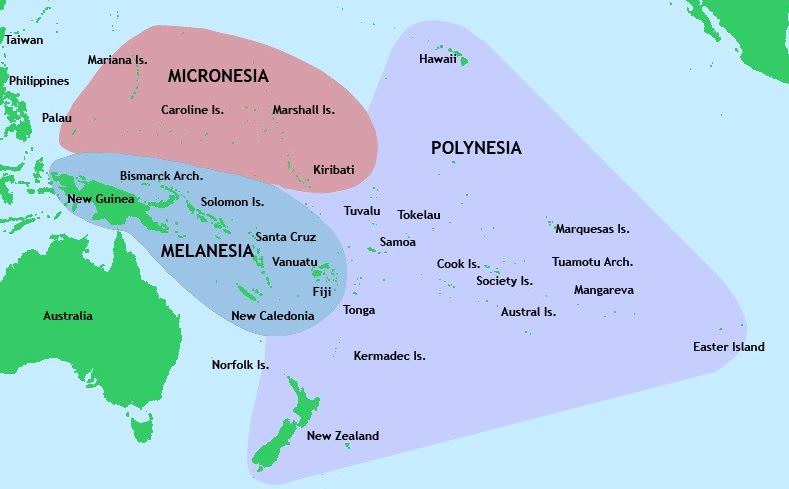
- Some groups of Islands (Polynesia, Melanesia, Micronesia) fall on either of the dateline. So if the dateline was straight, then two regions of the same Island Country or Island group would fall under different date zones. Thus to avoid any confusion of date, this line is drawn through where the sea lies and not land. Hence, the IDL is drawn in a zig-zag manner.
Indian Standard Time
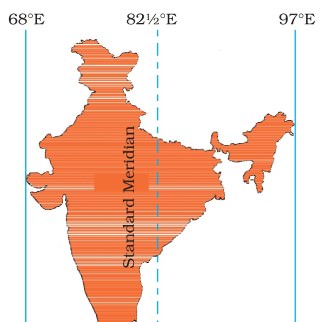
- The Indian Government has accepted the meridian of 82.5° east for the standard time which is 5 hours 30 mins, ahead of Greenwich Mean Time.
Chaibagaan Time
- 150 years ago British colonialists introduced “chaibagaan time” or “bagaan time”, a time schedule observed by tea planters, which was one hour ahead of IST.
- This was done to improve productivity by optimizing the usage of daytime.
- After Independence, Assam, along with the rest of India, has been following IST for the past 66 years.
- The administration of the Indian state of Assam now wants to change it’s time zone back to Chaibagaan time to conserve energy and improve productivity.
- Indian government didn’t accept to such a proposal.
________________________________________________________________________
3. India and its neighbourhood-relations
India is land where people believe in cooperation and maintain healthy relationship with its neighbour. India has always been known as a “peace-loving country”. India has official political relations with most nations. India is considered as the world’s second most populous and democratic country. Its economy is the fastest growing around the world. With the world’s eighth largest military expenditure, third largest armed force, seventh largest economy by nominal rates and third largest economy in terms of purchasing power parity. India is a regional power, an embryonic global power and has capability to become superpower. India has a developing international influence and a prominent voice in global businesses.
India is a progressing industrialised nation. It has a history of partnership with several countries, is a component of the BRICS and a major part of developing world. India was one of the founding members of several international organisations, most notably the United Nations, the Asian Development Bank, G-20 major economies and the founder of the Non-Aligned Movement. India has also played an important and influential role in other international organisations like East Asia Summit, World Trade Organisation, International Monetary Fund (IMF), G8+5 and IBSA Dialogue Forum. Locally, India is a part of SAARC and BIMSTEC.
Foreign policy of India has always regarded the concept of neighbourhood as one of broadening concentric circles, around a central axis of historical and cultural commonalities. Millions people of Indian origin, live and work abroad and constitute an important link with the mother country. An important role of India’s foreign policy has been to guarantee their welfare and wellbeing within the framework of the laws of the country where they live.
The Ministry of External Affairs is the Indian government’s agency look after the foreign relations of India. The Minister of External Affairs holds cabinet rank as a member of the Council of Ministers. Sushma Swaraj is current Minister of External Affairs. When reviewing historical approach, India’s international influence varied over the years after independence. Indian prestige and moral authority were high in the 1950s and enabled the acquisition of developmental assistance from both East and West. Although the prestige stemmed from India’s nonaligned stance, the nation was incapable to prevent Cold War politics from becoming intertwined with interstate relations in South Asia.
In the decade of 1960 and 1970s, India’s international position among developed and developing countries faded in the course of wars with China and Pakistan, disputes with other countries in South Asia, and India’s effort to balance Pakistan’s support from the United States and China by signing the Indo-Soviet Treaty of Friendship and Cooperation in August 1971. Although India obtained substantial Soviet military and economic aid, which helped to strengthen the nation, India’s influence was undercut regionally and internationally by the perception that its friendship with the Soviet Union prevented a more forthright disapproval of the Soviet presence in Afghanistan. In the late 1980s, India developed relations with the United States, other developed countries, and China while continuing close ties with the Soviet Union. Relations with its South Asian neighbours, especially Pakistan, Sri Lanka, and Nepal, occupied much of the energies of the Ministry of External Affairs.
In the mid-1990s, India fascinated the world attention towards the terrorism supported by Pakistan in Kashmir. The Kargil War resulted in a major diplomatic victory for India. The United States and European Union recognised the fact that Pakistani military had illegally infiltrated into Indian Territory and pressured Pakistan to withdraw from Kargil. Several anti-India militant groups based in Pakistan were labelled as terrorist groups by the United States and European Union.
After disastrous terrorist attack in September 11 in 2001, Indian intelligence agencies provided the U.S. with significant information on Al-Qaeda and related groups’ activities in Pakistan and Afghanistan. India’s extensive contribution to the War on Terror, along with a surge in its economy, has assisted India’s diplomatic relations with several countries.
India championed the cause of peace in the world. Being a large country, India has a long border and many neighbours with them have traditionally maintained welcoming and good neighbourly relations. Countries nearby India include Afghanistan, Bhutan, Bangladesh, China, Pakistan, Burma, Sri Lanka, Maldives, Bhutan, and Nepal. These neighbourhood countries are the member countries of the South Asian Association for Regional Cooperation (SAARC). The constituent countries individually as well as collectively represent a world of historical links, shared legacies, commonalities as well as diversities which are elaborately reflected in their ethnic, linguistic, religious and political fabric. China and Myanmar, the other two neighbours, are no less complex.
The South Asian region is also full of inconsistencies, disparities and paradoxes. In the post-colonial period, the South Asia has been a theatre of blood spattered interstate as well as civil wars. It has witnessed liberation movements, nuclear rivalry, military dictatorships and continues to suffer from insurgencies, religious fundamentalism and terrorism, besides serious problems associated with drugs and human trafficking.
The South Asian Association for Regional Cooperation (SAARC) has remained in existence for over two decades, yet South Asia is considered as the least integrated of the global regions. This is despite the stipulation in its Charter that “bilateral and contentious issues shall be excluded” from its deliberations, thus making it possible to put the contentious issues on the back burner and focus on areas of possible cooperation. On the positive side, the region has been registering good growth during the past several years. Also democratic forms of governance are beginning to gain some ground in most parts of the region.
India’s position is unique in its neighbourhood. As a matter of geographic factor, India shares borders with all other South Asian nations whereas no other South Asian nation (except Afghanistan and Pakistan) shares borders with any other South Asian nation. Notwithstanding some inadequacies, democracy and rule of law as instruments of political governance are well engrained in India. Transfer of power has been more or less peaceful and transparent. In relative terms, India can be debatably considered as the most stable country in the region, progressing at speedy rate, even though the growth has of late slowed down. In terms of its population, territory, GDP, its image as an evolving world economy and a responsible de-facto nuclear State, and as a country which is intended to play vital role at international stage.
Effect of pollutant on plants (Source: Rao, 1989)
India has many achievements. But, in the regional perspective, there is neighbours’ bitterness. There are unfair and erroneous perceptions about India floating around in the region. India treats its neighbours as an ignored courtyard. There are vested interests and lobbies for whom being anti-Indian is synonymous with being patriot and nationalist. There are strong institutions within the framework of a more or less failed State in the neighbourhood (Pakistan) which would like to see relations with India in a state of perpetual suspension. India’s intentions are suspected even in cases of innocent proposals for economic cooperation which would lead to win-win situations.
Afghanistan:
India’s relations with Afghanistan are healthy and there is co-operation in economic, technical and cultural fields. India applauded the UN-sponsored Geneva Agreement on Afghanistan in 1988. India recapped its stand for an independent, non-aligned Afghanistan. Country realized that the Afghans themselves should be allowed to decide upon their future without external pressure. To maintain friendly relations, India provided Rs.10 crore assistance for relief and rehabilitation of Afghan refugees. India is also supporting Afghanistan in public health, small-scale industries, and education. Bilateral relations between India and Afghanistan have been customarily strong and pleasant. While India was the only South Asian country to identify the Soviet-backed Democratic Republic of Afghanistan in the 1980s. Its relations were weakened during the Afghan civil wars and the rule the Islamist Taliban in the 1990s. India assisted the rebellion of the Taliban and became the largest regional provider of humanitarian and reconstruction aid. The new constitutionally elected Afghan government strengthened its ties with India in wake of persisting tensions and problems with Pakistan, which is continuing to shelter and support the Taliban. India espoused a policy of cooperation to boost its standing as a regional power and contain its competitor Pakistan, which supports Islamic militants in Kashmir and other parts of India. India is the major regional investor in Afghanistan, having committed more than US$2.2 billion for rebuilding purposes.
India offers aid programs for Afghanistan include infrastructure development, institutional capacity building, small development projects, as well as food security assistance in the form of ongoing deliveries of wheat to Afghanistan. Since 2001, more than 10,000 Afghan students have studied in India on ICCR scholarships, with approximately 7,000 returning home armed with an education and technical skills, which they are using to drive Afghanistan’s stabilization and development. In the meantime, many officers in the Afghan government have benefited from the technical capacity building programs of ITEC and the Indian Council of Agricultural Research, while some 8,000 Afghan students are pursuing self-financed degrees in different fields across India.
Despite many transit obstacles, the volume of Indo-Afghan trade stood at $680 million during 2013-2014, which is continually rising, following the full implementation of the Afghanistan and Pakistan Trade and Transit Agreement (APTTA). Furthermore, air connectivity between the two nations has grown progressively. There are four to five flights operating daily between Kabul and Delhi, bringing to India nearly 1,000 Afghans, many of them medical tourists, seeking treatment in Delhi hospitals.
To expand economic ties between the two nations, the Afghan Embassy in Delhi has frequently engaged with the national and local chambers of commerce and industries of India. The embassy has so far signed five memorandums of understanding (MOUs) covering commercial and medical cooperation between Afghanistan’s respective chambers of commerce and hospitals, while it has initiated another 20 MOUs with state chambers and hospitals across India among these few are in the coming months. Indian investors are more interested in the many “virgin markets” of Afghanistan, including mining, agriculture and agribusiness, information and technology, telecommunications, and others.
Furthermore, to strength relation between Afghans and Indians, the Afghan Embassy in Delhi has introduced the creation of sister-city relations between major Indian cities and states and their Afghan counterparts. Presently, the embassy has proposed the creation of relations between Delhi and Kabul, Mumbai and Kandahar, Ajmer Sharif (Rajasthan) and Herat, Hyderabad and Jalalabad, Ahmadabad (Gujrat) and Asadabad (Kunar), as well as the State of Assam and the Province of Helmand.
It can be assessed that India remains a vital part of Afghanistan’s stable progress in institutionalizing peace, pluralism, and prosperity. Links between Afghanistan and India go beyond the traditionally strong relations at the government level. Since ancient time, the peoples of Afghanistan and India have interacted with each other through trade and commerce, peacefully coexisting on the basis of their shared cultural values and commonalities. This history has become the foundation of mutual trust. Public opinion polls in Afghanistan confirm this, as well as the sentiment Afghans share about feeling at home whenever they visit India.
Bangladesh:
Indian government believe in maintaining good relations with neighbouring countries. Bangladesh is one of its close neighbour. India had recognised Bangladesh as a separate and independent state, did so on 6 December 1971. India fought together with the Bangladeshis to liberate Bangladesh from West Pakistan in 1971. Bangladesh and India share a common tradition. They are pleasant and both nations make great efforts to solve the problem of waters of Ganga at Farakka and Tin Bigha corridor in a spirit of give and take. India has helped Bangladesh in the recovery of cyclone victims in 1985. In broad sense, the relations between the two nations continue to be amiable. But major issues in relation with these two nation is that of about 145,000 Chakma refugees who crossed over to India. Bangladesh’s relationship with India has been difficult in terms of irrigation and land border disputes post 1976. Nevertheless, India has maintained favourable relationship with Bangladesh during governments formed by the Awami League in 1972 and 1996. The solutions of land and maritime disputes have taken out nuisances in ties.
At the beginning, India’s relations with Bangladesh have not been stronger because of India’s absolute support for independence and opposition against Pakistan in 1971. During the independence war, many refugees fled to India. When the struggle of resistance matured in November 1971, India also interfered militarily and has helped in bring international attention to the issue through Indira Gandhi’s visit to Washington, D.C. Afterwards India furnished relief and reconstruction aid. India also withdrew its military from the land of Bangladesh when Sheikh Mujibur Rahman requested Indira Gandhi to do so during the latter’s visit to Dhaka in 1972. Indo-Bangladesh relations have been somewhat less friendly since the fall of Mujib government in August 1975. But as the time passed, many issues emerged such as South Talpatti Island, the Tin Bigha Corridor and access to Nepal, the Farakka Barrage and water sharing, border conflicts near Tripura and the construction of a fence along most of the border which India explains as security provision against migrants, insurgents and terrorists. Bilateral relations began to friendly in 1996, due to soft Indian foreign policy and the new Awami League Government. A 30-year water-sharing agreement for the Ganges River was signed in December 1996, after an earlier bilateral water-sharing agreement for the Ganges River lapsed in 1988. Both nations also have cooperated on the issue of flood warning and readiness. The Bangladesh Government and tribal insurgents signed a peace accord in December 1997, which allowed for the return of tribal refugees who had escaped into India, beginning in 1986, to escape violence caused by an insurgency in their homeland in the Chittagong Hill Tracts. The Bangladesh Army maintains a very strong presence in the area presently. The army is progressively concerned about problem of cultivation of illegal drugs.
There are also small pieces of land along the border region that Bangladesh is tactfully trying to reclaim. Padua, part of Sylhet Division before 1971, has been under Indian control since the war in 1971. This small strip of land was re-occupied by the BDR in 2001, but later given back to India after Bangladesh government decided to solve the problem through diplomatic negotiations. The Indian New Moore Island no longer exists, but Bangladesh repeatedly claims it to be part of the Satkhira district of Bangladesh.
India has increasingly complained that Bangladesh does not secure its border well. It fears an increasing flow of poor Bangladeshis and it accuses Bangladesh of sheltering Indian separatist groups like ULFA and alleged terrorist groups. The Bangladesh government has snubbed to accept these allegations. India estimates that over 20 million Bangladeshis are living unlawfully in India. Since 2002, India has been building an India – Bangladesh Fence along much of the 2500 mile border. The failure to resolve migration disputes bears a human cost for illegal migrants, such as imprisonment and health risks, namely HIV/Aids. Presently, India’s Prime Minister Narendra Modi and his Bangladeshi counterpart Sheikh Hasina have completed a revolutionary deal redrawing their disordered shared border and there by solving disputes between India and Bangladesh. Bangladesh and India have signed a historic agreement to simplify their border by exchanging more than 150 enclaves of land.
Bangladesh also offer India transit route to travel through Bangladesh to its North East states. India and Bangladesh also have free trade agreement in June 7, 2015. Both nations solved its border dispute on June 6, 2015. To connect Kolkata with Tripura via Bangladesh through railway, the Union Government on 10 February 2016 sanctioned about 580 crore rupees. The funds were sanctioned for constructing the 15-kilometer railway track between Kolkata and Tripura. The project that is expected to be completed by 2017 will pass through Bangladesh. The Agartala-Akhaura rail-link between Indian Railway and Bangladesh Railway will reduce the current 1700 km road distance between Kolkata to Agartala via Siliguri to just 350-kilometer by railway. These projects are high level and on Prime Minister’s ‘Act East’ Policy, and is anticipated to increase connectivity and increase trade between India and Bangladesh.
Bhutan:
Relations between India and Bhutan are friendly since past and it is strengthened recently. Co-operation in economic field between the two countries has advanced them. India has helped Bhutan in industry development such as in the field of telecommunications, hydel survey, education and forestry. Historically, there have been strong ties with India. Both countries signed a friendship treaty in 1949, where India would support Bhutan in foreign relations. On 8th February 2007, the Indo-Bhutan Friendship Treaty was substantially revised under the Bhutanese King, Jigme Khesar Namgyel Wangchuck. Whereas in the Treaty of 1949 Article 2 read as “The Government of India undertakes to exercise no interference in the internal administration of Bhutan. On its part, the Government of Bhutan agrees to be guided by the advice of the Government of India in regard to its external relations.” In the revised treaty, it is described as, “In keeping with the abiding ties of close friendship and cooperation between Bhutan and India, the Government of the Kingdom of Bhutan and the Government of the Republic of India shall cooperate closely with each other on issues relating to their national interests. Neither government shall allow the use of its territory for activities harmful to the national security and interest of the other”. The revised treaty also includes in it the preamble.
The Indo-Bhutan Friendship Treaty of 2007 supports Bhutan’s position as an independent and sovereign nation. The hydropower sector is one of the main supports of bilateral cooperation. It demonstrates mutually beneficial synergy by providing clean energy to India and exports revenue to Bhutan (power contributes 14% to the Bhutanese GDP, comprising about 35% of Bhutan’s total exports). Three hydroelectric projects (HEPs) totaling 1416 MW, (336 MW Chukha HEP, the 60 MW Kurichu HEP, and the 1020 MW Tala HEP), are already exporting electricity to India. In 2008, the both governments identified ten more projects for development with a total generation capacity of 10,000 MW. Of these, three projects totalling 2940 MW (1200 MW Punatsangchu-I, 1020 MW Punatsangchu-II and 720 MW Mangdechu HEPs) are under construction and are scheduled to be commissioned in the last quarter of 2017-2018. Out of the remaining 7 HEPs, 4 projects totalling 2120 MW (600 MW Kholongchhu, 180 MW Bunakha, 570 MW Wangchu and 770 MW Chamkarchu) will be constructed under Joint Venture model, for which a Framework Inter-Governmental Agreement was signed between both governments in 2014. Of these 4 JV-model projects, pre-construction activities for Kholongchhu HEP have commenced.
It is assessed that India continuously involved in business relations and development partner of Bhutan. Planned development efforts in Bhutan began in the early 1960s. The First Five Year Plan (FYP) of Bhutan was launched in 1961. Since then, India has been extending financial assistance to Bhutan’s FYPs. The 10th FYP ended in June 2013. India’s overall help to the 10th FYP was a little over Rs.5000 crores, excluding grants for hydropower projects.
https://saitejatiru143.wordpress.com/2018/05/12/unit-1-topic-1-about-india/ |
|
|
|
|
New Delhi
From Wikipedia, the free encyclopedia
|
|
Parts of this article (those related to Demographics) need to be updated. The reason given is: Update with information from 2021 census. Please help update this article to reflect recent events or newly available information. (July 2024)
|
New Delhi (;[6] Hindi: Naī Dillī , pronounced [ˈnəiː ˈdɪlːiː]) is the capital of India and a part of the National Capital Territory of Delhi (NCT). New Delhi is the seat of all three branches of the Government of India, hosting the Rashtrapati Bhavan, Sansad Bhavan, and the Supreme Court. New Delhi is a municipality within the NCT, administered by the New Delhi Municipal Council (NDMC), which covers mostly Lutyens' Delhi and a few adjacent areas. The municipal area is part of a larger administrative district, the New Delhi district.
Although colloquially Delhi and New Delhi are used interchangeably to refer to the National Capital Territory of Delhi, both are distinct entities, with the municipality and the New Delhi district forming a relatively small part within the megacity of Delhi. The National Capital Region is an even larger entity, comprising the entire NCT along with adjoining districts in the two neighbouring states forming a continuously built-up area with it, including Ghaziabad, Noida, Greater Noida, Meerut, YEIDA City, Gurgaon, and Faridabad.
The foundation stone of New Delhi, south of central Delhi, was laid by George V during the Delhi Durbar of 1911.[7] It was designed by British architects Edwin Lutyens and Herbert Baker. The new capital was inaugurated on 13 February 1931,[8] by Viceroy and Governor-General Irwin.
https://en.wikipedia.org/wiki/New_Delhi
|
|
|
|
|
WASHINGTON D.C 77 WEST+NEW DELHI 77 EAST=154
|
|
|
|
|
She is interchangeable with Columbia - the feminine personification of the United States. It was in the South Carolina state capital Columbia that Gov. Sanford revealed his Argentine affair... echoed by a train collision in the District of Columbia (Washington DC) on June 22:
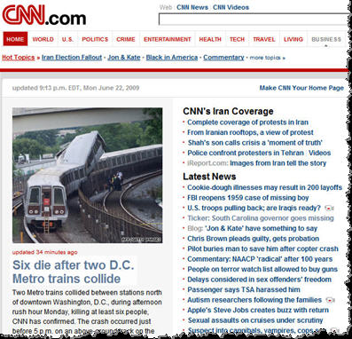
June 22 DC Metro subway trains collide - 9 dead, 80 injured
Timeline:
June 18-24: Gov. Sanford missing/crying in Argentina
June 21: 'Impact' Part 1 on ABC; Prince William birthday
June 22: DC Metro Red Line trains in collision
June 23: US Moon probes (LRO/LCROSS) reach Moon
June 24: Gov. Sanford reveals Argentine affair
June 25: Death of Michael Jackson & Farahh Fawcett
'Metro' means 'meter' in Spanish, Italian, Portuguese, etc. The meter is historically defined as 1/10,000,000 of the distance between the North Pole and the equator through Paris, or in other words the Paris Meridian between the North Pole and the equator. The Paris Meridian is also the 'Rose Line' (an esoteric concept popularized by The Da Vinci Code) i.e. a 'Red Line'...

DC Metro Red Line = French/Columbian Rose Line
...traditionally implying the Blood Royal/Sangraal or the Marian/Columbian Bloodline of the Holy Grail.
In Bloodline of the Holy Grail Laurence Gardner writes of the House of Stuart, the royal bloodline to which Princess Diana and her children belong (pp. 344-5):
https://www.goroadachi.com/etemenanki/moonwalker.htm |
|
|
|
|
La Crucifixión La Crucifixión con María, Juan, María Magdalena, San Longino y el centurión convertido
(The Crucifixion The Crucifixion with Mary, John, Mary Magdalene, St Longinus and the Converted Centurion)
|
|
|
|
|
|
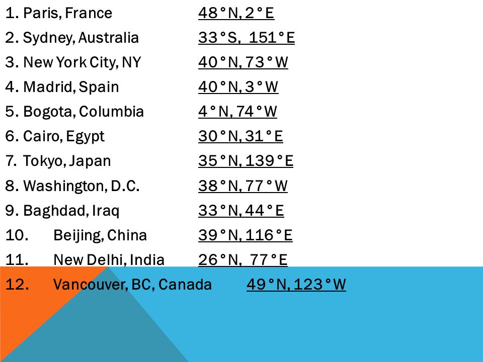
The streets of Washington depict an inverted pentagram next to a Square and Compass that overlaps an inverted cross. There's another pentagram that is connected by an underground tunnel. More in SS. If this doesn't prove to you that masons are satanic pedos, nothing will.
https://www.reddit.com/r/conspiracy/comments/uqr98p/the_streets_of_washington_depict_an_inverted/?rdt=45041 |
|
|
|
|
It is alleged that George Washington requested the stars on the Great Seal to be put in the shape of a hexagram because that's also the shape of the Star of David – supposedly as a way of thanking the Jewish patriot Haym Salomon for his service to the country, particularly his financial help during the Revolution.
Haym Solomon (or Salomon) (April 7, 1740 – January 6, 1785) was a Spanish and Portuguese Jew who immigrated to New York from Poland during the period of the American Revolution, and who became a prime financier of the Continental Army during the American Revolutionary War against Great Britain.
Descended from Jewish refugees from Portugal, Solomon was born in Leszno, Poland. He studied Hebrew and had basic education, but he did not know how to write in Yiddish.[2] In the 18th century, he journeyed throughout western Europe, during which time he acquired a knowledge of finance as well as fluency in several languages. He returned to Poland in 1770 but left two years later during the Partitions of Poland. After traveling to England, Solomon immigrated to New York City in 1775, where he established himself as a financial broker for merchants engaged in overseas trade.
Sympathizing with the Patriot cause, Solomon joined the New York branch of the Sons of Liberty. In September 1776, he was arrested as a spy but the British pardoned him, only after serving 18 months of his sentence and claims of torture on a British boat, in order to use his abilities as an interpreter for their Hessian mercenaries. Solomon used his position to help prisoners of the British escape and encouraged the Hessians to desert the war effort. In 1778 Solomon was arrested again and sentenced to death, but he managed to escape, whereupon he made his way with his family to the rebel capital in Philadelphia.
Once resettled, Solomon resumed his activities as a broker. He became the agent to the French consul, as well as the paymaster for the French forces in North America. In 1781, he began working extensively with Robert Morris, the newly appointed Superintendent for Finance for the Thirteen Colonies. Often working out of the "London Coffee House" in Philadelphia, Solomon sold about $600,000 in Bills of Exchange to his clients, netting about 2.5% per sale. During this period he had to turn to Morris for help when one sale of over $50,000 nearly sent him to prison. Morris used his position and influence to sue the defrauder and saved Solomon from default and disaster.
In August of 1781, the Continental Army had trapped Lieutenant General Charles Cornwallis in the little Virginia coastal town of Yorktown. George Washington and the main army and the Count de Rochambeau with his French army decided to march from the Hudson Highlands to Yorktown and deliver the final blow. But Washington's war chest was completely empty, as was that of Congress. Washington determined that he needed at least $20,000 to finance the campaign. When Morris told him there were no funds and no credit available, Washington gave him a simple but eloquent order: "Send for Haym Solomon". Haym again came through, and the $20,000 was raised. Washington conducted the Yorktown campaign, which proved to be the final battle of the Revolution, thanks to Haym Solomon.
Solomon negotiated the sale of a majority of the war aid from France and Holland, selling bills of exchange to American merchants. Solomon also personally supported various members of the Continental Congress during their stay in Philadelphia, including James Madison and James Wilson. Acting as the patriot he was, he requested below market interest rates, and he never asked for repayment.
The Treaty of Paris, signed on September 3, 1783, ended the Revolutionary War but not the financial problems of the newly established nation. It was Haym Solomon who managed, time-after-time, to raise the money to bailout the debt-ridden government.
Solomon was involved in Jewish community affairs, being a member of Congregation Mikveh Israel in Philadelphia, and in 1782, made the largest individual contribution towards the construction of its main building. In 1783, Solomon was among the prominent Jews involved in the successful effort to have the Pennsylvania Council of Censors remove the religious test oath required for office-holding under the State Constitution. In 1784, he answered anti-Semitic slander in the press by stating: "I am a Jew; it is my own nation; I do not despair that we shall obtain every other privilege that we aspire to enjoy along with our fellow-citizens."
https://www.dcmessageboards.com/topic/21364-star-of-david-found-on-capitol-hill/ |
|
|
Primer
Anterior
2 a 16 de 16
Següent
Darrer
|
| |
 Català
 Español
 English
 Português
 Italiano
 Français
 العربية