|
|
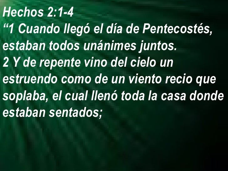
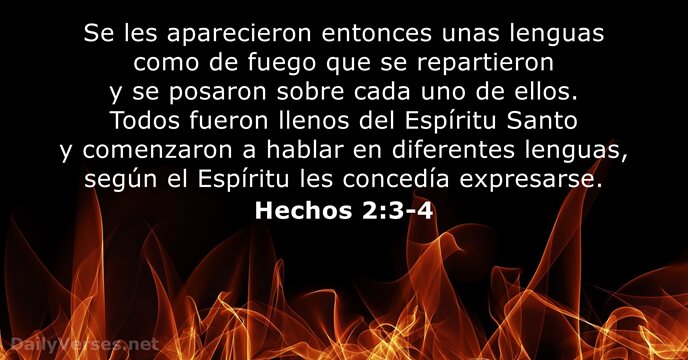
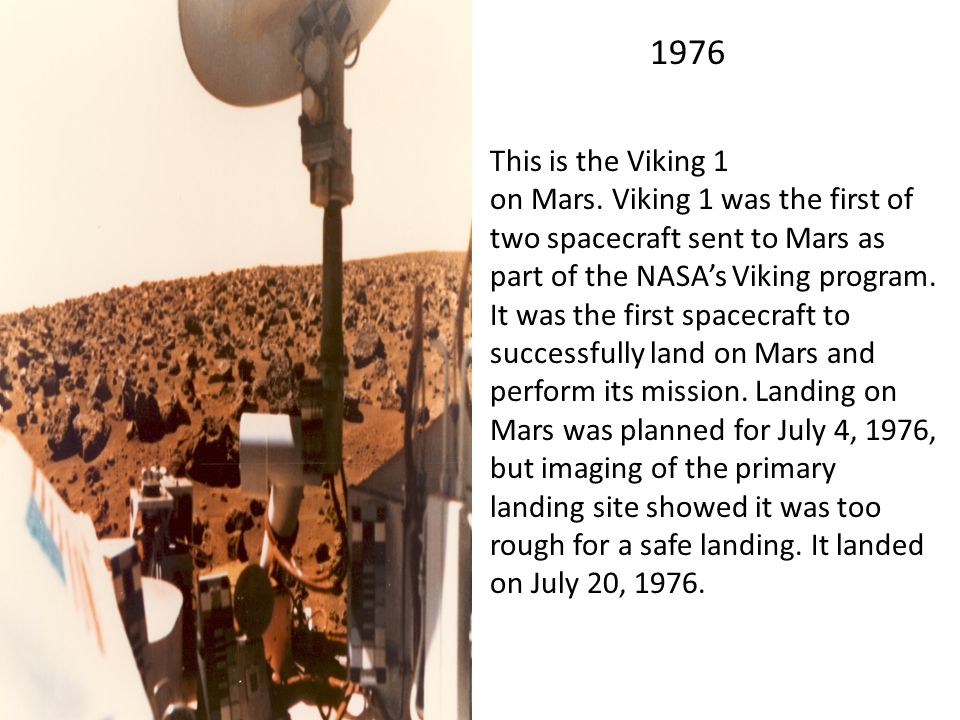
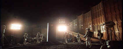
General: TERMINATOR II, LA MUERTE DE LADY DY (DIANA), ROBOTH PATHFINDER EN MARTE
Escolher outro painel de mensagens |
|
|
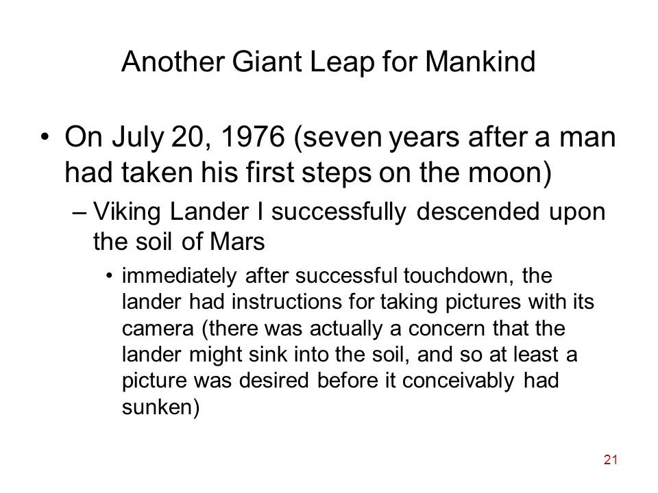
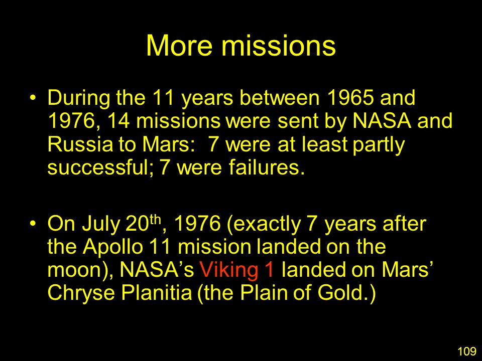
TERMINATOR 3 Y ALDEBARAN
OBSERVEN QUE ALLI AFIRMA QUE LA GUERRA/MARTE SE INICIA EL 2 DE JULIO (VERDADERA INDEPENDENCIA DE ESTADOS UNIDOS), QUE INSISTO LLEVADOS AL AÑO 30 DC, EN EL CONTEXTO A LA DIFERENCIA DE DOS DIAS DEBIDO A QUE EN LA REFORMA DEL CALENDARIO JULIANO-GREGORIANO SE HIZO DE 10 DIAS, EN LUGAR DE 12, EN EL CONTEXTO AL AÑO 30 DC, DICHO DIA VERDADERAMENTE FUE EN MARTES 4 DE JULIO DE 1776 EN LUNA LLENA. ¿PORQUE LA RELACION CON ALDEBARAN, EL OJO ISQUIERDO, DEL TORO? 2003 FUE EL AÑO 227 DESDE LA INDEPENDENCIA DE LOS ESTADOS UNIDOS. ESE AÑO FUE TAMBIEN INCLUSO EL ESTRENO DEL CODIGO DA VINCI.
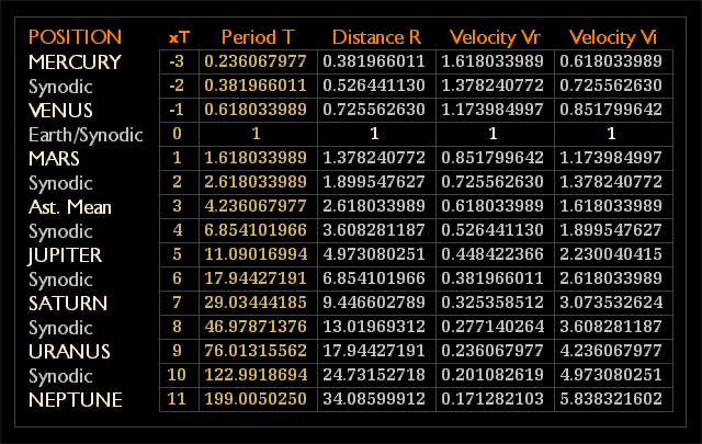
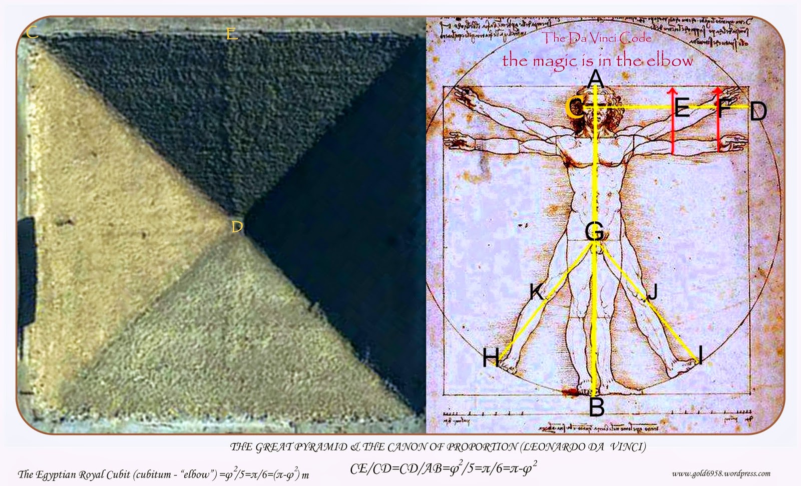
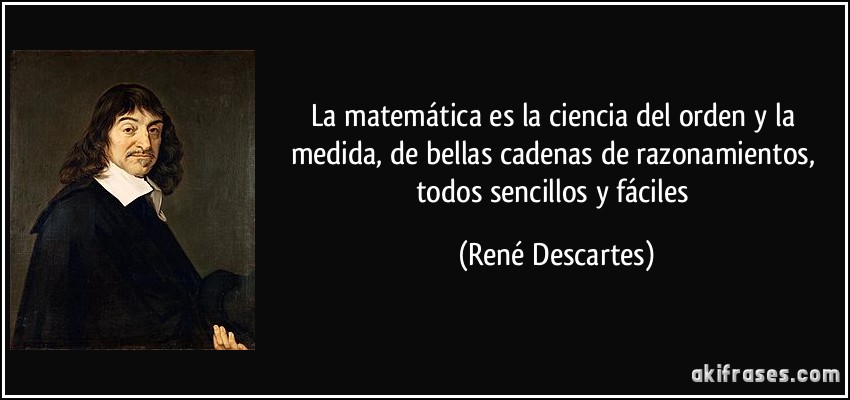
NUMERO PHI Y PI

LA  |
|
|
|
|
27 mar. 2017 - Subido por Canal Liberal Artifex
Conferencia del economista libertario argentino Javier Milei, en el año 2016. SINGULARIDAD: LOS AGUJEROS ...
19 abr. 2017 - Subido por Canal Liberal Artifex
Conferencia del economista libertario argentino Javier Milei, en el año 2014. CRECIMIENTO, CONVERGENCIA ...
24 oct. 2015 - Subido por Canal CREA
Lic. Javier Milei. ... 001 - Desafíos económicos de cara a la singularidad. Canal CREA. Loading... Unsubscribe ...
17 sept. 2015 - Subido por Fundación Atlas para una Sociedad Libre
AtlasTV: Javier Milei "Populismo salvaje" ... SINGULARIDAD EN ECONOMIA prof JAVIER MILEI ...
8 abr. 2015 - Subido por Fabio gorosito wales
SINGULARIDAD EN ECONOMIA prof JAVIER MILEI Programa TOTAL POLITIK de CARLOS MASLATON ...
5 ago. 2015 - Subido por Fundación Atlas para una Sociedad Libre
Javier Milei - Keynesianismo argentino y catástrofe populista. Fundación Atlas para una Sociedad Libre. Loading ...
|
|
|
|
|
17 ago. 2009 - Subido por milan vladanovic
50+ videos Play all Mix - Guns And Roses You Could Be Mine Terminator 2YouTube. Guns N' Roses ...
24 sept. 2015 - Subido por musique cinema et série télévisée
terminator 2 ( guns n'roses you could be mine )1991. musique cinema et série télévisée. Loading ...
|
|
|
|
|
 |
PARA SEGUIR LAS EXPOSICIONES DEL FORO DIA A DIA |
2145 |
BARILOCHENSE6999 |
11/12/2019 16:39 |
|
LEONHARD PAUL EULER (NOMBRE HIPER MASONICO)-MATEMATICO DE LA CREACION DIVINA |
9 |
BARILOCHENSE6999 |
11/12/2019 16:38 |
|
SERPIENTE/GUSANO ¿DAN BROWN VIAJO EN EL TIEMPO O SERPIENTE SE MUERDE LA COLA? |
336 |
BARILOCHENSE6999 |
11/12/2019 16:33 |
|
ALIEN, EL OCTAVO PASAJERO, UNA PELICULA REVOLUCIONARIA |
36 |
BARILOCHENSE6999 |
11/12/2019 16:32 |
|
PHILIPS COPPENS=CODIGO DA VINCI=ALIENIGENAS ANCESTRALES=TRANSFIGURACION |
11 |
BARILOCHENSE6999 |
11/12/2019 16:32 |
|
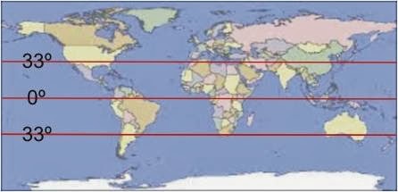
ESPOSA DE PIÑERA, SANTIAGO DE CHILE, PARALELO 33, "INVASION ALIENIGENA" |
71 |
BARILOCHENSE6999 |
11/12/2019 16:31 |
|
¿VENECIA ES UN PORTAL "STAR GATE" "ALIENIGENA O EXTRATERRESTRE"? APARENTEMENTE |
19 |
BARILOCHENSE6999 |
11/12/2019 16:31 |
|
https://busy.org/@j1337/meta-mathematics-perfect-cube-uni-matrix-star-theory-sir |
1 |
BARILOCHENSE6999 |
11/12/2019 16:23 |
|
APOCALIPSIS 21, JUAN MARCOS Y LOS "VIAJES EN EL TIEMPO" |
589 |
BARILOCHENSE6999 |
11/12/2019 16:21 |
|
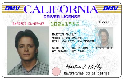
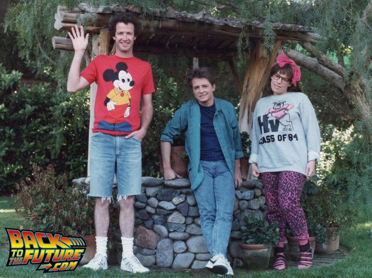
BACK TO THE FUTURE - THE POWER OF LOVE (VOLVER AL FUTURO - EL PODER DEL AMOR) |
12 |
BARILOCHENSE6999 |
11/12/2019 16:19 |
|
UN RELIGIOSO O UN POLITICO TE PUEDE SACAR TU DINERO PERO JAMAS TU CONOCIMIENTO |
6 |
BARILOCHENSE6999 |
11/12/2019 16:16 |
|
TE PUEDEN SACAR TU CASA, TU AUTO, ETC PERO NO TU CEREBRO EQUIVALENTE A DINERO |
9 |
BARILOCHENSE6999 |
11/12/2019 16:16 |
|
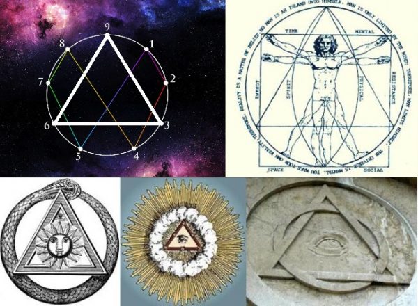
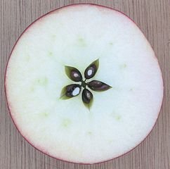
1+1+2+3+5+8+13=33 (TREINTA Y TRES)-SANTA CENA=33=MANZANA=RELOJ |
259 |
BARILOCHENSE6999 |
11/12/2019 16:13 |
|
ULTRA SECRETO MASONICO DEL ORIGEN DIVINO DE LA UBICACION DE LA MECA |
20 |
BARILOCHENSE6999 |
11/12/2019 16:07 |
|
LA MECA=FILADELFIA=ROMA=SIETE COLINAS (CAPITAL DE ARABIA SAUDITA Y DEL ISLAM) |
10 |
BARILOCHENSE6999 |
11/12/2019 16:07 |
|
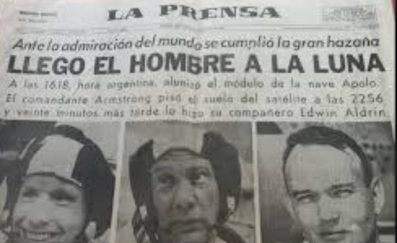
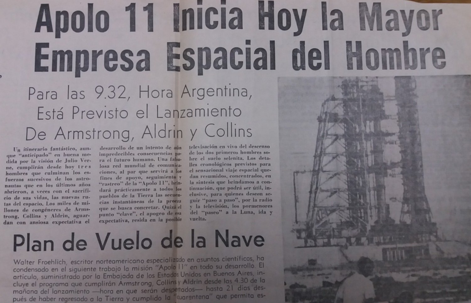
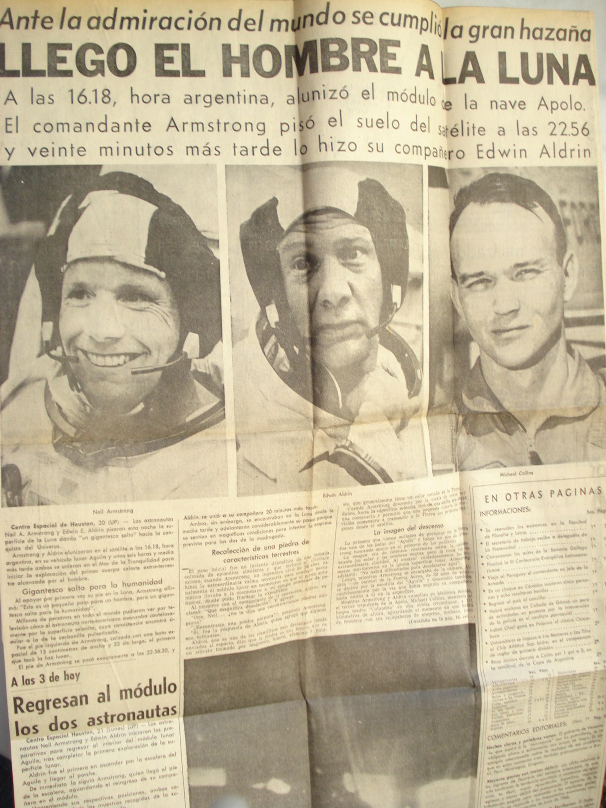
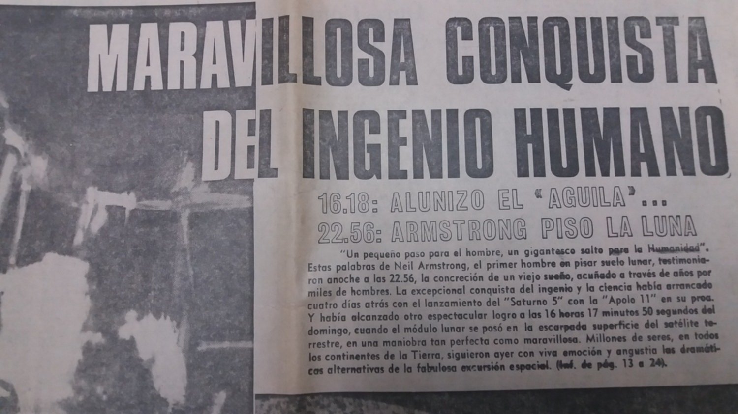
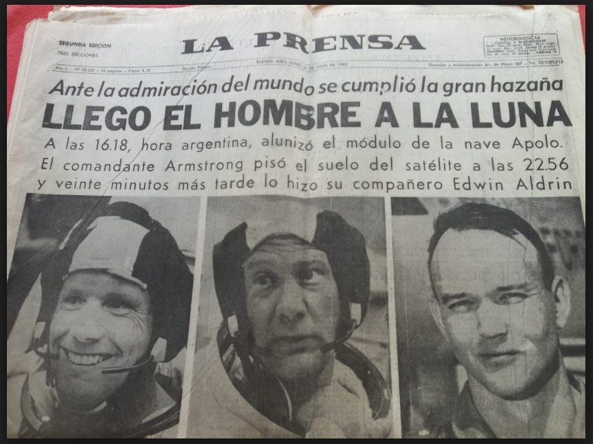
EL MODULO DEL APOLO 11 ALUNIZO A LAS 16:18 HORA ARGENTINA (NUMERO DE ORO PHI) |
14 |
BARILOCHENSE6999 |
11/12/2019 16:03 |
|
DIA MUNDIAL DEL OVNI-24 DE JUNIO-DIA DE SAN JUAN EL BAUTISTA-JUAN/PUERTA/MARCO |
141 |
BARILOCHENSE6999 |
11/12/2019 16:00 |
|
¿EL RELIGIOSO NARCISISTA SANTURRON ALGUNA VEZ EN SU VIDA COMIO UNA MANZANA? |
11 |
BARILOCHENSE6999 |
11/12/2019 15:56 |
|
EL PENTAGONO/MANZANA Y SU NEXO CON LOS VIAJES EN EL TIEMPO |
22 |
BARILOCHENSE6999 |
11/12/2019 15:56 |
|
SIR ISAAC NEWTON, EL MAYOR CIENTIFICO DE TODA LA HISTORIA |
71 |
BARILOCHENSE6999 |
11/12/2019 15:47 |
|
SIR ISAAC NEWTON, CIENTIFICO Y ALQUIMISTA |
15 |
BARILOCHENSE6999 |
11/12/2019 15:47 |
|
¿PORQUE ISAAC NEWTON FUE EL CREADOR DEL CALCULO INTEGRAL Y DIFERENCIAL? |
4 |
BARILOCHENSE6999 |
11/12/2019 15:47 |
|
PROBERVIOS 25:11 (SIR ISAAC NEWTON EL MAYOR CIENTIFICO Y TAMBIEN ALQUIMISTA) |
12 |
BARILOCHENSE6999 |
11/12/2019 15:46 |
|
SIR ISAAC NEWTON (MATEMATICO, FISICO, FILOSOFO, TEOLOGO, ALQUIMISTA, ASTRONOMO) |
10 |
BARILOCHENSE6999 |
11/12/2019 15:46 |
|
LEY DE GRAVITACION UNIVERSAL (ISAAC NEWTON)-ALQUIMIA (HOMBRE/MUJER) |
28 |
BARILOCHENSE6999 |
11/12/2019 15:46 |
|
¿LOS NIÑOS Y LAS NIÑAS TIENEN EL CEREBRO DE EINSTEIN O ISAAC NEWTON? (OBVIO) |
9 |
BARILOCHENSE6999 |
11/12/2019 15:45 |
|
PIRAMIDE DEL VATICANO="EXPERIMENTO FILADELFIA"="MAQUINA DEL TIEMPO"=SANTA CENA |
1054 |
BARILOCHENSE6999 |
11/12/2019 15:45 |
|
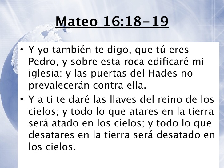
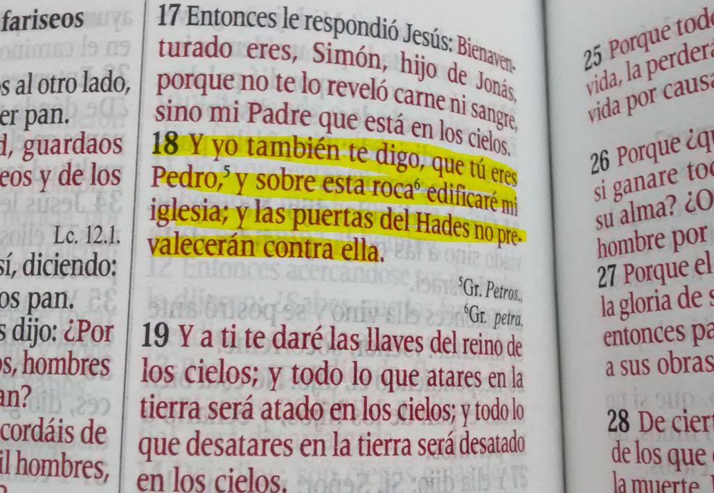
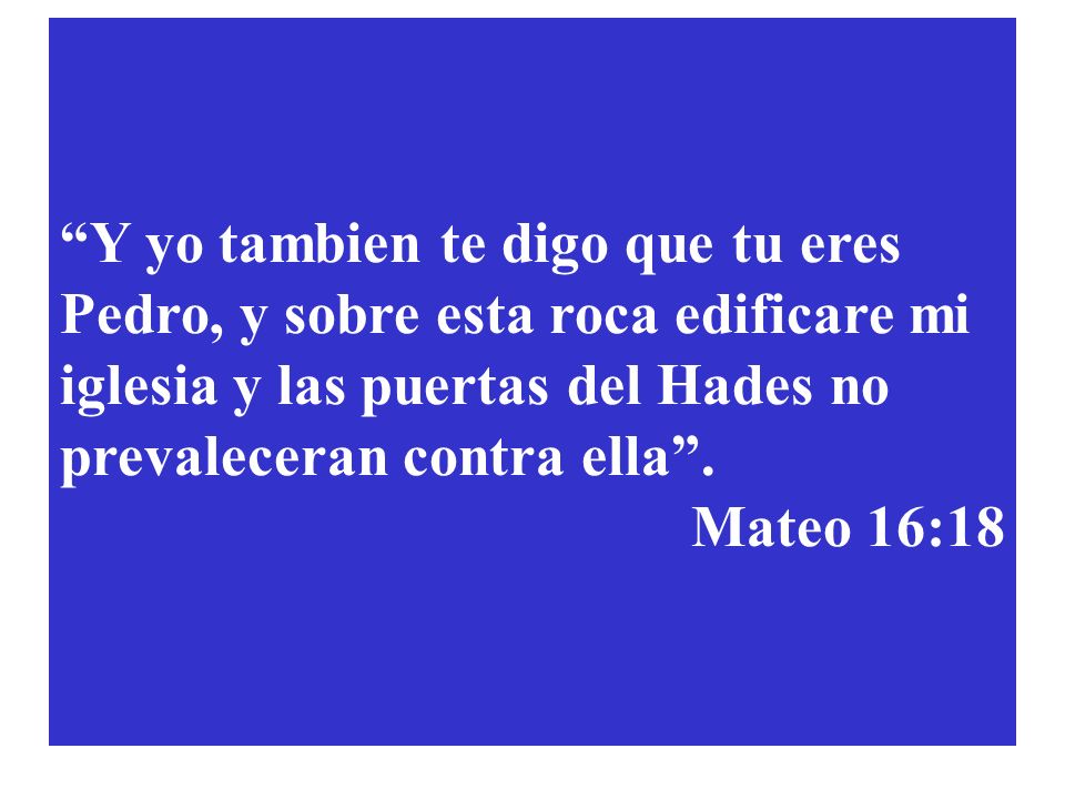
MATEO 16:18=VATICANO="AGUJERO DE GUSANO"="TRASLACION EN EL TIEMPO"=MANZANA |
138 |
BARILOCHENSE6999 |
11/12/2019 15:42 |
|
JESUCRISTO FUE EL ALQUIMISTA Y EL CIENTIFICO MAS GRANDE DE LA HISTORIA |
1396 |
BARILOCHENSE6999 |
11/12/2019 15:39 |
|
El número de oro , el número del Gran Arquitecto del Universo. |
12 |
BARILOCHENSE6999 |
11/12/2019 15:38 |
|
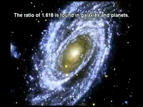
MATEMATICAS=ARTE=GEOMETRIA=ARQUITECTURA=DISEÑO=COSMOLOGIA=TEOLOGIA=VIDA=1.618 |
24 |
BARILOCHENSE6999 |
11/12/2019 15:37 |
|
"SOMOS ARQUITECTOS DE NUESTRO DESTINO" - ALBERT EINSTEIN |
22 |
BARILOCHENSE6999 |
11/12/2019 15:37 |
|
Cristo era de oficio CONSTRUCTOR/TEKTON/ARQUI-TEKTUN |
175 |
BARILOCHENSE6999 |
11/12/2019 15:37 |
|
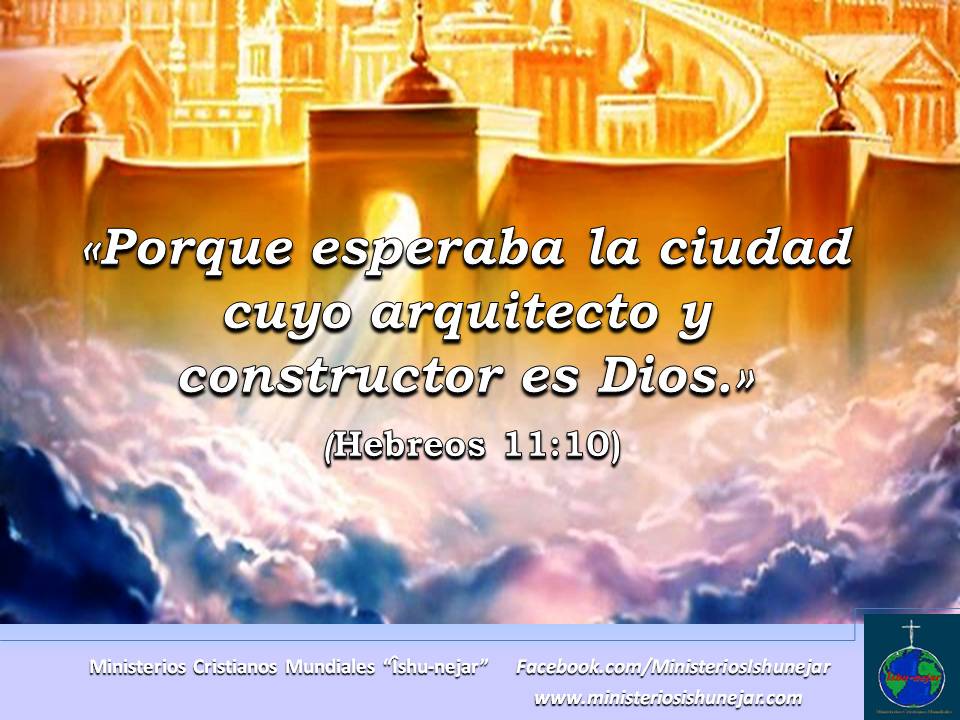
HEBREOS 11:10-YHWH, ES EL ARQUITECTO Y CONSTRUCTOR, OSEA MASON DE LA CIUDAD |
193 |
BARILOCHENSE6999 |
11/12/2019 15:36 |
|
CODIGO DA VINCI=BIBLIA=FRANCO MASONERIA=IGLESIA CATOLICA=ALTO NIVEL CIENTIFICO |
450 |
BARILOCHENSE6999 |
11/12/2019 15:23 |
|
HEBREOS 11:10,11 LA TORA RELACIONA A LA MASONERIA CON EL PACTO DE ABRAHAM (SARA) |
18 |
BARILOCHENSE6999 |
11/12/2019 15:23 |
|
¿SE PUEDE ENTENDER LA RELATIVIDAD DE EINSTEIN SIN SER CATOLICO Y FRANC MASON? |
9 |
BARILOCHENSE6999 |
11/12/2019 15:21 |
|
¿QUIERE ENTENDER LA LEY DE LA RELATIVIDAD DE EINSTEIN?-ESTUDIE LA BIBLIA |
162 |
BARILOCHENSE6999 |
11/12/2019 15:21 |
|
BABILONIA LA RAMERA NO QUIERE QUE YHWH SEA MASON Y MATEMATICO (NARCISISMO) |
31 |
BARILOCHENSE6999 |
11/12/2019 15:19 |
|
VATICANO=ESCALERA DE BRAMANTE=PUERTA ESTELAR O PORTAL STAR GATE (NEXO BABILONIA) |
21 |
BARILOCHENSE6999 |
11/12/2019 15:16 |
|
1 DE REYES 6:6 (CARACOL=UN PORTAL CON REFERENCIA AL "EXPERIMENTO FILADELFIA") |
100 |
BARILOCHENSE6999 |
11/12/2019 15:12 |
|
SOL-O-MON=SOL Y LUNA=SABIDURIA=SO-PHI-A=PHI=1.618=ESCALERA DE JACOB=VIA LACTEA |
1181 |
BARILOCHENSE6999 |
11/12/2019 15:08 |
|
VENECIA ES LA LLAVE VENUS / SIRIO / "ESCALERA DE JACOB" PARA ENTENDER EL GRIAL |
447 |
BARILOCHENSE6999 |
11/12/2019 15:07 |
|
YOUR BRAIN IS A TIME MACHINE (DEAN BUONOMANO)-CEREBRO ES UNA MAQUINA DEL TIEMPO |
38 |
BARILOCHENSE6999 |
11/12/2019 15:04 |
|
ESPIRITUAL/ESPIRAL/VIA LACTEA/NUMERO DE ORO/CASTILLO SAN ANGELO (PUERTA ESTELAR) |
20 |
BARILOCHENSE6999 |
11/12/2019 15:02 |
|
¿LOS EXTRATERRESTRES COMEN MANZANAS? - ES MUY PROBABLE |
44 |
BARILOCHENSE6999 |
11/12/2019 14:57 |
|
¿PORQUE EL PENTAGONO EN WASHINGTON FUE INAGURADO EL 11 DE SEPTIEMBRE DE 1941? |
83 |
BARILOCHENSE6999 |
11/12/2019 14:55 |
|
SOLUCION DE LORENZ-NEXO DE LA RELATIVIDAD CON EL NUMERO DE ORO/PENTAGONO/MANZANA |
34 |
BARILOCHENSE6999 |
11/12/2019 14:55 |
|
PENTAGRAMA / PENTAGONO / MANZANA / NUMERO DE ORO=1.618 (TODO ES MASONERIA) |
6 |
BARILOCHENSE6999 |
11/12/2019 14:55 |
|
MANZANA=AMOR=ROMA=PENTAGONO=SEXO DE LA MUJER=OJO DE GATO=SECRETO MATRIX |
12 |
BARILOCHENSE6999 |
11/12/2019 14:54 |
|
|
|
|
|
Saint Mary Magdalene in Venice
 A closer look 
 the Apple
|
|
|
|
|

Jordan River (Utah)
From Wikipedia, the free encyclopedia
The Jordan River, in the state of Utah, United States, is a river about 51 miles (82 km) long. Regulated by pumps at its headwaters at Utah Lake, it flows northward through the Salt Lake Valley and empties into the Great Salt Lake. Four of Utah's six largest cities border the river: Salt Lake City, West Valley City, West Jordan, and Sandy. More than a million people live in the Jordan Subbasin, part of the Jordan River watershed that lies within Salt Lake and Utah counties. During the Pleistocene, the area was part of Lake Bonneville.
Members of the Desert Archaic Culture were the earliest known inhabitants of the region; an archaeological site found along the river dates back 3,000 years. Mormon pioneers led by Brigham Young were the first European American settlers, arriving in July 1847 and establishing farms and settlements along the river and its tributaries. The growing population, needing water for drinking, irrigation, and industrial use in an arid climate, dug ditches and canals, built dams, and installed pumps to create a highly regulated river.
Although the Jordan was originally a cold-water fishery with 13 native species, including Bonneville cutthroat trout, it has become a warm-water fishery where the common carp is most abundant. It was heavily polluted for many years by raw sewage, agricultural runoff, and mining wastes. In the 1960s, sewage treatment removed many pollutants. In the 21st century, pollution is further limited by the Clean Water Act, and, in some cases, the Superfund program. Once the home of bighorn sheep and beaver, the contemporary river is frequented by raccoons, red foxes, and domestic pets. It is an important avian resource, as are the Great Salt Lake and Utah Lake, visited by more than 200 bird species.
Big Cottonwood, Little Cottonwood, Red Butte, Mill, Parley's, and City creeks, as well as smaller streams like Willow Creek at Draper, Utah, flow through the sub-basin. The Jordan River Parkway along the river includes natural areas, botanical gardens, golf courses, and a 40-mile (64 km) bicycle and pedestrian trail, completed in 2017.[6]
The Jordan River is Utah Lake's only outflow. It originates at the northern end of the lake between the cities of Lehi and Saratoga Springs. It then meanders north through the north end of Utah Valley for approximately 8 miles (13 km) until it passes through a gorge in the Traverse Mountains, known as the Jordan Narrows. The Utah National Guard base at Camp Williams lies on the western side of the river through much of the Jordan Narrows.[7][8] The Turner Dam, located 41.8 miles (67.3 km) from the river's mouth (or at river mile 41.8) and within the boundaries of the Jordan Narrows, is the first of two dams of the Jordan River. Turner Dam diverts the water to the right or easterly into the East Jordan Canal and to the left or westerly toward the Utah and Salt Lake Canal. Two pumping stations situated next to Turner Dam divert water to the west into the Provo Reservoir Canal, Utah Lake Distribution Canal, and Jacob-Welby Canal. The Provo Reservoir Canal runs north through Salt Lake County, Jacob-Welby runs south through Utah County. The Utah Lake Distribution Canal runs both north and south, eventually leading back into Utah Lake.[9] Outside the narrows, the river reaches the second dam, known as Joint Dam, which is 39.9 miles (64.2 km) from the river's mouth. Joint Dam diverts water to the east for the Jordan and Salt Lake City Canal and to the west for the South Jordan Canal.[10][11][12]

Map of the Salt Lake Valley
The river then flows through the middle of the Salt Lake Valley, initially moving through the city of Bluffdale and then forming the border between the cities of Riverton and Draper.[7] The river then enters the city of South Jordan where it merges with Midas Creek from the west. Upon leaving South Jordan, the river forms the border between the cities of West Jordan on the west and Sandy and Midvale on the east. From the west, Bingham Creek enters West Jordan. Dry Creek, an eastern tributary, combines with the main river in Sandy. The river then forms the border between the cities of Taylorsville and West Valley City on the west and Murray and South Salt Lake on the east. The river flows underneath Interstate 215 in Murray. Little and Big Cottonwood Creeks enter from the east in Murray, 21.7 miles (34.9 km) and 20.6 miles (33.2 km) from the mouth respectively. Mill Creek enters on the east in South Salt Lake, 17.3 miles (27.8 km) from the mouth. The river runs through the middle of Salt Lake City, where the river travels underneath Interstate 80 a mile west of downtown Salt Lake City and again underneath Interstate 215 in the northern portion of Salt Lake City. Interstate 15 parallels the river's eastern flank throughout Salt Lake County. At 16 miles (26 km) from the mouth, the river enters the Surplus Canal channel. The Jordan River physically diverts from the Surplus Canal through four gates and heads north with the Surplus Canal heading northwest. Parley's, Emigration, and Red Butte Creeks converge from the east through an underground pipe, 14.2 miles (22.9 km) from the mouth.[7] City Creek also enters via an underground pipe, 11.5 miles (18.5 km) from the river's mouth. The length of the river and the elevation of its mouth varies year to year depending on the fluctuations of the Great Salt Lake caused by weather conditions. The lake has an average elevation of 4,200 feet (1,300 m) which can deviate by 10 feet (3.0 m).[3] The Jordan River then continues for 9 to 12 miles (14 to 19 km) with Salt Lake County on the west and North Salt Lake and Davis County on the east until it empties into the Great Salt Lake.[7][8][11]
Discharge[edit]
The United States Geological Survey maintains a stream gauge in Salt Lake City that shows annual runoff from the period 1980–2003 is just over 150,000 acre-feet (190,000,000 m3) per year or 100 percent of the total 800,000 acre-feet (990,000,000 m3) of water entering the Jordan River from all sources. The Surplus Canal carries almost 60 percent of the water into the Great Salt Lake, with various irrigation canals responsible for the rest. The amount of water entering the Jordan River from Utah Lake is just over 400,000 acre-feet (490,000,000 m3) per year. Inflow from the 11 largest streams feeding the Jordan River, sewage treatment plants, and groundwater each account for approximately 15 percent of water entering the river.[13]
Watershed[edit]

Map of the entire Jordan River Basin
|
|
|
|
|
Jordan River (Utah)
From Wikipedia, the free encyclopedia
The Jordan River, in the state of Utah, United States, is a river about 51 miles (82 km) long. Regulated by pumps at its headwaters at Utah Lake, it flows northward through the Salt Lake Valley and empties into the Great Salt Lake. Four of Utah's six largest cities border the river: Salt Lake City, West Valley City, West Jordan, and Sandy. More than a million people live in the Jordan Subbasin, part of the Jordan River watershed that lies within Salt Lake and Utah counties. During the Pleistocene, the area was part of Lake Bonneville.
Members of the Desert Archaic Culture were the earliest known inhabitants of the region; an archaeological site found along the river dates back 3,000 years. Mormon pioneers led by Brigham Young were the first European American settlers, arriving in July 1847 and establishing farms and settlements along the river and its tributaries. The growing population, needing water for drinking, irrigation, and industrial use in an arid climate, dug ditches and canals, built dams, and installed pumps to create a highly regulated river.
Although the Jordan was originally a cold-water fishery with 13 native species, including Bonneville cutthroat trout, it has become a warm-water fishery where the common carp is most abundant. It was heavily polluted for many years by raw sewage, agricultural runoff, and mining wastes. In the 1960s, sewage treatment removed many pollutants. In the 21st century, pollution is further limited by the Clean Water Act, and, in some cases, the Superfund program. Once the home of bighorn sheep and beaver, the contemporary river is frequented by raccoons, red foxes, and domestic pets. It is an important avian resource, as are the Great Salt Lake and Utah Lake, visited by more than 200 bird species.
Big Cottonwood, Little Cottonwood, Red Butte, Mill, Parley's, and City creeks, as well as smaller streams like Willow Creek at Draper, Utah, flow through the sub-basin. The Jordan River Parkway along the river includes natural areas, botanical gardens, golf courses, and a 40-mile (64 km) bicycle and pedestrian trail, completed in 2017.[6]
The Jordan River is Utah Lake's only outflow. It originates at the northern end of the lake between the cities of Lehi and Saratoga Springs. It then meanders north through the north end of Utah Valley for approximately 8 miles (13 km) until it passes through a gorge in the Traverse Mountains, known as the Jordan Narrows. The Utah National Guard base at Camp Williams lies on the western side of the river through much of the Jordan Narrows.[7][8] The Turner Dam, located 41.8 miles (67.3 km) from the river's mouth (or at river mile 41.8) and within the boundaries of the Jordan Narrows, is the first of two dams of the Jordan River. Turner Dam diverts the water to the right or easterly into the East Jordan Canal and to the left or westerly toward the Utah and Salt Lake Canal. Two pumping stations situated next to Turner Dam divert water to the west into the Provo Reservoir Canal, Utah Lake Distribution Canal, and Jacob-Welby Canal. The Provo Reservoir Canal runs north through Salt Lake County, Jacob-Welby runs south through Utah County. The Utah Lake Distribution Canal runs both north and south, eventually leading back into Utah Lake.[9] Outside the narrows, the river reaches the second dam, known as Joint Dam, which is 39.9 miles (64.2 km) from the river's mouth. Joint Dam diverts water to the east for the Jordan and Salt Lake City Canal and to the west for the South Jordan Canal.[10][11][12]
Map of the Salt Lake Valley
The river then flows through the middle of the Salt Lake Valley, initially moving through the city of Bluffdale and then forming the border between the cities of Riverton and Draper.[7] The river then enters the city of South Jordan where it merges with Midas Creek from the west. Upon leaving South Jordan, the river forms the border between the cities of West Jordan on the west and Sandy and Midvale on the east. From the west, Bingham Creek enters West Jordan. Dry Creek, an eastern tributary, combines with the main river in Sandy. The river then forms the border between the cities of Taylorsville and West Valley City on the west and Murray and South Salt Lake on the east. The river flows underneath Interstate 215 in Murray. Little and Big Cottonwood Creeks enter from the east in Murray, 21.7 miles (34.9 km) and 20.6 miles (33.2 km) from the mouth respectively. Mill Creek enters on the east in South Salt Lake, 17.3 miles (27.8 km) from the mouth. The river runs through the middle of Salt Lake City, where the river travels underneath Interstate 80 a mile west of downtown Salt Lake City and again underneath Interstate 215 in the northern portion of Salt Lake City. Interstate 15 parallels the river's eastern flank throughout Salt Lake County. At 16 miles (26 km) from the mouth, the river enters the Surplus Canal channel. The Jordan River physically diverts from the Surplus Canal through four gates and heads north with the Surplus Canal heading northwest. Parley's, Emigration, and Red Butte Creeks converge from the east through an underground pipe, 14.2 miles (22.9 km) from the mouth.[7] City Creek also enters via an underground pipe, 11.5 miles (18.5 km) from the river's mouth. The length of the river and the elevation of its mouth varies year to year depending on the fluctuations of the Great Salt Lake caused by weather conditions. The lake has an average elevation of 4,200 feet (1,300 m) which can deviate by 10 feet (3.0 m).[3] The Jordan River then continues for 9 to 12 miles (14 to 19 km) with Salt Lake County on the west and North Salt Lake and Davis County on the east until it empties into the Great Salt Lake.[7][8][11]
Discharge[edit]
The United States Geological Survey maintains a stream gauge in Salt Lake City that shows annual runoff from the period 1980–2003 is just over 150,000 acre-feet (190,000,000 m3) per year or 100 percent of the total 800,000 acre-feet (990,000,000 m3) of water entering the Jordan River from all sources. The Surplus Canal carries almost 60 percent of the water into the Great Salt Lake, with various irrigation canals responsible for the rest. The amount of water entering the Jordan River from Utah Lake is just over 400,000 acre-feet (490,000,000 m3) per year. Inflow from the 11 largest streams feeding the Jordan River, sewage treatment plants, and groundwater each account for approximately 15 percent of water entering the river.[13]
Watershed[edit]
Map of the entire Jordan River Basin
|
|
|
|
|
The Moonwalker Prophecy
Death of Michael Jackson & Rebirth of Princess Diana
by Goro (goroadachi.com)
July 04, 2009

The way I see it, events are time portals, especially those that send shockwaves around the world. A chain of countless 'coincidences' culminate in an eruption known as 'event'. A butterfly flapping its wings causing a hurricane on the other side of the world. The longer we fail to recognize such a sequence, the bigger the resultant 'eruption'. Our attention alleviates the 'pressure', because it all begin with seeds of truth and truth by its nature wants to be known. As a 'force' like gravity it demands our attention or we suffer the consequences, like for instance 9/11, or the latest example, the sudden death of Michael Jackson. Taking us by surprise, they force us to pay attention. Better late than never. By that time it's nothing but a big all 'X marking the spot', a guaranteed treasure-trove of hidden knowledge. You start digging and you shall find treasure. It's in effect a timegate through which the past and the future leak into the present, into our conscious awareness. That's one way to look at it in any case.
With Michael Jackson, the treasure - the trans-temporal knowledge - was, is, and will be decidedly lunar. A 'Moon Impact' it was...

There was a noticeable 'swelling of the ocean' in the days leading up to June 25:
|
|
 |
June 10/11:
Japan's Kaguya/SELENE spacecraft impacts the Moon
|
|
June 12:
Film 'Moon' released in US (New York & Los Angeles); story about man working all alone on Moon
|

|
 |
June 18:
NASA's LCROSS mission launched with Lunar Reconnaissance Orbiter; will strike the Moon in October
|
|
June 21 & 28:
ABC mini TV series 'Impact': 'The most spectacular meteor shower in 10,000 years results in a direct hit to the moon, leaving it on a collision course with the Earth'
|
 |
 |
June 30:
Yemenia Flight 626 crash near destination 'Comoros' deriving from word meaning 'moon'
|
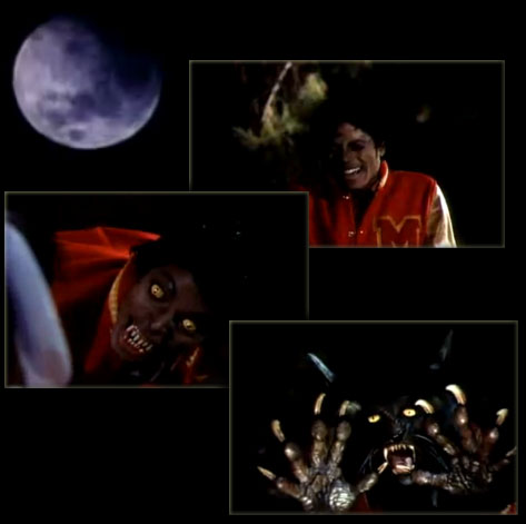
Michael Jackson's untimely death was the tsunami wave hitting land. And he had a message to deliver...

He was 'Bigfoot'...

[Bigfoot = super theme of 2009]
...born in Gary, Indiana
|
Indiana => 'In-Diana' => 'In Moon' (Diana = moon goddess)
|
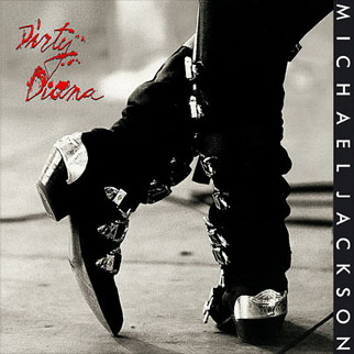
['Dirty Diana' - video]
...launched to Moon at Apollo

 
...carrying a torch

[Indiana state flag]

...of Diana
AKA Flame of Liberty
 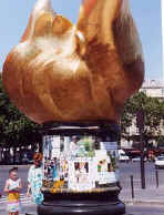
...burning bright in Paris
where she was killed on August 31, 1997

[Diana car accident site in Paris]
...precisely 10 years after 'Bad'
containing hit song 'Dirty Diana'

[Release August 31, 1987]
It was...
'Moon Impact'

* * *
'For now doth Cain with fork of thorns confine
On either hemisphere, touching the wave
Beneath the towers of Seville. Yesternight
The moon was round.'
- Dante, Inferno
Why Diana?
'Follow the rabbit', whispered the Man in the Mirror...


 'King of Pop' 'King of Pop'- Christmas - birth of 'King of the Jews'
- Death of Eartha Kitt famous for singing 'Santa Baby'
Reflected in the mirror was a messianic baby... a prince.
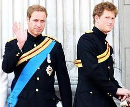
Michael Jackson had two boys named 'Prince Michael' and a daughter 'Paris Michael (Katherine)' whom, according to his will, he wanted in the hands of Diana (Ross) if his mother was unavailable, as widely reported on Princess Diana's birthday (July 1).

The close, lifelong ties between Michael Jackson's and his friend Diana Ross are made dramatically clear in his 2002 will - he chose her to raise his three children if his mother is unable to do so. [...]
Note also:
- Princess Diana died in Paris
- Diana's 'baby' Prince William had his birthday (June 21) marked by literal Moon Impact (TV movie) 4 days before MJ's death
- A member of the British Royal Family named Prince Michael (of Kent)
-- June 21, 2009 --
 
['Impact' preview video]
Prince William
He was 'in-Diana'...

He came out of Diana's womb...

He became Prince Charles' 'angel'...
...as in Charlie's Angels


Jun 25 Farrah Fawcett succumbs to cancer at 62
Farrah Fawcett:
- One of 'Charlie's Angels'
- Born in Corpus Christi or 'Body of Christ'
- Death hours before Michael Jackson's
Closely preceded by Neda...
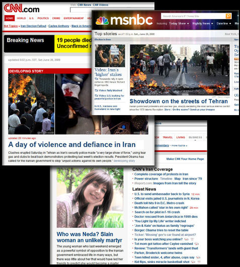
Neda:
- Killed on June 20, day before Prince William's BD
- 'Neda' means 'divine message' ('angel' means 'messenger')
Following her heart-breaking death captured on video, Neda became the face of the protests raging at the time in Iran following the June 12 presidential election (starting on June 13).
June 12-13...
|
|
| June 11 - Kaguya Moon Impact |
June 12 - Film 'Moon' release |
...Moon/Diana and Bigfoot/St. Anthony
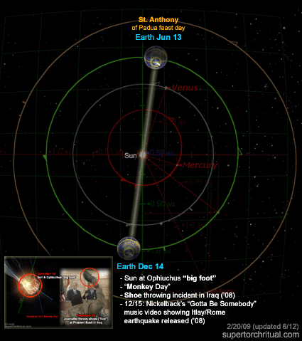
Dec 14 Shoes thrown at Bush on Iraq trip
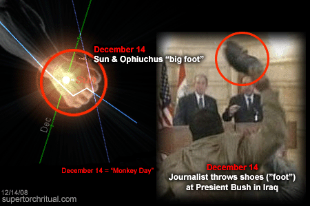
'Bigfoot' = evolution/missing link
Michael Jackson = one-man 'evolution'

[MJ's ever-changing face]
 Werewolf = man-beast = Bigfoot Werewolf = man-beast = Bigfoot
Etymology: The first part, wer, translates as "man"... The second half, wulf, is the ancestor of modern English "wolf"; in some cases it also had the general meaning "beast."
His was an unnatural evolution (plastic surgeries, etc.). What about ours? Is human evolution natural? If not, has the Moon had a hand in it?
We can almost hear the whisper: 'Human evolution is a hoax':
August 15, 2008
St. Anthony of Padua birthday
Bigfoot hoax...
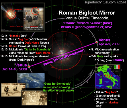
Bigfoot's message was so urgent Earth had to shake violently on April 6, 2009 in Bigfoot/boot Land, Italy...
 

April 6 Italy hunts for quake survivors
..from December 14-16, 2008 with love. (See 'Whisper of the Fifth Sun' for more on this predicted quake.)
Bigfoot, giant foot, giants... Genesis 6, the Nephilim, heaven-earth interbreeding, i.e. human genetic manipulation ('guided evolution'):
Book of Genesis chapter 6: And it came to pass, when men began to multiply on the face of the earth, and daughters were born unto them, That the sons of God saw the daughters of men that they were fair; and they took them wives of all which they chose. [...] There were giants [Nephilim] in the earth in those days; and also after that, when the sons of God came in unto the daughters of men, and they bare children to them, the same became mighty men which were of old, men of renown. And God saw that the wickedness of man was great in the earth, and that every imagination of the thoughts of his heart was only evil continually. And it repented the LORD that he had made man on the earth, and it grieved him at his heart. And the LORD said, I will destroy man whom I have created from the face of the earth; both man, and beast, and the creeping thing, and the fowls of the air; for it repenteth me that I have made them. But Noah found grace in the eyes of the LORD.
A monstrous Sin deemed irreversible, Earth had to be cleansed by a Great Flood.
Sin is the name of a Sumerian (and Minaean) god of the Moon...
Still standing after the Flood as 'Noah'.
A forbidden 'lunar strain' of mankind...
A 'Diana bloodline'.
https://www.goroadachi.com/etemenanki/moonwalker.htm |
|
|
|
|
El puente del Alma (en francés: Pont de l'Alma) está localizado en París, atraviesa el río Sena. Su nombre recuerda la batalla del río Almá el 20 de septiembre de 1854 que tuvo lugar durante la Guerra de Crimea.
En 1999, quedó incluido dentro de la delimitación del ámbito de Riberas del Sena en París, bien declarado patrimonio de la Humanidad por la Unesco.1
 Zuavo
Sobre la única pilastra que descansa en el agua, se encuentra la estatua de un zuavo realizada en 1856, que sirve de instrumento popular de medida de las crecidas del Sena. Cuando el nivel del Sena llega a los pies de este zuavo, las vías de las orillas en general se cortan. Cuando el agua sube hasta los muslos del zuavo, el Sena deja de ser navegable. Durante la crecida de 1910, el agua llegó hasta los hombros.
El zuavo se sitúa hoy a mayor altura que en su ubicación original, debido a un elevación en 1970. Por lo que en la actualidad la misma indicación anterior a 1970 significa una mayor crecida. La administración mide las crecidas del Sena en el puente de la Tournelle.
 Le Pont de l'Alma Le Pont de l'Alma en 1900, con su pasarela peatonal.
El puente fue construido entre 1854 y 1856 bajo la dirección de Charles-Marie Gariel. Para la Exposición Universal de 1900, estuvo doblada de una pasarela peatonal, llamada pasarela del Almá. Se inauguró por Napoleón III el 2 de abril de 1856 (en principio su inauguración estaba prevista para la Exposición Universal de 1855 las pilastras estaban decoradas por 4 estatuas —un zuavo y un granadero, esculpidos por Georges Diebolt, y un cazador a pie y un artillero, esculpidos per Auguste Arnaud— representando los cuatro regimientos que combatieron en la Guerra de Crimea. El Cazador a pie es visible desde la autopista A4 contra el muro sur de la redoute de Gravelle en el bosque de Vincennes, el Granadero está en Dijon y el Artillero ha sido llevado a La Fère en Aisne.
De 1970 a 1974, el puente ha sido completamente reconstruido, como consecuencia de su estrechez y, sobre todo, de su hundimiento. Sólo el Zuavo se conserva en el mismo sitio.
El puente enlaza los distritos 7.º, 8.º y 16.º de París, y está situado entre la avenida de New York y el muelle Branly.
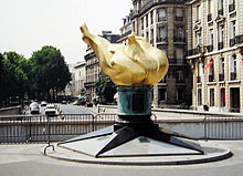 Llama en el Puente del Almá, la entrada al túnel se encuentra detrás, el puente (no visible) justo a la izquierda.  Estación de hidrógeno de Air Liquide en el Pont de l'Alma
El puente del Almá se encuentra cerca del túnel donde Diana, princesa de Gales, falleció en agosto de 1997.2 Este túnel, a menudo llamado túnel del puente del Almá, se encuentra de hecho entre el puente y la Place de l'Alma. Sobre esté túnel, se levanta la Llama de la Libertad, réplica a tamaño real de la llama de la Estatua de la Libertad. Este monumento, ofrecido por el periódico International Herald Tribune en 1987, conmemora la amistad franco-estadounidense y agradece a Francia la restauración de la estatua de la Libertad. Este monumento se ha convertido en un lugar de homenaje a Lady Di por parte de sus admiradores y esta parte de la plaza se llama desde 2019 "Place Diana" (Plaza Diana).3
- ↑ Puede consultarse el ámbito de la delimitación del bien «Paris, rives de la Seine», en formato pdf, en el sitio oficial de la Unesco, disponible en línea en: [1]. Consultado el 14 de agosto de 2018.
|
|
|
 Primeira
Anterior
85 a 99 de 99
Seguinte Primeira
Anterior
85 a 99 de 99
Seguinte
 Última
|
|
| |
|
|
©2025 - Gabitos - Todos os direitos reservados | |
|
|